HOME | ABOUT US | CONTACT | REGIONAL MANAGERS
 
  OCS Snapshots  
 
  In Rotation  
     •   Columbia Glacier Survey  
     •   Quicks Hole Survey  
     •   Uncharted Mystery  
     •   Virginia Capes Wrecks  
     •   New York Harbor Wrecks  
     •   Safe Seas 2006 Exercise  
     •   NOAA 200th Anniversary Video  
     •   Western Sambos Survey  
     •   Petersburg Obstruction  
     •   Disenchantment Bay  
     •   GPS for Surveys  
     •   Quartermaster Harbor  
     •   Ferdinand R. Hassler  
     •   Measuring Water Levels  
     •   Hurricane Ivan Simulation  
     •   Mount Fairweather  
 
  View all OCS Snapshots  
 

Mount Fairweather
NOAA Ship Fairweather

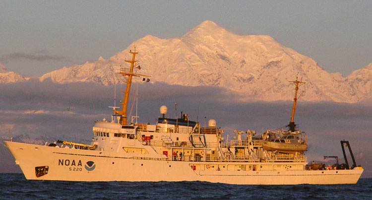
The NOAA Ship Fairweather in the Gulf of Alaska with namesake Mt. Fairweather in the background during the end of field season transit back to home port in Ketchikan, Alaska. The NOAA Ship Fairweather is one of four NOAA vessels primarily equipped for hydrographic survey operations in support of nautical charting and NOAA's mission to promote safe navigation.  The ship is equipped with the latest in hydrographic survey technology and is named for Mt. Fairweather in southeast Alaska, the highest peak in the Fairweather Range—the tallest coastal range on earth. For more information on the Fairweather and other NOAA vessels visit NOAA’s Office of Marine and Aviation Operations.

Privacy Policy  |  Disclaimer  |  NOAA's National Ocean Service  |  NOAA  |  U.S. Department of Commerce