The Global Positioning System (GPS) is the basis for nearly all position measurement in NOAA hydrography. In addition to providing location information for survey ships and launches, accurate positioning is required for several other elements of coastal hydrography.
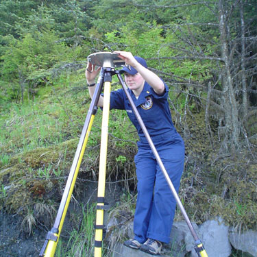
Fixed Aids to Navigation (ATONs) are occasionally found to be out of their published positions. The location of these ATONS must be accurately measured for charting. Rainier utilizes static GPS survey methods to position critical Aids to sub-meter level accuracy.
Rainier Crew member obtaining position of ATON.
Rainier Crew member setting up a temporary DGPS station for a tide gauge.
NOAA utilizes USCG-maintained differential GPS beacons to improve the accuracy of position measurements. However, in some remote areas far from permanent differential beacons or where local topography blocks the beacon’s signal, Rainier establishes its own temporary DGPS station to broadcast correctors to the survey launches.
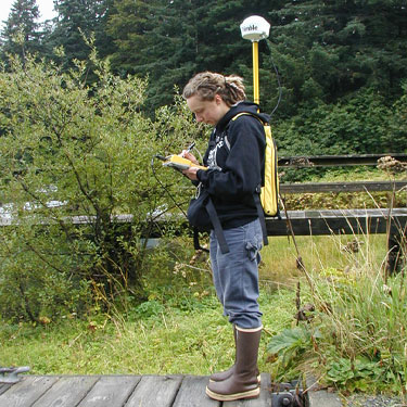
Nearshore features such as pilings and piers must be portrayed accurately on nautical charts. While remote sensing methods such as aerial photogrametry are usually the most efficient means of positioning these items, Rainier often locates new features which do not appear in the latest remote sensing data. In these cases, hydrographers use portable backpack DGPS receivers to define the position, extents, and attributes of these items.
Rainier Crew member using a backpack GPS unit to obtainpositional information on a pier.
NOAA is also working to establish the relationship between local water level datums such as Mean Lower Low Water, and Ellipsoidal Height produced by GPS. To assist in this effort, Rainier uses dual frequency static GPS methods to measure the ellipsoidal height of water level (tide) stations to centimeter level accuracy.