|
|
projects > high accuracy elevation data collection
High Accuracy Elevation Data Collection
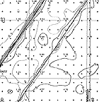
Modeling of sheet flow and water surface levels in the Florida Everglades is very sensitive to changes in elevation due to its expansive and extremely low relief terrain. This project is applying state-of-the-art Global Positioning System (GPS) technology to perform topographic surveys that meets a vertical accuracy specification of ±15 centimeters (6 inches). The objective is to complete a wide-area regional topographic survey that will provide elevation data to parameterize hydrologic and ecological models. This project supports the restoration and resource management efforts of several agencies by providing critical base elevation data for the parameterization of numerical hydrologic and ecological models. Water resources and land management decisions will rely heavily on the results of these simulation models. Therefore, it is imperative to derive and use the most accurate elevation data available for the models to produce meaningful results. The USGS developed Airborne Height Finder system is the superior technology for conducting a wide-area topographic survey of the Florida Everglades where the terrain surface being measured is inundated by surface water and obscured by vegetation. ProposalsWork PlansProject SummariesData
Metadata
PublicationsAbstracts
Fact Sheets
|
U.S. Department of the Interior, U.S. Geological Survey
This page is: http://sofia.usgs.gov/projects/index.php?project_url=elev_data
Comments and suggestions? Contact: Heather Henkel - Webmaster
Script last updated: 04 February 2009 @ 10:18 AM by BJM. Record creator: BJM. Record last updated by: BJM.