|
| |
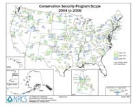
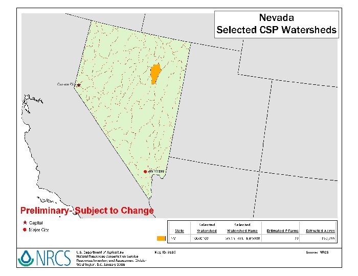
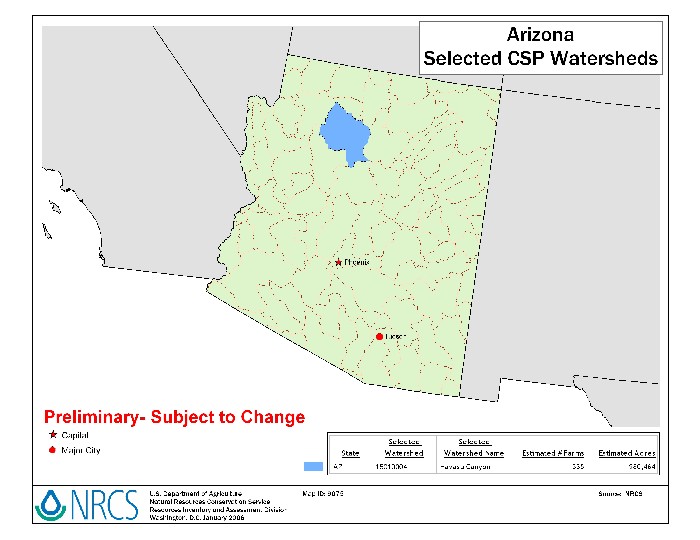
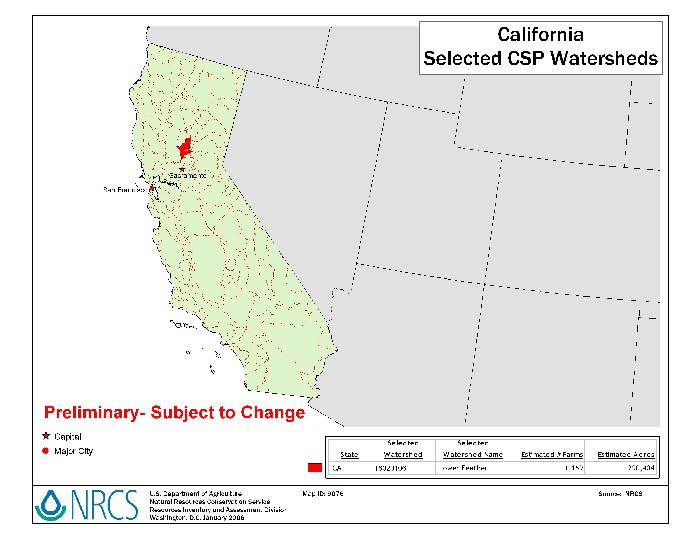
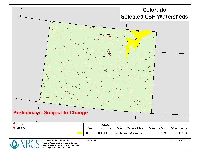
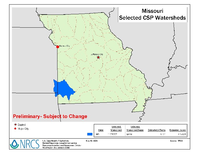
Conservation Security Program (CSP) Watersheds, FY-2006
Updated 3/06/2006
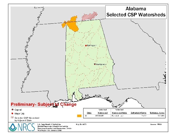
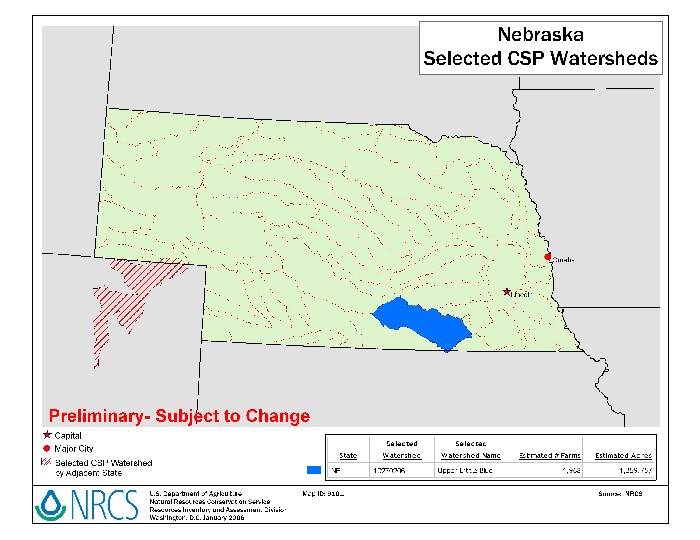
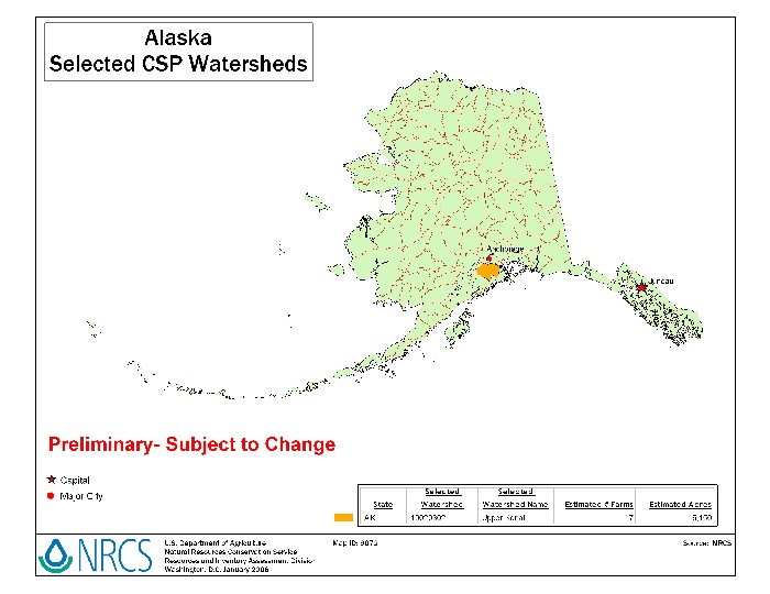
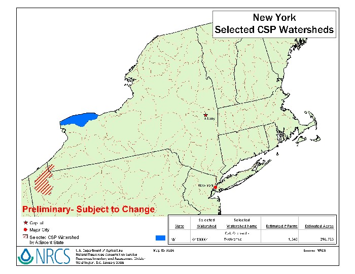
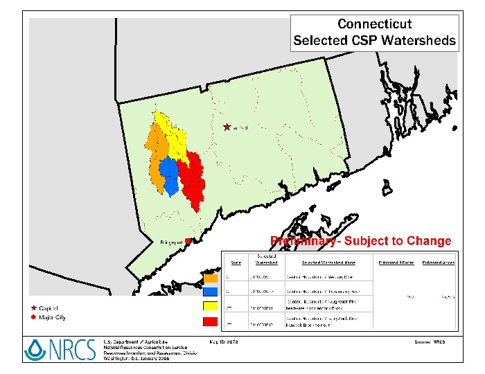
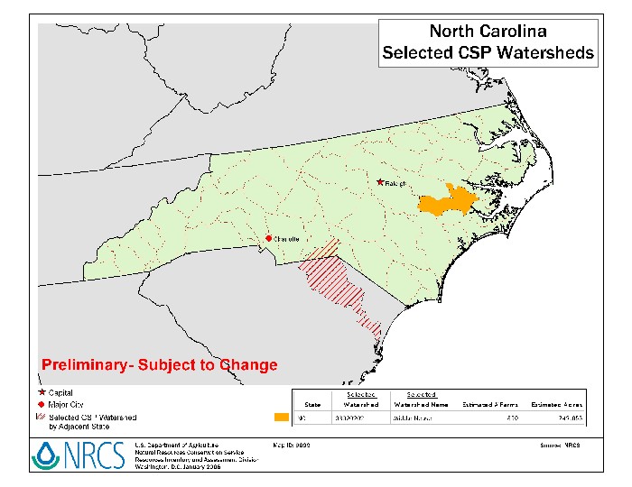
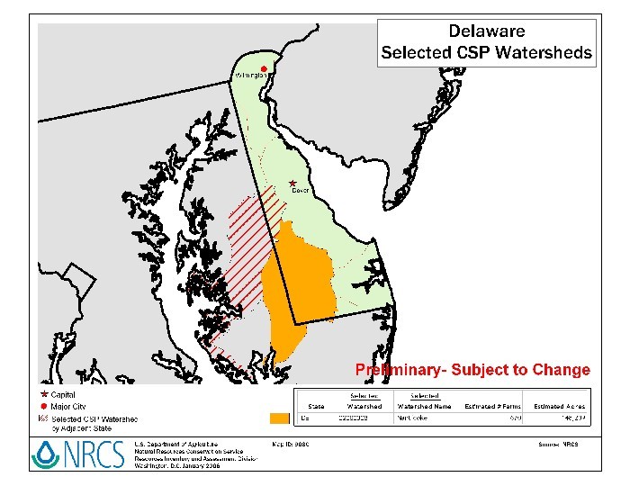
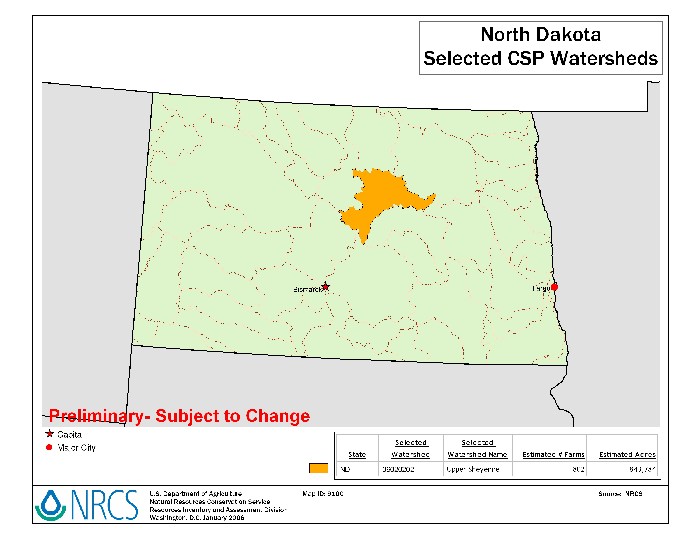
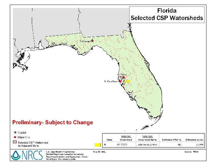
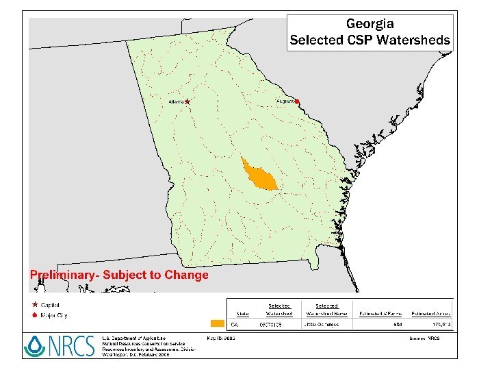
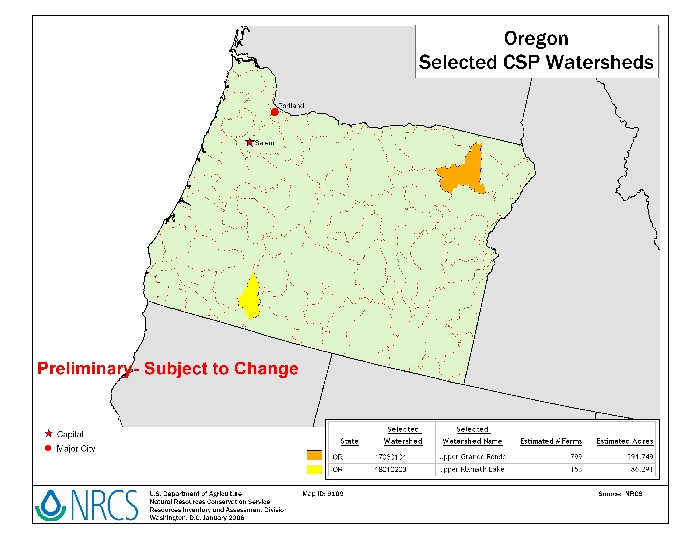
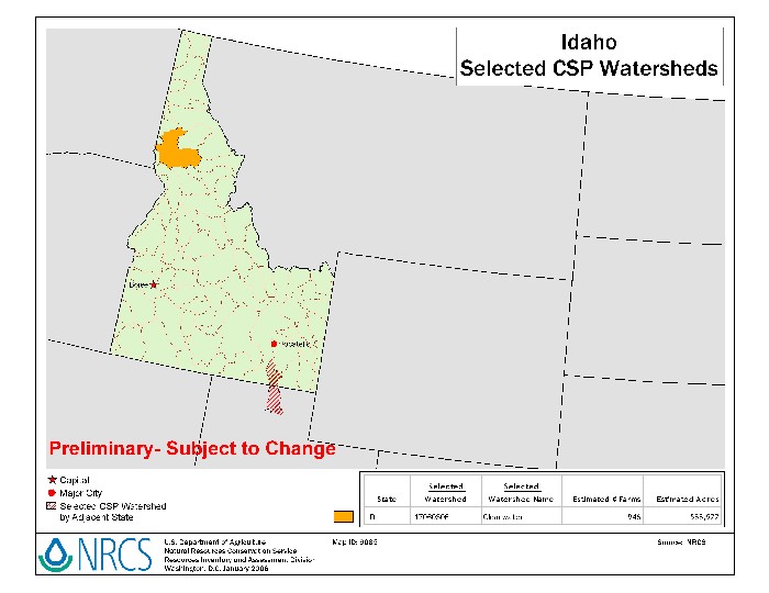
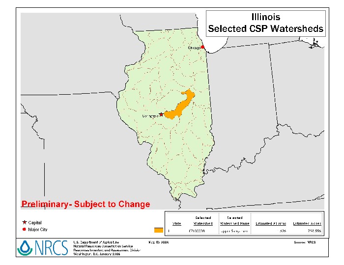
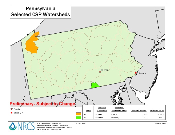
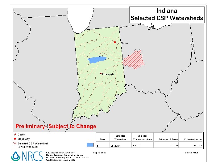
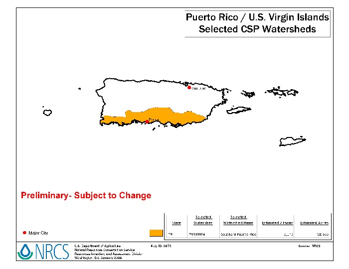
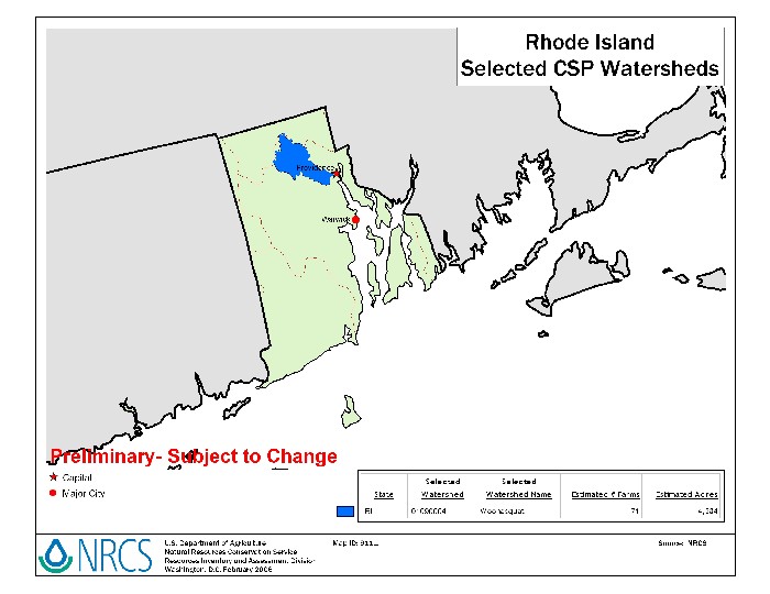
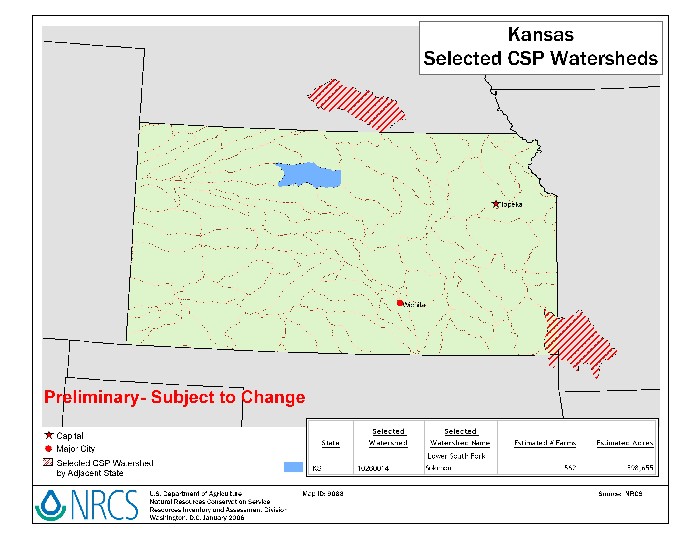
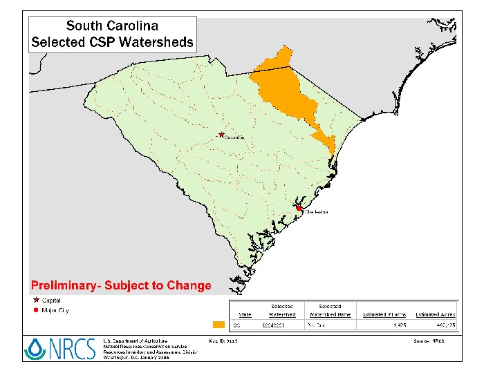
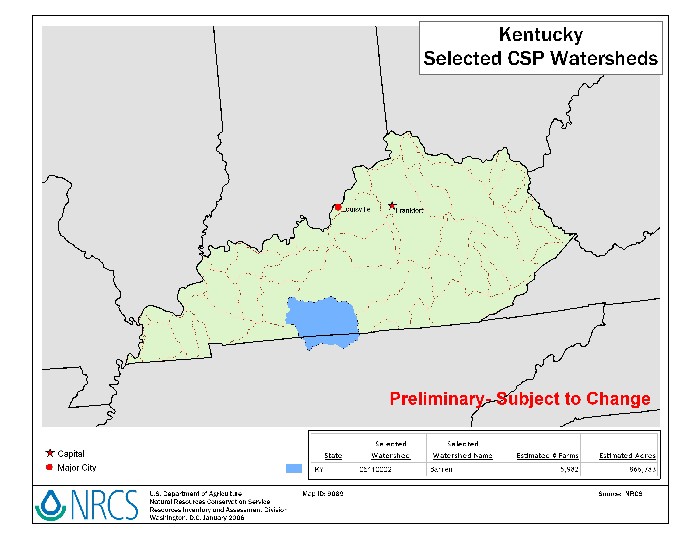
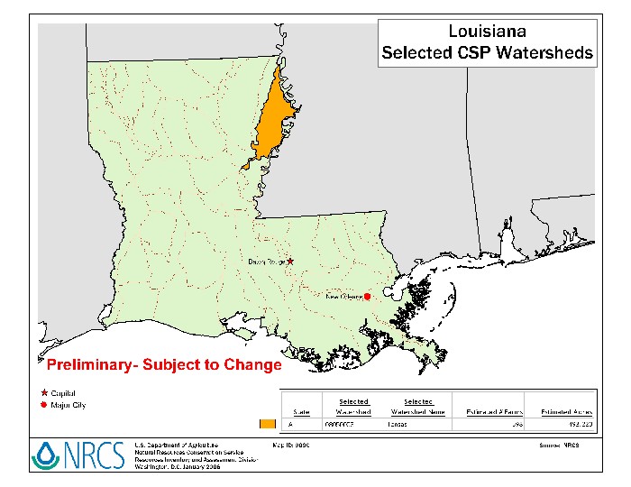
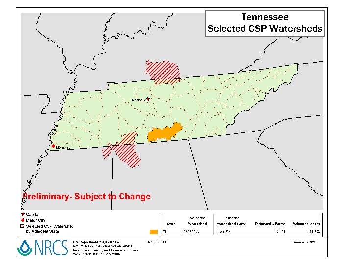
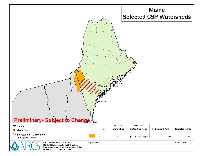
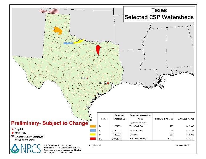
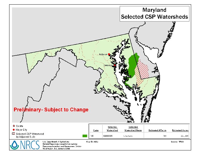
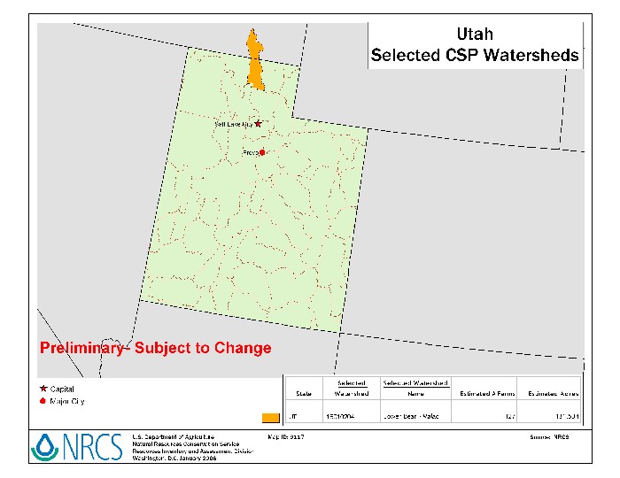
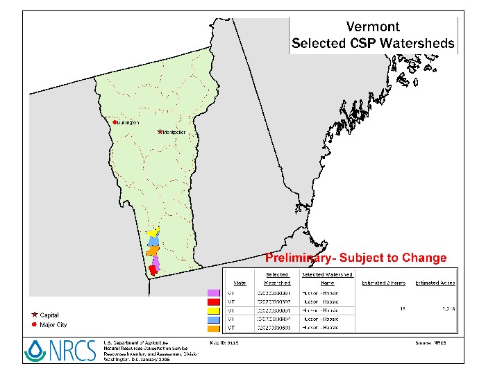
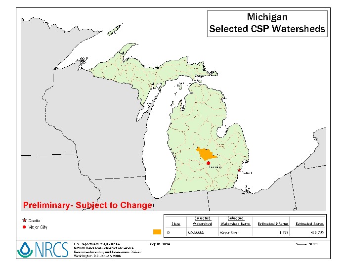
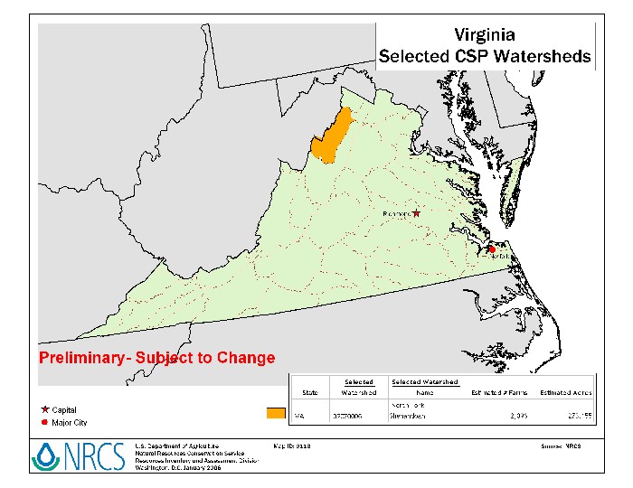
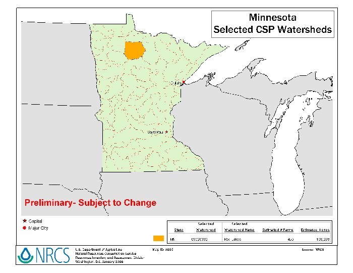
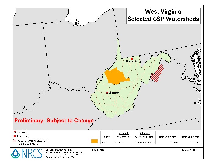
For a more detailed State map, click on a State under "State
Map" in the list below. For your watershed CSP sign-up information, click
on the "State CSP Web Page" below.
Download
CSP Watersheds - FY-2006 Map (3 MB jpg)
To print, first save the map to your computer.
These documents require Adobe Acrobat
Reader
 CSP
2006 Watersheds List CSP
2006 Watersheds List
CSP
2006 Watersheds List Summary
CSP
2006 Watersheds by County
To print State maps, you may want to first save the map to your
computer.
FY-2006 CSP Factoids
In FY 2006, the Conservation Security Program will touch…
• every State, Puerto Rico, and the Pacific Basin
• 60 watersheds (8-digit hydrologic unit code)
• about 380 counties, parishes, and municipios
More than 75,000 farms and ranches are within these watershed boundaries and
they cover more than 25 million acres.
About half of the farmland is cropland and half is grazing land.
2004 to 2006 CSP Scope Map
 < Back to Conservation Security Program
| | |


