|
|
 |
Coastal Change Hazards
Forecasts of sea level rise and increased hurricane activity suggest that our nation's coastlines are becoming increasingly vulnerable to the powerful forces of the ocean. Along our coasts, rising sea levels expose higher locations not usually subjected to the power of the sea and to the erosive forces of waves and currents.
In order to address the increased vulnerability of our Nation's coasts, the USGS has created the National Assessment of Coastal Change Hazards program. The primary objective of this program is to determine and quantify the relative vulnerabilities of U.S. coastlines to coastal change hazards. More specifically, this research includes:
- Monitoring Coastal Hazards:
The locations of our Nation's shorelines, dunes, and coastal cliffs have been mapped with airborne lidar creating an objective baseline that can be used to determine how our coasts have changed in the past and how they might change in the future. For example, these baseline surveys have been compared to several historical shoreline measures in order to quantitatively assess past coastal change. Comparison to lidar topographic surveys collected following the landfall of a major storm allow for quantification of storm-induced changes.
- Understanding Processes:
Coastal change data and complementary oceanographic data sets are used to test critical hypotheses related to understanding the physical processes that control coastal hazards. For example, are wave runup models accurate enough to predict overwash and inundation of barrier islands? Can these models be used effectively, and over thousands of kilometers of coast, to assess vulnerability?
- Predicting and Mapping Coastal Change Vulnerabilities:
The ultimate goal is to develop a quantitative, probabilistic assessment of the vulnerability of our Nation's coasts to change from storms, long-term shoreline erosion/accretion, sea-level rise, and sea cliff erosion. In order to create rigorous and quantitative models, the methodologies are continually being tested and improved using recent data sets.
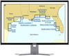
There are five main components of this work. Each addresses a particular type of coastal change hazard, such as sea cliff erosion and sea level rise, or presents a comprehensive summary of the current state of our coastlines. The specific goals of the individual components are listed below:  Hurricane and extreme storm hazards [web site] Hurricane and extreme storm hazards [web site]
- Monitor coastal impacts from extreme storms.
- Test methods for determining vulnerability assessments at a national scale.
- Develop the means to forecast regional-scale storm hazards.
 Coastal classification [web site] Coastal classification [web site]
- Establish an accurate representation of pre-storm ground conditions for high-priority coastal areas (designated as such due to dense populations and/or valuable resources).
- Develop a geomorphic (land feature) coastal classification that can be applied to most coastal regions in the United States.
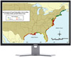
 Long-term shoreline change hazards [web site] Long-term shoreline change hazards [web site]
- Assess past magnitudes of coastal change based on the historical record of shoreline position.
- Develop an improved understanding of and method to assess future long-term change hazards; this includes developing and maintaining an objective, lidar-based shoreline for the Nation that can be periodically updated.
 Sea level rise hazards [web site] Sea level rise hazards [web site]
- Develop and implement a methodology for mapping the vulnerability of the nation's coasts to sea level rise.
 Sea cliff erosion hazards [web site] Sea cliff erosion hazards [web site]
- Inventory sea cliff stability nationwide.
- Monitor change to the Nation's cliff-backed coasts.
- Develop an understanding of the processes controlling cliff erosion regionally and nationally.
continue to Assessing Coastal Vulnerability to Extreme Storms
|

