The BLM Nevada State Director established the Nevada Groundwater Projects Office to facilitate the preparation of environmental impact statements (EIS) for three rights-of-way applications. The applications are for the placement of surface facilities (wells, roads, pipelines, and power lines) to develop and transport water across public lands. The links below provide detailed information for each of the three projects.
CLARK, LINCOLN, AND WHITE PINE COUNTIES GROUNDWATER DEVELOPMENT PROJECT

The Southern Nevada Water Authority (SNWA) submitted a right-of-way application to the BLM for construction and operation of a groundwater development project that would allow them to develop and transport water from Clark, Lincoln, and White Pine counties to Southern Nevada. The proposed project consists of approximately 327 miles of buried pipelines, five pumping stations, six regulating tanks, one buried storage reservoir, one water treatment facility, and approximately 341 miles of power lines with two primary electrical substations, 5 secondary substations, and four hydroturbine energy recovery facilities. Construction is anticipated to take place between 2009 and 2015, depending on approvals and phasing.
LINCOLN COUNTY LAND ACT (LCLA) GROUNDWATER DEVELOPMENT AND UTILITY RIGHT-OF-WAY PROJECT
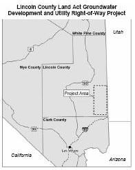
The Lincoln County Water Disctict (LCWD) submitted a right-of-way application to the BLM for construction and operation of a groundwater development project. The right-of-way would authorize LCWD to construct infrastructure required to pump and convey groundwater resources in the Tule Desert and Clover Valley to help meet future municipal water needs in newly urbanizing areas. The proposed project consists of a 47-mile main transmission pipeline and 54 miles of collection/lateral pipelines, up to 30 production wells, water storage tanks, booster stations, access roads, 138kV, 22.8kV, and 4.16kV transmission lines, a power substation, a natural gas pipeline, underground telephone lines and a telemetry system utilizing a fiber optic line. Contruction would begin upon acquisition of necessary permits, approvals, and grants.
KANE SPRINGS VALLEY (KSV) GROUNDWATER DEVELOPMENT PROJECT
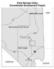
The Lincoln County Water District (LCWD) submitted a right-of-way application to the BLM for construction and operation of a groundwater development project. The right-of-way would authorize LCWD to construct infrastructure required to pump and convey groundwater resources in the Kane Springs Valley. The proposed project consists of groundwater production/monitoring wells, water collection pipelines, one main water transmission pipeline, one terminal storage tank, one forebay storage tank, electrical distribution lines, electrical substations, and a telemetry system/fiber optic lines. Project construction would occur in three phases with 1 to 3 years between phases. Construction of Phase 1 would begin upon acquisition of necessary permits, approvals, and grants.