USGS/CVO Logo, click to link to National USGS Website
USGS/Cascades Volcano Observatory, Vancouver, Washington

Mount St. Helens, Washington
Photo Geology and Annotated Images

2004 to 2006


Current
Eruption
HomePage
CVO
HomePage
Mount St.
Helens
HomePage
Current
Update
University of
Washington
Webicorders
Eruption
Highlights
Eruption
Chronology
Photo
Gallery
USFS
VolcanoCam
 

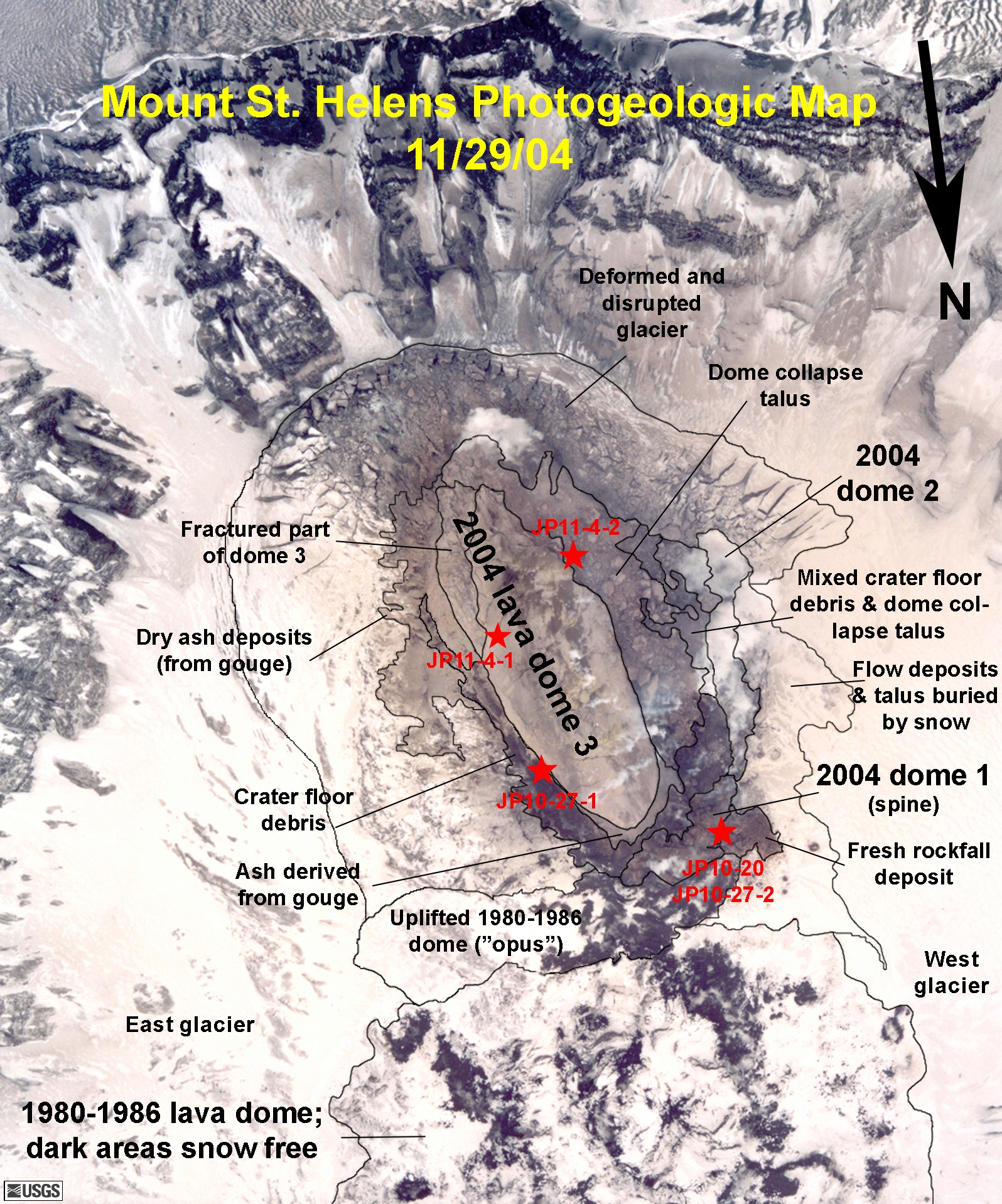
  • November 29, 2004 --- Mount St. Helens 2004 Dome Photogeologic Map
    From USGS Photograph, November 29, 2004, by John Pallister.
    • Map -- [JPG Format, 2.5M]
    • Map -- [PDF Format, 371K]


  • November 12, 2004 --- Panoramic view of new dome on Mount St. Helens, as seen from the east, with a football field for comparison
    From USGS Photograph taken on November 12, 2004, by Willie Scott.


  • November 7, 2004 --- Mount St. Helens 2004 Dome Photogeologic Map
    From USGS Photograph, November 7, 2004, by John Pallister, taken at 12:30 PST.


[an error occurred while processing this directive]

URL for CVO HomePage is: <http://vulcan.wr.usgs.gov/home.html>
URL for this page is: <http://vulcan.wr.usgs.gov/Volcanoes/MSH/Eruption04/PhotoGeology/framework.html>
If you have questions or comments please contact: <GS-CVO-WEB@usgs.gov>
01/03/06, Lyn Topinka