
The Nature and Timing of Tectonism in the Western Facies Terrane of Nevada and California -- An Outline of Evidence and Interpretations Derived from Geologic Maps of Key Areas
By: Keith B. Ketner
Desert Winds: Monitoring Wind-Related Surface Processes in Arizona, New Mexico, and California
Edited by Carol S. Breed and Marith C. Reheis
Mountain Meadows Dacite: Oligocene Intrusive Complex that Welds Together the Los Angeles Basin, Northwestern Peninsular Ranges, and Central Transverse Ranges, California
By: Thane H. McCulloh, Larry A. Beyer, and Ronald W. Morin
Crustal Structure of the Coastal and Marine San Francisco Bay Region, California
Edited by: Tom Parsons
Age and Tectonic Significance of Volcanic Rocks in the Northern Los Angeles Basin, California
By: Thane H. McCulloh, Robert J. Fleck, Rodger E. Denison, Larry A. Beyer, and Richard G. Stanley
Marine Geology and Earthquake Hazards of the San Pedro Shelf Region, Southern California
By: Michael A. Fisher, William R. Normark, Victoria E. Langenheim, Andrew J. Calvert, and Ray Sliter
Mid-Tertiary Isopach and Lithofacies Maps for the Los Angeles Region, California: Templates for Palinspastic Reconstruction to 17.4 Ma
By: Thane H. McCulloh and Larry A. Beyer
Tephra Layers of Blind Spring Valley and Related Upper Pliocene and Pleistocene Tephra Layers, California, Nevada, and Utah: Isotopic Ages, Correlation, and Magnetostratigraphy
By: Andrei M. Sarna-Wojcicki, Marith C. Reheis, Malcolm S. Pringle, Robert J. Fleck, Doug Burbank, Charles E. Meyer, Janet L. Slate, Elmira Wan, James R. Budahn, Bennie Troxel, and James P. Walker
Geologic Map of Yosemite National Park and Vicinity, California: a digital database
Compiled By: N. King Huber, Paul C. Bateman, and Clyde Wahrhaftig; Digital database by: D. Aitken and E. Phillips
Geologic Map of the Red Bluff 30' x 60' Quadrangle, California
By: M.C. Blake, Jr., D.S. Harwood, E.J. Helley, W.P. Irwin, A.S. Jayko, and D.L. Jones
Geologic Map of the Tower Peak Quadrangle, Central Sierra Nevada, California
By: Clyde Wahrhaftig
Geologic Map of the Lassen Peak, Chaos Crags, and Upper Hat Creek Area, California
By: Robert L. Christiansen, Michael A. Clynne, and L.J. Patrick Muffler
Maps showing locations of damaging landslides caused by El Niño rainstorms, winter season 1997-98, San Francisco Bay region, California; Pamphlet to accompany Miscellaneous Field Studies Maps MF-2325-A-J
By: Jonathan W. Godt, Editor
Map Showing Locations of Damaging Landslides in Napa County, California, Resulting From 1997-98 El Niño Rainstorms
By: Jonathan W. Godt, William Z. Savage, and Raymond C. Wilson
Map Showing Locations of Damaging Landslides in Alameda County, California, Resulting From 1997-98 El Niño Rainstorms
By: Jeffrey A. Coe, Jonathan W. Godt, Dianne Brien, and Nicolas Houdre
Map Showing Locations of Damaging Landslides in Marin County, California, Resulting From 1997-98 El Niño Rainstorms
By: Meghan M. Morrissey, Gerald F. Wieczorek, and Jonathan W. Godt
Map Showing Locations of Damaging Landslides in Santa Cruz County, California, Resulting From 1997-98 El Niño Rainstorms
By: Rex L. Baum, Robert L. Schuster, and Jonathan W. Godt
Map Showing Locations of Damaging Landslides in Contra Costa County, California, Resulting From 1997-98 El Niño Rainstorms
By: Russell W. Graymer and Jonathan W. Godt
Map Showing Locations of Damaging Landslides in Sonoma County, California, Resulting From 1997-98 El Niño Rainstorms
By: David W. Ramsey and Jonathan W. Godt
Map Showing Locations of Damaging Landslides in San Francisco City and County, California, Resulting From 1997-98 El Niño Rainstorms
By: John W. Hillhouse and Jonathan W. Godt
Map Showing Locations of Damaging Landslides in San Mateo County, California, Resulting From 1997-98 El Niño Rainstorms
By: Angela S. Jayko, Jean De Mouthe, Kenneth R. Lajoie, David W. Ramsey, and Jonathan W. Godt
Map Showing Locations of Damaging Landslides in Solano County, California, Resulting From 1997-98 El Niño Rainstorms
By: David G. Howell and Jonathan W. Godt
Map Showing Locations of Damaging Landslides in Santa Clara County, California, Resulting From 1997-98 El Niño Rainstorms
By: William L. Ellis, Edwin L. Harp, Caroline H. Arnal, and Jonathan W. Godt
Geologic Map and Map Database of the Palo Alto 30' x 60' Quadrangle, California
By: E.E. Brabb, R.W. Graymer, and D.L. Jones
Geology of the Cape Mendocino, Eureka, Garberville, and Southwestern Part of the Hayfork 30 x 60 Minute Quadrangles and Adjacent Offshore Area, Northern California
By: Robert J. McLaughlin, S.D. Ellen, M.C. Blake, Jr., Angela S. Jayko, W.P. Irwin, K.R. Aalto, G.A. Carver, and S.H. Clarke Jr.
Digital Database by J.B. Barnes, J.D. Cecil, and K.A. Cyr
Geologic Map and Map Database of Parts of Marin, San Francisco, Alameda, Contra Costa, and Sonoma Counties, California
By: M. C. Blake Jr., R.W. Graymer, and D.L. Jones
Digital Database by Adam Soule and R.W. Graymer
Geologic Map and Map Database of the Oakland Metropolitan Area, Alameda, Contra Costa, and San Francisco Counties, California
By: R.W. Graymer
Seafloor Rocks and Sediments of the Continental Shelf From Monterey Bay to Point Sur, California
By: Stephen L. Eittreim, Roberto J. Anima, Andrew J. Stevenson, and Florence L. Wong
Geologic Map and Map Database of the Spreckels 7.5-minute Quadrangle, Monterey County, California
By: Joseph C. Clark, Earl E. Brabb, and Lewis I. Rosenberg
Surface Fractures Formed in the Potrero Canyon, Tapo Canyon, and McBean Parkway Areas in Association with the 1994 Northridge, California, Earthquake
By: Michael J. Rymer, Jerome A. Treiman, Thomas J. Powers, Thomas E. Fumal, David P. Schwartz, John C. Hamilton, and Francesca R. Cinti
Interpretive Geologic Cross Sections for the Death Valley Regional Flow System and Surrounding Areas, Nevada and California
By: Donald S. Sweetkind, Robert P. Dickerson, Richard J. Blakely, and Paul D. Denning
Hydrostructural Maps of the Death Valley Regional Flow System, Nevada and California
By: C.J. Potter, D.S. Sweetkind, R.P. Dickerson, and M.L. Killgore
Geologic Maps and Structure Sections of the southwestern Santa Clara Valley and southern Santa Cruz Mountains, Santa Clara and Santa Cruz Counties, California
By: R.J. McLaughlin, J.C. Clark, E.E. Brabb, E.J. Helley, and C.J. Colón
Seismic Landslide Hazard for the City of Berkeley, California
By: Scott B. Miles and David K. Keefer
Seismic Landslide Hazard for the Cities of Oakland and Piedmont, California
By: Scott B. Miles and David K. Keefer
Isostatic Gravity Map of the Death Valley Ground-water Model Area, Nevada and California
By: D.A. Ponce, R.J. Blakely, R.L. Morin, and E.A. Mankinen
Aeromagnetic Map of the Death Valley Ground-water Model Area, Nevada and California
By: D.A. Ponce and R.J. Blakely
Map Showing Depth to Pre-Cenozoic Basement in the Death Valley Ground-water Model Area, Nevada and California
By: R.J. Blakely and D.A. Ponce
Debris Flows Triggered by the El Niño Rainstorm of February 2-3, 1998, Walpert Ridge and Vicinity, Alameda County, California
By: Jeffrey A. Coe and Jonathan W. Godt
Map and Map Database of Susceptibility to Slope failure by sliding and earthflow in the Oakland area, California
By: Richard J. Pike, Russell W. Graymer, Sebastian Roberts, Naomi B. Kalman, and Steven Sobieszczyk
Logs and Data from Trenches Across the Hayward Fault at Tyson's Lagoon (Tule Pond), Fremont, Alameda County, California
By: James J. Lienkaemper, Timothy E. Dawson, Stephen F. Personius, Gordon G. Seitz, Liam M. Reidy, and David P. Schwartz
Digital Bathymetric Model of Mono Lake, California
By: Christian G. Raumann, Scott Stine, Alexander Evans, and Jerry Wilson
Map Showing Seacliff Response to Climatic and Seismic Events, Depot Hill, Santa Cruz County, California
By: Cheryl J. Hapke, Bruce M. Richmond, and Mimi M. D'Iorio
Map Showing Seacliff Response to Climatic and Seismic Events, Seacliff State Beach, Santa Cruz County, California
By: Cheryl J. Hapke, Bruce M. Richmond, and Mimi M. D'Iorio
Map Showing Seacliff Response to Climatic and Seismic Events, Seabright Beach, Santa Cruz County, California
By: Cheryl J. Hapke, Bruce M. Richmond, and Mimi M. D'Iorio
Geologic Map and Map Database of Western Sonoma, Northernmost Marin, and Southernmost Mendocino Counties, California
By: M.C. Blake, Jr., R.W. Graymer, and R.E. Stamski
Geologic Map and Map Database of Northeastern San Francisco Bay Region, California
By: R.W. Graymer, D.L. Jones, and E.E. Brabb
Earthquakes and Faults in the San Francisco Bay Area (1970-2003)
By: Benjamin M. Sleeter, James P. Calzia, Stephen R. Walter, Florence L Wong, and George J. Saucedo
Geologic Map of the Cerro Gordo Peak 7.5' Quadrangle, Inyo County, California
By: Paul Stone, George C. Dunne, James E. Conrad, Brian J. Swanson, Calvin H. Stevens, and Zenon C. Valin
Maps Showing Estimated Sediment Yield From Coastal Landslides and Active Slope Distribution Along the Big Sur Coast, Monterey and San Luis Obispo Counties, California
By: Cheryl J. Hapke, Krystal R. Green, and Kate Dallas
Map Showing Coastal Cliff Retreat Rates Along the Big Sur Coast, Monterey and San Luis Obispo Counties, California
By: Cheryl J. Hapke and Krystal R. Green
Geology, Tephrochronology, Radiometric Ages, and Cross Sections of the Mark West Springs 7.5' Quadrangle, Sonoma and Napa Counties, California
By: R.J. McLaughlin, A.M. Sarna-Wojcicki, R.J. Fleck, W.H. Wright, V.R.G. Levin, and Z.C. Valin
Digital compilation by: Carl M. Wentworth
Compiled by: C.M. Wentworth, R.D. Borcherdt, R.K. Mark, and D.M. Boore
By: E.J. Helley, R.W. Graymer, G.A. Phelps, P.K. Showalter, and C.M.
Wentworth
Geology by: E.J. Helley
Compiled by: R.W. Graymer, G.A. Phelps,
P.K. Showalter, and C.M. Wentworth
Preliminary Geologic Map of the Topanga Quadrangle, Southern California
By: R. F. Yerkes and R. H. Campbell
Preliminary Geologic Map Emphasizing Bedrock Formations In Contra Costa County, California: A Digital Database
Compiled by: R.W. Graymer, D.L. Jones, and E.E. Brabb
By: R. F. Yerkes and R. H. Campbell
By: R. F. Yerkes and R. H. Campbell
By: R. F. Yerkes and R. H. Campbell
By: R. F. Yerkes and R. H. Campbell
By: R. F. Yerkes and R. H. Campbell
By: Carl M. Wentworth, G. Reid Fisher, Paia Levine, and Robert C. Jachens
Inventory of Landslides triggered by the 1994 Northridge, California, earthquake, in ARC/INFO export format, with Postscript and HPGL plot files and descriptive text
Geologic Map of the Hayward fault zone, Contra Costa, Alameda, and Santa Clara Counties, California: A digital database
By: R.W. Graymer, D.L. Jones, and E.E. Brabb
By: R. F. Yerkes and R. H. Campbell
By: R. F. Yerkes and R. H. Campbell
By: R. F. Yerkes and R. H. Campbell
By: R. F. Yerkes and R. H. Campbell
Preliminary Geologic Map of the Van Nuys 7.5’ Quadrangle, Southern California
Compiled By: R. F. Yerkes
Preliminary geologic map emphasizing bedrock formations in Alameda County, California: A digital database
By: R.W. Graymer, D.L. Jones, and E.E. Brabb
URL: http://geopubs.wr.usgs.gov/open-file/of96-252
By: Michael D. Carr, David A. Sawyer, Kathryn Nimz, Florian Maldonado, and WC Swadley
MAS/MILS Arc/Info Point Coverage for the Western U.S. (excluding Hawaii)
By: J. Douglas Causey
By: Joseph C. Clark, William R. Dupre, and Lewis I. Rosenberg
By: E.J. Helley and R.W. Graymer
By: E.J. Helley and R.W. Graymer
By: R. F. Yerkes
By: R. F. Yerkes
By: R. F. Yerkes
By: R. F. Yerkes
By: R. F. Yerkes and R. H. Campbell
By: R. F. Yerkes and R. H. Campbell
By: R. F. Yerkes and R. H. Campbell
By: R. F. Yerkes and R. H. Campbell
By: R. F. Yerkes
By: R. F. Yerkes and R. H. Campbell
By: R. F. Yerkes and S. E. Graham
By: R. F. Yerkes and S. E. Graham
By: R. F. Yerkes and S. E. Graham
By: Joseph C. Clark and Earl E. Brabb
By: R. F. Yerkes and R. H. Campbell
Compiled by: William P. Irwin
By: E. E. Brabb
By: Douglas S. Aitken
By: Keith A. Howard, Michael L. Dennis, Karl Karlstrom, and Geoffrey A. Phelps
By: R.W. Graymer
By: K.L. Knudsen, J.S. Noller, J.M. Sowers and W.R. Lettis
Compiled by Carl M. Wentworth
Based on the work of E.E. Brabb (1989), S.E. Ellen and C.M. Wentworth (1995), and E.J. Helley and K.R. Lajoie (1979)
By: San Francisco Bay Landslide Mapping Team
A Method for Producing Digital Probabilistic Seismic Landslide Hazard Maps: An Example from the Los Angeles, California, Area
Randall W. Jibson, Edwin L. Harp, and John A. Michael
Rotational and Accretionary Evolution of the Klamath Mountains, California and Oregon, from Devonian to Present time
By: Willian P. Irwin and Edward A. Mankinen
By: E.E. Brabb, R.W. Graymer, and D.L. Jones
By: E.E. Brabb, R.W. Graymer, and D.L. Jones
By: M.G. Bonilla
By: Janet M. Sowers, Jay S. Noller and William R. Lettis
By: Gerald F. Wieczorek, Meghan M. Morrissey, Giulio Iovine, and Jonathan Godt
By: F.K. Miller, J.C. Matti, H.J. Brown, and R.E. Powell
Digital preparation by: P.M. Cossette, and G. Morton
The Purisima Formation and Related Rocks (Upper Miocene - Pliocene), Greater San Francisco Bay Area, Central California: Review of literature and USGS collection (now housed at the Museum of Paleontology, University of California, Berkeley)
By: Charles L. Powell, II
Elevation maps of the San Francisco Bay Region, California: A digital database
By: Scott E. Graham and Richard J. Pike
Sedimentation and Bathymetric Change in San Pablo Bay: 1856–1983
By: Bruce E. Jaffe, Richard E. Smith, and Laura Zink Torresan
By: Scott E. Graham and Richard J. Pike
By: Sebastian Roberts and Andrew D. Baron
with a preface by Earl E. Brabb and Richard J. Pike
By: Carl M. Wentworth, M. Clark Blake, Jr., Robert J. McLaughlin, and Russell W. Graymer
Complied by T. W. Dibblee
Digital database compiled by S. E. Graham, T. M. Mahony, J. L. Blissenbach, J. J. Mariant, and C. M. Wentworth
Geology by Jane E. Nielson and Ryan D. Turner
Digital database by David R. Bedford
Geology by Jane E. Nielson
Digital database by David R. Bedford
Cruise Report for A1-98-SC Southern California Earthquake Hazards Project
By: William R. Normark, Robert G. Bohannon, Ray Sliter, Gita Dunhill, David W. Scholl, Jane Laursen, Jane A. Reid, and David Holton
Long Valley Coring Project, Inyo County, California, 1998-, Preliminary Stratigraphy and Images of Recovered Core
By: Penelope C. Sackett, Vicki S. McConnell, Angela L. Roach, Susan S. Priest, John H. Sass
Geology of the Cordelia and the northern part of the Benicia 7.5 minute quadrangles, California: A digital map database
By: R.W. Graymer, E.E. Brabb, and D.L. Jones
An ARC/Info Point Coverage of Mineral Resource Data System (MRDS) Locations in Eleven Western States
By: David G. Frank
Preliminary Digital Geologic Map of the Santa Ana 30' x 60' Quadrangle, Southern California, Version 2.0 (2004)
Compiled by: D.M. Morton
Digital preparation by: Rachel M. Hauser and Kelly R. Ruppert
Gas and Isotope Geochemistry of 81 Steam Samples from Wells in The Geysers Geothermal Field, Sonoma and Lake Counties, California, U.S.A.
By: Jacob B. Lowenstern, Cathy J. Janik, Lynne Fahlquist, and Linda S. Johnson
Timing of Paleoearthquakes on the Northern Hayward Fault—Preliminary Evidence in El Cerrito, California
By: the Hayward Fault Paleoearthquake Group (HPEG)
High-Resolution Seismic Reflection/Refraction Imaging from Interstate 10 to Cherry Valley Boulevard, Cherry Valley, Riverside County, California: Implications for Water Resources and Earthquake Hazards
By: G. Gandhok, R. D. Catchings, M.R. Goldman, E. Horta, M. J. Rymer, P. Martin, and A. Christensen
Digital Databases Containing Mining Claim Density Information for Arizona, California, Colorado, Idaho, Montana, Nebraska, New Mexico, Nevada, Oregon, South Dakota, Utah, Washington, and Wyoming Created From the BLM Mining Claim Recordation System: 1996
By: Paul C. Hyndman and Harry W. Campbell
Cruise Report: RV Coastal Surveyor Cruise C-1-99-SC
Multibeam Mapping of the Long Beach, California, Continental Shelf
April 12, through May 19, 1999 Long Beach, California
James V. Gardner, John E. Hughes Clarke, and Larry A. Mayer
Plutons and Accretionary Episodes of the Klamath Mountains, California and Oregon
By: William P. Irwin and Joseph L. Wooden
Isostatic Gravity Map of the Las Vegas 30 x 60 Minute Quadrangle, California and Nevada
By: V.E. Langenheim, R.L. Morin, J.G. Davidson, K.M. Schmidt, and H.R. Blank, Jr.
Digital Mining Claim Density Map for Federal Lands in California: 1996
By: Paul C. Hyndman and Harry W. Campbell
Calibration Formulae and Values for Velocity Seismometers Used in the 1998 Santa Clara Valley, California Seismic Experiment
By: Allan G. Lindh, Jerry P. Eaton, Mary O'Neill Allen, John H. Healy, Samuel W. Stewart, and Lu Damerell
Preliminary Aeromagnetic Anomaly Map of California
By: Carter W. Roberts and Robert C. Jachens
Landslides in Alameda County, California, A Digital Database Extracted from Preliminary Photointerpretation Maps of Surficial Deposits by T.H. Nilsen in USGS Open-File Report 75-277
By: Sebastian Roberts, Michelle A. Roberts , and Eileen M. Brennan
with a preface by Richard J. Pike and Sebastian Roberts
Earthquake Probabilities in the San Francisco Bay Region: 2000 to 2030 - A Summary of Findings
By: Working Group on California Earthquake Probabilities
Part A - Digital Geologic Map of the Nevada Test Site and Vicinity, Nye, Lincoln, and Clark Counties, Nevada, and Inyo County, California, Revision 4
By: Janet L. Slate, Margaret E. Berry, Peter D. Rowley, Christopher J. Fridrich, Karen S. Morgan, Jeremiah B. Workman, Owen D. Young, Gary L. Dixon, Van S. Williams, Edwin H. McKee, David A. Ponce, Thomas G. Hildenbrand, W C Swadley, Scott C. Lundstrom, E. Bartlett Ekren, Richard G. Warren, James C. Cole, Robert J. Fleck, Marvin A. Lanphere, David A. Sawyer, Scott A. Minor, Daniel J. Grunwald, Randell J. Laczniak, Christopher M. Menges, James C. Yount, and Angela S. Jayko
Part B - Digital aeromagnetic map of the Nevada Test Site and vicinity, Nye, Lincoln, and Clark Counties, Nevada, and Inyo County, California
By: David A. Ponce
Part C - Digital isostatic gravity map of the Nevada Test Site and vicinity, Nye, Lincoln, and Clark Counties, Nevada, and Inyo County, California
By: D.A. Ponce, E.A. Mankinen, J.G. Davidson, R.L. Morin, and R.J. Blakely
Cruise Report for 01-99-SC: Southern California Earthquake Hazards Project
By: William R. Normark, Jane A. Reid, Ray W. Sliter, David Holton, Christina E. Gutmacher, Michael A. Fisher, and Jonathon R. Childs
Sedimentation and Bathymetry Changes in Suisun Bay: 1867-1990
By: Karen Cappiella, Chris Malzone, Richard Smith, and Bruce Jaffe
Rock-fall Potential in the Yosemite Valley, California
By: Gerald F. Wieczorek, Meghan M. Morrissey, Giulio Iovine and Jonathan Godt
Physical, Chemical, and Isotopic Data for Samples from the Anderson Springs Area, Lake County, California, 19981999
By: C.J. Janik, F. Goff, M.L. Sorey, J.J. Rytuba, D. Counce, E.M. Colvard, M. Huebner, L.D. White, and A. Foster
Height Changes in the Epicentral Region Preceding the January 17, 1994 Northridge Earthquake
By: Robert O. Castle, Robert F. Packard, and Laura B. Dinitz
Abrupt Physical and Chemical Changes During 1992 - 1999, Anderson Springs, SE Geysers Geothermal Field, California
By: Cathy J. Janik, Fraser Goff, Stephen R. Walter, Michael L. Sorey, Dale Counce, and Elizabeth M. Colvard
Bathymetric, Geophysical, and Geologic Sample Data from Medicine Lake, Siskiyou County, northern California
By: onathan R. Childs, Jacob B. Lowenstern , R. Lawrence Phillips, Patrick Hart, James J. Rytuba, John A. Barron, Scott W. Starratt, and Sarah Spaulding
Possible Costs Associated with Investigating and Mitigating Geologic Hazards in Rural Areas of Western San Mateo County California
By: Earl E. Brabb, Sebastian Roberts, William R. Cotton, Alan L. Kropp, Robert H. Wright, and Erik N. Zinn
With a section on Using the USGS Website to Determine the Cost of Developing Property for Residences in Rural Parts of San Mateo County, California
By: Sebastian Roberts and Earl E. Brabb
Digital Geologic Map of the Butler Peak 7.5' Quadrangle, San Bernardino County, California
By: Fred K. Miller, Jonathan C. Matti, Howard J. Brown
Digital Preparation by P.M. Cossette
Location and Ages of Middle Tertiary Volcanic Centers in Coastal California
By: Richard G. Stanley, Douglas S. Wilson, and Patricia A. McCrory
Earthquake Ground-Motion Amplification in Southern California
By: Edward H. Field
Geologic Map and Digital Database of the Cougar Buttes 7.5' Quadrangle, San Bernardino County, California
By: Robert E. Powell and Jonathan C. Matti
Digital Preparation by P.M. Cossette
Aeromagnetic Survey of the Amargosa Desert, Nevada and California: A Tool for Understanding Near-Surface Geology and Hydrology
By: Richard J. Blakely, Victoria E. Langenheim, David A. Ponce, and Gary L. Dixon
Principal Facts for Gravity Stations in the Vicinity of San Bernardino, Southern California
By: Megan L. Anderson, Carter W. Roberts, and Robert C. Jachens
Preliminary Potential-Field Constraints on the Geometry of the San Fernando Basin, Southern California
By: V.E. Langenheim, A. Griscom, R.C. Jachens, and T.G. Hildenbrand
Bibliography of Literature Pertaining to Long Valley Caldera and Associated Volcanic Fields
By: John W. Ewert and Christopher J. Harpel
Geologic Map Database of the El Mirage Lake Area, San Bernardino and Los Angeles Counties, California
By: David M. Miller and David R. Bedford
Digital preparation by: D.R. Bedford
Age and Paleoenvironmental Significance of Mega-Invertebrates from the "San Pedro" Formation in the Coyote Hills, Fullerton and Buena Park, Orange County, Southern California
By: Charles L. Powell, II and Dave Stevens
Activities and prelimiary results of nearshore benthic habitat mapping in Southern California, 1998
By: Guy R. Cochrane and Kevin D. Lafferty
Geology and Coastal Hazards in the Northern Monterey Bay, California Field Trip Guidebook November 4, 2000
By: Cheryl Hapke
Preliminary Maps of Quaternary Deposits and Liquefaction Susceptibility, Nine-County San Francisco Bay Region, California: A Digital Database
Geology By Keith L. Knudsen, Janet M. Sowers, Robert C. Witter, Carl M. Wentworth, and Edward J. Helley
Digital Database By Carl M. Wentworth, Robert S. Nicholson, Heather M. Wright, and Katherine H. Brown
High-resolution marine seismic reflection data from the San Francisco Bay area
By: Jonathan R. Childs, Patrick Hart, Terry R. Bruns, Michael S. Marlow, and Ray Sliter
The Lasting Effects of Tank Maneuvers on Desert Soils and Intershrub Flora
By: Douglas V. Prose and Howard G. Wilshire
Cruise Report for A1-00-SC Southern California Earthquake Hazards Project, Part A
By: Christina E. Gutmacher, William R. Normark, Stephanie L. Ross, Brian D. Edwards, Ray Sliter, Patrick Hart, Becky Cooper, Jon Childs, and Jane A. Reid
Geologic Map and Digital Database of the Porcupine Wash 7.5 minute Quadrangle, Riverside County, Southern California
By: Robert E. Powell
Digital preparation by Pamela M. Cossette
Geologic Map and Digital Database of the Conejo Well 7.5 minute Quadrangle, Riverside County, Southern California
By: Robert E. Powell
Digital preparation by Pamela M. Cossette
Stratigraphic and Structural Characterization of the OU-1 area at the former George Air Force Base, Adelanto, Southern California
By: R. D. Catchings, G. Gandhok, and M.R. Goldman
Analytical Data for Waters of the Harvard Open Pit, Jamestown Mine, Tuolumne County, California, March 1998 – September 1999
By: R.P. Ashley and K.S. Savage
Clay Mineral Content of Continental Shelf and River Sediments, Southern California
By: James R. Hein and Jennifer S. Dowling
Under San Francisco Bay—A New View of the Floor of West-Central San Francisco Bay
Contributors: David A. Cacchione, Paul R. Carlson, Pat F. Chavez, Jr., John L. Chin, Peter Dartnell, James V. Gardner, Helen Gibbons, David M. Rubin, Miguel Velasco, and Florence L. Wong
1:100,000-Scale Topographic Contours Derived from Digital Elevation Models, San Francisco Bay Region, California: A Digital Database
By: Heather M. Wright and Carl M. Wentworth
Seismic Images and Fault Relations of the Santa Monica Thrust Fault, West Los Angeles, California
By: R. D. Catchings, G. Gandhok, M. R. Goldman, and D. Okaya
Principal Facts for Gravity Data Along the Hayward Fault andVicinity, San Francisco Bay Area, Northern California
By: David A. Ponce
Six Aeromagnetic Surveys in Nevada and California: A Web Site for Distribution of Data
Preliminary Compilation of Data for Selected Oil Test Wells in Northern California
By: Earl E. Brabb, Charles Powell, II, and Thomas M. Brocher
Heavy Minerals from the Palos Verdes Margin, Southern California: Data and Factor Analysis
By: Florence L. Wong
Earthquake Ground-Motion Amplification in Southern California
By: Edward H. Field
Geologic Map of the Devore 7.5' Quadrangle, San Bernardino County, California
By: D.M. Morton and J.C. Matti
Geologic Map of the Lakeview 7.5' Quadrangle, Riverside County, California
By: Douglas M. Morton and Jonathan C. Matti
Impacts of Climate Change on Landscapes of the Eastern Sierra Nevada and Western Great Basin
By: A.S. Jayko and C.I. Millar
Map Showing Plutons and Accreted Terranes of the Sierra Nevada, California with a Tabulation of U/Pb Isotopic Ages
By: William P. Irwin and Joseph L. Wooden
Automated Remote Digital Imaging System (ARDIS): Applications for Monitoring Dust Emissions in the Mojave Desert, California
By: Richard K. Tigges, Stuart Sides, and Mark Ohms
Eagle Mountain Mine—Geology of the Former Kaiser Steel Operation in Riverside County, California
By: Eric R. Force
Petrography and Physical Properties of Selected Rock Types Associated with the Hayward Fault, California
By: Diane E. Moore and David A. Ponce
Geologic Map and Digital Database of the San Rafael Mtn. 7.5-minute Quadrangle, Santa Barbara County, California
By: John G. Vedder and Richard G. Stanley
Geologic Map of the Telegraph Peak 7.5’ quadrangle, San Bernardino County, California
By: D.M. Morton, M.O. Woodburne, and J.H. Foster
Geologic map of the Cucamonga Peak 7.5’ quadrangle, San Bernardino County, California
By: D.M. Morton and J.C. Matti
Geochemistry of Selected Mercury Mine-tailings in the Parkfield Mercury District
By: James J. Rytuba, Boris B. Kotlyar, Gregg Wilkerson, and Jerry Olson
Facies Analysis of Late Proterozoic through Lower Cambrian Rocks of the Death Valley Regional Ground-Water System and Surrounding areas, Nevada and California
By: Donald S. Sweetkind and Diane K. White
A Gravity Data Along LARSE (Los Angeles Regional Seismic Experiment) Line 2, Southern California
By: R.J. Wooley and V.E. Langenheim
Implications for the Formation of the Hollywood Basin from Gravity Interpretations of the Northern Los Angeles Basin, California
By: Thomas G. Hildenbrand, Jeffrey G. Davidson, Daniel J. Ponti, and V.E. Langenheim
Facies Analysis of Tertiary Basin-Filling Rocks of the Death Valley Regional Ground-Water System and Surrounding Areas, Nevada and California
By: Donald S. Sweetkind, Christopher J. Fridrich, and Emily Taylor
Report for Borehole Explosion Data Acquired in the 1999 Los Angeles Region Seismic Experiment (LARSE II), Southern California: Part I, Description of the Survey
By: Gary S. Fuis, Janice M. Murphy, David A. Okaya, Robert W. Clayton, Paul M. Davis, Kristina Thygesen, Shirley A. Baher, Trond Ryberg, Mark L. Benthien, Gerry Simila, J. Taylor Perron, Alan K. Yong, Luke Reusser, William J. Lutter, Galen Kaip, Michael D. Fort, Isa Asudeh, Russell Sell, John R. Vanschaack, Edward E. Criley, Ronald Kaderabek, Will M. Kohler, Nickolas H. Magnuski
Hayward Fault Rocks: Porosity, Density, and Strength Measurements
By: C.A. Morrow and D.A. Lockner
Geologic Map of the Steele Peak 7.5'Quadrangle, Riverside County, California
By: Douglas M. Morton
Geologic Map of the Sunnymead 7.5' Quadrangle, Riverside County, California
By: Douglas M. Morton and Jonathan C. Matti
Geologic Map of the Riverside West 7.5' Quadrangle, Riverside County, California
By: Douglas M. Morton and Brett F. Cox
Geologic Map of the Riverside East 7.5' Quadrangle, Riverside County, California
By: Douglas M. Morton and Brett F. Cox
Rb-Sr Whole-Rock and Mineral Ages, K-Ar, 40Ar/39Ar, and U-Pb Mineral ages, and Strontium, Lead, Neodymium, and Oxygen Isotopic Compositions for Granitic Rocks from the Salinian Composite Terrane, California
By: R. W. Kistler and D. E. Champion
Geologic Map of the Lake Mathews 7.5' Quadrangle, Riverside County, California
By: Douglas M. Morton and F. Harold Weber
Borehole P- and S-Wave Velocity at Thirteen Stations in Southern California
By: James F. Gibbs, David M. Boore, John C. Tinsley, and Charles S. Mueller
Geologic Map of the Corona South 7.5’Quadrangle, Riverside and Orange Counties, California
By: C.H. Gray, Jr., Douglas M. Morton, and F. Harold Weber, Jr.
Geologic Map of the Corona North 7.5’ Quadrangle, Riverside and San Bernardino Counties, California
By: Douglas M. Morton and C.H. Gray Jr.
Felt Reports and Intensity Assignments for Aftershocks and Triggered Events of the Great 1906 California Earthquake
By: Aron J. Meltzner and David J. Wald
Shear-Wave Velocity Compilation for Northridge Strong-Motion Recording Sites
By: Roger D. Borcherdt and Thomas E. Fumal
Field-Trip Guide to the Southeastern Foothills of the Santa Cruz Mountains In Santa Clara County, California
By: Philip W. Stoffer and Paula Messina
Distribution of High-Temperature (>150 °C) Geothermal Resources in California
By: John H. Sass and Susan S. Priest
Preliminary Geologic Map of the Santa Barbara Coastal Plain Area, Santa Barbara County, California
By: Scott A. Minor, Karl S. Kellogg, Richard G. Stanley, Paul Stone, Charles L. Powell, II, Larry D. Gurrola, Amy J. Selting, and Theodore R. Brandt
Multibeam Mapping of the Los Angeles, California Margin
By: James V. Gardner and Peter Dartnell
Report for Borehole Explosion Data Acquired in the 1999 Los Angeles Region Seismic Experiment (LARSE II), Southern California, California: Part II, Data Tables and Plots
By: Janice M. Murphy, Gary S. Fuis, David A. Okaya, Kristina Thygesen, Shirley A. Baher, Trond Ryberg, Galen Kaip, Michael D. Fort, Isa Asudeh, and Russell Sell
Borehole Velocity Measurements at Five Sites That Recorded the Cape Mendocino, California Earthquake of 25 April, 1992
By: James F. Gibbs, John C. Tinsley, and David M. Boore
Seismicity maps of the Santa Rosa 1° x 2° quadrangle, California for the period 1969-1995
By: Jeroen S. Preiss, Stephen R. Walter, and David H. Oppenheimer
Data from Theodolite Measurements of Creep Rates on San Francisco Bay Region Faults, California: 1979–2001
By: Jon S. Galehouse
Multielement Geochemical Dataset of Surficial Materials for the Northern Great Basin
By: Mary Jane Coombs, Boris B. Kotlyar, Steve Ludington, Helen W. Folger, and Victor G. Mossotti
Digital Version of "Open-File Report 92–182: Geologic Map of the Marl Mountains Quadrangle, San Bernardino County, California"
Geology by: Howard G. Wilshire
GIS database by: David R. Bedford and Teresa Coleman
Digital Version of "Open-File Report 92–181: Geologic Map of the Indian Spring Quadrangle, San Bernardino County, California"
Geology by: Howard G. Wilshire
GIS database by: David R. Bedford and Teresa Coleman
Digital Version of "Open-File Report 92–183: Geologic Map of the Granite Spring Quadrangle, San Bernardino County, California"
Geology by: Howard G. Wilshire
GIS database by: David R. Bedford and Teresa Coleman
Digital Version of "Open-File Report 92–179: Geologic Map of the Cow Cove Quadrangle, San Bernardino County, California"
Geology by: Howard G. Wilshire
GIS database by: David R. Bedford and Teresa Coleman
Soil Chemistry and Mineralogy of the Santa Cruz Coastal Terraces
By: Colin Pinney, Jacob Aniku, Raymond Burke, Jennifer Harden, Michael Singer, and Jennie Munster
Liquefaction Hazard and Shaking Amplification Maps of Alameda, Berkeley, Emeryville, Oakland, and Piedmont, California: A Digital Database
By: Thomas L. Holzer, Michael J. Bennett, Thomas E. Noce, Amy C. Padovani, and John C. Tinsley III
Physical Data of Soil Profiles Formed on Late Quaternary Marine Terraces near Santa Cruz, California
By: Jennie Munster and Jennifer W. Harden
Gravity Map and Data of the Eastern Half of the Big Bear Lake, 100,000 Scale Quadrangle, California and Analysis of the Depths of Several Basins
By: Carter Roberts, Robert Jachens, Allan Katzenstein, Gregory Smith, and Russell Johnson
Geologic Map of the Sawmill Mountain Quadrangle, Kern and Ventura Counties, California
By: Karl S. Kellogg and Daniel P. Miggins
Comments on Potential Geologic and Seismic Hazards Affecting Mare Island, Solano County, California
By: T.L. Holzer, C.M. Wentworth, W.H. Bakun, J. Boatwright, T.E. Brocher, M. Çelebi, W.L. Ellsworth, J.P.B. Fletcher, E.L. Geist, R. W. Graymer, R.E. Kayen, D. K. Keefer, D. H. Oppenheimer, W.U. Savage, D.P. Schwartz, and R. W. Simpson
Six Aeromagnetic Surveys in California, Nevada, and Arizona: A Web Site for Distribution of Data
By: By Ronald E. Sweeney
Geologic Map and Digital Database of the Pinto Mountain 7.5 minute quadrangle, Riverside County, California
By: Robert E. Powell
Geologic map and digital database of the San Bernardino Wash 7.5 minute quadrangle, Riverside County, California
By: Robert E. Powell
Investigation of Linear Magnetic Anomalies in the Funeral Mountains, Death Valley Region, California
By: John W. Hillhouse and Robert Morin
Preliminary Soil-Slip Susceptibility Maps, Southwestern California
By: D.M. Morton, R.M. Alvarez, and R.H. Campbell
Stratigraphic inferences derived from borehole data of Tertiary basin-filling rocks of the Pahrump Valley basin, Nevada and California
By: Donald S. Sweetkind, Emily Taylor and Heather Putnam
Huntington Beach Shoreline Contamination Investigation, Phase III: Coastal Circulation and Transport Patterns: The Likelihood of OCSD's Plume Impacting Huntington Beach Shoreline
By: Marlene Noble, Jingping Xu, Leslie Rosenfeld, John Largier, Peter Hamilton, Burt Jones, and George Robertson
Data Report for the Main Line of the PSINE Seismic Survey Across the San Andreas Fault and SAFOD Site Near Parkfield, California
By: R. D. Catchings, M. R. Goldman, M. J. Rymer, G. Gandhok, and G. S. Fuis
Nearshore Benthic Habitat GIS for the Channel Islands National Marine Sanctuary and Southern California State Fisheries Reserves Volume 1
By: Guy R. Cochrane, Nicole M. Nasby, Jane A. Reid, Ben Waltenberger, and Kristen M. Lee
Geologic Map of the Valjean Hills 7.5'Quadrangle, San Bernardino County, California
By: J.P. Calzia and B.W. Troxel
Geologic Map and Digital Database of the Romoland 7.5' Quadrangle, Riverside County, California
By: Douglas M. Morton
Geologic Map and Digital Database of the Bachelor Mountain 7.5' Quadrangle, Riverside County, California
By: Douglas M. Morton and Michael P. Kennedy
Cruise Report for A1-02-SC Southern California CABRILLO project, Earthquake Hazards Task
By: William R. Normark, Michael A. Fisher, Christina E. Gutmacher, Ray Sliter, Lori Hibbeler, Beth Feingold, and Jane A. Reid
Preliminary Analysis Of Cores From North San Francisco Bay, California
By: Dan Allison, Margaret Hampton, and Bruce Jaffe
Cruise Summary For P-1-02-SC: Acoustic Imaging Of Natural Oil And Gas Seeps and Measurement of Dissolved Methane Concentration In Coastal Waters Near Pt. Conception, California
By: Thomas D. Lorenson, Jennifer A. Dougherty, William Ussler III, and Charles K. Paull
Geologic database for digital geology of California, Nevada, and Utah—An application of the North American Data Model
By: David R. Bedford, Steve Ludington, Constance M. Nutt, Paul A. Stone, David M. Miller, Robert J. Miller, David L. Wagner, and George J. Saucedo
Dust Deposition in Nevada, California, and Utah, 1984-2002
By: Marith C. Reheis
Location and Age of Foraminifer Samples Collected by Chevron Petroleum Geologists in California
By: Earl E. Brabb and John M. Parker
Preliminary Paleomagnetic Results from the Coyote Creek Outdoor Classroom Drill Hole, Santa Clara Valley, California
By: Edward A. Mankinen and Carl M. Wentworth
Preliminary Geologic Map of the Winchester 7.5’ Quadrangle, Riverside County, California
By: Douglas M. Morton
Preliminary Geologic Map of the Murrieta 7.5' Quadrangle, Riverside County, California
By: Michael P. Kennedy and Douglas M. Morton
Earthquake Probabilities in the San Francisco Bay Region: 2002–2031
By: Working Group On California Earthquake Probabilities
Bed-Sediment Grain-Size and Morphologic Data from Suisun, Grizzly, and Honker Bays, CA, 1998-2002
By: Margaret A. Hampton, Noah P. Snyder, John L. Chin, Dan W. Allison, David M. Rubin
Chromium geochemistry of serpentinous sediment in the Willow core, Santa Clara County, CA
By: Christopher J. Oze, Matthew J. LaForce, Carl M. Wentworth, Randall T. Hanson, Dennis K. Bird, and Robert G. Coleman
Isostatic Gravity Map with Simplified Geology of the Los Angeles 30 x 60 Minute Quadrangle
By: R.J. Wooley, R.F. Yerkes, V.E. Langenheim, and F.C. Chuang
Preliminary Geologic Map of the Perris 7.5’ Quadrangle, Riverside County, California
By: Douglas M. Morton
Preliminary Geologic Map of the Elsinore 7.5’ Quadrangle, Riverside County, California
Compiled by: Douglas M. Morton and F. Harold Weber, Jr.
Preliminary geologic map of the San Bernardino 30' x 60' quadrangle, California
By: Douglas M. Morton and Fred K. Miller
Geologic Map and Digital Database of the Yucaipa 7.5’ Quadrangle, San Bernardino and Riverside Counties, California
By: J.C. Matti, D.M. Morton, B.F. Cox, S.E. Carson, and T.J. Yetter
Geologic Map and Digital Database of the Redlands 7.5’ Quadrangle, San Bernardino and Riverside Counties, California
By: J.C. Matti, D.M. Morton, B.F. Cox, and K.J. Kendrick
A Bibliography of Klamath Mountains Geology, California and Oregon, listing Authors from Aalto to Zucca for the Years 1849 to Mid-2003
Compiled by: William P. Irwin
Shaded Relief Aeromagnetic Map of the Santa Clara Valley and Vicinity, California
By: Carter W. Roberts and Robert C. Jachens
Bathymetric and geophysical surveys of Englebright Lake, Yuba-Nevada Counties, California
By: Jonathan R. Childs, Noah P. Snyder, and Margaret A. Hampton
Preliminary Cross Section of Englebright Lake Sediments
By: Noah P. Snyder and Margaret A. Hampton
Preliminary Geologic Map of the Fontana 7.5’ Quadrangle, Riverside and San Bernardino Counties, California
By: Douglas M. Morton
Location and Age Database for Selected Foraminifer Samples Collected by Exxon Petroleum Geologists in California
Compiled By: Earl E. Brabb and John M. Parker
Photomosaics and Logs of Trenches on the San Andreas Fault, Thousand Palms Oasis, California
By: Thomas E. Fumal, William T. Frost, Christopher Garvin, John C. Hamilton, Monique Jaasma and Michael J. Rymer
Photomosaics and Logs of Trenches on the San Andreas Fault at Arano Flat near Watsonville, California
By: Thomas E. Fumal, Gordon F. Heingartner, Laura Samrad, Timothy E. Dawson, John C. Hamilton and John N. Baldwin
Preliminary Location and Age Database for Invertebrate Fossils Collected in the San Francisco Bay Region, California
Compiled by: John M. Parker, William B. West, William T. Malmborg, and Earl E. Brabb
Photomosaics and Logs of Trenches on the San Andreas Fault at Mill Canyon Near Watsonville, California
By: Thomas E. Fumal, Timothy E. Dawson, Rebecca Flowers, John C. Hamilton, Gordon F. Heingartner, James Kessler, and Laura Samrad
Proceedings of the Hayward Fault Workshop, Eastern San Francisco Bay Area, California, September 19-20, 2003
Edited By: David A. Ponce, Roland Bürgmann, Russell W. Graymer, James J. Lienkaemper, Diane E. Moore, and David P. Schwartz
Logs and Data from Trenches Across the Hayward Fault at Tyson’s Lagoon (Tule Pond), Fremont, Alameda County, California, 2001-2003
By: James J. Lienkaemper, Patrick L. Williams, Timothy E. Dawson, Stephen F. Personius, Gordon G. Seitz, Samuel J. Heller, and David P. Schwartz
Isotopes and Ages in the Northern Peninsular Ranges Batholith, Southern California
By: R. W. Kistler, J. L. Wooden, and D.M. Morton
Surficial and Bedrock Geologic Map Database of the Kelso 7.5 Minute Quadrangle, San Bernardino County, California
By: David R. Bedford
Geology of the Right Stepover Region between the Rodgers Creek, Healdsburg, and Maacama Faults, Northern San Francisco Bay Region; A Contribution to Northern California Geological Society Field Trip Guide, June 6-8, 2003
By: Robert J. McLaughlin and Andrei Sarna-Wojcicki
Desert Landforms and Surface Processes in the Mojave National Preserve and Vicinity
By: Philip Stoffer
Inverterate Paleontology of the Wilson Grove Formation (Late Miocene to Late Pliocene), Sonoma and Marin Counties, California, with some Observations on Its Stratigraphy, Thickness, and Structure
By: Charles L. Powell, II, James R. Allen, and Peter J. Holland
Huntington Beach Shoreline Contamination Investigation, Phase III, Final Report: Coastal Circulation and Transport Patterns: The Likelihood of OCSD's Plume Impacting Huntington Beach Shoreline
Edited By: Marlene Noble and Jingping Xu
Geologic and Bathymetric Reconnaissance Overview of the San Pedro Shelf Region, Southern California
By: Stephen C. Wolf and Christina E. Gutmacher
Report on the May-June 2002 Englebright Lake Deep Coring Campaign
By: Noah P. Snyder, Charles N. Alpers, Lorraine E. Flint, Jennifer A. Curtins, Margaret A. Hampton, Brian J. Haskell, and Dennis L. Nielson
Sediment Grain-Size and Loss-on-Ignition Analyses from 2002 Englebright Lake Coring and Sampling Campaigns
By: Noah P. Snyder, James R. Allen, Carlin Dare, Margaret A. Hampton, Gary Schneider, Ryan J. Wooley, Charles N. Alpers, and Mark C. Marvin-DiPasquale
Predicted Seafloor Facies of Central Santa Monica Bay, California
By: Peter Dartnell and James V. Gardner
Cross-Sections and Maps Showing Double-Difference Relocated Earthquakes from 1984-2000 along the Hayward and Calaveras Faults, California
By: Robert W. Simpson, Russell W. Graymer, Robert C. Jachens, David A. Ponce, and Carl M. Wentworth
Map Showing Fossil Localities of the Rattlesnake Creek, Western and Eastern Hayfork, and North Fork Terranes of the Klamath Mountains
By: William P. Irwin, and Charles D. Blome
Deposition, Erosion, and Bathymetric Change in South San Francisco Bay: 1858-1983
By: Amy C. Foxgrover, Shawn A. Higgins, Melissa K. Ingraca, Bruce E. Jaffe, and Richard E. Smith
Preliminary Geologic Map of the Big Bear City 7.5' Quadrangle, San Bernardino County, California
By: Fred K. Miller
Review of Results and Recommendations from the GCMRC 2000-2003 Remote-Sensing Initiative for Monitoring Environmental Resources Within the Colorado River Ecosystem
By: Philip A. Davis
Los Angeles and San Diego Margin High-Resolution Multibeam Bathymetry and Backscatter Data
By: Peter Dartnell, James V. Gardner, Larry A. Mayer, & John E. Hughes Clarke
Spatial databases of the Humboldt Basin mineral resource assessment, northern Nevada
By: Mark J. Mihalasky and Lorre A. Moyer
Liquefaction-Induced Lateral Spreading in Oceano, California, During the 2003 San Simeon Earthquake
By: Thomas L. Holzer, Thomas E. Noce, Michael J. Bennett, Carola Di Alessandro, John Boatwright, John C. Tinsley, III, Russell W. Sell, and Lewis I. Rosenberg
Using Twelve Years of USGS Refraction Lines to Calibrate the Brocher and others (1997) 3D Velocity Model of the Bay Area
By: John Boatwright, Luke Blair, Rufus Catchings, Mark Goldman, Fabio Perosi, and Clare Steedman
Comments on Potential Geologic and Seismic Hazards Affecting Coastal Ventura County, California
By: Stephanie L. Ross, David M. Boore, Michael A. Fisher, Arthur D. Frankel, Eric L. Geist, Kenneth W. Hudnut, Robert E. Kayen, Homa J. Lee, William R. Normark, and Florence L. Wong
Isostatic residual gravity map of The Santa Clara Valley and vicinity, California
By: Carter W. Roberts, Robert C. Jachens, David A. Ponce and Victoria E. Langenheim
Preliminary Geologic Map of the El Cajon 30' x 60' Quadrangle, Southern California
Compiled by Victoria R. Todd. Digital preparation by Rachel M. Alvarez and TGS, Techni Graphic Systems, Inc.
Acceleration and Volumetric Strain Generated by the Parkfield 2004 Earthquake on the GEOS Strong-Motion Array Near Parkfield, Calif.
By: Roger D. Borcherdt, Malcolm J.S. Johnston, Christopher Dietel, Gary Glassmoyer, Doug Myren, and Christopher Stephens
Real-time Forecasts of Tomorrow's Earthquakes in California: A New Mapping Tool
By: Matt Gerstenberger, Stefan Wiemer and Lucy Jones
Proceedings of the First Annual Northern California Earthquake Hazards Workshop, January 13-14, 2004
Edited by Mary Lou Zoback
Digital Database of Faulting Accompanying the 1966 Parkfield, California, Earthquake
Digital database prepared by Christopher J. Crosby
Preliminary Geologic Map of the Hemet 7.5' Quadrangle, Riverside County, California
By: D.M. Morton and J.C. Matti
Preliminary Geologic Map of the Los Angeles 30' x 60' Quadrangle, Southern California
Compiled by Robert F. Yerkes and Russell H. Campbell
Digital preparation by Rachel M. Alvarez and Kelly R. Bovard
Multichannel seismic-reflection data acquired off the coast of southern California - Part A 1997, 1998, 1999, and 2000
By: Ray W. Sliter, William R. Normark, and Christina E. Gutmacher
The San Andreas Fault In The San Francisco Bay Area, California: A Geology Fieldtrip Guidebook To Selected Stops On Public Lands
By: Philip W. Stoffer
Ground-Magnetic Studies of the Amargosa Desert Region, California and Nevada
By: Richard J. Blakely, John W. Hillhouse, and Robert L. Morin
Height Changes Along Selected Lines Through the Death Valley Region, California and Nevada, 1905-1984
By: Robert O. Castle, Thomas D. Gilmore, James P. Walker, and Susan A. Castle
Modified Mercalli Intensity Maps for the 1906 San Francisco Earthquake Plotted in ShakeMap Format
By: John Boatwright and Howard Bundock
Multibeam Bathymetry and Backscatter Data: Northeastern Channel Islands Region, Southern California
By: Peter Dartnell, Guy Cochrane, and Mary Elaine Dunaway
Blind Comparisons Of Shear-Wave Velocities At Closely-Spaced Sites In San Jose, California
Edited by Michael W. Asten and David M. Boore
Nearshore Benthic Habitat GIS for the Channel Islands National Marine Sanctuary and Southern California State Fisheries Reserves Volume II
By: Guy R. Cochrane, James E. Conrad, Jane A. Reid, Sarah Fangman, and Nadine Golden
Map showing Features and Displacements of the Scenic Drive Landslide, La Honda, California, During the Period March 31-May 7, 2005
By: Ray E. Wells, Michael J. Rymer, Carol S. Prentice and Karen L. Wheeler
South San Francisco Bay 2004 Topographic Lidar Survey: Data Overview and Preliminary Quality Assessment
By: Amy C. Foxgrover and Bruce E. Jaffe
Preliminary Geologic Map of the Sage 7.5' Quadrangle, Riverside County, California
By: D.M. Morton and M.P. Kennedy
Compressional and Shear Wave Velocity Versus Depth in the San Francisco Bay Area, California: Rules for USGS Bay Area Velocity Model 05.0.0
By: Thomas M. Brocher
Beyond the Golden Gate—Oceanography, Geology, Biology, and Environmental Issues in the Gulf of the Farallones
Edited by: Herman A. Karl, John L. Chin, Edward Ueber, Peter H. Stauffer, and James W. Hendley II
Shifting Shoals and Shattered Rocks-How Man Has Transformed the Floor of West-Central San Francisco Bay
By: John L. Chin, Florence L. Wong, and Paul R. Carlson
Quaternary Tectonic Setting of South-Central Coastal California
By: William R. Lettis, Kathryn L. Hanson, Jeffrey R. Unruh, Marcia McLaren, and William U. Savage
Chapter AA of
Evolution of Sedimentary Basins/Offshore Oil and Gas Investigations-Santa Maria Province
Edited by Margaret A. Keller
Style and Rate of Quaternary Deformation of the Hosgri Fault Zone, Offshore South-Central Coastal California
By: Kathryn L. Hanson, William R. Lettis, Marcia McLaren, William U. Savage, and N. Timothy Hall
Chapter BB of
Evolution of Sedimentary Basins/Offshore Oil and Gas Investigations-Santa Maria Province
Edited by Margaret A. Keller
Response Plan for Volcano Hazards in the Long Valley Caldera and Mono Craters Region, California
By: David P. Hill, Dan Dzurisin, William L. Ellsworth, Elliot T. Endo, D.L. Galloway, Terry M. Gerlach, Malcolm S.J. Johnston, John Langbein, Ken A. McGee, C. Dan Miller, David Oppenheimer, and Michael L. Sorey
Geology and Natural History of the San Francisco Bay Area—A Field-Trip Guidebook
Edited By: Philip W. Stoffer and Leslie C. Gordon
Rocks and Geology in the San Francisco Bay Region
By: Philip Stoffer
Putting Down Roots, Your Handbook for the San Francisco Bay Region
Developed by: American Red Cross, Bay Area Chapter, Association of Bay Area Governments, California Earthquake Authority, California Geological Survey, Earthquake Engineering Research Institute, Governor's Office of Emergency Services, San Francisco Office of Emergency Services and Homeland Security, Southern California Earthquake Center, Structural Engineers Association of Northern California, University of California Berkeley, U.S. Department of Homeland Security/Federal Emergency Management Agency, U.S. Geological Survey
Southern Californians Cope With Earthquakes
By: Kenneth W. Hudnut, James J. Mori, William H. Prescott, and Peter H. Stauffer
When Will the Next Great Quake Strike Northern California?
By: Wayne R. Thatcher, Peter L. Ward, David J. Wald, James W. Hendley II, and Peter H. Stauffer
Living with a Restless Caldera—Long Valley, California
By: David P. Hill, Roy A. Bailey, Michael L. Sorey, James W. Hendley II, and Peter H. Stauffer
Invisible CO2 Gas Killing Trees at Mammoth Mountain, California
By: Michael L. Sorey, Christopher D. Farrar, Terrance M. Gerlach, Kenneth A. McGee, William C. Evans, Elizabeth M. Colvard, David P. Hill, Roy A. Bailey, John D. Rogie, James W. Hendley II, and Peter H. Stauffer
Future Eruptions in California's Long Valley Area—What's Likely?
By: David P. Hill, Roy A. Bailey, C. Dan Miller, James W. Hendley II, and Peter H. Stauffer
Living with Volcanic Risk in the Cascades
By: Dan Dzurisin, Peter H. Stauffer, and James W. Hendley II
Scientific Drilling in Long Valley, California—What Will We Learn?
By: Susan S. Priest, John H. Sass, Bill Ellsworth, Christopher D. Farrar, Michael L. Sorey, David P. Hill, Boy Bailey, Ronald D. Jacobson, John T. Finger, Vicki Su McConnell, and Mark Zoback
Eruptions of Lassen Peak, California, 1914 to 1917
By: Michael A. Clynne, Robert L. Christiansen, Tracey J. Felger, Peter H. Stauffer, and James W. Hendley II
The "LARSE" project - working towards a safer future for Los Angeles
By: Thomas L. Henyey, Gary S. Fuis, Mark L. Benthien, Thomas R. Burdette, Shari A. Christofferson, Robert W. Clayton, Edward E. Criley, Paul M. Davis, James W. Hendley II, Monica D. Kohler, William J. Lutter, John K. McRaney, Janice M. Murphy, David A. Okaya, Trond Ryberg, Gerald W. Simila, and Peter H. Stauffer
El Proyecto Sísmico “LARSE”—Trabajando Hacia un Futuro con Más Seguridad para Los Angeles
De Thomas L. Henyey, Gary S. Fuis, Mark L. Benthien, Thomas R. Burdette, Shari A. Christofferson, Robert W. Clayton, Edward E. Criley, Paul M. Davis, James W. Hendley II, Monica D. Kohler, William J. Lutter, John K. McRaney, Janice M. Murphy, David A. Okaya, Trond Ryberg, Gerald W. Simila, y Peter H. Stauffer
Progress Toward a Safer Future Since the 1989 Loma Prieta Earthquake
A two-page fact sheet by Robert A. Page, Peter H. Stauffer, and James W. Hendley II
Major Quake Likely to Strike Between 2000 and 2030
Andrew J. Michael, Stephanie L. Ross, David P. Schwartz, James W. Hendley II, and Peter H. Stauffer
Saltwater Intrusion in Los Angeles Area Coastal Aquifers—the Marine Connection
By: Brian D. Edwards and Kevin R. Evans
The Parkfield Experiment‹Capturing What Happens in an Earthquake
By: Steve Hickman and John Langbein
Probing the Los Angeles Basin—Insights into Ground-Water Resources and Earthquake Hazards
By: John W. Hillhouse, Eric G. Reichard, and Daniel J. Ponti
“Hot Water” in Lassen Volcanic National Park— Fumaroles, Steaming Ground, and Boiling Mudpots
By: Michael A. Clynne, Cathy J. Janik, and L.J.P. Muffler
Tracking Contaminants in Santa Monica Bay, Offshore of Greater Los Angeles
By: Homa J. Lee, Megan McQuarrie, and Lori Hibbeler
Bacterial Contamination at Huntington Beach, California—Is It From a Local Offshore Wastewater Outfall?
By: Jingping Xu, Marlene Noble, Leslie Rosenfeld, John Largier, Peter Hamilton, and Burt Jones
Is a Powerful Quake Likely to Strike in the Next 30 Years?
By: Andrew J. Michael, Stephanie L. Ross, Robert W. Simpson, Mary Lou Zoback, David P. Schwartz, Michael L. Blanpied, and Working Group 2002
Precipitation History of the Mojave Desert Region, 1893-2001
By: Richard Hereford, Robert H. Webb, and Claire I. Longpre
Rates of Landsliding and Cliff Retreat Along the Big Sur Coast, California—Measuring a Crucial Baseline
By: Cheryl J. Hapke and Krystal R. Green
Status of the Sierra Nevada: The Sierra Nevada Ecosystem Project
By: Don C. Erman (General Editor) and the SNEP Team
Año Nuevo to Santa Cruz, California—a Photographic Tour of the Coastline
By: Henry Chezar and Florence L. Wong
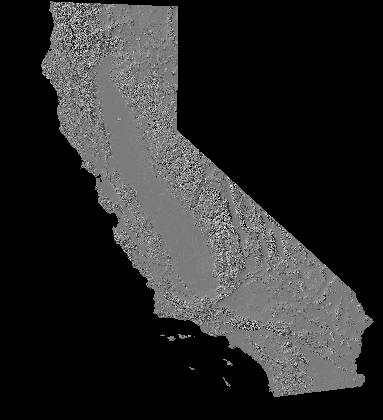 Shaded relief image of California (20 KB)
Created from 1:250,000 scale (3 arc-second resolution) Defense Mapping Agency Digital Elevation Models (DEM)
Download full image: calif.tif.tar.Z (4.0MB)
 Geologic Story of Yosemite National Park
 Return
to WRGIS Home Page
Return
to WRGIS Home Page