Link to USGS Home Page
fractured rockaquifers explainedgroundwater explainedour water supplystudy areas

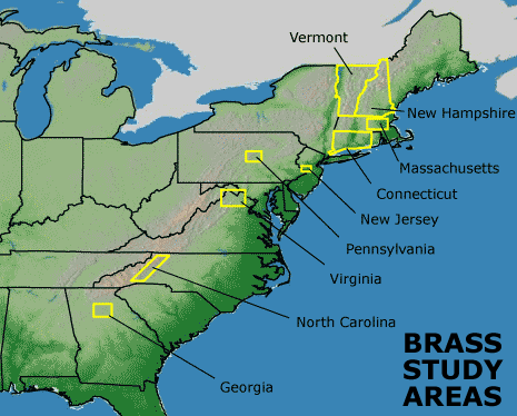
Berock Regional Aquifer Systematics Study

Study Areas

Click through the menu on the left side bar or this map to find out about ongoing research.

clicable map of study areas Georgia North Carolina Virginia Pennsylvania New Jersey Connecticut Massachussetts New Hampshire Vermont

BRASS researchers use modern digital data acquisition techniques to facilitate the production of geologic maps and structural analysis.

3COM PALM III PDA GPS Compaq IPAQ with ESRI ARCPAD and GPS GPS
BiologyGeologyMappingWaterPublicationsGlossaryAsk USGSSearch

U.S. Department of the Interior, U.S. Geological Survey, Reston, VA USA
URL http://geology.er.usgs.gov/eespteam/brass/index.htm
Maintained by: Boris Barrios bbarrios@usgs.gov
Contact: Bill Burton bburton@usgs.gov
Last modification: 27-Aug-2004
|| Accessibility || Disclaimer || Privacy Statement ||