USGS - science for a changing world

Indiana Water Science Center

home projects publications drought flood
Picture of the main Indiana Water Science Center office.

DATA CENTER

ABOUT THE INDIANA WSC

USGS IN YOUR STATE

USGS Water Science Centers are located in each state.

There is a USGS Water Science Center office in each State. Washington Oregon California Idaho Nevada Montana Wyoming Utah Colorado Arizona New Mexico North Dakota South Dakota Nebraska Kansas Oklahoma Texas Minnesota Iowa Missouri Arkansas Louisiana Wisconsin Illinois Mississippi Michigan Indiana Ohio Kentucky Tennessee Alabama Pennsylvania West Virginia Georgia Florida Caribbean Alaska Hawaii New York Vermont New Hampshire Maine Massachusetts South Carolina North Carolina Rhode Island Virginia Connecticut New Jersey Maryland-Delaware-D.C.

Water Resources of Indiana

Current streamflow conditions in Indiana; click to go to a live map.
Map legend.

Welcome to the U.S. Geological Survey (USGS) Web page for the water resources of Indiana; this is your direct link to all kinds of water-resource information. Here you'll find information on Indiana's rivers and streams. You'll also find information about ground water, water quality, and many other topics. The USGS operates the most extensive satellite network of streamgaging stations in the state, many of which form the backbone of flood-warning systems.

The USGS provides current ("real-time") stream stage and streamflow, water-quality, ground-water levels, precipitation, and lake-stage for over 200 sites in Indiana.

Indiana Data Highlights
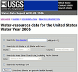
2007 Water Data Report Now Available (Quick look:
Beginning with water year 2006, the annual water data product took on a new format different from the previous report series. The basic product is a Site Data Sheet that serves to publish all data collected during the water year at any given site.

For more information about this topic, click now.
)

Annual Water Data for Indiana home page.The 2007 USGS Water Data Report (Opens Water Data Report page in new window. ) is now available to provide a snapshot of water conditions for a given year. The report includes text and map interfaces that can be used to identify and access an area of interest, locate sites where water data were collected for various Water Years
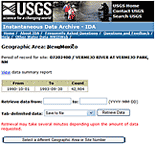
Instantaneous Data Archive (IDA) (Quick look:
Since 1889 the United States Geological Survey has collected continuous stage, discharge, and other instantaneous time-series data on the nations rivers and streams. These time-series data have been and are typically recorded at intervals ranging from 5 to 60 minutes. These instantaneous data have been processed into and published as various daily values, such as the daily maximum, minimum, and/or mean. Because the published record are daily values, the original instantaneous data have not historically been officially approved, published, or made widely available. This web site has been established to make available as much historical instantaneous data from USGS data collection stations as possible. Although this site currently serves instantaneous discharge (streamflow) data only, work is planned to extend it to other time-series parameters in the future.

For more information about this topic, click now.
)

Instantaneous Data Archive for Indiana.

The Instantaneous Data Archive(Opens Water Data Report page in new window. ) makes available as much intra-day streamflow data and historical instantaneous data continuous (measurements from every 5 to every 60 minutes), as possible, often several years' worth of data.

Featured Projects

Investigations and Monitoring of Mercury in Indiana

Marty Risch with a precip sampler.

Look!Find out more

The Indianapolis Museum of Art and the Indiana USGS

White River at the IMA.

Look!Find out more

Beverly Shores, Indiana Water Monitoring Network

Marsh at Beverly Shores, Indiana.

Look!Find out more

Of Current Interest

Mixed News on Mercury in Indiana's Water

Sampling a stream for mercury. Sampling atmospheric mercury.

Rain and snow falling in Indiana contains less mercury than it did in years past. Yet some of the state's major waterways have mercury levels that could be harmful to humans and wildlife. The USGS, in cooperation with the Indiana Department of Environmental Management, has released new reports about mercury in streams and precipitation in Indiana. The full press release can be found in the USGS Newsroom at:
http://www.usgs.gov/newsroom/article.asp?ID=2099

Recent Publications

The Indiana Water Science Center produces publications about water resources.

Report cover.Processing, Analysis, and General Evaluation of Well-Driller Logs for Estimating Hydrogeologic Parameters of the Glacial Sediments in a Ground-Water Flow Model of the Lake Michigan Basin
Scientific Investigations Report 2008–5184

Report cover.Occurrence and Distribution of Algal Biomass and Its Relation to Nutrients and Selected Basin Characteristics in Indiana Streams, 2001-2005
Scientific Investigations Report 2008–5203


Report cover.Total Mercury and Methylmercury in Indiana Streams, August 2004–September 2006
Scientific Investigations Report 2008–5176


Report cover.Mercury in Precipitation in Indiana, January 2004–December 2005
Scientific Investigations Report 2008–5148


Report cover.Flood of June 7–9, 2008, in Central and Southern Indiana
Open-File Report 2008–1322


Report cover.Watershed Regressions for Pesticides (WARP) for Predicting Annual Maximum and Annual Maximum Moving-Average Concentrations of Atrazine in Streams Open-File Report 2008–1186


Report cover.Environmental Assessment of the Muscatatuck Urban Training Center near Butlerville, Indiana, October and November 2005
Open-File Report 2007–1100


Report cover.Methods Used to Assess the Susceptibility to Contamination of Transient, Non-Community Public Ground-Water Supplies in Indiana
Scientific Investigations Report 2005-5059


Report cover.Nutrient, Habitat, and Basin-Characteristics Data and Relations with Fish and Invertebrate Communities in Indiana Streams, 1998–2000
Scientific Investigations Report 2007-5076

Search our publications

Cooperators

Ball State University
Bartholomew County Soil and Water Conservation District
Boone County
City of Anderson, Office of Emergency Management
City of Carmel
City of Fort Wayne
City of Indianapolis, DPW
City of Indianapolis, DPW Department of Capital Assest Management
Hamilton County
Hancock County
IUPUI
Indiana Department of Environmental Management Office of Water Quality
Indiana Department of Environmental Mgmt, Office of Air Quality
Indiana Department of Homeland Security
Indiana Department of Natural Resources
Indiana Department of Natural Resources - Division of Nature Preserves
Indiana Department of Natural Resources, Division of Reclamation
Indiana Department of Natural Resources, Division of Water
Indiana Department of Transportation
Indianapolis Airport Authority
Kankakee River Basin
Little Calumet River Basin
Maumee River Basin Commission
Miami County EDA
National Parks Service
ORSANCO
Sanitary District of Michigan City
Shelby County Soil & Water Conservation District
South Bend Water Works
Tipton County
U.S. Army Corps of Engineers - Chicago
U.S. Army Corps of Engineers - Louisville
US EPA OW
USAEC, Aberdeen Proving Ground
Underwriters Laboratories, Inc Drinking Water Laboratory

Additional funding for streamgages and hydrologic investigations provided by:
AES Corporation
ARCADIS G&M of Michigan, LLC
Citizens Energy Group
Duke Energy
Hoosier Energy
Indianapolis Museum of Art
Veolia Water North America


USGS Home Water Resources Biology Geography Geology Geospatial

Accessibility FOIA Privacy Policies and Notices

Take Pride in America logo USA.gov logo U.S. Department of the Interior | U.S. Geological Survey
URL: http://in.water.usgs.gov/index.html
Page Contact Information: webmaster-in@usgs.gov
Page Last Modified: Thursday, 26-Mar-2009 11:15:27 EDT

05515500: Flow=924cfs,Stage=10.00ft,Floodstage=10.0ft,2009-05-06 10:00,>90,KANKAKEE RIVER AT DAVIS, IN 04182000: Flow=2340cfs,Stage=7.49ft,Floodstage=14.0ft,2009-05-06 09:30,>90,ST. MARYS RIVER NEAR FORT WAYNE, IN 04181500: Flow=2010cfs,Stage=12.99ft,Floodstage=17.0ft,2009-05-06 07:00,>90,ST. MARYS RIVER AT DECATUR, IN 04101500: Flow=7420cfs,Stage=8.34ft,Floodstage=11.0ft,2009-05-06 07:30,>90,ST. JOSEPH RIVER AT NILES, MI 04099000: Flow=3760cfs,Stage=5.56ft,Floodstage=8.0ft,2009-05-06 07:30,>90,ST. JOSEPH RIVER AT MOTTVILLE, MI 03374000: Flow=40100cfs,Stage=19.36ft,Floodstage=16.0ft,2009-05-06 09:00,>90,WHITE RIVER AT PETERSBURG, IN 03373500: Flow=17200cfs,Stage=11.52ft,Floodstage=20.0ft,2009-05-06 09:30,>90,EAST FORK WHITE RIVER AT SHOALS, IN 03371500: Flow=15100cfs,Stage=18.49ft,Floodstage=20.0ft,2009-05-06 09:00,>90,EAST FORK WHITE RIVER NEAR BEDFORD, IN 03360500: Flow=16200cfs,Stage=13.42ft,Floodstage=13.0ft,2009-05-06 09:00,>90,WHITE RIVER AT NEWBERRY, IN 03353000: Flow=3340cfs,Stage=6.13ft,2009-05-06 09:45,>90,WHITE RIVER AT INDIANAPOLIS, IN 03348000: Flow=715cfs,Stage=5.37ft,Floodstage=10.0ft,2009-05-06 07:00,>90,WHITE RIVER AT ANDERSON, IN 03342000: Flow=37700cfs,Stage=18.34ft,Floodstage=15.0ft,2009-05-06 09:00,>90,WABASH RIVER AT RIVERTON, IN 03341500: Flow=34100cfs,Stage=16.88ft,Floodstage=14.0ft,2009-05-06 09:00,>90,WABASH RIVER AT TERRE HAUTE, IN 03339500: Flow=990cfs,Stage=2.71ft,Floodstage=8.0ft,2009-05-06 06:00,>90,SUGAR CREEK AT CRAWFORDSVILLE, IN 03336000: Flow=17300cfs,Stage=14.90ft,Floodstage=16.0ft,2009-05-06 06:00,>90,WABASH RIVER AT COVINGTON, IN 03335000: Flow=1790cfs,Stage=6.03ft,Floodstage=10.0ft,2009-05-06 10:00,>90,WILDCAT CREEK NEAR LAFAYETTE, IN 03334500: Flow=493cfs,Stage=4.37ft,Floodstage=10.0ft,2009-05-06 09:30,>90,SOUTH FORK WILDCAT CREEK NEAR LAFAYETTE, IN 03329000: Flow=9530cfs,Stage=6.98ft,Floodstage=15.0ft,2009-05-06 09:00,>90,WABASH RIVER AT LOGANSPORT, IN 03327500: Flow=8160cfs,Stage=8.76ft,Floodstage=20.0ft,2009-05-06 09:00,>90,WABASH RIVER AT PERU, IN 03325000: Flow=4990cfs,Stage=8.88ft,Floodstage=14.0ft,2009-05-06 09:30,>90,WABASH RIVER AT WABASH, IN 03322900: Flow=1400cfs,Stage=7.30ft,Floodstage=11.0ft,2009-05-06 06:00,>90,WABASH RIVER AT LINN GROVE, IN 05536290: Flow=213cfs,Stage=6.66ft,Floodstage=16.5ft,2009-05-06 08:30,76-90,LITTLE CALUMET RIVER AT SOUTH HOLLAND, IL 05536275: Flow=130cfs,Stage=3.36ft,Floodstage=10.0ft,2009-05-06 08:30,76-90,THORN CREEK AT THORNTON, IL 05536255: Flow=24cfs,Stage=4.52ft,2009-05-06 08:30,76-90,BUTTERFIELD CREEK AT FLOSSMOOR, IL 05517530: Flow=2340cfs,Stage=8.54ft,Floodstage=11.0ft,2009-05-06 10:00,76-90,KANKAKEE RIVER NR KOUTS, IN 05517500: Flow=2450cfs,Stage=7.63ft,Floodstage=10.0ft,2009-05-06 10:00,76-90,KANKAKEE RIVER AT DUNNS BRIDGE, IN 05517000: Flow=643cfs,Stage=6.18ft,Floodstage=10.0ft,2009-05-06 09:45,76-90,YELLOW RIVER AT KNOX, IN 04183000: Flow=3370cfs,Stage=8.59ft,Floodstage=17.0ft,2009-05-06 09:30,76-90,MAUMEE RIVER AT NEW HAVEN, IN 04101000: Flow=6070cfs,Stage=21.34ft,Floodstage=24.0ft,2009-05-06 09:30,76-90,ST. JOSEPH RIVER AT ELKHART, IN 04100500: Flow=990cfs,Stage=3.59ft,Floodstage=7.0ft,2009-05-06 09:45,76-90,ELKHART RIVER AT GOSHEN, IN 04100222: Flow=239cfs,Stage=4.89ft,Floodstage=8.0ft,2009-05-06 09:30,76-90,NB ELKHART RIVER AT COSPERVILLE, IN 04099750: Flow=555cfs,Stage=4.54ft,Floodstage=6.0ft,2009-05-06 08:00,76-90,PIGEON RIVER NEAR SCOTT, IN 04093000: Flow=156cfs,Stage=5.61ft,2009-05-06 09:45,76-90,DEEP RIVER AT LAKE GEORGE OUTLET AT HOBART, IN 03377500: Flow=80200cfs,Stage=20.37ft,Floodstage=19.0ft,2009-05-06 06:00,76-90,WABASH RIVER AT MT. CARMEL, IL 03365500: Flow=5060cfs,Stage=9.21ft,Floodstage=12.0ft,2009-05-06 09:00,76-90,EAST FORK WHITE RIVER AT SEYMOUR, IN 03364000: Flow=3010cfs,Stage=2.25ft,Floodstage=9.0ft,2009-05-06 09:00,76-90,EAST FORK WHITE RIVER AT COLUMBUS, IN 03363900: Flow=1010cfs,Stage=6.26ft,Floodstage=11.0ft,2009-05-06 09:30,76-90,FLATROCK RIVER AT COLUMBUS, IN 03363500: Flow=612cfs,Stage=1.84ft,Floodstage=6.0ft,2009-05-06 09:45,76-90,FLATROCK RIVER AT ST. PAUL, IN 03362500: Flow=668cfs,Stage=5.97ft,Floodstage=10.0ft,2009-05-06 10:00,76-90,SUGAR CREEK NEAR EDINBURGH, IN 03361850: Flow=122cfs,Stage=2.85ft,Floodstage=9.0ft,2009-05-06 09:00,76-90,BUCK CREEK AT ACTON, IN 03361650: Flow=154cfs,Stage=3.69ft,Floodstage=8.0ft,2009-05-06 09:45,76-90,SUGAR CREEK AT NEW PALESTINE, IN 03361500: Flow=742cfs,Stage=5.83ft,Floodstage=11.0ft,2009-05-06 09:45,76-90,BIG BLUE RIVER AT SHELBYVILLE, IN 03358000: Flow=334cfs,Stage=6.14ft,Floodstage=15.0ft,2009-05-06 07:00,76-90,MILL CREEK NEAR CATARACT, IN 03354000: Flow=5000cfs,Stage=5.26ft,Floodstage=12.0ft,2009-05-06 10:00,76-90,WHITE RIVER NEAR CENTERTON, IN 03353800: Flow=276cfs,Stage=8.49ft,Floodstage=17.0ft,2009-05-06 09:30,76-90,WHITE LICK CREEK AT MOORESVILLE, IN 03353600: Flow=31cfs,Stage=2.41ft,Floodstage=6.0ft,2009-05-06 09:45,76-90,LITTLE EAGLE CREEK AT SPEEDWAY, IN 03353500: Flow=293cfs,Stage=3.34ft,Floodstage=9.0ft,2009-05-06 08:30,76-90,EAGLE CREEK AT INDIANAPOLIS, IN 03353200: Flow=147cfs,Stage=2.47ft,Floodstage=9.0ft,2009-05-06 09:15,76-90,EAGLE CREEK AT ZIONSVILLE, IN 03352500: Flow=393cfs,Stage=3.85ft,Floodstage=10.0ft,2009-05-06 09:45,76-90,FALL CREEK AT MILLERSVILLE, IN 03351500: Flow=280cfs,Stage=2.89ft,Floodstage=8.0ft,2009-05-06 07:00,76-90,FALL CREEK NEAR FORTVILLE, IN 03351000: Flow=2360cfs,Stage=5.22ft,Floodstage=11.0ft,2009-05-06 09:00,76-90,WHITE RIVER NEAR NORA, IN 03349000: Flow=1530cfs,Stage=6.05ft,Floodstage=14.0ft,2009-05-06 09:45,76-90,WHITE RIVER AT NOBLESVILLE, IN 03347000: Flow=343cfs,Stage=4.78ft,Floodstage=9.0ft,2009-05-06 07:00,76-90,WHITE RIVER AT MUNCIE, IN 03342500: Flow=416cfs,Stage=5.00ft,Floodstage=16.0ft,2009-05-06 09:00,76-90,BUSSERON CREEK NEAR CARLISLE, IN 03341300: Flow=1000cfs,Stage=7.96ft,Floodstage=14.0ft,2009-05-06 09:45,76-90,BIG RACCOON CREEK AT COXVILLE, IN 03340800: Flow=212cfs,Stage=3.59ft,Floodstage=11.0ft,2009-05-06 09:00,76-90,BIG RACCOON CREEK NEAR FINCASTLE, IN 03340500: Flow=28300cfs,Stage=17.13ft,Floodstage=14.0ft,2009-05-06 08:00,76-90,WABASH RIVER AT MONTEZUMA, IN 03339000: Flow=2220cfs,Stage=6.34ft,Floodstage=18.0ft,2009-05-06 08:45,76-90,VERMILION RIVER NEAR DANVILLE, IL 03335500: Flow=12300cfs,Stage=8.87ft,Floodstage=11.0ft,2009-05-06 09:00,76-90,WABASH RIVER AT LAFAYETTE, IN 03334000: Flow=820cfs,Stage=3.38ft,2009-05-06 09:15,76-90,WILDCAT CREEK AT OWASCO, IN 03333450: Flow=303cfs,Stage=3.36ft,Floodstage=9.0ft,2009-05-06 09:15,76-90,WILDCAT CREEK NEAR JEROME, IN 03329700: Flow=297cfs,Stage=3.07ft,Floodstage=11.0ft,2009-05-06 07:00,76-90,DEER CREEK NEAR DELPHI, IN 03326500: Flow=690cfs,Stage=2.47ft,Floodstage=12.0ft,2009-05-06 06:00,76-90,MISSISSINEWA RIVER AT MARION, IN 03325500: Flow=88cfs,Stage=3.35ft,Floodstage=11.0ft,2009-05-06 08:00,76-90,MISSISSINEWA RIVER NEAR RIDGEVILLE, IN 03324300: Flow=318cfs,Stage=7.11ft,Floodstage=12.0ft,2009-05-06 06:00,76-90,SALAMONIE RIVER NEAR WARREN, IN 03291500: Flow=479cfs,Stage=3.46ft,2009-05-06 10:15,76-90,EAGLE CREEK AT GLENCOE, KY 03275600: Flow=359cfs,Stage=3.78ft,2009-05-06 09:45,76-90,EAST FORK WHITEWATER RIVER AT ABINGTON, IN 03275000: Flow=882cfs,Stage=8.62ft,Floodstage=17ft,2009-05-06 08:00,76-90,WHITEWATER RIVER NEAR ALPINE, IN 05536235: Flow=2.8cfs,Stage=4.79ft,2009-05-06 08:30,10-24,DEER CREEK NEAR CHICAGO HEIGHTS, IL 05525000: Flow=712cfs,Stage=9.31ft,Floodstage=18.0ft,2009-05-06 08:30,25-75,IROQUOIS RIVER AT IROQUOIS, IL 05524500: Flow=399cfs,Stage=9.16ft,2009-05-06 08:15,25-75,IROQUOIS RIVER NEAR FORESMAN, IN 05522500: Flow=231cfs,Stage=5.72ft,Floodstage=12.0ft,2009-05-06 09:30,25-75,IROQUOIS RIVER AT RENSSELAER, IN 05516500: Flow=278cfs,Stage=5.66ft,Floodstage=13.0ft,2009-05-06 09:45,25-75,YELLOW RIVER AT PLYMOUTH, IN 04180500: Flow=803cfs,Stage=4.12ft,Floodstage=12.0ft,2009-05-06 07:45,25-75,ST. JOSEPH RIVER NEAR FORT WAYNE, IN 04180000: Flow=225cfs,Stage=2.19ft,Floodstage=18.0ft,2009-05-06 09:30,25-75,CEDAR CREEK NEAR CEDARVILLE, IN 04178000: Flow=582cfs,Stage=7.01ft,Floodstage=12.0ft,2009-05-06 09:30,25-75,ST. JOSEPH RIVER NEAR NEWVILLE, IN 04177720: Flow=29cfs,Stage=4.08ft,Floodstage=9.0ft,2009-05-06 09:45,25-75,FISH CREEK AT HAMILTON, IN 04099510: Flow=101cfs,Stage=6.78ft,Floodstage=11.0ft,2009-05-06 09:30,25-75,PIGEON CREEK NR ANGOLA, IN 03378550: Flow=71cfs,Stage=3.49ft,2009-05-06 09:15,25-75,BIG CREEK NEAR WADESVILLE, IN 03376500: Flow=2250cfs,Stage=13.33ft,Floodstage=18.0ft,2009-05-06 06:00,25-75,PATOKA RIVER NEAR PRINCETON, IN 03376300: Flow=1590cfs,Stage=17.60ft,2009-05-06 07:30,25-75,PATOKA RIVER AT WINSLOW, IN 03375500: Flow=217cfs,Stage=7.37ft,2009-05-06 09:00,25-75,PATOKA RIVER AT JASPER, IN 03369500: Flow=202cfs,Stage=3.63ft,Floodstage=17.0ft,2009-05-06 09:45,25-75,VERNON FORK MUSCATATUCK RIVER AT VERNON, IN 03368000: Flow=5.1cfs,Stage=2.23ft,Floodstage=8.0ft,2009-05-06 09:15,25-75,BRUSH CREEK NEAR NEBRASKA, IN 03366500: Flow=236cfs,Stage=4.45ft,Floodstage=20.0ft,2009-05-06 09:30,25-75,MUSCATATUCK RIVER NEAR DEPUTY, IN 03364500: Flow=62cfs,Stage=1.72ft,Floodstage=9.0ft,2009-05-06 05:00,25-75,CLIFTY CREEK AT HARTSVILLE, IN 03362000: Flow=89cfs,Stage=1.74ft,Floodstage=7.0ft,2009-05-06 09:15,25-75,YOUNGS CREEK NEAR EDINBURGH, IN 03360000: Flow=1450cfs,Stage=7.36ft,Floodstage=17.0ft,2009-05-06 09:00,25-75,EEL RIVER AT BOWLING GREEN, IN 03357350: Flow=3.8cfs,Stage=2.14ft,Floodstage=4.0ft,2009-05-06 09:15,25-75,PLUM CREEK NEAR BAINBRIDGE, IN 03353620: Flow=15cfs,Stage=1.80ft,Floodstage=7.0ft,2009-05-06 09:15,25-75,LICK CREEK AT INDIANAPOLIS, IN 03353120: Flow=3.9cfs,Stage=3.20ft,Floodstage=8.0ft,2009-05-06 09:30,25-75,PLEASANT RUN AT ARLINGTON AV AT INDIANAPOLIS, IN 03351310: Flow=19cfs,Stage=3.17ft,Floodstage=8.0ft,2009-05-06 09:15,25-75,CROOKED CREEK AT INDIANAPOLIS, IN 03350700: Flow=65cfs,Stage=2.48ft,Floodstage=6.0ft,2009-05-06 09:15,25-75,STONY CREEK NEAR NOBLESVILLE, IN 03333600: Flow=18cfs,Stage=2.77ft,Floodstage=8.0ft,2009-05-06 09:15,25-75,KOKOMO CREEK NEAR KOKOMO, IN 03331500: Flow=1280cfs,Stage=9.08ft,Floodstage=12.0ft,2009-05-06 09:30,25-75,TIPPECANOE RIVER NEAR ORA, IN 03330500: Flow=170cfs,Stage=6.68ft,Floodstage=7.5ft,2009-05-06 09:45,25-75,TIPPECANOE RIVER AT OSWEGO, IN 03328500: Flow=709cfs,Stage=4.19ft,Floodstage=9.0ft,2009-05-06 09:00,25-75,EEL RIVER NEAR LOGANSPORT, IN 03328000: Flow=372cfs,Stage=4.64ft,2009-05-06 08:00,25-75,EEL RIVER AT NORTH MANCHESTER, IN 03324000: Flow=120cfs,Stage=3.03ft,2009-05-06 08:00,25-75,LITTLE RIVER NEAR HUNTINGTON, IN 03303300: Flow=93cfs,Stage=7.58ft,2009-05-06 09:30,25-75,MIDDLE FORK ANDERSON RIVER AT BRISTOW, IN 03303000: Flow=697cfs,Stage=3.88ft,2009-05-06 09:15,25-75,BLUE RIVER NEAR WHITE CLOUD, IN 03302800: Flow=241cfs,Stage=3.63ft,Floodstage=20.0ft,2009-05-06 09:30,25-75,BLUE RIVER AT FREDERICKSBURG, IN 03302680: Flow=11cfs,Stage=3.32ft,2009-05-06 09:30,25-75,WEST FORK BLUE RIVER AT SALEM, IN 03302220: Flow=53cfs,Stage=2.04ft,2009-05-06 09:15,25-75,BUCK CREEK NEAR NEW MIDDLETOWN, IN 03294000: Flow=165cfs,Stage=5.38ft,2009-05-06 08:45,25-75,SILVER CREEK NEAR SELLERSBURG, IN 03293000: Flow=12cfs,Stage=0.97ft,2009-05-06 10:45,25-75,M FK BEARGRASS CR AT OLD CANNONS LN AT LOUISVILLE, 03292500: Flow=11cfs,Stage=2.00ft,2009-05-06 10:45,25-75,SOUTH FORK BEARGRASS CREEK AT LOUISVILLE, KY 03291780: Flow=20cfs,Stage=3.44ft,2009-05-06 09:15,25-75,INDIAN-KENTUCK CREEK NEAR CANAAN, IN 413438087311701: Not ranked,LITTLE CALUMET RIVER AT MUNSTER, IN (LCRDAN) 413340087285001: Not ranked,HART DITCH AT MUNSTER, IN (LCRDAN) 413339087223001: Stage=6.62ft,2009-05-06 09:15:00,Not ranked,LITTLE CALUMET RIVER AT BURR STREET AT GARY, IN 413028087303601: Stage=2.80ft,2009-05-06 09:15:00,Not ranked,HART DITCH AT DYER, IN (LCRDAN) 400620085401601: Stage=5.42ft,2009-05-06 09:45:00,Not ranked,WHITE RIVER AT ANDERSON, IN (WRDAN) 400250086010001: Stage=6.09ft,2009-05-06 10:00:00,Not ranked,WHITE RIVER AT NOBLESVILLE, IN (WRDAN) 395435086062001: Stage=5.17ft,2009-05-06 10:00:00,Not ranked,WHITE RIVER NEAR NORA, IN (WRDAN) 395107086051501: Stage=3.87ft,2009-05-06 10:00:00,Not ranked,FALL CREEK AT MILLERSVILLE, IN (WRDAN) 394633086150101: Not ranked,EAGLE CREEK AT INDIANAPOLIS, IN (WRDAN) 394414086100801: Not ranked,WHITE RIVER AT INDIANAPOLIS, IN (WRDAN) 033356786: Flow=21cfs,Stage=4.45ft,2009-05-06 10:00,Not ranked,LITTLE PINE CREEK NEAR MONTMORENCI, IN 033356725: Flow=10cfs,Stage=2.79ft,2009-05-06 09:00,Not ranked,ELLIOTT DITCH NEAR ELSTON, IN 05536357: Stage=2.98ft,2009-05-06 09:30:00,Not ranked,Rating being developed or revised,GRAND CALUMET RIVER AT HOHMAN AV AT HAMMOND, IN 05536195: Stage=6.12ft,2009-05-06 09:00:00,Floodstage=12.0ft,Not ranked,LITTLE CALUMET RIVER AT MUNSTER, IN 05536190: Stage=3.42ft,2009-05-06 09:15:00,Not ranked,Rating being developed or revised,HART DITCH AT MUNSTER, IN 05536179: Flow=41cfs,Stage=2.80ft,2009-05-06 09:00,Not ranked,HART DITCH AT DYER, IN 05536165: Stage=9.34ft,2009-05-06 09:15:00,Not ranked,LITTLE CALUMET RIVER AT HIGHLAND, IN 05536160: Stage=6.94ft,2009-05-06 09:30:00,Not ranked,LITTLE CALUMET RIVER NEAR HAMMOND, IN 05518000: Not ranked,Temporarily unavailable,KANKAKEE RIVER AT SHELBY, IN 04185440: Flow=1.3cfs,Stage=1.50ft,2009-05-06 10:00,Not ranked,Unnamed Tributary to Lost Creek near Farmer OH 04182950: Flow=3370cfs,Stage=8.59ft,Floodstage=17.0ft,2009-05-06 09:15,Not ranked,MAUMEE RIVER AT COLISEUM BLVD AT FORT WAYNE, IN 04182900: Stage=7.28ft,2009-05-06 07:00:00,Floodstage=17.0ft,Not ranked,MAUMEE RIVER AT FORT WAYNE, IN 04182808: Stage=6.99ft,2009-05-06 09:00:00,Not ranked,Rating being developed or revised,SPY RUN CREEK NEAR PARK DRIVE AT FORT WAYNE, IN 04179520: Flow=85cfs,Stage=3.29ft,2009-05-06 10:00,Not ranked,CEDAR CREEK AT 18TH STREET AT AUBURN, IN 04101370: Flow=31cfs,Stage=2.49ft,2009-05-06 09:30,Not ranked,JUDAY CREEK NEAR SOUTH BEND, IN 04100180: Stage=9.66ft,2009-05-06 09:00:00,Not ranked,SYLVAN LAKE AT ROME CITY, IN 04095380: Flow=24cfs,Stage=3.11ft,2009-05-06 08:45,Not ranked,TRAIL CREEK AT MICHIGAN CITY HARBOR, IN 04095300: Flow=83cfs,Stage=2.84ft,2009-05-06 09:30,Not ranked,TRAIL CREEK AT MICHIGAN CITY, IN 04095090: Flow=753cfs,Stage=4.50ft,2009-05-06 09:00,Not ranked,BURNS DITCH AT PORTAGE, IN 04094400: Stage=3.30ft,2009-05-06 09:00:00,Not ranked,Rating being developed or revised,SALT CREEK AT VALPARAISO, IN 04094000: Flow=78cfs,Stage=4.60ft,2009-05-06 09:45,Not ranked,LITTLE CALUMET RIVER AT PORTER, IN 04092750: Flow=457cfs,2009-05-06 09:00,Stage=9.32ft,2009-05-06 09:05:00,Not ranked,INDIANA HARBOR CANAL AT EAST CHICAGO, IN 04092677: Flow=644cfs,Stage=2.13ft,2009-05-06 07:50,Not ranked,GRAND CALUMET RIVER AT INDUSTRIAL HWY AT GARY, IN 03378500: Stage=15.47ft,2009-05-06 08:00:00,Floodstage=15.0ft,Not ranked,WABASH RIVER AT NEW HARMONY, IN 03374500: Stage=4.11ft,2009-05-06 07:00:00,Not ranked,PATOKA RIVER NEAR CUZCO, IN 03373980: Stage=19.18ft,2009-05-06 09:30:00,Floodstage=16.0ft,Not ranked,WHITE RIVER ABOVE PETERSBURG, IN 03373508: Flow=29cfs,Stage=2.90ft,Floodstage=7.0ft,2009-05-06 09:45,Not ranked,BEAVER CREEK NEAR SHOALS, IN 03372500: Stage=16.25ft,2009-05-06 06:00:00,Floodstage=25.0ft,Not ranked,SALT CREEK NEAR HARRODSBURG, IN 03364650: Flow=179cfs,Stage=5.30ft,Floodstage=17.0ft,2009-05-06 09:15,Not ranked,CLIFTY CREEK NEAR COLUMBUS, IN 03361632: Flow=131cfs,Stage=4.42ft,2009-05-06 09:45,Not ranked,SUGAR CREEK NEAR EDEN, IN 03361630: Flow=6.5cfs,Stage=2.37ft,2009-05-06 09:45,Not ranked,SUGAR CREEK AT EDEN, IN 03361109: Flow=12cfs,Stage=1.90ft,2009-05-06 08:45,Not ranked,NAMELESS CREEK AT STRINGTOWN, IN 03361000: Stage=1.84ft,2009-05-06 09:45:00,Floodstage=7.0ft,Not ranked,BIG BLUE RIVER AT CARTHAGE, IN 03359000: Stage=9.67ft,2009-05-06 07:00:00,Floodstage=12.0ft,Not ranked,MILL CREEK NEAR MANHATTAN, IN 03357500: Stage=5.06ft,2009-05-06 09:00:00,Floodstage=12.0ft,Not ranked,BIG WALNUT CREEK NEAR REELSVILLE, IN 03357330: Flow=125cfs,Stage=5.54ft,2009-05-06 09:15,Not ranked,BIG WALNUT CREEK NEAR ROACHDALE, IN 03357000: Stage=9.44ft,2009-05-06 10:00:00,Floodstage=14.0ft,Not ranked,WHITE RIVER AT SPENCER, IN 03353910: Flow=53cfs,Stage=4.19ft,Floodstage=9.0ft,2009-05-06 09:15,Not ranked,EAST FORK WHITE LICK CREEK AT MOORESVILLE, IN 03353890: Flow=32cfs,Stage=4.30ft,Floodstage=8.0ft,2009-05-06 09:30,Not ranked,EAST FORK WHITE LICK CREEK NEAR CAMBY, IN 03353885: Flow=30cfs,Stage=2.44ft,Floodstage=6.0ft,2009-05-06 09:30,Not ranked,EAST FORK WHITE LICK CREEK AT BRIDGEPORT, IN 03353637: Flow=13cfs,Stage=2.27ft,Floodstage=6.0ft,2009-05-06 09:15,Not ranked,LITTLE BUCK CREEK NEAR INDIANAPOLIS, IN 03353611: Flow=3280cfs,Stage=4.23ft,Floodstage=10.0ft,2009-05-06 09:45,Not ranked,WHITE R. AT STOUT GEN. STN. AT INDIANAPOLIS, IN 03353460: Flow=273cfs,Stage=4.12ft,Floodstage=9.0ft,2009-05-06 09:15,Not ranked,EAGLE CREEK AT CLERMONT, IN 03353451: Flow=44cfs,2009-04-27 17:30,Stage=3.92ft,2009-05-06 09:45:00,Not ranked,EAGLE CREEK BELOW RESERVOIR AT INDIANAPOLIS, IN 03353450: Stage=789.88ft,2009-05-06 09:45:00,Not ranked,EAGLE CREEK RESERVOIR NEAR INDIANAPOLIS, IN 03352988: Flow=3.3cfs,Stage=1.46ft,2009-05-06 09:45,Not ranked,POGUES RUN AT VERMONT STREET AT INDIANAPOLIS, IN 03352972: Stage=3.78ft,2009-05-06 09:45:00,Not ranked,POGUES RUN ABOVE DAM INDIANAPOLIS 03352953: Flow=2860cfs,Stage=8.80ft,Floodstage=16.0ft,2009-05-06 09:15,Not ranked,WHITE RIVER AT MICHIGAN STREET AT INDIANAPOLIS, IN 03352695: Stage=5.18ft,2009-05-06 07:00:00,Not ranked,HERON LAKE AT INDIANAPOLIS, IN 03352690: Stage=3.84ft,2009-05-06 09:00:00,Not ranked,LAKE MAXINHALL AT INDIANAPOLIS, IN 03351201: Stage=6.26ft,2009-05-06 10:00:00,Not ranked,WHITE RIVER AT INDIANAPOLIS MUSEUM OF ART, IN 03351072: Flow=20cfs,Stage=3.56ft,2009-05-06 09:45,Not ranked,WILLIAMS CREEK AT 96TH STREET, INDIANAPOLIS, IN 03351071: Stage=3.38ft,2009-05-06 09:00:00,Floodstage=8.5ft,Not ranked,WHITE RIVER BELOW DAM AT BROAD RIPPLE, IN. 03351060: Stage=3.88ft,2009-05-06 10:00:00,Floodstage=6.0ft,Not ranked,WHITE RIVER AT BROAD RIPPLE, IN 03350800: Flow=2160cfs,Stage=5.69ft,Floodstage=13.0ft,2009-05-06 10:00,Not ranked,WHITE RIVER AT 146TH ST NEAR NOBLESVILLE, IN 03350660: Flow=17cfs,Stage=7.74ft,2009-05-06 09:15,Not ranked,WILLIAM LOCK DITCH NEAR DURBIN, IN 03350655: Flow=15cfs,Stage=4.85ft,2009-05-06 09:45,Not ranked,STONY CREEK AT FISHERSBURG, IN 03349510: Flow=234cfs,Stage=4.31ft,Floodstage=9.0ft,2009-05-06 09:30,Not ranked,CICERO CREEK AT ARCADIA, IN 03349210: Flow=163cfs,Stage=3.76ft,2009-05-06 06:45,Not ranked,CICERO CREEK AT TIPTON, IN 03348130: Flow=752cfs,Stage=3.78ft,Floodstage=10.0ft,2009-05-06 09:00,Not ranked,WHITE RIVER AT RAIBLE AVENUE AT ANDERSON, IN 03348100: Flow=164cfs,Stage=3.18ft,Floodstage=7.0ft,2009-05-06 09:15,Not ranked,KILLBUCK CREEK NR ANDERSON, IN 03346500: Flow=8090cfs,Stage=30.32ft,Floodstage=30.0ft,2009-05-06 08:55,Not ranked,EMBARRAS RIVER AT LAWRENCEVILLE, IL 03343010: Stage=16.62ft,2009-05-06 09:45:00,Not ranked,WABASH RIVER AT MEMORIAL BRIDGE AT VINCENNES, IN 03343000: Stage=17.18ft,2009-05-06 09:00:00,Not ranked,WABASH RIVER AT VINCENNES, IN 03340900: Stage=8.04ft,2009-05-06 02:00:00,Not ranked,BIG RACCOON CREEK AT FERNDALE, IN 03339280: Flow=39cfs,Stage=5.37ft,Floodstage=9.0ft,2009-05-06 09:15,Not ranked,PRAIRIE CREEK NEAR LEBANON, IN 03338780: Flow=336cfs,Stage=6.20ft,2009-05-06 08:45,Not ranked,NORTH FORK VERMILION RIVER NEAR BISMARCK, IL 03335673: Flow=31cfs,Stage=4.34ft,2009-05-06 10:00,Not ranked,LITTLE WEA CREEK AT SOUTH RAUB, IN 03335671: Flow=9.2cfs,Stage=1.89ft,2009-05-06 09:15,Not ranked,ELLIOTT DITCH NEAR LAFAYETTE, IN 03333700: Not ranked,Temporarily unavailable,WILDCAT CREEK AT KOKOMO, IN 03333050: Flow=2690cfs,Stage=4.16ft,Floodstage=8.0ft,2009-05-06 09:00,Not ranked,TIPPECANOE RIVER NEAR DELPHI, IN 03332605: Flow=2670cfs,Stage=6.96ft,2009-05-06 09:15,Not ranked,TIPPECANOE RIVER BELOW OAKDALE DAM, IN 03332555: Flow=2380cfs,Stage=9.21ft,2009-05-06 09:45,Not ranked,TIPPECANOE RIVER AT NORWAY, IN 03331753: Flow=1460cfs,Stage=6.72ft,Floodstage=10.0ft,2009-05-06 09:00,Not ranked,TIPPECANOE RIVER AT WINAMAC, IN 03330241: Flow=57cfs,Stage=3.88ft,Floodstage=6.0ft,2009-05-06 09:45,Not ranked,TIPPECANOE RIVER AT NORTH WEBSTER, IN 03327507: Flow=12cfs,Stage=2.23ft,2009-05-06 10:00,Not ranked,PRAIRIE DITCH NEAR PERU, IN 03327503: Flow=12cfs,Stage=2.84ft,2009-05-06 10:00,Not ranked,PRAIRIE DITCH AT PERU, IN 03327000: Stage=6.09ft,2009-05-06 07:00:00,Floodstage=11.0ft,Not ranked,MISSISSINEWA RIVER AT PEORIA, IN 03324500: Stage=6.27ft,2009-05-06 07:00:00,Floodstage=11.0ft,Not ranked,SALAMONIE RIVER AT DORA, IN 03323500: Stage=12.08ft,2009-05-06 07:00:00,Not ranked,WABASH RIVER AT HUNTINGTON, IN 03322985: Flow=1510cfs,Stage=7.65ft,Floodstage=12.0ft,2009-05-06 09:45,Not ranked,WABASH RIVER NEAR BLUFFTON, IN 03322420: Stage=28.38ft,2009-05-06 09:00:00,Not ranked,OHIO RIVER AT UNIONTOWN DAM, KY 03322190: Stage=20.43ft,2009-05-06 09:45:00,Not ranked,OHIO RIVER AT HENDERSON, KY 03322000: Stage=24.10ft,2009-05-06 06:15:00,Floodstage=42.0ft,Not ranked,OHIO RIVER AT EVANSVILLE, IN 03304300: Stage=26.95ft,2009-05-06 09:00:00,Floodstage=38.0ft,Not ranked,OHIO RIVER AT NEWBURGH LOCK AND DAM, IN 03303280: Stage=22.54ft,2009-05-06 06:15:00,Floodstage=42.0ft,Not ranked,OHIO RIVER AT CANNELTON DAM AT CANNELTON, IN 03302849: Not ranked,WHISKEY RUN AT MARENGO, IN 03302110: Flow=71cfs,Stage=3.24ft,2009-05-06 10:15,Not ranked,OTTER CREEK AT OTTER CR PARK NEAR ROCK HAVEN KY. 03302050: Flow=4.9cfs,Stage=1.57ft,2009-05-06 10:15,Not ranked,BRIER CREEK AT PENDELTON ROAD NEAR LOUISVILLE, KY 03302030: Flow=47cfs,Stage=5.28ft,2009-05-06 10:15,Not ranked,POND CREEK AT PENDLETON ROAD NEAR LOUISVILLE, KY 03294600: Stage=27.29ft,2009-05-06 11:00:00,Not ranked,OHIO RIVER AT KOSMOSDALE, KY 03294570: Flow=1.9cfs,Stage=1.41ft,2009-05-06 10:15,Not ranked,MILL CREEK AT ORELL ROAD NEAR LOUISVILLE, KY 03294550: Flow=0.68cfs,Stage=2.56ft,2009-05-06 10:15,Not ranked,MILL CREEK CUTOFF NEAR LOUISVILLE, KY 03294500: Stage=32.25ft,2009-05-06 11:00:00,Floodstage=55.0ft,Not ranked,OHIO RIVER AT LOUISVILLE, KY 03293548: Stage=13.38ft,2009-05-06 11:00:00,Floodstage=23.0ft,Not ranked,OHIO RIVER AT 2ND STREET BRIDGE AT LOUISVILLE, KY 03293530: Flow=10cfs,Stage=1.16ft,2009-05-06 10:45,Not ranked,MUDDY FK AT MOCKINGBIRD VALLEY RD AT LOUISVILLE,KY 03293510: Stage=9.26ft,2009-05-06 10:50:00,Not ranked,BEARGRASS CREEK AT RIVER ROAD AT LOUISVILLE, KY 03293500: Flow=11cfs,Stage=2.41ft,2009-05-06 10:15,Not ranked,M FK BEARGRASS CR AT LEXINGTON RD AT LOUISVILLE,KY 03292550: Flow=22cfs,Stage=3.77ft,2009-05-06 10:15,Not ranked,S FK BEARGRASS CR AT WINTER AVE AT LOUISVILLE, KY 03292480: Flow=5.9cfs,Stage=3.10ft,2009-05-06 10:15,Not ranked,LITTLE GOOSE CREEK NEAR HARRODS CREEK, KY 03292475: Flow=7.9cfs,Stage=2.39ft,2009-05-06 10:30,Not ranked,GOOSE CREEK AT US HWY 42 NEAR GLENVIEW ACRES, KY 03292474: Flow=6.7cfs,Stage=0.87ft,2009-05-06 10:30,Not ranked,GOOSE CREEK AT OLD WESTPORT RD NR ST MATTHEWS, KY 03292470: Flow=41cfs,Stage=2.17ft,2009-05-06 10:15,Not ranked,HARRODS CREEK AT HIGHWAY 329 NR GOSHEN, KY. 03277200: Stage=33.43ft,2009-05-06 08:00:00,Floodstage=51.0ft,Not ranked,OHIO RIVER AT MARKLAND DAM NEAR WARSAW, KY 03277130: Flow=15cfs,Stage=1.41ft,2009-05-06 10:45,Not ranked,MUD LICK CR AT HWY 42 NR BEAVERLICK, KY 03276500: Flow=4370cfs,Stage=5.72ft,Floodstage=20ft,2009-05-05 10:00,Not ranked,WHITEWATER RIVER AT BROOKVILLE, IN 03276000: Stage=4.50ft,2009-05-06 07:00:00,Not ranked,EAST FORK WHITEWATER RIVER AT BROOKVILLE, IN 03274650: Stage=3.60ft,2009-05-06 09:45:00,Not ranked,Rating being developed or revised,WHITEWATER RIVER NEAR ECONOMY, IN 03262001: Flow=4.8cfs,Stage=1.07ft,2009-05-06 10:45,Not ranked,WOOLPER CREEK AT WOOLPER ROAD NEAR BURLINGTON, KY Go to WaterWatch (offsite) for a larger map with additional options 05515500: Flow=924cfs,Stage=10.00ft,Floodstage=10.0ft,2009-05-06 10:00,>90,KANKAKEE RIVER AT DAVIS, IN 04182000: Flow=2340cfs,Stage=7.49ft,Floodstage=14.0ft,2009-05-06 09:30,>90,ST. MARYS RIVER NEAR FORT WAYNE, IN 04181500: Flow=2010cfs,Stage=12.99ft,Floodstage=17.0ft,2009-05-06 07:00,>90,ST. MARYS RIVER AT DECATUR, IN 04101500: Flow=7420cfs,Stage=8.34ft,Floodstage=11.0ft,2009-05-06 07:30,>90,ST. JOSEPH RIVER AT NILES, MI 04099000: Flow=3760cfs,Stage=5.56ft,Floodstage=8.0ft,2009-05-06 07:30,>90,ST. JOSEPH RIVER AT MOTTVILLE, MI 03374000: Flow=40100cfs,Stage=19.36ft,Floodstage=16.0ft,2009-05-06 09:00,>90,WHITE RIVER AT PETERSBURG, IN 03373500: Flow=17200cfs,Stage=11.52ft,Floodstage=20.0ft,2009-05-06 09:30,>90,EAST FORK WHITE RIVER AT SHOALS, IN 03371500: Flow=15100cfs,Stage=18.49ft,Floodstage=20.0ft,2009-05-06 09:00,>90,EAST FORK WHITE RIVER NEAR BEDFORD, IN 03360500: Flow=16200cfs,Stage=13.42ft,Floodstage=13.0ft,2009-05-06 09:00,>90,WHITE RIVER AT NEWBERRY, IN 03353000: Flow=3340cfs,Stage=6.13ft,2009-05-06 09:45,>90,WHITE RIVER AT INDIANAPOLIS, IN 03348000: Flow=715cfs,Stage=5.37ft,Floodstage=10.0ft,2009-05-06 07:00,>90,WHITE RIVER AT ANDERSON, IN 03342000: Flow=37700cfs,Stage=18.34ft,Floodstage=15.0ft,2009-05-06 09:00,>90,WABASH RIVER AT RIVERTON, IN 03341500: Flow=34100cfs,Stage=16.88ft,Floodstage=14.0ft,2009-05-06 09:00,>90,WABASH RIVER AT TERRE HAUTE, IN 03339500: Flow=990cfs,Stage=2.71ft,Floodstage=8.0ft,2009-05-06 06:00,>90,SUGAR CREEK AT CRAWFORDSVILLE, IN 03336000: Flow=17300cfs,Stage=14.90ft,Floodstage=16.0ft,2009-05-06 06:00,>90,WABASH RIVER AT COVINGTON, IN 03335000: Flow=1790cfs,Stage=6.03ft,Floodstage=10.0ft,2009-05-06 10:00,>90,WILDCAT CREEK NEAR LAFAYETTE, IN 03334500: Flow=493cfs,Stage=4.37ft,Floodstage=10.0ft,2009-05-06 09:30,>90,SOUTH FORK WILDCAT CREEK NEAR LAFAYETTE, IN 03329000: Flow=9530cfs,Stage=6.98ft,Floodstage=15.0ft,2009-05-06 09:00,>90,WABASH RIVER AT LOGANSPORT, IN 03327500: Flow=8160cfs,Stage=8.76ft,Floodstage=20.0ft,2009-05-06 09:00,>90,WABASH RIVER AT PERU, IN 03325000: Flow=4990cfs,Stage=8.88ft,Floodstage=14.0ft,2009-05-06 09:30,>90,WABASH RIVER AT WABASH, IN 03322900: Flow=1400cfs,Stage=7.30ft,Floodstage=11.0ft,2009-05-06 06:00,>90,WABASH RIVER AT LINN GROVE, IN 05536290: Flow=213cfs,Stage=6.66ft,Floodstage=16.5ft,2009-05-06 08:30,76-90,LITTLE CALUMET RIVER AT SOUTH HOLLAND, IL 05536275: Flow=130cfs,Stage=3.36ft,Floodstage=10.0ft,2009-05-06 08:30,76-90,THORN CREEK AT THORNTON, IL 05536255: Flow=24cfs,Stage=4.52ft,2009-05-06 08:30,76-90,BUTTERFIELD CREEK AT FLOSSMOOR, IL 05517530: Flow=2340cfs,Stage=8.54ft,Floodstage=11.0ft,2009-05-06 10:00,76-90,KANKAKEE RIVER NR KOUTS, IN 05517500: Flow=2450cfs,Stage=7.63ft,Floodstage=10.0ft,2009-05-06 10:00,76-90,KANKAKEE RIVER AT DUNNS BRIDGE, IN 05517000: Flow=643cfs,Stage=6.18ft,Floodstage=10.0ft,2009-05-06 09:45,76-90,YELLOW RIVER AT KNOX, IN 04183000: Flow=3370cfs,Stage=8.59ft,Floodstage=17.0ft,2009-05-06 09:30,76-90,MAUMEE RIVER AT NEW HAVEN, IN 04101000: Flow=6070cfs,Stage=21.34ft,Floodstage=24.0ft,2009-05-06 09:30,76-90,ST. JOSEPH RIVER AT ELKHART, IN 04100500: Flow=990cfs,Stage=3.59ft,Floodstage=7.0ft,2009-05-06 09:45,76-90,ELKHART RIVER AT GOSHEN, IN 04100222: Flow=239cfs,Stage=4.89ft,Floodstage=8.0ft,2009-05-06 09:30,76-90,NB ELKHART RIVER AT COSPERVILLE, IN 04099750: Flow=555cfs,Stage=4.54ft,Floodstage=6.0ft,2009-05-06 08:00,76-90,PIGEON RIVER NEAR SCOTT, IN 04093000: Flow=156cfs,Stage=5.61ft,2009-05-06 09:45,76-90,DEEP RIVER AT LAKE GEORGE OUTLET AT HOBART, IN 03377500: Flow=80200cfs,Stage=20.37ft,Floodstage=19.0ft,2009-05-06 06:00,76-90,WABASH RIVER AT MT. CARMEL, IL 03365500: Flow=5060cfs,Stage=9.21ft,Floodstage=12.0ft,2009-05-06 09:00,76-90,EAST FORK WHITE RIVER AT SEYMOUR, IN 03364000: Flow=3010cfs,Stage=2.25ft,Floodstage=9.0ft,2009-05-06 09:00,76-90,EAST FORK WHITE RIVER AT COLUMBUS, IN 03363900: Flow=1010cfs,Stage=6.26ft,Floodstage=11.0ft,2009-05-06 09:30,76-90,FLATROCK RIVER AT COLUMBUS, IN 03363500: Flow=612cfs,Stage=1.84ft,Floodstage=6.0ft,2009-05-06 09:45,76-90,FLATROCK RIVER AT ST. PAUL, IN 03362500: Flow=668cfs,Stage=5.97ft,Floodstage=10.0ft,2009-05-06 10:00,76-90,SUGAR CREEK NEAR EDINBURGH, IN 03361850: Flow=122cfs,Stage=2.85ft,Floodstage=9.0ft,2009-05-06 09:00,76-90,BUCK CREEK AT ACTON, IN 03361650: Flow=154cfs,Stage=3.69ft,Floodstage=8.0ft,2009-05-06 09:45,76-90,SUGAR CREEK AT NEW PALESTINE, IN 03361500: Flow=742cfs,Stage=5.83ft,Floodstage=11.0ft,2009-05-06 09:45,76-90,BIG BLUE RIVER AT SHELBYVILLE, IN 03358000: Flow=334cfs,Stage=6.14ft,Floodstage=15.0ft,2009-05-06 07:00,76-90,MILL CREEK NEAR CATARACT, IN 03354000: Flow=5000cfs,Stage=5.26ft,Floodstage=12.0ft,2009-05-06 10:00,76-90,WHITE RIVER NEAR CENTERTON, IN 03353800: Flow=276cfs,Stage=8.49ft,Floodstage=17.0ft,2009-05-06 09:30,76-90,WHITE LICK CREEK AT MOORESVILLE, IN 03353600: Flow=31cfs,Stage=2.41ft,Floodstage=6.0ft,2009-05-06 09:45,76-90,LITTLE EAGLE CREEK AT SPEEDWAY, IN 03353500: Flow=293cfs,Stage=3.34ft,Floodstage=9.0ft,2009-05-06 08:30,76-90,EAGLE CREEK AT INDIANAPOLIS, IN 03353200: Flow=147cfs,Stage=2.47ft,Floodstage=9.0ft,2009-05-06 09:15,76-90,EAGLE CREEK AT ZIONSVILLE, IN 03352500: Flow=393cfs,Stage=3.85ft,Floodstage=10.0ft,2009-05-06 09:45,76-90,FALL CREEK AT MILLERSVILLE, IN 03351500: Flow=280cfs,Stage=2.89ft,Floodstage=8.0ft,2009-05-06 07:00,76-90,FALL CREEK NEAR FORTVILLE, IN 03351000: Flow=2360cfs,Stage=5.22ft,Floodstage=11.0ft,2009-05-06 09:00,76-90,WHITE RIVER NEAR NORA, IN 03349000: Flow=1530cfs,Stage=6.05ft,Floodstage=14.0ft,2009-05-06 09:45,76-90,WHITE RIVER AT NOBLESVILLE, IN 03347000: Flow=343cfs,Stage=4.78ft,Floodstage=9.0ft,2009-05-06 07:00,76-90,WHITE RIVER AT MUNCIE, IN 03342500: Flow=416cfs,Stage=5.00ft,Floodstage=16.0ft,2009-05-06 09:00,76-90,BUSSERON CREEK NEAR CARLISLE, IN 03341300: Flow=1000cfs,Stage=7.96ft,Floodstage=14.0ft,2009-05-06 09:45,76-90,BIG RACCOON CREEK AT COXVILLE, IN 03340800: Flow=212cfs,Stage=3.59ft,Floodstage=11.0ft,2009-05-06 09:00,76-90,BIG RACCOON CREEK NEAR FINCASTLE, IN 03340500: Flow=28300cfs,Stage=17.13ft,Floodstage=14.0ft,2009-05-06 08:00,76-90,WABASH RIVER AT MONTEZUMA, IN 03339000: Flow=2220cfs,Stage=6.34ft,Floodstage=18.0ft,2009-05-06 08:45,76-90,VERMILION RIVER NEAR DANVILLE, IL 03335500: Flow=12300cfs,Stage=8.87ft,Floodstage=11.0ft,2009-05-06 09:00,76-90,WABASH RIVER AT LAFAYETTE, IN 03334000: Flow=820cfs,Stage=3.38ft,2009-05-06 09:15,76-90,WILDCAT CREEK AT OWASCO, IN 03333450: Flow=303cfs,Stage=3.36ft,Floodstage=9.0ft,2009-05-06 09:15,76-90,WILDCAT CREEK NEAR JEROME, IN 03329700: Flow=297cfs,Stage=3.07ft,Floodstage=11.0ft,2009-05-06 07:00,76-90,DEER CREEK NEAR DELPHI, IN 03326500: Flow=690cfs,Stage=2.47ft,Floodstage=12.0ft,2009-05-06 06:00,76-90,MISSISSINEWA RIVER AT MARION, IN 03325500: Flow=88cfs,Stage=3.35ft,Floodstage=11.0ft,2009-05-06 08:00,76-90,MISSISSINEWA RIVER NEAR RIDGEVILLE, IN 03324300: Flow=318cfs,Stage=7.11ft,Floodstage=12.0ft,2009-05-06 06:00,76-90,SALAMONIE RIVER NEAR WARREN, IN 03291500: Flow=479cfs,Stage=3.46ft,2009-05-06 10:15,76-90,EAGLE CREEK AT GLENCOE, KY 03275600: Flow=359cfs,Stage=3.78ft,2009-05-06 09:45,76-90,EAST FORK WHITEWATER RIVER AT ABINGTON, IN 03275000: Flow=882cfs,Stage=8.62ft,Floodstage=17ft,2009-05-06 08:00,76-90,WHITEWATER RIVER NEAR ALPINE, IN 05536235: Flow=2.8cfs,Stage=4.79ft,2009-05-06 08:30,10-24,DEER CREEK NEAR CHICAGO HEIGHTS, IL 05525000: Flow=712cfs,Stage=9.31ft,Floodstage=18.0ft,2009-05-06 08:30,25-75,IROQUOIS RIVER AT IROQUOIS, IL 05524500: Flow=399cfs,Stage=9.16ft,2009-05-06 08:15,25-75,IROQUOIS RIVER NEAR FORESMAN, IN 05522500: Flow=231cfs,Stage=5.72ft,Floodstage=12.0ft,2009-05-06 09:30,25-75,IROQUOIS RIVER AT RENSSELAER, IN 05516500: Flow=278cfs,Stage=5.66ft,Floodstage=13.0ft,2009-05-06 09:45,25-75,YELLOW RIVER AT PLYMOUTH, IN 04180500: Flow=803cfs,Stage=4.12ft,Floodstage=12.0ft,2009-05-06 07:45,25-75,ST. JOSEPH RIVER NEAR FORT WAYNE, IN 04180000: Flow=225cfs,Stage=2.19ft,Floodstage=18.0ft,2009-05-06 09:30,25-75,CEDAR CREEK NEAR CEDARVILLE, IN 04178000: Flow=582cfs,Stage=7.01ft,Floodstage=12.0ft,2009-05-06 09:30,25-75,ST. JOSEPH RIVER NEAR NEWVILLE, IN 04177720: Flow=29cfs,Stage=4.08ft,Floodstage=9.0ft,2009-05-06 09:45,25-75,FISH CREEK AT HAMILTON, IN 04099510: Flow=101cfs,Stage=6.78ft,Floodstage=11.0ft,2009-05-06 09:30,25-75,PIGEON CREEK NR ANGOLA, IN 03378550: Flow=71cfs,Stage=3.49ft,2009-05-06 09:15,25-75,BIG CREEK NEAR WADESVILLE, IN 03376500: Flow=2250cfs,Stage=13.33ft,Floodstage=18.0ft,2009-05-06 06:00,25-75,PATOKA RIVER NEAR PRINCETON, IN 03376300: Flow=1590cfs,Stage=17.60ft,2009-05-06 07:30,25-75,PATOKA RIVER AT WINSLOW, IN 03375500: Flow=217cfs,Stage=7.37ft,2009-05-06 09:00,25-75,PATOKA RIVER AT JASPER, IN 03369500: Flow=202cfs,Stage=3.63ft,Floodstage=17.0ft,2009-05-06 09:45,25-75,VERNON FORK MUSCATATUCK RIVER AT VERNON, IN 03368000: Flow=5.1cfs,Stage=2.23ft,Floodstage=8.0ft,2009-05-06 09:15,25-75,BRUSH CREEK NEAR NEBRASKA, IN 03366500: Flow=236cfs,Stage=4.45ft,Floodstage=20.0ft,2009-05-06 09:30,25-75,MUSCATATUCK RIVER NEAR DEPUTY, IN 03364500: Flow=62cfs,Stage=1.72ft,Floodstage=9.0ft,2009-05-06 05:00,25-75,CLIFTY CREEK AT HARTSVILLE, IN 03362000: Flow=89cfs,Stage=1.74ft,Floodstage=7.0ft,2009-05-06 09:15,25-75,YOUNGS CREEK NEAR EDINBURGH, IN 03360000: Flow=1450cfs,Stage=7.36ft,Floodstage=17.0ft,2009-05-06 09:00,25-75,EEL RIVER AT BOWLING GREEN, IN 03357350: Flow=3.8cfs,Stage=2.14ft,Floodstage=4.0ft,2009-05-06 09:15,25-75,PLUM CREEK NEAR BAINBRIDGE, IN 03353620: Flow=15cfs,Stage=1.80ft,Floodstage=7.0ft,2009-05-06 09:15,25-75,LICK CREEK AT INDIANAPOLIS, IN 03353120: Flow=3.9cfs,Stage=3.20ft,Floodstage=8.0ft,2009-05-06 09:30,25-75,PLEASANT RUN AT ARLINGTON AV AT INDIANAPOLIS, IN 03351310: Flow=19cfs,Stage=3.17ft,Floodstage=8.0ft,2009-05-06 09:15,25-75,CROOKED CREEK AT INDIANAPOLIS, IN 03350700: Flow=65cfs,Stage=2.48ft,Floodstage=6.0ft,2009-05-06 09:15,25-75,STONY CREEK NEAR NOBLESVILLE, IN 03333600: Flow=18cfs,Stage=2.77ft,Floodstage=8.0ft,2009-05-06 09:15,25-75,KOKOMO CREEK NEAR KOKOMO, IN 03331500: Flow=1280cfs,Stage=9.08ft,Floodstage=12.0ft,2009-05-06 09:30,25-75,TIPPECANOE RIVER NEAR ORA, IN 03330500: Flow=170cfs,Stage=6.68ft,Floodstage=7.5ft,2009-05-06 09:45,25-75,TIPPECANOE RIVER AT OSWEGO, IN 03328500: Flow=709cfs,Stage=4.19ft,Floodstage=9.0ft,2009-05-06 09:00,25-75,EEL RIVER NEAR LOGANSPORT, IN 03328000: Flow=372cfs,Stage=4.64ft,2009-05-06 08:00,25-75,EEL RIVER AT NORTH MANCHESTER, IN 03324000: Flow=120cfs,Stage=3.03ft,2009-05-06 08:00,25-75,LITTLE RIVER NEAR HUNTINGTON, IN 03303300: Flow=93cfs,Stage=7.58ft,2009-05-06 09:30,25-75,MIDDLE FORK ANDERSON RIVER AT BRISTOW, IN 03303000: Flow=697cfs,Stage=3.88ft,2009-05-06 09:15,25-75,BLUE RIVER NEAR WHITE CLOUD, IN 03302800: Flow=241cfs,Stage=3.63ft,Floodstage=20.0ft,2009-05-06 09:30,25-75,BLUE RIVER AT FREDERICKSBURG, IN 03302680: Flow=11cfs,Stage=3.32ft,2009-05-06 09:30,25-75,WEST FORK BLUE RIVER AT SALEM, IN 03302220: Flow=53cfs,Stage=2.04ft,2009-05-06 09:15,25-75,BUCK CREEK NEAR NEW MIDDLETOWN, IN 03294000: Flow=165cfs,Stage=5.38ft,2009-05-06 08:45,25-75,SILVER CREEK NEAR SELLERSBURG, IN 03293000: Flow=12cfs,Stage=0.97ft,2009-05-06 10:45,25-75,M FK BEARGRASS CR AT OLD CANNONS LN AT LOUISVILLE, 03292500: Flow=11cfs,Stage=2.00ft,2009-05-06 10:45,25-75,SOUTH FORK BEARGRASS CREEK AT LOUISVILLE, KY 03291780: Flow=20cfs,Stage=3.44ft,2009-05-06 09:15,25-75,INDIAN-KENTUCK CREEK NEAR CANAAN, IN 413438087311701: Not ranked,LITTLE CALUMET RIVER AT MUNSTER, IN (LCRDAN) 413340087285001: Not ranked,HART DITCH AT MUNSTER, IN (LCRDAN) 413339087223001: Stage=6.62ft,2009-05-06 09:15:00,Not ranked,LITTLE CALUMET RIVER AT BURR STREET AT GARY, IN 413028087303601: Stage=2.80ft,2009-05-06 09:15:00,Not ranked,HART DITCH AT DYER, IN (LCRDAN) 400620085401601: Stage=5.42ft,2009-05-06 09:45:00,Not ranked,WHITE RIVER AT ANDERSON, IN (WRDAN) 400250086010001: Stage=6.09ft,2009-05-06 10:00:00,Not ranked,WHITE RIVER AT NOBLESVILLE, IN (WRDAN) 395435086062001: Stage=5.17ft,2009-05-06 10:00:00,Not ranked,WHITE RIVER NEAR NORA, IN (WRDAN) 395107086051501: Stage=3.87ft,2009-05-06 10:00:00,Not ranked,FALL CREEK AT MILLERSVILLE, IN (WRDAN) 394633086150101: Not ranked,EAGLE CREEK AT INDIANAPOLIS, IN (WRDAN) 394414086100801: Not ranked,WHITE RIVER AT INDIANAPOLIS, IN (WRDAN) 033356786: Flow=21cfs,Stage=4.45ft,2009-05-06 10:00,Not ranked,LITTLE PINE CREEK NEAR MONTMORENCI, IN 033356725: Flow=10cfs,Stage=2.79ft,2009-05-06 09:00,Not ranked,ELLIOTT DITCH NEAR ELSTON, IN 05536357: Stage=2.98ft,2009-05-06 09:30:00,Not ranked,Rating being developed or revised,GRAND CALUMET RIVER AT HOHMAN AV AT HAMMOND, IN 05536195: Stage=6.12ft,2009-05-06 09:00:00,Floodstage=12.0ft,Not ranked,LITTLE CALUMET RIVER AT MUNSTER, IN 05536190: Stage=3.42ft,2009-05-06 09:15:00,Not ranked,Rating being developed or revised,HART DITCH AT MUNSTER, IN 05536179: Flow=41cfs,Stage=2.80ft,2009-05-06 09:00,Not ranked,HART DITCH AT DYER, IN 05536165: Stage=9.34ft,2009-05-06 09:15:00,Not ranked,LITTLE CALUMET RIVER AT HIGHLAND, IN 05536160: Stage=6.94ft,2009-05-06 09:30:00,Not ranked,LITTLE CALUMET RIVER NEAR HAMMOND, IN 05518000: Not ranked,Temporarily unavailable,KANKAKEE RIVER AT SHELBY, IN 04185440: Flow=1.3cfs,Stage=1.50ft,2009-05-06 10:00,Not ranked,Unnamed Tributary to Lost Creek near Farmer OH 04182950: Flow=3370cfs,Stage=8.59ft,Floodstage=17.0ft,2009-05-06 09:15,Not ranked,MAUMEE RIVER AT COLISEUM BLVD AT FORT WAYNE, IN 04182900: Stage=7.28ft,2009-05-06 07:00:00,Floodstage=17.0ft,Not ranked,MAUMEE RIVER AT FORT WAYNE, IN 04182808: Stage=6.99ft,2009-05-06 09:00:00,Not ranked,Rating being developed or revised,SPY RUN CREEK NEAR PARK DRIVE AT FORT WAYNE, IN 04179520: Flow=85cfs,Stage=3.29ft,2009-05-06 10:00,Not ranked,CEDAR CREEK AT 18TH STREET AT AUBURN, IN 04101370: Flow=31cfs,Stage=2.49ft,2009-05-06 09:30,Not ranked,JUDAY CREEK NEAR SOUTH BEND, IN 04100180: Stage=9.66ft,2009-05-06 09:00:00,Not ranked,SYLVAN LAKE AT ROME CITY, IN 04095380: Flow=24cfs,Stage=3.11ft,2009-05-06 08:45,Not ranked,TRAIL CREEK AT MICHIGAN CITY HARBOR, IN 04095300: Flow=83cfs,Stage=2.84ft,2009-05-06 09:30,Not ranked,TRAIL CREEK AT MICHIGAN CITY, IN 04095090: Flow=753cfs,Stage=4.50ft,2009-05-06 09:00,Not ranked,BURNS DITCH AT PORTAGE, IN 04094400: Stage=3.30ft,2009-05-06 09:00:00,Not ranked,Rating being developed or revised,SALT CREEK AT VALPARAISO, IN 04094000: Flow=78cfs,Stage=4.60ft,2009-05-06 09:45,Not ranked,LITTLE CALUMET RIVER AT PORTER, IN 04092750: Flow=457cfs,2009-05-06 09:00,Stage=9.32ft,2009-05-06 09:05:00,Not ranked,INDIANA HARBOR CANAL AT EAST CHICAGO, IN 04092677: Flow=644cfs,Stage=2.13ft,2009-05-06 07:50,Not ranked,GRAND CALUMET RIVER AT INDUSTRIAL HWY AT GARY, IN 03378500: Stage=15.47ft,2009-05-06 08:00:00,Floodstage=15.0ft,Not ranked,WABASH RIVER AT NEW HARMONY, IN 03374500: Stage=4.11ft,2009-05-06 07:00:00,Not ranked,PATOKA RIVER NEAR CUZCO, IN 03373980: Stage=19.18ft,2009-05-06 09:30:00,Floodstage=16.0ft,Not ranked,WHITE RIVER ABOVE PETERSBURG, IN 03373508: Flow=29cfs,Stage=2.90ft,Floodstage=7.0ft,2009-05-06 09:45,Not ranked,BEAVER CREEK NEAR SHOALS, IN 03372500: Stage=16.25ft,2009-05-06 06:00:00,Floodstage=25.0ft,Not ranked,SALT CREEK NEAR HARRODSBURG, IN 03364650: Flow=179cfs,Stage=5.30ft,Floodstage=17.0ft,2009-05-06 09:15,Not ranked,CLIFTY CREEK NEAR COLUMBUS, IN 03361632: Flow=131cfs,Stage=4.42ft,2009-05-06 09:45,Not ranked,SUGAR CREEK NEAR EDEN, IN 03361630: Flow=6.5cfs,Stage=2.37ft,2009-05-06 09:45,Not ranked,SUGAR CREEK AT EDEN, IN 03361109: Flow=12cfs,Stage=1.90ft,2009-05-06 08:45,Not ranked,NAMELESS CREEK AT STRINGTOWN, IN 03361000: Stage=1.84ft,2009-05-06 09:45:00,Floodstage=7.0ft,Not ranked,BIG BLUE RIVER AT CARTHAGE, IN 03359000: Stage=9.67ft,2009-05-06 07:00:00,Floodstage=12.0ft,Not ranked,MILL CREEK NEAR MANHATTAN, IN 03357500: Stage=5.06ft,2009-05-06 09:00:00,Floodstage=12.0ft,Not ranked,BIG WALNUT CREEK NEAR REELSVILLE, IN 03357330: Flow=125cfs,Stage=5.54ft,2009-05-06 09:15,Not ranked,BIG WALNUT CREEK NEAR ROACHDALE, IN 03357000: Stage=9.44ft,2009-05-06 10:00:00,Floodstage=14.0ft,Not ranked,WHITE RIVER AT SPENCER, IN 03353910: Flow=53cfs,Stage=4.19ft,Floodstage=9.0ft,2009-05-06 09:15,Not ranked,EAST FORK WHITE LICK CREEK AT MOORESVILLE, IN 03353890: Flow=32cfs,Stage=4.30ft,Floodstage=8.0ft,2009-05-06 09:30,Not ranked,EAST FORK WHITE LICK CREEK NEAR CAMBY, IN 03353885: Flow=30cfs,Stage=2.44ft,Floodstage=6.0ft,2009-05-06 09:30,Not ranked,EAST FORK WHITE LICK CREEK AT BRIDGEPORT, IN 03353637: Flow=13cfs,Stage=2.27ft,Floodstage=6.0ft,2009-05-06 09:15,Not ranked,LITTLE BUCK CREEK NEAR INDIANAPOLIS, IN 03353611: Flow=3280cfs,Stage=4.23ft,Floodstage=10.0ft,2009-05-06 09:45,Not ranked,WHITE R. AT STOUT GEN. STN. AT INDIANAPOLIS, IN 03353460: Flow=273cfs,Stage=4.12ft,Floodstage=9.0ft,2009-05-06 09:15,Not ranked,EAGLE CREEK AT CLERMONT, IN 03353451: Flow=44cfs,2009-04-27 17:30,Stage=3.92ft,2009-05-06 09:45:00,Not ranked,EAGLE CREEK BELOW RESERVOIR AT INDIANAPOLIS, IN 03353450: Stage=789.88ft,2009-05-06 09:45:00,Not ranked,EAGLE CREEK RESERVOIR NEAR INDIANAPOLIS, IN 03352988: Flow=3.3cfs,Stage=1.46ft,2009-05-06 09:45,Not ranked,POGUES RUN AT VERMONT STREET AT INDIANAPOLIS, IN 03352972: Stage=3.78ft,2009-05-06 09:45:00,Not ranked,POGUES RUN ABOVE DAM INDIANAPOLIS 03352953: Flow=2860cfs,Stage=8.80ft,Floodstage=16.0ft,2009-05-06 09:15,Not ranked,WHITE RIVER AT MICHIGAN STREET AT INDIANAPOLIS, IN 03352695: Stage=5.18ft,2009-05-06 07:00:00,Not ranked,HERON LAKE AT INDIANAPOLIS, IN 03352690: Stage=3.84ft,2009-05-06 09:00:00,Not ranked,LAKE MAXINHALL AT INDIANAPOLIS, IN 03351201: Stage=6.26ft,2009-05-06 10:00:00,Not ranked,WHITE RIVER AT INDIANAPOLIS MUSEUM OF ART, IN 03351072: Flow=20cfs,Stage=3.56ft,2009-05-06 09:45,Not ranked,WILLIAMS CREEK AT 96TH STREET, INDIANAPOLIS, IN 03351071: Stage=3.38ft,2009-05-06 09:00:00,Floodstage=8.5ft,Not ranked,WHITE RIVER BELOW DAM AT BROAD RIPPLE, IN. 03351060: Stage=3.88ft,2009-05-06 10:00:00,Floodstage=6.0ft,Not ranked,WHITE RIVER AT BROAD RIPPLE, IN 03350800: Flow=2160cfs,Stage=5.69ft,Floodstage=13.0ft,2009-05-06 10:00,Not ranked,WHITE RIVER AT 146TH ST NEAR NOBLESVILLE, IN 03350660: Flow=17cfs,Stage=7.74ft,2009-05-06 09:15,Not ranked,WILLIAM LOCK DITCH NEAR DURBIN, IN 03350655: Flow=15cfs,Stage=4.85ft,2009-05-06 09:45,Not ranked,STONY CREEK AT FISHERSBURG, IN 03349510: Flow=234cfs,Stage=4.31ft,Floodstage=9.0ft,2009-05-06 09:30,Not ranked,CICERO CREEK AT ARCADIA, IN 03349210: Flow=163cfs,Stage=3.76ft,2009-05-06 06:45,Not ranked,CICERO CREEK AT TIPTON, IN 03348130: Flow=752cfs,Stage=3.78ft,Floodstage=10.0ft,2009-05-06 09:00,Not ranked,WHITE RIVER AT RAIBLE AVENUE AT ANDERSON, IN 03348100: Flow=164cfs,Stage=3.18ft,Floodstage=7.0ft,2009-05-06 09:15,Not ranked,KILLBUCK CREEK NR ANDERSON, IN 03346500: Flow=8090cfs,Stage=30.32ft,Floodstage=30.0ft,2009-05-06 08:55,Not ranked,EMBARRAS RIVER AT LAWRENCEVILLE, IL 03343010: Stage=16.62ft,2009-05-06 09:45:00,Not ranked,WABASH RIVER AT MEMORIAL BRIDGE AT VINCENNES, IN 03343000: Stage=17.18ft,2009-05-06 09:00:00,Not ranked,WABASH RIVER AT VINCENNES, IN 03340900: Stage=8.04ft,2009-05-06 02:00:00,Not ranked,BIG RACCOON CREEK AT FERNDALE, IN 03339280: Flow=39cfs,Stage=5.37ft,Floodstage=9.0ft,2009-05-06 09:15,Not ranked,PRAIRIE CREEK NEAR LEBANON, IN 03338780: Flow=336cfs,Stage=6.20ft,2009-05-06 08:45,Not ranked,NORTH FORK VERMILION RIVER NEAR BISMARCK, IL 03335673: Flow=31cfs,Stage=4.34ft,2009-05-06 10:00,Not ranked,LITTLE WEA CREEK AT SOUTH RAUB, IN 03335671: Flow=9.2cfs,Stage=1.89ft,2009-05-06 09:15,Not ranked,ELLIOTT DITCH NEAR LAFAYETTE, IN 03333700: Not ranked,Temporarily unavailable,WILDCAT CREEK AT KOKOMO, IN 03333050: Flow=2690cfs,Stage=4.16ft,Floodstage=8.0ft,2009-05-06 09:00,Not ranked,TIPPECANOE RIVER NEAR DELPHI, IN 03332605: Flow=2670cfs,Stage=6.96ft,2009-05-06 09:15,Not ranked,TIPPECANOE RIVER BELOW OAKDALE DAM, IN 03332555: Flow=2380cfs,Stage=9.21ft,2009-05-06 09:45,Not ranked,TIPPECANOE RIVER AT NORWAY, IN 03331753: Flow=1460cfs,Stage=6.72ft,Floodstage=10.0ft,2009-05-06 09:00,Not ranked,TIPPECANOE RIVER AT WINAMAC, IN 03330241: Flow=57cfs,Stage=3.88ft,Floodstage=6.0ft,2009-05-06 09:45,Not ranked,TIPPECANOE RIVER AT NORTH WEBSTER, IN 03327507: Flow=12cfs,Stage=2.23ft,2009-05-06 10:00,Not ranked,PRAIRIE DITCH NEAR PERU, IN 03327503: Flow=12cfs,Stage=2.84ft,2009-05-06 10:00,Not ranked,PRAIRIE DITCH AT PERU, IN 03327000: Stage=6.09ft,2009-05-06 07:00:00,Floodstage=11.0ft,Not ranked,MISSISSINEWA RIVER AT PEORIA, IN 03324500: Stage=6.27ft,2009-05-06 07:00:00,Floodstage=11.0ft,Not ranked,SALAMONIE RIVER AT DORA, IN 03323500: Stage=12.08ft,2009-05-06 07:00:00,Not ranked,WABASH RIVER AT HUNTINGTON, IN 03322985: Flow=1510cfs,Stage=7.65ft,Floodstage=12.0ft,2009-05-06 09:45,Not ranked,WABASH RIVER NEAR BLUFFTON, IN 03322420: Stage=28.38ft,2009-05-06 09:00:00,Not ranked,OHIO RIVER AT UNIONTOWN DAM, KY 03322190: Stage=20.43ft,2009-05-06 09:45:00,Not ranked,OHIO RIVER AT HENDERSON, KY 03322000: Stage=24.10ft,2009-05-06 06:15:00,Floodstage=42.0ft,Not ranked,OHIO RIVER AT EVANSVILLE, IN 03304300: Stage=26.95ft,2009-05-06 09:00:00,Floodstage=38.0ft,Not ranked,OHIO RIVER AT NEWBURGH LOCK AND DAM, IN 03303280: Stage=22.54ft,2009-05-06 06:15:00,Floodstage=42.0ft,Not ranked,OHIO RIVER AT CANNELTON DAM AT CANNELTON, IN 03302849: Not ranked,WHISKEY RUN AT MARENGO, IN 03302110: Flow=71cfs,Stage=3.24ft,2009-05-06 10:15,Not ranked,OTTER CREEK AT OTTER CR PARK NEAR ROCK HAVEN KY. 03302050: Flow=4.9cfs,Stage=1.57ft,2009-05-06 10:15,Not ranked,BRIER CREEK AT PENDELTON ROAD NEAR LOUISVILLE, KY 03302030: Flow=47cfs,Stage=5.28ft,2009-05-06 10:15,Not ranked,POND CREEK AT PENDLETON ROAD NEAR LOUISVILLE, KY 03294600: Stage=27.29ft,2009-05-06 11:00:00,Not ranked,OHIO RIVER AT KOSMOSDALE, KY 03294570: Flow=1.9cfs,Stage=1.41ft,2009-05-06 10:15,Not ranked,MILL CREEK AT ORELL ROAD NEAR LOUISVILLE, KY 03294550: Flow=0.68cfs,Stage=2.56ft,2009-05-06 10:15,Not ranked,MILL CREEK CUTOFF NEAR LOUISVILLE, KY 03294500: Stage=32.25ft,2009-05-06 11:00:00,Floodstage=55.0ft,Not ranked,OHIO RIVER AT LOUISVILLE, KY 03293548: Stage=13.38ft,2009-05-06 11:00:00,Floodstage=23.0ft,Not ranked,OHIO RIVER AT 2ND STREET BRIDGE AT LOUISVILLE, KY 03293530: Flow=10cfs,Stage=1.16ft,2009-05-06 10:45,Not ranked,MUDDY FK AT MOCKINGBIRD VALLEY RD AT LOUISVILLE,KY 03293510: Stage=9.26ft,2009-05-06 10:50:00,Not ranked,BEARGRASS CREEK AT RIVER ROAD AT LOUISVILLE, KY 03293500: Flow=11cfs,Stage=2.41ft,2009-05-06 10:15,Not ranked,M FK BEARGRASS CR AT LEXINGTON RD AT LOUISVILLE,KY 03292550: Flow=22cfs,Stage=3.77ft,2009-05-06 10:15,Not ranked,S FK BEARGRASS CR AT WINTER AVE AT LOUISVILLE, KY 03292480: Flow=5.9cfs,Stage=3.10ft,2009-05-06 10:15,Not ranked,LITTLE GOOSE CREEK NEAR HARRODS CREEK, KY 03292475: Flow=7.9cfs,Stage=2.39ft,2009-05-06 10:30,Not ranked,GOOSE CREEK AT US HWY 42 NEAR GLENVIEW ACRES, KY 03292474: Flow=6.7cfs,Stage=0.87ft,2009-05-06 10:30,Not ranked,GOOSE CREEK AT OLD WESTPORT RD NR ST MATTHEWS, KY 03292470: Flow=41cfs,Stage=2.17ft,2009-05-06 10:15,Not ranked,HARRODS CREEK AT HIGHWAY 329 NR GOSHEN, KY. 03277200: Stage=33.43ft,2009-05-06 08:00:00,Floodstage=51.0ft,Not ranked,OHIO RIVER AT MARKLAND DAM NEAR WARSAW, KY 03277130: Flow=15cfs,Stage=1.41ft,2009-05-06 10:45,Not ranked,MUD LICK CR AT HWY 42 NR BEAVERLICK, KY 03276500: Flow=4370cfs,Stage=5.72ft,Floodstage=20ft,2009-05-05 10:00,Not ranked,WHITEWATER RIVER AT BROOKVILLE, IN 03276000: Stage=4.50ft,2009-05-06 07:00:00,Not ranked,EAST FORK WHITEWATER RIVER AT BROOKVILLE, IN 03274650: Stage=3.60ft,2009-05-06 09:45:00,Not ranked,Rating being developed or revised,WHITEWATER RIVER NEAR ECONOMY, IN 03262001: Flow=4.8cfs,Stage=1.07ft,2009-05-06 10:45,Not ranked,WOOLPER CREEK AT WOOLPER ROAD NEAR BURLINGTON, KY Go to WaterWatch (offsite) for a larger map with additional options