
Photo by Bert Duet
DATA CENTER
Arizona Weather Radar
ABOUT THE Arizona WSC
USGS IN YOUR STATE
USGS Water Science Centers are located in each state.
|
Water Resources of Arizona
Welcome to the U.S. Geological Survey (USGS) Web page for the water resources of Arizona; this is your direct link to all kinds of water-resource information. Here you'll find information on Arizona's rivers and streams. You'll also find information about ground water, water quality, and many other topics.
|
Photo of the Month
 Photo by Tim Ryan
(September 1, 2008)
A view of giant saguaro cacti in Catalina State Park, located just north of Tucson
in the Coronado National Forest. Pusch Ridge, one of the most prominent features of the Santa Catalina
Mountains, towers in the background.
|
|
Hydrologic Conditions
Drought Conditions for Selected Basins
|
The USGS, in cooperation with the Governor's Drought Task Force, has developed a series of maps showing drought intensity for selected drainage basins in Arizona. To view historical maps,
learn how the maps are developed, and download images, visit our drought page.
|
Drought conditions for
March 2009

Click to view larger image
|
|
Arizona Water Science Center Highlights

USGS Participates in Ocotillo Ridge Elementary School Science Fair
Kim Beisner participated in the Ocotillo Ridge Elementary School Science Fair on Thursday January 29th as a project judge. The event included entries from kindergartners though fifth-graders with projects in various scientific disciplines (earth science, engineering, psychology, and others). Science was a favorite subject among many of the students and they were excited to learn that their projects were similar to studies conducted by professional scientists.

USGS Hydrologists Stan Leake, Don Pool, and Jim Leenhouts used a ground-water flow model of the upper part of the San Pedro Basin in Arizona to produce capture maps (Scientific Investigations Report 2008-5207) to help managers understand the possible timing of effects ground-water pumping in the lower basin fill has on streams, springs, and evapotranspiration by riparian plants. Maps in the report for pumping times of 10 years and 50 years show patterns that reflect the fraction of pumping that is simulated to be a reduction of water available to the riparian system. For example, on the map for a withdrawal time of 10 years, a capture-fraction zone of 0.5-0.6 shows areas where capture or depletion of surface water and evapotranspiration will be 50-60 percent of the well pumping rate at that time. The accompanying video takes the analysis one step further by showing how some of these simulated capture zones evolve over a 100-year period of pumping. In this example, capture zones in ranges of 0.5-0.6, 0.6-0.7, 0.7-0.8, 0.8-0.9, and 0.9-1.0 are shown.
The USGS Yuma Field Office, which is headed by Hugh Darling, has a young and enthusiastic staff implementing new technology to improve the precision of data collected. The staff has embraced hydroacoustics using both Acoustic Doppler Velocity Meters (ADVM) and Acoustic Doppler Current Profilers (ADCP). Nearly 100 percent of stream flow measurements made by the Yuma Field Office staff are made with acoustic instruments while using current meters as quality assurance. One of the most critical roles the Yuma Field office plays is the quantification of flow in the Colorado River, its tributaries, and diversions. This video shows the Yuma Field Office staff demonstrating acoustic technology to members of Arizona Floodplain Managers Association on November 7, 2008.
The video describes observations made by AzWSC scientists on the recent high-flow event that occurred around August 17th, in Havasu Canyon on the Havasupai Indian Reservation, northern Arizona. The Havasupai Indian Tribe lives in the remote Havasu Canyon, a tributary canyon to Grand Canyon National Park, and is only accessible by foot, horseback, or helicopter. The high-flow event caused massive erosion below the village of Supai, resulting in the creation of new water falls and the cessation of Navajo Falls. AzWSC scientists made assessments of the high-flow event on August 28th and 29th, and made an indirect measurement of the peak flow that passed through the village of Supai. A preliminary calculation of the peak flow is 6,000 cubic feet per second. (August 29, 2008 — narrated by Greg Fisk and Steve Wiele)
|
Recent Publications

 Fact Sheet 2009-3015 Fact Sheet 2009-3015
Southwest Principal Aquifers Regional Ground-Water Quality Assessment
by D.W. Anning, S.A. Thiros, L.M. Bexfield, T.S. McKinney, and J.M. Green |
 Scientific Investigations Report 2008-5209
Methods and Indicators for Assessment of Regional Ground-Water Conditions in the Southwestern United States
by Fred D Tillman, Stanley A. Leake, Marilyn E. Flynn, Jeffrey T. Cordova, Kurt T. Schonauer, and Jesse E. Dickinson |
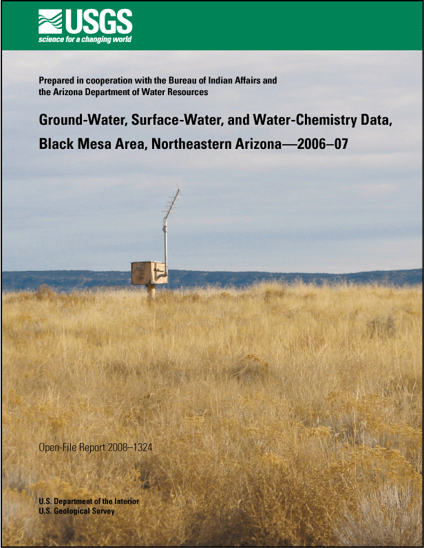 Open-File Report 2008-1324
Ground-Water, Surface-Water, and Water-Chemistry Data, Black Mesa Area, Northeastern Arizona�06�
by Margot Truini and J.P. Macy |
 Scientific Investigations Report 2008-5207
Simulated Effects of Ground-Water Withdrawals and Artificial Recharge on Discharge to Streams, Springs, and Riparian Vegetation in the Sierra Vista Subwatershed of the Upper San Pedro Basin, Southeastern Arizona
by Stanley A. Leake, Donald R. Pool, and James M. Leenhouts |
 Scientific Investigations Report 2008-5189
Use of Superposition Models to Simulate Possible Depletion of Colorado River Water by Ground-Water Withdrawal
by Stanley A. Leake, William Greer, Dennis Watt, and Paul Weghorst |
 Fact Sheet 2008-3076
Dissolved Solids in Basin-Fill Aquifers and Streams in the Southwestern United States桬xecutive Summary
by David W. Anning |
 Scientific Investigations Report 2007-5275
Ground-Water Storage Change and Land Subsidence in Tucson Basin and Avra Valley, Southeastern Arizona, 1998�02
by Donald R. Pool and Mark T. Anderson |
 Open-File Report 2008-1273
Hydrologic Data from the Study of Acidic Contamination in the Miami Wash桺inal Creek Area, Arizona, Water Years 1997�04
by A.D. Konieczki, J.G. Brown, and J.T.C. Parker |
 Scientific Investigations Report 2008-5113
Update of the Accounting Surface Along the Lower Colorado River
by Stephen M. Wiele, Stanley A. Leake, Sandra J. Owen-Joyce, and Emmet H. McGuire |
 Open-File Report 2008-1098
Bathymetric Survey and Storage Capacity of Upper Lake Mary near Flagstaff, Arizona
by N. J. Hornewer and M. E. Flynn |
|
|


