 |
 | |
  | |
|
|
|
|
Yukon Charley Rivers National Preserve
Directions
|
|
|
directions includes: | Maps
|  | | | |
|
|
|
 |
 |
|
Although there is no direct highway connection to Yukon-Charley Rivers,two highways serve towns near the preserve boundaries. Driving to Eagle, Alaska along the 161 mile Taylor Highway begins at Tetlin Junction on the Alaska Highway and ends on the banks of the Yukon river, 12 miles upstream from the preserve. It is usually open from mid-April to mid-October and is suitable for cars, trucks and small RV's. The Steese Highway begins in Fairbanks and travels 162 miles to Circle, 14 miles downstream of the preserve boundary. It is open year round, depending upon snow and drifting conditions in winter months. Check locally about road conditions before beginning your journey and always remember to bring sufficient emergency supplies with you. It is recommended that you carry water, food, warm clothing and two spare tires, just in case. Road condition reports are available and updated regularly. Visitors are able to access the preserve via water or air. Arriving in historic Eagle, AK, visitors can enjoy a leisurely float down the majestic Yukon River or charter an air taxi from Fairbanks or Tok, AK and challenge their abilities on the rapids of the wild Charley River. Visitors arriving in Circle are able to motor upstream into the preserve. Information on Eagle, AK can be obtained by visiting http://www.EagleAK.org
|

|
| NPS Photo - Pat Sanders |
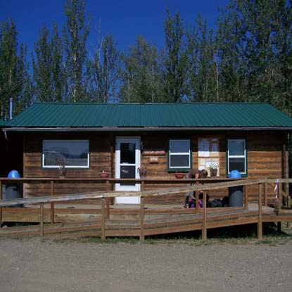
| Eagle Visitor Center |
|
|  |

|
 |
|
|
|
|
|
 |
|
Did You Know?
The 1.1 million acre Charley River watershed is the only complete watershed managed by the federal government.
|
|
|
|
Last Updated: July 21, 2007 at 00:35 EST |


