
Digital Elevation Model (DEM)
A Digital Elevation Model (DEM) is a digital cartographic/geographic dataset of elevations in xyz coordinates. The terrain elevations for ground positions are sampled at regularly spaced horizontal intervals. DEMs are derived from hypsographic data (contour lines) and/or photogrammetric methods using USGS 7.5-minute, 15-minute, 2-arc-second (30- by 60-minute), and 1-degree (1:250,000-scale) topographic quadrangle maps.
Many DEMs provided by the USGS use a 30-m grid. In other words, the area covered in the DEM is split into squares with 30-m sides. Hills or valleys smaller than the 30-m cells will not show up. In an effort to improve the data available for the Lake Tahoe region, the USGS Western Geographic Science Center has created a set of DEMs with 10-m cells. These 10-m DEMs come from the same source data, the hypsographic DLGs, which have 40 ft contours. No new elevations have been included, but elevation information has been interpolated to a finer resolution.
For more information about DEMs, please visit ![]() http://craterlake.wr.usgs.gov/dem_brief.html.
http://craterlake.wr.usgs.gov/dem_brief.html.
![]()
DEM Download
The following files are a complete DEM for the Lake Tahoe Basin, created from the 18 7.5-minute quadrangles of 10-m DEMs and the bathymetric elevation model.The 18 DEM quadrangles that cover the Lake Tahoe Basin have been mosaicked together. The mosaicked files are more convenient for looking at areas throughout the basin or areas on the edge of two quadrangles.
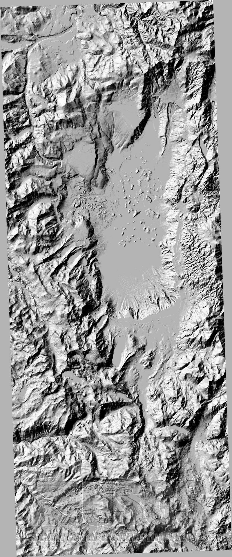 |
DEMs are in UTM NAD27 zone 10 projection. Raw (original) data are in the following projections: data east of 120 degrees longitude are in UTM zone 11 and data west of 120 degrees longitude are in UTM zone 10. It is not possible to combine different projections in Geographic Information System (GIS), therefore, all data have been reprojected into one standard projection, UTM NAD27 zone 10 projection, for the Lake Tahoe Basin. The following DEM data are available in different file formats, each contain the same information: DEM without bathymetry DEM with bathymetry Metadata |
|
Welcome Digital Data General |

