The National Invasive Species Council has noted, "No comprehensive national system is in place for detecting and responding to incipient invasions." Yet the threat of invasive species is perhaps our most urgent economic and ecological challenge. There is a growing sense among land management agencies that a national assessment of native and non-native plant diversity needs to be completed on all public lands. Particularly high on the agenda are issues such as detecting the loss of native plant diversity caused by nonnative plant species, predicting where nonnative species are most likely to damage native diversity, and developing a science-based, long-term monitoring plan for natural resources.
 |
|
Cheatgrass has become a top-priority concern of land management agencies in the West. Cheatgrass changes fire frequency and behavior and "cheats" native plants of precious soil moisture by growing before native species become active.
|
Recent funding from NASA's Earth Science Applications Program is helping to support a NASA/U.S. Geological Survey (USGS) partnership to develop high-performance models and system prototypes directly applicable to invasive species prediction and monitoring. The USGS, through its Fort Collins Science Center (FORT) Invasive Species Science Program, is making significant programmatic commitments to the effort. FORT also will house a high-performance, commodity cluster "supercomputer" to generate the models and analyses. Colorado State University's Department of Forest, Rangeland, and Watershed Stewardship and its Natural Resource Ecology Laboratory provide additional support and expertise through development of new spatial analysis techniques and mathematical models that are being incorporated into the forecasting system.
This project builds on NASA's unique remote sensing capabilities and on current joint USGS/NASA work on invasive species. The FORT research team will develop maps of invasive species at local, regional, and national scales and identify priority invasive species, vulnerable habitats, and pathways of invasion. County-level and point data on occurrence will be linked to plot-level and site-level information on species abundance and spread. Together, USGS, NASA, and CSU scientists will integrate field data with remote sensing data and Geographic Information System-based predictive models to track the spread of invasive species across the country.
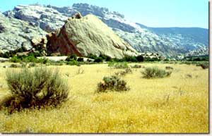
The project will proceed through three major phases. The first phase involves developing a prototypical invasive species forecasting system at selected test sites that include Rocky Mountain National Park in Colorado; the Cerro Grande Wildfire site in New Mexico; and Grand Staircase-Escalante National Monument in Utah. Preliminary sites were chosen in consultation with the USGS ecologists, land managers in bureaus of the Departments of Agriculture and the Interior, and private stakeholder groups. At each test site, project scientists are compiling existing field survey data, ground measurements, and airborne and satellite data. Using this information, local and regional models will be developed, refined, and tested.
The second phase will expand the system to include high-resolution hyperspectral and structural measurements in the modeling protocols. The capability to perform periodic, on-demand national assessments of management-scale risks will require unprecedented data integration and computing capacity. During this second phase, NASA will lend its expertise to develop and operate the technological infrastructure for conducting these assessments at the USGS-FORT facility.
In phase three, the forecasting system will be deployed beyond the test sites and expanded into a fully operational National Invasive Species Forecasting System for use throughout the Department of the Interior. The community of ecologists and land managers who will use this application will be involved in all stages of its development. The system will be made widely available to the scientific and natural resource management communities through the Internet-based National Biological Information Infrastructure (NBII), which provides U.S. interagency coordination for online biological databases and information services. FORT scientists are co-developing the NBII Invasive Species Information Node through which the forecasting system will be delivered.
See Also: |

![]() U.S. Department of the Interior | U.S. Geological Survey
U.S. Department of the Interior | U.S. Geological Survey
URL: http://www.fort.usgs.gov/resources/spotlight/EcoForecasting/EF_projects.asp
Page Contact Information: AskFORT@usgs.gov
Page Last Modified: 6:53:12 PM