| 
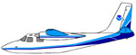
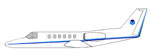
Cessna
Citation II (CE-550)
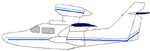
The Cessna Citation (CE-550) is a versatile twin-engine
jet aircraft modified for acquiring remote
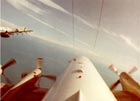
sensing imagery. The aircraft is equipped with two equal sized camera ports which can support a wide variety of remote sensing configurations including large format aerial photography as well as data collection for digital
cameras, hyperspectral, multispectral, and LIDAR systems.
Standard
configuration includes space for two pilots, two equipment
operators, and a scientific equipment rack. The
aircraft can accommodate additional passengers
depending on the amount of scientific equipment. The aircraft's unique side-by-side sensor port modification allows two different sensors to collect data simultaneously. The sensor ports have glass optical flats that allow the cabin to remain pressurized. Additionally, two high-precision GPS antennas provide signals to user receivers.
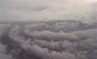
The Citation primarily supports the Remote Sensing Division of the National Geodetic Survey, collecting remote sensing data in support of coastal mapping and remote sensing research. Imagery acquired onboard the Citation is used for updating the shoreline and shore features on NOAA's nautical charts. The Citation also serves as an emergency responder during hurricane season by collecting digital photography of damaged areas caused by hurricane landfall.
|

Hurricane Damage Assessment
|
STANDARD
AIRCRAFT SPECIFICATIONS |
| Type: |
Jet
Citation II/ Model C550 |
| Crew: |
2
Pilots and 2-3 Scientists |
| Ceiling: |
43,000
feet (without supplemental cabin oxygen) |
| Rate
of Climb: |
2500
ft/min at sea level (20 minutes to
climb to 30,000 ft) |
| Cruise
Airspeed: |
350
knots (true) |
| Scientific
Power: |
3x15 amps @ 115 volts (3 power strips)
3x30 amps @ 28 volts DC (3 power strips) plus single 100 amp option |
| Aircraft Modifications: |
Dual Sensor Camera Ports with electrically operated doors
Drift sight port |
| Max.
Gross Weight: |
14,500 lbs |
| Empty
Weight: |
8,000
lbs |
| Useful
Load: |
6,800
lbs (fuel, personnel, cargo) |
| Fuel
Load: |
5,008
lbs |
| Standard
Fuel Burn: |
Normal
Cruise (98%): Range-1325 nm Duration-4 hrs15 min
Max. Cruise (104%): Range-1200 nm Duration-3 hrs
40min
Max. Endurance: Range-1610 nm Duration-5 hrs |
| |
| Wing
Span: |
51
ft 8.4 in |
| Total
Length: |
47
ft 3 in |
| Fuselage
Height: |
4.8
ft |
| Tail
Height: |
14
ft 9.6 in |
| Cabin
Doors: |
39
in x 21.25 in |
| Baggage
Doors (rear): |
22
in x 27 in |
| Cabin
Length: |
20.9
ft |
| Cabin
Width: |
4.9
ft |
| Useable
Volume: |
491
cu ft |
| Nose
Baggage: |
28
cu ft |
| Cabin
Baggage: |
947
cu ft |
| Cockpit:
|
Color
weather radar, radar altimeter,
integrated flight director system, GPS
Flight Management System, traffic alert |
| Cabin: |
Dual
camera ports: Normal configuration includes Wild RC-30 on the Right Side
and Applanix DSS Camera system on the left side. A POS/AV IMU system and
other components are installed in a certified scientific rack. |
DATA COLLECTED WITH N52RF, CESSNA CITATION
For
more information please visit the Coastal Mapping Remote Sensing
Program web
site: http://www.ngs.noaa.gov/RSD/rsd_home.html.
|