www.weather.gov
Home
News
Organization
Search
Going Boating?
If you are headed out on area lakes, check on water levels before you go.
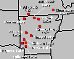
Lake Information
Click on the links below the map to get the latest levels for several lakes in Arkansas and southern Missouri.
Beaver Lake:
Text
|
Graph
Blue Mountain Lake:
Text
|
Graph
Table Rock Lake:
Text
|
Graph
Nimrod Lake:
Text
|
Graph
Bull Shoals Lake:
Text
|
Graph
DeQueen Lake:
Text
|
Graph
Norfork Lake:
Text
|
Graph
Gillham Lake:
Text
|
Graph
Greers Ferry Lake:
Text
|
Graph
Dierks Lake:
Text
|
Graph
Clearwater Lake:
Text
|
Graph
Millwood Lake:
Text
|
Graph
Other lake information for Lake Ouachita (Blakely Mountain Dam), Lake DeGray (DeGray Dam) and Lake Greeson (Narrows Dam) can be found by clicking
here
.
Back to River and Lake Page
http://www.srh.noaa.gov/lzk/html/lakeinfo.htm
National Weather Service
Little Rock Weather Forecast Office
Page last modified: 14 April, 2008
Disclaimer
Credits
Glossary
Privacy Policy
About Our Organization
Career Opportunities