Jump to main content.
 Q&A
Q&A
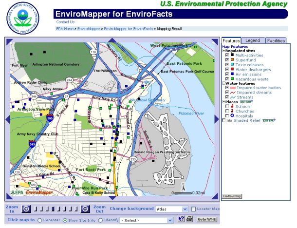
 What is EnviroMapper?
Why would I use EnviroMapper (i.e., what services or information does it provide)?
How do I use EnviroMapper?
How do I create a map of my community?
What are layers?
Can I recenter the map to view a particular area?
Why can't I see the environmental information?
Can I print my map?
Why did I get a JavaScript error?
Where can I find directions on how to use EnviroMapper?
Who do I contact with questions?
What is EnviroMapper?
EnviroMapper is a Web-based interactive mapping tool for viewing and querying environmental information. This application allows
users to zoom in to an area, or enter a state, county, city, ZIP code, or watershed to view environmental
data from EPA's Envirofacts Warehouse.
Why would I use EnviroMapper (i.e., what services or information does it provide)?
EnviroMapper allows you to
generate maps of your geographic area that contain environmental information stored in
EPA's Envirofacts Warehouse.
The type of environmental information includes: Superfund sites, drinking water, toxic and air releases,
hazardous waste, and water discharge permits. You can also view this information in context by adding map
features to your map, including major roads, railroads, churches, hospitals, schools, populated places,
counties, states, streams, streets, water bodies, watersheds, rivers, and federal lands.
How do I use EnviroMapper?
You can manipulate and change EnviroMapper that is displayed by zooming in, zooming out, identifying features, re-centering the map, and displaying a locator map.
.
How do I create a map of my community?
Your can zoom in by entering a state, county (and state), city (and state), ZIP code, address, facility, watershed, EPA region or Latitude/
Longitude.
What are layers?
"Layers" is a term used in the Geographic Information System (GIS) community to refer to how spatial data
are stored. Examples of spatial data includes: state and county boundaries, roads, railroads, and other
points of interest. In EnviroMapper, these data are stored according to the feature, meaning that if
you turn on (click on the box) for railroads, it will be displayed on your map.
Can I recenter the map to view a particular area?
You can use the Recenter Map option or click on the triangles in each corner and side of the map.
To use the recenter map option, first click on the corresponding radio button (circle), then click on the
area of the map that you would like to center on. This will automatically redraw the map and recenter
the map at the point you just clicked on. Another option is to click on the triangles located in each
corner and side of the map, in the direction that you want to go. The map will shift (pan) in that direction.
Why can't I see the environmental information?
To be able to generate reports of environmental information, you must zoom in far enough on the map
(so the map displays 16 miles across, maximum). This can be accomplished by either zooming in manually,
or zoom in by entering a state, county (and state), city (and state), watershed or ZIP code.
Can I print my map?
Some EnviroMapper applications offer the ability to print the map you are viewing. Maps can be printed through your browser
by clicking on the Print Map option. A dialog will pop up to let you enter your map title. The printable map
includes the legend, scale, and north arrow.
Why did I get a JavaScript error?
JavaScript errors generally occur when the browser you use does not support JavaScript 1.1 used by EnviroMapper.
Another suggestion is to make sure that your browser has been configured to enable JavaScript
(you can typically find this in the preferences option of your browser menu).
If you are running an older browser you may want to download the latest copy of the browser
from the Internet to alleviate potential problems. If you are using Microsoft IE Explorer 4.0,
please upgrade to version 6.

Where can I find directions on how to use EnviroMapper?
Online help is available. From the application screen, click on the Help option.
Who do I contact with questions?
Use the EnviroMapper Contact Us Form to submit any questions or comments you have about EnviroMapper.
Jump to main content.