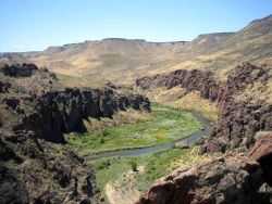
 The Bureau of Land Management (BLM) Jarbidge Field Office (FO) is preparing a Resource Management Plan (RMP) for approximately 1.4 million acres of public land in southern Idaho. An RMP is a land use plan that describes broad, multiple-use guidance for managing public lands.
Management of public lands within the Jarbidge FO is currently guided by the 1987 Jarbidge RMP. Regulations, policies and issues have changed during the life of the existing plan. Decisions in the new RMP will guide land management actions and subsequent site-specific implementation decisions for the next 15 to 20 years in compliance with current mandates and consistent with current issues.
What's New