|
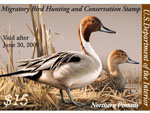
2008 Federal Duck Stamp Contest
Phone: 573-876-1826 |
Due to its close proximity to city of Chesterfield and other urban developments, the 130 acres adjacent to the Chesterfield Athletic Complex is Archery hunting. No Firearms are allowed this includes shotguns. All other refuge regulations apply.
The Boone's Crossing Unit is located in northeastern St. Louis county. It lies in Chesterfield bottoms just east of the Highway 40/64 bridge across the Missouri River. The unit is has two parcels, 442 acre Johnson Island and 130 acre parcel next to the Chesterfield Athletic Complex. These two parcels are seperated by a side channel of the Missouri River.

This is a view of the side channel on the west end of the unit.
The island is on your right and the main channel of the river is in the distance.
Getting to the Boone's Crossing Unit
In Chesterfield take the Chesterfield Airport Road to Spirit of St. Louis Blvd. Turn north. Cross over Interstate 64/40 to North Outer 40 Drive. Turn left, take the next right into the ![]() Chesterfield Athletic Complex playing fields. Drive straight ahead past the playing fields up and over the levee. At the bottom of the levee turn right through the playing fields parking area to the parking area behind the refuge sign.This parking area is at the south and west end of the 130 acre parcel.
Chesterfield Athletic Complex playing fields. Drive straight ahead past the playing fields up and over the levee. At the bottom of the levee turn right through the playing fields parking area to the parking area behind the refuge sign.This parking area is at the south and west end of the 130 acre parcel.
Johnson Island is only accessible by boat. The closest boat access is the ![]() Missouri Department of Conservation Weldon Spring Access.
Missouri Department of Conservation Weldon Spring Access.
From the Weldon Spring Access, travel four miles down river, pass under the Highway 40/64 bridge, and the island is about one mile further on the right. The channel around the island is usually navigable except during extremely low flows. At all times watch for submerged logs, old pilings, and debris.
On the main channel side of the island several dikes and sandbars are present. The best access is on the eastern or down river side of the island. An information kiosk exists at Mosely's Landing in this area of the island. The island is approximately 442 acres of bottomland forest.


