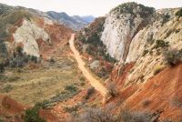
The Grand Staircase-Escalante National Monument’s vast and austere 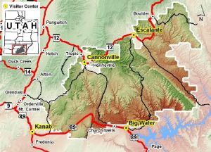 landscape embraces a spectacular array of scientific and historic resources. This high, rugged, and remote region, where bold plateaus and multi-hued cliffs run for distances that defy human perspective, was the last place in the continental United States to be mapped.
Even today, this unspoiled natural area remains a frontier, a quality that greatly enhances the Monument’s value for scientific study. The Monument has a long and dignified human history: it is a place where one can see how nature shapes human endeavors in the American West, where distance and aridity have pitted against our dreams and courage.
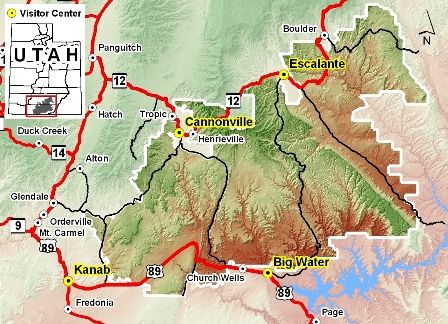
Grand Staircase-Escalante National Monument spans nearly 1.9 million acres of America’s public lands. From its spectacular Grand Staircase of cliffs and terraces, across the rugged Kaiparowits Plateau, to the wonders of the Escalante River Canyons, the Monument’s size, resources, and remote character provide extraordinary opportunities for geologists, paleontologists, archeologists, historians, and biologists in scientific research, education, and exploration.
Grand Staircase-Escalante National Monument
Kanab Headquarters
190 East Center
Kanab, Utah 84741
(435) 644-4300
Fax (435) 644-4350
escalante_interagency@blm.gov