|
The GOES-N Spacecraft
 GOES-NOP Brochure
GOES-N Databook
GOES-N Mission Booklet
GOES-N Fact Sheet 2006
GOES-N Short launch Video (.mov)
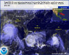
GOES-N/13 First Official Visible
Images
On January 28, 1998, the National Oceanic and Atmospheric Administration (NOAA) and the National
Aeronautics and Space Administration (NASA) awarded a contract to Hughes Space and Communications
(now Boeing),in El Segundo, California, for the manufacture, launch and delivery on-orbit of up
to four advanced environmental monitoring Geostationary Operational Environmental Satellites (GOES)
and delivery of associated ground system elements. The procurement of the GOES-N series was an
extension of a program designed to primarily provide continuous monitoring of the Earth’s weather
systems and the near earth space environment. The new spacecraft of the GOES-N Series will be used to
continue and enhance the environmental monitoring and communications functions of the GOES-I thru M
(GOES-8 thru 12) series of NOAA operational spacecraft.
The basic contract provides for two spacecraft, GOES-N & O. NOAA decided to only exercise the option
for a third GOES-P satellite with all three using the expendable launch vehicle Delta IV (4,2) with
two solids for additional on orbit fuel savings. The first satellite to be purchased under this
contract, GOES-N, is ready for Boeing commercial launch, with a Federal Aviation Administration launch
license in late 2005. GOES-N will carry government furnished ITT built Imager and Sounder instruments
to provide regular measurements of the Earth’s atmosphere, cloud cover, ocean temperatures, and land
surfaces. GOES-N will carry a new operational government furnished Solar X-ray Imager built by Lockheed.
Space Environment Monitor instruments were part of the Boeing spacecraft contract and were built by
Science Applications International Corporation (built the magnetometers) in Columbia, Maryland,
and Assurance Technology Corporation (formerly GE Panametrics) in Carlisle, Massachusetts. Assurance
Technology built the high energy, electron, and proton particle sensors and the new extreme ultraviolet
solar monitoring instrument. Significant portions of the GOES-N satellite support ground system are provided
by Integral Systems, Inc., of Lanham, Maryland.
In 2004, the GOES-N spacecraft completed construction and spacecraft level thermal-vacuum testing. In 2005
post-environmental deployment tests and other functional verifications were completed. GOES-N was shipped
to Cape Canaveral by a USAF C-17 aircraft on March 9, 2005, and was processed at the Astrotech Space
Operations, Inc. facility in Titusville, Florida. GOES-N was transported to the Delta IV Space launch
Complex 37 and hoisted and mated to the Delta IV as shown in the photo gallery images. GOES-N launch
attempts in late August 2005 were aborted and the spacecraft has weathered through the 62 MPH winds of
Hurricane Wilma while safely encapsulated in a clean and dry air conditioned environment on top of the
Delta IV at Space Launch Complex 37B.
The multimission GOES-N Series of satellites will be a vital contributor to weather, solar, and space
operations and future science improvements with weather prediction and remote sensing. The GOES-N Series
will aid severe storm warnings, resource management, search and rescue, emergency managers, and likely
lead to additional advances in environmental sciences and multifaceted data applications of remotely sensed
phenomena. GOES-N data will add to the global climate change databases of knowledge, embracing many civil
and government environmental forecasting organizations that work to benefit people everywhere and help save
lives every day.
GOES-N represents the first of the next generation of GOES satellites.
An advanced attitude control system using star trackers, a spacecraft
optical bench, and improved Imager and Sounder mountings provides enhanced
instrument pointing performance for improved image navigation and
registration to better locate severe storms and other events important
to
the NOAA National Weather Service. NASA Goddard Space Flight Center
(GSFC) and
the NOAA National Environmental Satellite, Data and Information
Service (NESDIS) have set a higher standard of location accuracy
for the GOES-N series, including data picture element (pixel) location to
approximately
two
kilometers from geosynchronous orbit of 33,900 km (22,300 miles)
above the Earth’s surface.
GOES-O is in ground storage at Boeing, in El Segundo, California
and can be launched as early as September 2007, if needed by NOAA.
GOES-O is nominally being planned for launch in April 2008. As
of June 2006, GOES-P
has completed vibration and acoustics testing and is in thermal
vacuum testing. GOES-P will
go into ground storage following the completion of environmental
testing and should be prepared for an April 2008 launch readiness
with an October 2009 planned launch date.
Imager
The Serial Number 08 GOES-N Imager satisfies the NOAA primary mission imagery requirements and
was built and tested at ITT in Fort Wayne, Indiana. It is similar to the GOES-M Imager and was
delivered to Boeing by NASA/GSFC and integrated onto GOES-N. Several evolutionary improvements
have been incorporated to reduce single point failures; improve launch vehicle environments
flexibility; add thermal shields to the secondary mirror structure to eliminate solar intrusion
keep out zones and allow operations during eclipse periods; and take advantage of cooler
operational set points for infrared detectors provided by the spacecraft accommodation clearer
view of and improved thermal radiation to space. The Imager blackbody dwell time has been
increased from 0.2 to 2 seconds and this should help reduce potential image striping.
The first official GOES-13 visible full disk image was taken on June 22, 2006.
Sounder
The Serial Number 08 GOES-N Sounder was built and tested at ITT in Fort Wayne, Indiana and
satisfies the NOAA atmospheric sounding multi-spectral mission visible and infrared sensing
requirements. It was delivered to Boeing by NASA/GSFC and integrated onto GOES-N. The Sounder
has likewise incorporated low risk evolutionary improvements to improve channel to channel
coregistration; add thermal shields to the secondary mirror structure to eliminate solar
intrusion keep out zones and allow operations during eclipse periods; reduce single point
failures; improve launch vehicle environments flexibility; and take advantage of cooler
operational set points for infrared detectors provided by the spacecraft accommodation clearer
view of and improved thermal radiation to space.
Solar X-ray Imager
The GOES-N Solar X-Ray Imager (SXI) contract was awarded in 1997 to Lockheed Martin Advanced
Technology Center in Palo Alto, California for two firm flight models with options and associated
ground support equipment and services. These units have been successfully delivered and
integrated for flight on the GOES-N Series of spacecraft. Spare components have been integrated
and tested for possible flight. The first official GOES-13 SXI image was taken on July 6, 2006.
Space Environment Monitor
The main GOES-N Space Environment Monitor (SEM) subcontract was awarded by Boeing in 1998 to GE
Panametrics (now Assurance Technology Corporation) in Waltham, Massachusetts. The contract includes
instrument packages to be flown on each of the spacecraft in the series and includes in situ measurements
of the magnetic and particle environments as well as remote measurement of the integrated X-ray emission
and the extreme ultraviolet (EUV) spectra of the Sun. These units have been delivered and integrated for
flight on the GOES-N spacecraft. The two GOES-N magnetometers were provided by Boeing subcontract to
Science Applications International Corporation (SAIC) in Columbia, Maryland. To provide stable magnetic
field measurements independent of the spacecraft field, dual magnetometers are near the end of a deployable
boom that is more than 8 meters long. The GOES-13 SEM instruments have all been activated and the EUV and
the X-ray Sensor (XRS) appropriately responded to the M2 level solar flare that was observed on
July 6, 2006.
Launch and Orbit Raising
GOES-N was launched from Cape Canaveral Air Force Station Space Launch Complex
(SLC) 37B on a Boeing Delta IV (4,2) using a 4 meter fairing common booster core
configuration, with two solid strap on motors, on May 24, 2006, at 6:11 pm EDT.
The GOES-N Delta IV was erected on March 16, 2005, and the two solid rockets were
attached the following week. The use of the Delta IV upper stage Pratt & Whitney
supplied RL10B engine performing a third burn to get to orbit will save fuel
on the spacecraft, and help achieve at least 13.5 years of fuel lifetime
(nominally 5 years of on orbit storage and 5 years of operations). The Delta
IV provided GOES-N an initial orbit of approximately 3,576 x 18,994 nmi at 12
degrees inclination. A series of spacecraft liquid apogee motor (LAM) firings
was subsequently done to bring the spacecraft to geosynchronous orbit of approximately
22,300 miles (33,900 km). GOES-N successfully completed the necessary Liquid Apogee
Motor Firings to get to geosynchronous orbit near 90 degrees west longitude and as of
June 4, 2006, at 2:46 am EDT became GOES-13. The solar array has been fully deployed
and remaining deployments include the magnetometer boom, Imager and Sounder optical
port covers and cooler doors, and the SXI. On Friday, June 2, 2006, the first
command was sent from Wallops Virginia to GOES-N. The NOAA Wallops Command and Data
Acquisition Station became the prime ground station on Sunday morning, June
4, 2006.
After successful post-launch checkout at 90 degrees west longitude by a coordinated
Boeing, NASA, NOAA, GOES-N integrated Government and Industry team, from the NOAA
Satellite Operations Control Center (SOCC) in Suitland, Maryland, the satellite will
be placed in an on-orbit storage mode at 105 degrees west longitude so that it can
more rapidly replace a failure of any of the other operational
GOES.
GOES N,O,P Enhancement Summary
• GOES
N,O,P will have an improved Image Navigation and Registration
(INR)
system that will use star trackers to provide precision image navigation
and registration
information for use with the Imaging and Sounding data products.
This
will improve knowledge of exactly where severe weather events are located.
• A stable optical bench has been provided to isolate the thermal deformations
of the
spacecraft from the Imager and Sounder instruments.
• A data product improvement has been provided with the development of
the digital Low Rate Image Information Transmission (LRIT) system for distribution
of data
Products that were distributed in an analog WEFAX format in the previous
generation of GOES satellites. The LRIT system will permit the transmission
of many data products consistent with the World Meteorological Organization
(WMO) and will permit the distribution of more National Weather Service (NWS)
information at a higher data rate to the NOAA data user community.
• The Data Collection System (DCS) has been enhanced with the addition
of 300 and 1200 bps Data Collection Platforms (DCPs) that will use 8-PSK
modulation and
a
higher power satellite transponder so that more DCPs can use the link at
the same
time.
• The power subsystem has been improved with the use of a single panel
solar array that contains high-efficiency dual-junction gallium-arsenide
solar cells.
A nickel-
hydrogen battery is provided to permit the satellites to operate during the
eclipse periods.
• A new Solar X-Ray Imager (SXI) has been developed by the Lockheed Martin
Advanced Technology Center to permit the observation and collection of solar
data
products.
•
A dedicated transponder is being provided to support the Emergency Manager’s
Weather Information Network (EMWIN) data product service.
• The Satellite design life time has been improved from 7 to 10 years,
and the
expected propellant lifetime has been increased to 13.5 years.
• The GOES-N,O,P command data rate has been increased to 2,000 bps, as
compared
to a data rate of 250 bps for the previous generation of GOES satellites.
• The GOES-N,O,P telemetry data rate has been improved to provide data
at either
4,000 or 1,000 bps, as compared to the 2,000 bps data rate on the previous
generation of GOES satellites.
•
An optional operational “yaw flip” capability and procedure has
been developed on
the GOES-N,O,P Program to permit optimum performance of the Imager and
Sounder radiation coolers. The procedure will permit operation of the Imager
and
Sounder detectors at a lower temperature and will result in lower noise performance
of the instruments because of a lower detector temperature.
• The Space Environment Monitoring (SEM) subsystem has been enhanced by
the
addition of the Extreme Ultraviolet (EUV) sensor, Energetic Proton, Electron,
and
Alpha particle Detector (EPEAD), the Magnetospheric Electron Detector
(MAGED), the Magnetospheric Proton Detector (MAGPD) and dual
magnetometers on a 27.9 foot (8.5 meter) long boom. The EPS sensors have
been expanded on GOES-N,O,P to provide coverage over an extended energy range
and
with improved directional accuracy.
• Provision was made to allow addition of a Lightning Mapper instrument
or another instrument of opportunity. No such instrument has been provided
at this time
and
GOES-N and GOES-O have completed their pre-launch qualification testing.
• The communications services have been tailored to comply with modern
national
and international requirements.
•
Potential reduction in striping in the image will be achieved due to increasing
the
Imager’s scan-mirror dwell time during the blackbody calibration process
from 0.2
seconds to 2 seconds.
• Outages due to solar intrusion Keep Out Zones (KOZ) will be minimized
because thermal shields have been added to the secondary mirror structure
elements for
the
Imager and Sounder instruments.
•
There will be no “boom snap” problems on the GOES-N,O,P satellites
since theeffect is due to the shadow of the magnetometer boom crossing the
solar sail
boomand the solar sail boom is not used with the GOES-N,O,P satellite design.
Additional GOES-N Series Satellite Information
The linked PDF document titled “NOAA GOES-NOP -- The Next Generation” contains
more top level information on the GOES history, mission, services,
payloads, and GOES-NOP improvements. The recently completed “GOES-N
Data Book” has more spacecraft and mission detailed information
and is also available in PDF from this web site above for download
or downloaded by section from the GOES Project Science web site at: http://goes.gsfc.nasa.gov/text/goes.databookn.html.
The GOES-N Mission Booklet prepared by Boeing, in PDF form above, is a very good
overview of the GOES-N mission and the expected performance from the Delta IV launch
vehicle. If more timely information is needed, the NOAA GOES Program Manager,
is Steve Kirkner at 301-286-1943 (email: Steve.Kirkner@noaa.gov)
and the NOAA GOES-N Series Technical Acquisition Manager is Thomas
M. Wrublewski at 301-286-3119 (email:
Thomas.M.Wrublewski@noaa.gov). A two page satellite and launch vehicle overview is
available for download in PDF form above.
GOES Planned Launch Schedule
|