|
|
|||
|
Website Updates
Western Oregon Plan Decisions Released.
Oregon State Office
Bureau of Land Management 333 S.W. 1st. Avenue Portland, OR 97204 503-808-6002 |
About BurnsThe Burns District is located in southeastern Oregon, extending from the Oregon-Nevada border on the south into the Blue Mountains on the north, a distance of nearly 200 miles. There are over 3.36 million acres of public land and it is divided into two Resource Areas: Three Rivers Resource Area, roughly 1.68 million acres in the northern portion of the District; and Andrews Resource Area, 1.68 million acres of public land in the south. Within the District boundary there are also large areas of private, other Federal and State lands. District ProgramsAnimals
Wildlife is as varied as the land, offering habitat for numerous wildlife species including Rocky Mountain elk, California bighorn sheep, pronghorn antelope, and mule deer. Several herds of wild horses are also seen roaming the Burns District. The area is well known for its plentiful and varied songbird and raptor populations, especially during the spring and fall migration periods. Upland game birds and small mammals are widespread. Most streams, perennial ponds, and reservoirs contain native and/or stocked trout as well as a variety of warm-water fish. Vegetation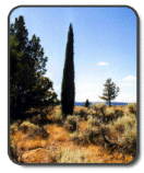
Composed of a diverse landscape with large areas of western juniper forests, wetlands and rivers scattered throughout, and ponderosa pine forests found in the foothills of the Blue Mountains, Burns provides habitat for a variety of plants and animals. There is also an extensive northern Great Basin sagebrush/bunchgrass system and high elevation sub-alpine vegetation and aspen forests, found on the Steens, Trout Creek, and Pueblo Mountains. Wild Horses
More than 1,000 wild horses roam within eight Herd Management Areas. The District has a primary role in coordinating and conducting roundups of excess horses throughout the State. At the Burns District Wild Horse Corrals, the animals are prepared for adoption through the National Adopt-A-Horse and Burro Program. Forestry
The District manages 9,000 acres of commercial forest (primarily ponderosa pine and Douglas-fir), and issues permits for a variety of special forest products including firewood, fence posts, poles, and juniper boughs. Special Designations
A total of 23 designated Wilderness Study Areas, containing over 1,074,000 acres of public lands, exist in the Burns District and are managed to protect their wilderness values. Other special designations have been given to some lands in recognition of certain outstanding natural attributes: the Donner and Blitzen National Wild and Scenic River, the Diamond Craters Outstanding Natural Area and a number of Areas of Critical Environmental Concern which include Research Natural Areas (RNAs) as well as several areas of important wildlife habitat and one area of high scenic value. The Steens Mountain, Diamond Loop, and Lakeview to Steens National Back Country Byways are also found in the District, although the latter is located primarily on the BLM Lakeview District. The most recent special designation, made in October 2000, is the Steens Mountain Cooperative Management and Protection Area – approximately 500,000 acres of public land on Steens Mountain offering diverse scenic/recreational experiences and extraordinary landscapes. Fire Management
|
||
 The District has fire management responsibilities for its public lands and a cooperative fire suppression role on adjacent U.S. Forest Service, U.S. Fish and Wildlife Service, and State of Oregon properties. The Burns Interagency Communication Center is located at the District Office and fulfills critical communication and dispatch operations for wildfire incidents occurring on the BLM Burns District, the Snow Mountain Ranger District of the Ochoco National Forest, the Emigrant Creek Ranger District of the Malheur National Forest, and the Malheur National Wildlife Refuge. The