1992 Earthquake
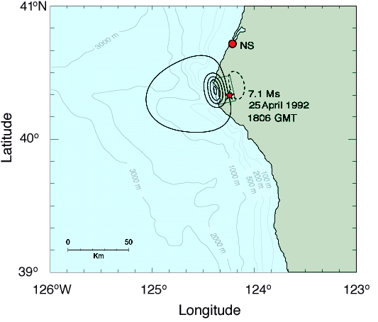
Computed vertical crustal deformation for a single fault plane model. Heavy, solid contours represent uplift, dashed subsidence; the first solid contour is 0.2 cm, and all other contours are at 20 cm intervals. The solid line rectangle delineates the surface projection of the fault plane (see Generation Mechanism section in text for fault plane parameters [Gonzalez, et al., 1995]), and the location of the epicenter is indicated by a star
. Note that the uplift region is located in shallow water near the coast, an optimal location for generating coastally trapped edge wave modes.
|