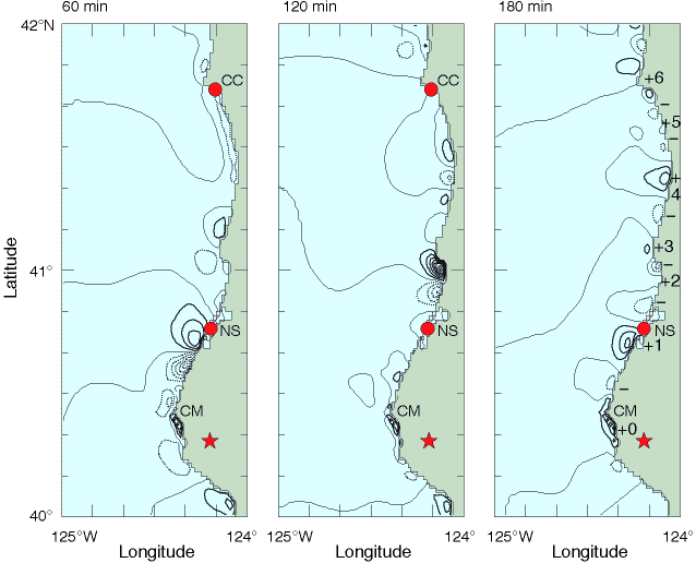
Sea Level after 1992 Tsunami
Sea level distributions computed by the tsunami numerical model at 60, 120, and 180 min after generation; contour interval is 5 cm, and solid and dotted lines indicate values above and below mean sea level, respectively.
At 180 min, six cycles of edge wave extrema along the coast are marked by numbered plus signs and unlabeled minus signs.
The locations of Cape Mendocino (CM), North Spit (NS) and Crescent City (CC) are also indicated, and the star marks the epicenter of the earthquake.
This earthquake induced uplift just offshore in shallow water, a source location that was optimal for the generation of coastally trapped edge waves.
The observations and model results agreed well with simple analytic solutions for edge waves on a sloping beach.
|