| |
Congressional Districts for the 110th Congress
- Printable Maps |
|
| |
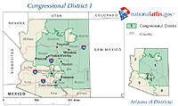 Sample printable map of Congressional Districts - 110th Congress.
|
|
View
and print Congressional Districts for the 110th Congress
Each map shows:
- Congressional districts for the 110th Congress
- State and county boundaries
- Interstate and US highways
- Selected rivers and waterbodies
- Major cities
Each map is available in GIF and PDF file formats
that allow you to view and print the maps.
Learn More |
|
|
|
|
| |
Federal Lands and Indian Reservations - Printable
Maps |
|
| |
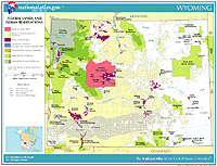 Sample printable map of Federal Lands and Indian Reservations maps
 |
|
View
and print Federal Lands and Indian Reservations maps
Each map shows:
- National Parks
- National Forests
- National Wildlife Refuges
- Military Reservations
- Lands administered as Indian Reservations
- State boundaries
Each map is available in GIF and PDF file formats
that allow you to view and print the maps.
Learn More |
|
|
|
|
| |
Precipitation of the Individual States and of
the Conterminous States - Printable Maps |
|
| |
 Sample printable map of Precipitation of the individual States and of the
Conterminous States maps
Sample printable map of Precipitation of the individual States and of the
Conterminous States maps |
|
View
and print Precipitation of the Individual States and of the Conterminous
States maps
Each map shows:
- Average Annual Precipitation in inches from
1961-1990
- State boundaries
Each map is available in GIF and PDF file formats
that allow you to view and print the maps.
Learn More |
|
|
|
|
| |
Presidential Elections 1789 to 2000 - Printable
Maps |
|
| |
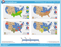 Sample printable map of Presidential Elections 1789-2000 maps
 |
|
View
and print Presidential Elections 1789-2000 maps
Each map shows:
- Presidential Election results for the years listed
- State boundaries
- County boundaries (2000 map only)
Each map is available in GIF and PDF file formats
that allow you to view and print the maps.
Learn More |
|
|
|
|
| |
Reference and Outline Maps of the United States
- Printable Maps |
|
| |
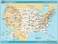 Sample printable map of Reference and Outline
Maps of the United States maps
Sample printable map of Reference and Outline
Maps of the United States maps |
|
View
and print Reference and Outline Maps of the United States
The Reference maps show:
- Cities and capitals
- State boundaries
- Interstate highways
- Selected rivers and waterbodies
- Shaded relief
Outline maps are available for teachers and students of American geography.
Each map is available in GIF and PDF file formats
that allow you to view and print the maps.
Learn More |
|
|
|
|
| |
Satellite View - Printable Maps |
|
| |
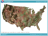 Sample printable map of
the Satellite View Map
Sample printable map of
the Satellite View Map |
|
View
and print the Satellite View Map
The Satellite View map shows:
- Terrain information
- Land cover characteristics
- Waterbodies
The map is available in GIF and PDF file formats
that allow you to view and print the map.
Learn More |
|
|
|
|
| |
Territorial Acquisitions of the United States
- Printable Maps |
|
| |
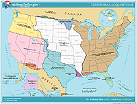 Sample printable map of Territorial Acquisitions of the United States map
 |
|
View
and print Territorial Acquisitions Map
The Territorial Acquisitions map shows:
- Territorial Acquisitions from 1783 to the present
- State boundaries
Each map is available in GIF and PDF file formats
that allow you to view and print the maps.
Learn More
|
|
|
|
|
| |
Time Zones - Printable Maps |
|
| |
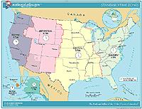 Sample printable map of
the Time Zones Map
Sample printable map of
the Time Zones Map |
|
View
and print the Time Zones Map
The Time Zones map shows:
- Time Zones
- State boundaries
The map is available in GIF and PDF file formats
that allow you to view and print the map.
Learn More |
|
|
|
|
| |
West Nile Virus 2000 - Printable Maps |
|
| |
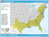 Sample printable map of West
Nile Virus 2000 maps
Sample printable map of West
Nile Virus 2000 maps
|
|
View
and print West Nile Virus 2000 maps
The maps show:
- State and county boundaries
- Human cases
- Wild bird cases
- Mosquito surveillance
- Veterinary cases
- Sentinel flock surveillance
Each map is available in GIF and PDF file formats
that allow you to view and print the maps.
Learn More |
|
| |
 |
|
|
|
|
 |
|
|
|
|

