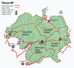
Tahoe National Forest
| Tahoe National Forest 631 Coyote Street Nevada City, CA 95959 (530) 265-4531 (voice) (530) 478-6118 (TDD) |
|
|
|
Maps & Brochures

The 2006 Tahoe National Forest recreation map is available by mail from the Forest Headquarters. We normally carry the forest map as well as these speciality maps and maps of adjacent forests:
- Overland Emigrant Trail
- South Yuba River
- Gold Lakes Basin
- Eldorado National Forest
- Plumas National Forest
- Lake Tahoe Basin Management Unit
Actual selection varies by office location.
Online NF Maps
The recreation maps for California national forests have been scanned and are available as digital files on the Pacific Southwest Region map page. Digital files are available as either .jpg (low resolution) or .pdf (high resolution) files. Adobe Acrobat reader is required for the .pdf files.
Map Purchases
Forest maps (Tahoe NF, Eldorado NF, Plumas NF, Lake Tahoe Basin Management Unit ) are $9.00 each. There is a version of the Forest map printed on waterproof paper available for $10.00.
- Specialty maps (Emigrant Trail, South Yuba river, Gold Lakes Basin) are $8.00 each
When you purchase them either in person or by mail from the Tahoe NF.
There is no shipping, handling or tax charged. To receive any of these maps by mail, send a check or money order made payable to "USDA Forest Service" to:
Tahoe National Forest
631 Coyote St.
Nevada City CA 95959
attn: Map Sales
Be sure to include what map(s) you are requesting, along with your mailing address.
- National Forest maps for all national forests are available by mail from the National Forest Store.
- Many National Forest maps are available from commercial vendors, such as outdoor equipment stores, in the regional area. Prices vary at commercial locations.
- When possible, our handouts and pamphlets are being converted to digital form for you to download from our publications page.
We do not sell topographic maps at our offices. Many other vendors carry some or all of these maps. The map index below will help you determine which quadrangles you desire. Our non-profit Interpretive Associations, Interpretation Association of the West and Eastern Sierra Interpretive Association sell National Geographic topographic maps of the Forest through their outlets in our Ranger Stations and Visitor Center at Big Bend. These maps (sheets 804 and 805) show the entire forest on a topographic base. They are not available by mail from the Forest Service.
Quad Map Index

USDA Forest Service - Tahoe National Forest
Last Modified:
Sunday, 15 July 2007 at 12:17:52 EDT
