Motor Vehicle Use Map (MVUM)
The Motor Vehicle Use Map (MVUM) is a requirement of the 2005 Final Travel Management Rule (For more information select the link: Forest Service National Website).
MVUM Links on this Page:
The MVUM Displays:
- National Forest System (NFS) roads, trails, or areas designated open to motorized travel.
- Allowed uses by vehicle class (ex. highway-legal vehicles, vehicles less than 50 inches wide and motorcycles), and
- seasonal allowances
Routes not shown on the MVUM are not open to public motor vehicle travel. Routes designated for motorized use may not always be signed on the ground but will be identified on the MVUM. It will be the public’s responsibility to reference the MVUM to stay on designated roads, trails, and areas open to motor vehicle use.
The MVUM will be updated annually, in March, to correct mapping errors and update travel decisions.
The MVUM is a black and white map with no topographic features. It is a map for legal designations of where you can travel with various motorized vehicles, but for additional reference it is best used in conjunction with other detailed maps. The MVUM is free to the public at each local Ranger District office and at the Supervisor’s Office. The MVUM is available on this website and sections of it may be printed from your home computer.
If you do not already have a copy of Adobe Acrobat Reader you can download a copy from Adobe.
MVUM Maps:
Note: All maps are set to print to ANSI Size D 34 x 22 paper- Landscape Orientation.
To print to a home computer make sure that under Print, you set Page Scaling to "Shrink to Printable Area" to print the whole map to one 8.5 x 11 sheet, or set the Page Scaling to "Booklet Printing" to print the map on multiple 8.5 x 11 pages.
If you would like a copy of the 34 x 22 map please contact one of our offices.
Huron National Forest East Map - (March 2008)
High Resolution - PDF (11,749 KB/300 dpi - Normal Print Quality)
Low Resolution - PDF (3,452 KB/72 dpi - Normal Print Quality)
Huron National Forest West Map - (March 2008)
High Resolution PDF (13,458 MB/300 dpi - Normal Print Quality)
Low Resolution PDF (4,901 KB/72 dpi - Normal Print Quality)
The following is the tabular and text information on the Huron Map. It has been provided in spreadsheet format to facilitate use of the information in finding roads and information.
Additional Route Information Tables (xls) 8.5 x 11 - 5 pages
Seasonal and Special Vehicle Designations (xls) 8.5 x 11 - 7 pages
Used in conjunction with the maps, these tables provide dates and locations of seasonal and special vehicle designation
MVUM Purpose and Use (pdf)
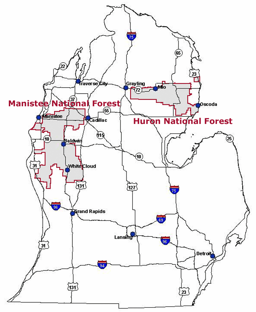
Manistee National Forest Maps: Fall 2009
Forest Location/Proximity Map
|