- Identification_Information:
-
- Citation:
-
- Citation_Information:
-
- Originator: U.S. Geological Survey (USGS), Coastal and Marine Geology (CMG)
- Publication_Date: 20081216
- Title:
-
Data of field activity P-7-94-AN in Ross Sea, Antarctica from
12/27/1994 to 02/05/1995
- Publication_Information:
-
- Publisher: U.S. Geological Survey (USGS), Coastal and Marine Geology (CMG)
- Online_Linkage: <http://walrus.wr.usgs.gov/infobank/gos/p-7-94-an.fmeta.xml>
- Online_Linkage:
-
<http://walrus.wr.usgs.gov/infobank/p/p794an/html/p-7-94-an.meta.html>
- Description:
-
- Abstract:
-
Data (sonobuoy) of field activity P-7-94-AN in Ross Sea,
Antarctica from 12/27/1994 to 02/05/1995,
<http://walrus.wr.usgs.gov/infobank/p/p794an/html/p-7-94-an.meta.html>.
- Purpose:
-
These data and information are intended for science
researchers, students from elementary through
college, policy makers, and general public.
- Supplemental_Information:
-
Equipment Used -
sonobuoy
Notes -
(from USGS Bulletin, 1/20/95)
A multi-institutional group. Guy is collecting sonobouy seimic-
refraction data in conjunction with the high-resolution reflection
data collection in order to help identify areas of outcropping
older sediment and improve his models of ice-loading related
sediment over consolidation. The sonobouys displayed a 50%
failure rate but are deployed two at a time successfully.
Similar information is available for thousands
of other USGS/CMG-related Activities.
If known, available are Activity-specific
navigation, gravity, magnetics, bathymetry,
seismic, and sampling data; track maps; and
equipment information; as well as summary
overviews, crew lists, and information
about analog materials.
If available, access to physical samples is
described in the "WR CMG Sample Distribution
Policy" at:
<http://walrus.wr.usgs.gov/infobank/programs/html/main/sample-dist-policy.html>
Primary access to the USGS/CMG Information
Bank's digital data, analog data, and
metadata is provided through...
<http://walrus.wr.usgs.gov/infobank/>
This page accomodates a variety of search
approaches (e.g., by platform, by region,
by scientist, by equipment type, etc.).
- Time_Period_of_Content:
-
- Time_Period_Information:
-
- Range_of_Dates/Times:
-
- Beginning_Date: 19941227
- Ending_Date: 19950205
- Currentness_Reference: ground condition
- Status:
-
- Progress: Complete
- Maintenance_and_Update_Frequency: As needed
- Spatial_Domain:
-
- Bounding_Coordinates:
-
- West_Bounding_Coordinate: 165.25000
- East_Bounding_Coordinate: -149.75000
- North_Bounding_Coordinate: -10.25000
- South_Bounding_Coordinate: -89.75000
- Keywords:
-
- Theme:
-
- Theme_Keyword_Thesaurus: ISO 19115 Topic Category
- Theme_Keyword: geoscientificinformation
- Theme_Keyword: oceans
- Theme:
-
- Theme_Keyword_Thesaurus: USGS CMG InfoBank
- Theme_Keyword: Marine Geology
- Place:
-
- Place_Keyword_Thesaurus: USGS CMG InfoBank
- Place_Keyword: Antarctic
- Place_Keyword: Antarctic Ocean
- Place_Keyword: Antarctic Southern Ocean
- Place_Keyword: Antarctica
- Place_Keyword: Ross Sea, Antarctica
- Place_Keyword: Southern Hemisphere
- Access_Constraints:
-
Physical materials are under controlled on-site access.
If available, access to physical samples is described
in the "WR CMG Sample Distribution Policy" at:
<http://walrus.wr.usgs.gov/infobank/programs/html/main/sample-dist-policy.html>
- Use_Constraints:
-
Please recognize the U.S. Geological Survey (USGS) as
the source of this information.
Physical materials are under controlled on-site access.
Some USGS information accessed through this means
may be preliminary in nature and presented without
the approval of the Director of the USGS. This
information is provided with the understanding
that it is not guaranteed to be correct or complete
and conclusions drawn from such information are
the responsibility of the user.
This information is not intended for navigational
purposes.
Any use of trade, firm, or product names is for
descriptive purposes only and does not imply
endorsement by the U.S. Government.
- Point_of_Contact:
-
- Contact_Information:
-
- Contact_Organization_Primary:
-
- Contact_Organization: U.S. Geological Survey (USGS), Coastal and Marine Geology (CMG)
- Contact_Person: Clint Steele
- Contact_Position: Data Acquisition, Processing, and Storage (DAPS) Group Leader
- Contact_Address:
-
- Address_Type: mailing and physical address
- Address: USGS, MailStop 999, 345 Middlefield Road
- City: Menlo Park
- State_or_Province: CA
- Postal_Code: 94025-3561
- Country: USA
- Contact_Voice_Telephone: (650) 329-5055
- Contact_Facsimile_Telephone: (650) 329-5190
- Contact_Electronic_Mail_Address: csteele@usgs.gov
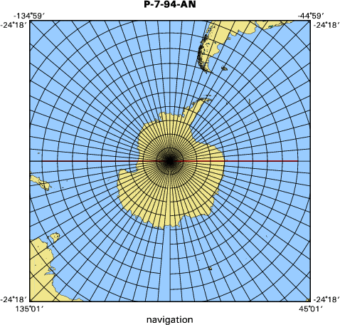
- Browse_Graphic:
-
- Browse_Graphic_File_Name:
-
<http://walrus.wr.usgs.gov/infobank/p/p794an/html/p-7-94-an.nav.gif>
- Browse_Graphic_File_Description: Trackline map of P-7-94-AN
- Browse_Graphic_File_Type: GIF
- Data_Set_Credit:
-
Guy Cochrane (Chief Scientist, USGS Western Region)
- Native_Data_Set_Environment: Digital, ASCII
- Cross_Reference:
-
- Citation_Information:
-
- Originator: U.S. Geological Survey (USGS), Coastal and Marine Geology (CMG)
- Publication_Date: Unknown
- Title: USGS/CMG Information Bank
- Publication_Information:
-
- Publisher: U.S. Geological Survey (USGS), Coastal and Marine Geology (CMG)
- Other_Citation_Details: Updated daily
- Online_Linkage: <http://walrus.wr.usgs.gov/infobank/>
- Data_Quality_Information:
-
- Attribute_Accuracy:
-
- Attribute_Accuracy_Report: Identified as best available version.
- Logical_Consistency_Report: Unspecified
- Completeness_Report:
-
Start and end date/times of data
Navigation Data (p-7-94-an.050 [SINS])
YYYYMMDDHHMMSST    YYYYMMDDHHMMSST
199401010101000    199401050101000
YYYYMMDDHHMMSST    YYYYMMDDHHMMSST
- Positional_Accuracy:
-
- Horizontal_Positional_Accuracy:
-
- Horizontal_Positional_Accuracy_Report: Unspecified
- Vertical_Positional_Accuracy:
-
- Vertical_Positional_Accuracy_Report: Unspecified
- Lineage:
-
- Process_Step:
-
- Process_Description:
-
Navigation Data
Unknown
- Process_Date: 20060306
- Process_Contact:
-
- Contact_Information:
-
- Contact_Organization_Primary:
-
- Contact_Organization: U.S. Geological Survey (USGS), Coastal and Marine Geology (CMG)
- Contact_Person: Clint Steele
- Contact_Position: Data Acquisition, Processing, and Storage (DAPS) Group Leader
- Contact_Address:
-
- Address_Type: mailing and physical address
- Address: USGS, MailStop 999, 345 Middlefield Road
- City: Menlo Park
- State_or_Province: CA
- Postal_Code: 94025-3561
- Country: USA
- Contact_Voice_Telephone: (650) 329-5055
- Contact_Facsimile_Telephone: (650) 329-5190
- Contact_Electronic_Mail_Address: csteele@usgs.gov
- Spatial_Data_Organization_Information:
-
- Indirect_Spatial_Reference: Ross Sea, Antarctica
- Direct_Spatial_Reference_Method: Point
- Point_and_Vector_Object_Information:
-
- SDTS_Terms_Description:
-
- SDTS_Point_and_Vector_Object_Type: Point
- Spatial_Reference_Information:
-
- Horizontal_Coordinate_System_Definition:
-
- Geographic:
-
- Latitude_Resolution: 0.00001
- Longitude_Resolution: 0.00001
- Geographic_Coordinate_Units: Decimal degrees
- Geodetic_Model:
-
- Horizontal_Datum_Name: North American Datum of 1983
- Ellipsoid_Name: Geodetic Reference System 80
- Semi-major_Axis: 6378137
- Denominator_of_Flattening_Ratio: 298.257
- Vertical_Coordinate_System_Definition:
-
- Depth_System_Definition:
-
- Depth_Datum_Name: Local surface
- Depth_Resolution: 0.1
- Depth_Distance_Units: meters
- Depth_Encoding_Method: Attribute values
- Entity_and_Attribute_Information:
-
- Overview_Description:
-
- Entity_and_Attribute_Overview: Navigation with Time Stamp
- Entity_and_Attribute_Detail_Citation:
-
Integrated navigation (SINS) data
Mnemonic:       (Year, Day, Hour, Min, Sec, Tenths, Latitude, Longitude)
FORTRAN format: (i4.4, i3.3, 3i2.2, i1.1, t16, f9.5, t26, f10.5)
C format:       (%4.4i%3.3i3%2.2i%1.1i %9.5f %10.5f\\n)
Naming:         .050
- Distribution_Information:
-
- Distributor:
-
- Contact_Information:
-
- Contact_Organization_Primary:
-
- Contact_Organization: U.S. Geological Survey (USGS), Coastal and Marine Geology (CMG)
- Contact_Person: Clint Steele
- Contact_Position: Data Acquisition, Processing, and Storage (DAPS) Group Leader
- Contact_Address:
-
- Address_Type: mailing and physical address
- Address: USGS, MailStop 999, 345 Middlefield Road
- City: Menlo Park
- State_or_Province: CA
- Postal_Code: 94025-3561
- Country: USA
- Contact_Voice_Telephone: (650) 329-5055
- Contact_Facsimile_Telephone: (650) 329-5190
- Contact_Electronic_Mail_Address: csteele@usgs.gov
- Resource_Description: Downloadable Data P-7-94-AN data set
- Distribution_Liability:
-
Please recognize the U.S. Geological Survey (USGS) as
the source of this information.
Physical materials are under controlled on-site access.
Some USGS information accessed through this means
may be preliminary in nature and presented without
the approval of the Director of the USGS. This
information is provided with the understanding
that it is not guaranteed to be correct or complete
and conclusions drawn from such information are
the responsibility of the user.
This information is not intended for navigational
purposes.
Any use of trade, firm, or product names is for
descriptive purposes only and does not imply
endorsement by the U.S. Government.
- Standard_Order_Process:
-
- Digital_Form:
-
- Digital_Transfer_Information:
-
- Format_Name: ASCII
- File_Decompression_Technique: No compression applied
- Transfer_Size: 0.1
- Digital_Transfer_Option:
-
- Online_Option:
-
- Computer_Contact_Information:
-
- Network_Address:
-
- Network_Resource_Name:
-
<http://walrus.wr.usgs.gov/infobank/p/p794an/html/p-7-94-an.nav.html>
- Fees: None
- Metadata_Reference_Information:
-
- Metadata_Date: 20081216
- Metadata_Contact:
-
- Contact_Information:
-
- Contact_Organization_Primary:
-
- Contact_Organization: U.S. Geological Survey (USGS), Coastal and Marine Geology (CMG)
- Contact_Person: Clint Steele
- Contact_Position: Data Acquisition, Processing, and Storage (DAPS) Group Leader
- Contact_Address:
-
- Address_Type: mailing and physical address
- Address: USGS, MailStop 999, 345 Middlefield Road
- City: Menlo Park
- State_or_Province: CA
- Postal_Code: 94025-3561
- Country: USA
- Contact_Voice_Telephone: (650) 329-5055
- Contact_Facsimile_Telephone: (650) 329-5190
- Contact_Electronic_Mail_Address: csteele@usgs.gov
- Metadata_Standard_Name: FGDC Content Standards for Digital Geospatial Metadata
- Metadata_Standard_Version: FGDC-STD-001-1998
- Metadata_Time_Convention: universal time
- Metadata_Access_Constraints: none
- Metadata_Use_Constraints: none
|


