|
 |
|
|
GIS Research & Applications | GIS Database Development | Spatial Data Analysis | Geovisualization Tools Development | Communication of Georeferenced Statistics Communication of Georeferenced StatisticsA. State Cancer ProfilesThe State Cancer Profiles Web site brings together data collected from public health surveillance systems in order to characterize the cancer burden in a standardized manner. It is hoped that health planners, policy makers and cancer information providers will be be able to use these descriptive cancer statistics to prioritize investements in cancer control.
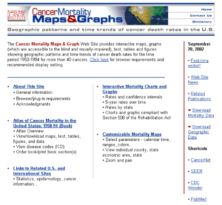
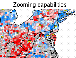
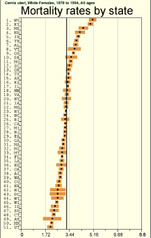
Example: Linked Micromap Plots (LMPlots) go from Paper to the WebB. Cancer Mortality AtlasThe Cancer Mortality Atlas Web site provides information associated with the Atlas of Cancer Mortality in the United States, 1950-94 for a general audience. Its features include:
GIS Research & Applications | GIS Database Development | Spatial Data Analysis | Geovisualization Tools Development | Communication of Georeferenced Statistics |
||||||
|
Maintained by the Surveillance Research Program,
Division of Cancer Control & Population Sciences. Contact Us | Accessibility Feedback | Privacy Policy |
|