Landsat Missions
The maps below show the locations of ground stations operated by our International Cooperators (ICs) for the direct downlink and distribution of Landsat 7 (L7) and/or Landsat 5 (L5) image data. The red circles show the approximate area over which each station has the capability for direct reception of Landsat data. The green circles show the components of the U.S. Geological Survey (USGS) ground station network, while the dashed circles show stations with dual status.
 |
 |
| Figure 1. L7 Network | Figure 2. L5 Network |
| International Cooperator | Ground Station Location | Ground Station ID | Landsat 5 | Landsat 7 |
| Argentina | Córdoba, Argentina | COA | x | x |
| Australia | Alice Springs, Australia | ASA, ASN | x | x |
| Australia | Hobart, Australia | HOA | x | x |
| Brazil | Cuíaba, Brazil | CUB | x | |
| Canada | Gatineau, Canada | GNC | x | |
| Canada | Prince Albert, Canada | PAC | x | |
| China | Beijing, China | BJC | x | |
| European Space Agency | Matera, Italy | MTI | x | |
| Indonesia | Parepare, Indonesia | DKI | Inactive | |
| Japan | Hatoyama, Japan | HAJ | x | |
| Japan | Hiroshima, Japan | HIJ | x | |
| South Africa | Hartebeesthoek, South Africa | JSA | Inactive | |
| Sweden | Kiruna, Sweden | KIS | x | |
| Thailand | Bangkok, Thailand | BKT | x |
In addition to our International Cooperators, there are numerous ground stations around the world that the Landsat Project uses for direct downlink. Campaign stations are short-term stations that collect data and send it to the Landsat archive. Polar ground stations downlink data for the Landsat Project on a more routine basis.
Table 2. The table below provides a list of the campaign or polar receiving stations that have recently collected Landsat data.
| Ground Station Location | Ground Station ID |
|---|---|
| Chetumal, Mexico | CHM |
| Irkutsk, Russia | IKR |
| Magadan, Russia | MGR |
| Malindi, Kenya | MLK |
| Maspalomas, Spain | MPS |
| Moscow, Russia | MOR |
| Svalbard, Norway | SGS |
| Poker Flats, Alaska | PFO |
| Unknown * | XXX |
*Data inherited by USGS Landsat from other agencies can lack associated detailed metadata.
Organizations interested in pursuing direct access to L7 or L5 data downlink should contact the Landsat Project Manager.

Comision Nacional de Actividades Espaciales (CONAE)
Web Address: E-mail Address:
The Australian Centre for Remote Sensing (ACRES) is part of the Geospatial & Earth Monitoring Division of Geoscience Australia, Commonwealth Department of Resources, Energy and Tourism.
The goal of Geoscience Australia's remote sensing program is to maintain and periodically refresh a comprehensive archive of satellite remotely sensed data over Australia to help ensure that fundamental geographic information is available for the benefit of the Australian community and to service government needs. Its primary functions are to acquire, catalogue, archive, process, and distribute remotely sensed data acquired from Earth observation satellites for both scientific and operational applications.
Geoscience Australia operates two remote sensing facilities - the Data Acquisition Facility (DAF) in Alice Springs and the Data Processing Facility (DPF) in Canberra. Data over the entire Australian landmass, most of Papua New Guinea, and Eastern Indonesia are recorded, archived and catalogued at Alice Springs. Tape copies of these data are transferred daily to Canberra, where they are available for processing. A high speed data link exists between Alice Springs and Canberra for on-demand near real-time needs.
Geoscience Australia is a member of the Tasmanian Earth Resources Satellite Station consortium (TERSS), which operates a receiving station at Hobart, Tasmania. Geoscience Australia provides satellite scheduling, data archiving, data cataloguing, and product generation services for the consortium. TERSS can acquire data over south-east Australia, New Zealand and a small part of Antarctica as well as a large expanse of the Southern Ocean.
Geoscience Australia offers a range of remote sensing products and services to suit various data analysis applications.
Web Addresses:
DGI - Image Generation Division - of INPE is in charge of the reception, processing and distribution of the images acquired by the LANDSAT and CBERS remote sensing satellites.
Goals

The Canada Centre for Remote Sensing of Natural Resources Canada (CCRS) operates a remote sensing program coordinated under the Earth Sciences Sector in co-operation with other agencies of the Government of Canada, provincial governments, industry, and Canadian universities. CCRS is responsible for the acquisition and archiving of Earth observation data and for the development of remote sensing applications and related methodologies and systems. CCRS is located in Ottawa and maintains satellite data receiving stations in Prince Albert, Saskatchewan, and Gatineau, Quebec.
CCRS has been receiving, archiving and distributing LANDSAT data since 1972.The archive catalogue is available on-line and is interoperable with the USGS catalogue. The catalogue of CCRS LANDSAT and other Earth Observation mission data is available at http://ceocat.ccrs.nrcan.gc.ca/pat.html.
CCRS engages the private sector in the processing and distribution LANDSAT data products and value-added products and services. This presently includes MDA Geospatial Services (http://www.mdacorporation.com/) and PhotoSat Information Ltd.
CCRS distributes MSS data directly to users.
Web Address:The missions of the China Remote Sensing Satellite Ground Station are to receive, process, archive, and distribute Earth resources data from various remote sensing satellites and to study related technology and methods of processing and receiving data from remote sensing satellites.
Web Address: Email Addresses:
The European Space Agency (ESA) has four stations that acquire Landsat data:
European Space Research INstitute (ESRIN), the European Space Agency's Centre in Frascati (near Rome), Italy, is in charge of the expliotation of the Agency's Earth observation satellites European Remote-Sensing Satellite (ERS) (launched 1991 and 1995) and ENVIronment SATellite (ENVISAT) (launched in 2001), and all of ESA's non-operational data processing and information systems. It has a workforce of approximately 140 international staff and around 250 contractors.
ESRIN's primary objective is the exploitation of remote sensing data from ESA (ENVISAT, ERS-1/ERS-2) and non-ESA (Landsat, National Oceanic and Atmospheric Administration (NOAA)-Tiros, Marine Observation Satellite (MOS), Japenese Earth Resources Satellite (JERS), Satellite Pour l'Observation de la Terre (SPOT), TERRA) Earth Observation missions. The facility at ESRIN manages the ground infrastructure necessary to fulfill this mandate. The infrastructure for ERS acquisitions presently consists of nearly 30 ground stations, 4 Processing and Archiving Facilities in ESA member states, and 2 commercial distributors for the dissemination of data to paying users.
Web Addresses:
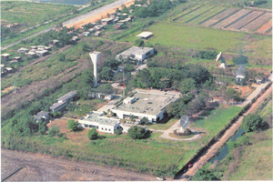
National Institute of Aeronautics and Space
Remote Sensing Application Center
Web Address:Japan Aerospace Exploration Agency (JAXA) established the Earth Observation Center (EOC) at Hatoyama to develop satellite remote sensing technology. EOC archives the following types of satellite data and processes these data for a variety of applications and research:
EOC distributes data in the form of CD-ROM, DVD. To make maximum use of the data, JAXA has set up the Earth Observation and Information System (EOIS).
Web Address:The Research Center for Advanced Earth Environmental Information at Hiroshima Institute of Technology is selected for a promotion foothold in the academic frontier project for a private university by the Ministry of Education. It is established within the Graduate Schools of Environmental Information Studies and of Engineering in cooperation with research organizations in Japan and overseas.
Web Address: http://rcaeei.cc.it-hiroshima.ac.jp/index.htm
Data Catalog: http://www.heeic.jp/index.html

CSIR Satellite Applications Centre
Maximising the benefits of space technology
Role in local and regional space programmes
Distribution of imagery
Department of Science and Technology space initiatives
Satellite navigation

The Space Technology Center's Geo-Informatics and Space Technology Development Agency (GISTDA) operates the Thailand ground receiving station. It is located in the Ladkrabang District, in the suburbs of Eastern Bangkok, Thailand.
GISTDA is a public organization responsible for space technology and geo-informatics. Its mission is to provide remote sensing data and geo-information to the public, and to carry out and participate in the research and development of space technology and geo-informatics both nationally and internationally.
Data Archival

![]() U.S. Department of the Interior |
U.S. Geological Survey
U.S. Department of the Interior |
U.S. Geological Survey
URL: http://landsat.usgs.gov
Sitemap
Page Contact Information: landsat@usgs.gov
Page Last Modified: November 06, 2008
