CARTOGRAPHIC MISCELLANY1007. Campamento En Pais Montañoso. [Military Training Map]. Palafax, Jesus. [19th century]. Wash pen-and-ink ms., 19 x 26 1/2 cm. Scale not given. This Mexican map served as a training map for military strategy related to campaigns in mountainous regions. Geographical location of map is not identified. G4410 18-- P Vault Cartographic Miscellany
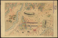
1008. [Military Training Map]. Herrera, Alvino. [19th century?]. Colored pen-and-ink ms., 21 x 30 cm. Scale not given. This Mexican military training map of an unidentified location includes streams, roads, cultivated fields, pictorial representation of vegetation and relief, fortifications, battle positions of unidentified troops, and settlements. In style, precise and sensitive. G4411 .S1 1848 H Vault Cartographic Miscellany 1009. [Military Training Map]. [184-?]. Colored pen-and-ink ms., 15 x23 cm. Scale not given. This apparent military training map of an unidentified location in Mexico includes roads, bodies of water, pictorial representation of relief, vegetation, cultivated fields, and a gun emplacement. G4410 18-- .M Vault Cartographic Miscellany 1010. [Military Training Map]. Castillo, Severo. [184-?]. Colored pen-and-ink ms., 19 x 22 1/2 cm. Scale not given. This military training map of an unidentified location in Mexico includes roads, coastline, coastal features, vegetation, settlements, and detailed and well executed pictorial representation of relief. G4410 18-- P1 Vault Cartographic Miscellany 1011. [Military Training Map]. Diaz, Agustin. 1846. Wash, pen-and-ink ms., 16 1/2 x 22 cm. Scale not given. This Mexican military training map of an unidentified location includes roads, streams, hachured relief, vegetation, cultivated fields, settlements, and a fortification. G4410 1846 .D Vault Cartographic Miscellany
|
||
|
Library of Congress Help Desk (January 30, 2001) |
||