|
|
|
Metadata
|
|
ID
|
01018
|
|
Also Known As
|
01018
R-1-01-NH
|
|
Abstract
|
United States Geological Survey, Woods Hole, Massachusetts.
Chief Scientist: Bill Danforth. Geophysical data
(sidescansonar, GPS) of field activity 01018 (R-1-01-NH) in
Portsmouth Harbor, New Hampshire from 06/10/2001 to
06/16/2001
|
|
Organization
|
United States Geological Survey, Woods Hole, Massachusetts
|
|
Project/Theme
|
Seafloor Mapping
|
|
Chief Scientist
|
Bill Danforth
|
|
Activity Type
|
Geophysical
|
|
Platform
|
Rafael
|
|
Area of Operation
|
Portsmouth Harbor, New Hampshire
|
|
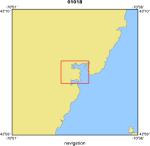
Location map
|
|
|
Bounding Coordinates
|
43.08600
-70.75000 -70.69600
43.05400
|
|
Ports
|
leave Portsmouth Harbor, NH
arrive Portsmouth Harbor, NH
|
|
Dates
|
06/10/2001 (JD 161) to 06/16/2001 (JD 167)
|
|
Analog Materials
|
No analog holdings.
|
|
Index map

|
|
|
Crew
|
|
Bill Danforth
|
Chief Scientist and Data Acquisition, USGS Woods Hole
|
|
Tom O'Brien
|
Electronics Technician, USGS Woods Hole
|
|
Dave Nichols
|
Ship Captain and Electronics Technician, USGS Woods Hole
|
|
|
Equipment Used
|
|
|
Purpose
|
|
Chart test area within harbor using Submetrix interferometric sidescan system.
|
|
|
Summary
|
|
|
Notes
|
|
Navigation techniques: Differential Global Positioning System (DGPS)
|
|
Related web sites: http://www.Ccom.unh.edu/shallowsurvey.htm
|
|
|
|
|
Got Help?
|
For 01018, we would appreciate any information on -- analog materials, contract, days at sea, dive count, funding, information specialist, information to be derived, kms of navigation, national plan, NGDC Info, owner, project number, publications, scanned materials, seismic description, station count, station description, submersible, tabulated info.
|
|