|
|
|
Metadata
|
|
ID
|
D-3-81-BS
|
|
Abstract
|
Chief Scientists: Paul Carlson, Herman Karl. Geological and
Geophysical data (3dot5khz, minisparker, sidescansonar,
magnetics, airgun, underwatertelevision, boxcore, dartcore,
vibratingcore, VanVeengrab, waterbucket, gravitycore,
CTDmeter, Hydroproducts, expendablebatthermograph, heatflow,
Niskenbottle) of field activity D-3-81-BS in Bering Sea,
Alaska from 07/08/1981 to 07/28/1981
|
|
Chief Scientist
|
Paul Carlson
Herman Karl
|
|
Activity Type
|
Geological and Geophysical
|
|
Platform
|
Discoverer
|
|
Area of Operation
|
Bering Sea, Alaska
|
|
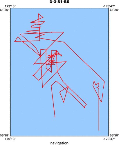
Location map
|

|
|
Bounding Coordinates
|
61.14167
179.52966 -174.09866
56.86867
|
|
Ports
|
leave Adak, AK
arrive Dutch Harbor, AK
|
|
Dates
|
07/08/1981 (JD 189) to 07/28/1981 (JD 209)
|
|
Analog Materials
|
list
|
|
Index map
|
|
|
Crew
|
|
Paul Carlson
|
Chief Scientist, USGS Western Region
|
|
Herman Karl
|
Chief Scientist, USGS Western Region
|
|
|
Equipment Used
|
|
3dot5khz
|
|
minisparker
|
|
sidescansonar
|
|
magnetics
|
|
airgun
|
|
underwatertelevision
|
|
boxcore
|
|
dartcore
|
|
vibratingcore
|
|
VanVeengrab
|
|
waterbucket
|
|
gravitycore
|
|
CTDmeter
|
|
Hydroproducts
|
|
expendablebatthermograph
|
|
heatflow
|
|
Niskenbottle
|
|
|
NGDC Overview
|
|
! Converted to time format with year at start.
|
|
!
|
|
DATA COLLECTION OVERVIEW (use NGDC GEODAS CD to retrieve data)
|
|
|
|
MCG Data Collection ID --- D381BS
|
|
Institution Data Collection ID --- D381BS
|
|
NGDC ID --- 06250011
|
|
Funding --- (unspecified)
|
|
Project, Cruise & Leg --- (unspecified)
|
|
Study region --- +62.00000,+56.00000,+179.00000,-174.00000
|
|
Chief Scientist(s) --- Herman Karl
|
|
Name of vessel --- Discoverer (surface ship)
|
|
Date field data collection started --- 07/08/81 LV ADAK
|
|
Date field data collection ended --- 07/28/81 AR DUTCH HARBOR
|
|
Parameters surveyed ---
|
|
Bathymetry: surveyed, contained in data file
|
|
Magnetics: (unspecified)
|
|
Gravity: (unspecified)
|
|
High-resolution seismics: (unspecified)
|
|
Deep penetration seismics: (unspecified)
|
|
Format --- (I1,A8,F5.2,4I2,F5.3,F8.5,F9.5,I1,F6.4,F6.1,I2,i1,3F6.1,I1,F5.1,F6.0,F7.1,F6.1,F5.1,A8,4I1)
|
|
Date of data input to NGDC --- 06/17/87
|
|
Contributing institution --- USGS Branch of Pacific Marine Geology
|
|
Country --- United States
|
|
|
|
Navigation instrumentation --- (unspecified)
|
|
Position determination method --- (unspecified)
|
|
|
|
Bathymetry instrumentation --- (unspecified)
|
|
Additional forms of bathymetric data --- (unspecified)
|
|
General rate of bathymetry in file --- 20.2 minutes
|
|
General collection rate of bathymetry --- (unspecified)
|
|
Assumed sound velocity --- (unspecified)
|
|
Bathymetric datum code --- No correction applied (sea level)
|
|
Bathmetry interpolation scheme --- (unspecified)
|
|
|
|
Magnetics instrumentation --- (unspecified)
|
|
Additional forms of magnetics data --- (unspecified)
|
|
General rate of magnetics in file --- (unspecified)
|
|
General collection rate of magnetics --- (unspecified)
|
|
Magnetic sensor tow distance --- (unspecified)
|
|
Magnetic sensor depth --- (unspecified)
|
|
Two sensor horizontal separation --- (unspecified)
|
|
Residual magnetics reference field --- (unspecified)
|
|
Method of applying residual field --- (unspecified)
|
|
|
|
Gravity instrumentation --- (unspecified)
|
|
Additional forms of gravity data --- (unspecified)
|
|
General rate of gravity in file --- (unspecified)
|
|
General collection rate of gravity --- (unspecified)
|
|
Theoretical gravity formula --- (unspecified)
|
|
Reference system --- (unspecified)
|
|
Corrections applied --- (unspecified)
|
|
Starting land tie --- (unspecified)
|
|
Ending land tie --- (unspecified)
|
|
|
|
Seismic instrumentation --- (unspecified)
|
|
Formats of seismic data --- (unspecified)
|
|
|
Publications
|
|
Carlson, Paul R., Karl, Herman A., Fischer, Jeffrey M., and Edwards, Brian D., 1982,
|
|
Geologic hazards in Navarin Basin Province, northern Bering Sea: Offshore Technology
|
Conference Proceedings, no. 14, v. 1, p. 73-87.
|
|
|
Carlson, P.R., and Karl, H.A., 1982, High-resolution seismic reflection profiles; Navarin
|
Basin Province, northern Bering Sea, 1981: U.S. Geological Survey Open-File Report 82-0786, 6 p.
|
|
|
Karl, H.A., and Carlson, P.R., 1982, Location and description of sediment samples; Navarin
|
Basin Province, Bering Sea, 1980-81: U.S. Geological Survey Open-File Report 82-0958, 6 p.
|
|
|
Fischer, J.M., Carlson, P.R., and Karl, H.A., 1982, Bathymetric map of Navarin Basin
|
Province, northern Bering Sea: U.S. Geological Survey Open-File Report 82-1038, 11 p.
|
|
|
Carlson, Paul R., Karl, Herman A., and Johnson, Kenneth A., 1981, Morphology, sedimentology,
|
|
and genesis of three large submarine canyons adjacent to Navarin Basin, Bering Sea, in Association
|
|
round table; 1981 American Association of Petroleum Geologists annual convention with divisions;
|
|
Society For Sedimentary Geology/EMD/DPA; technical program summaries and abstracts: American
|
Association of Petroleum Geologists Bulletin, v. 65, no. 5, p. 909.
|
|
|
Karl, H.A., Carlson, P.R., and Cacchione, D.A., 1981, Factors influencing sediment transport
|
|
at shelf break, in 1981 American Association of Petroleum Geologists annual convention with
|
|
divisions; Society For Sedimentary Geology/EMD/DPA: American Association of Petroleum Geologists
|
Bulletin, v. 65, no. 5, p. 943.
|
|
|
Carlson, Paul R., Karl, Herman A., and Quinterno, Paula J., 1982, Sedimentologic processes
|
|
in world's largest submarine canyons, Bering Sea, Alaska, in Braunstein, Jules, and Thomson, A.F.,
|
|
chairperson, 95th annual meeting, The Geological Society of America: Geological Society of America
|
Abstracts with Programs, v. 14, no. 7, p. 459-460.
|
|
|
Carlson, P.R., Fischer, J.M., and Karl, H.A., 1983, Two newly discovered submarine canyons
|
|
on the Alaskan continental margin of Bering Sea: U.S. Geological Survey Open-File Report
|
83-0024, 38 p.
|
|
|
Carlson, P.R., Molnia, B.F., Post, Austin, Wheeler, M.C., and Powell, R.D., 1983, Maps showing
|
|
post-neoglacial sediment thickness and bathymetry in Tarr Inlet, Glacier Bay, Alaska: U.S.
|
Geological Survey Miscellaneous Field Studies Map MF-1456, 1 sheet.
|
|
|
Vogel, Timothy M., Kvenvolden, Keith A., and Carlson, Paul R., 1981, Geochemical prospecting
|
|
for hydrocarbons in Navarin Basin province, in 1981 American Association of Petroleum Geologists
|
|
annual convention with divisions; Society For Sedimentary Geology/EMD/DPA: American Association
|
of Petroleum Geologists Bulletin, v. 65, no. 5, p. 1004.
|
|
|
Carlson, P.R., Karl, H.A., Kvenvolden, K.A., Vogel, T.M., and Fischer, J.A., 1983, Sea-floor
|
|
hazards of the Navarin Basin, northern Bering Sea: U.S. Geological Survey Professional
|
Paper 1375, p. 118-119.
|
|
|
Carlson, Paul R., and Karl, Herman A., 1984, Discovery of two new large submarine canyons
|
in the Bering Sea: Marine Geology, v. 56, no. 1-4, p. 159-179.
|
|
|
Karl, H.A., and Carlson, P.R., 1984, Geologic hazards, in Karl, H.A., and Carlson, P.R., eds.,
|
|
Surface and near-surface geology, Navarin Basin province; results of the 1980-81 field seasons:
|
U.S. Geological Survey Open-File Report 84-0089, p. 11-14.
|
Karl, H.A., and Carlson, P.R., 1984, Textural variations of surficial bottom sediment, in
|
|
Karl, H.A., and Carlson, P.R., eds., Surface and near-surface geology, Navarin Basin province;
|
results of the 1980-81 field seasons: U.S. Geological Survey Open-File Report 84-0089, p. 15-20.
|
|
|
Carlson, P.R., and Karl, H.A., 1984, Rates of sediment accumulation, in Carlson, P.R., and Karl,
|
|
H.A., eds., Surface and near-surface geology, Navarin Basin province; results of the 1980-81
|
field seasons: U.S. Geological Survey Open-File Report 84-0089, p. 21-27.
|
|
|
Carlson, P.R., and Karl, H.A., 1984, Rates of sediment accumulation, in Karl, H.A., and
|
|
Carlson, P.R., eds., Surface and near-surface geology, Navarin Basin province; results of
|
the 1980-81 field seasons: U.S. Geological Survey Open-File Report 84-0089, p. 21-27.
|
|
|
Carlson, P.R., Fischer, J.M., Karl, H.A., and Larkin, Christopher, 1984, Isopach map of
|
|
seismic unit A, youngest sedimentary sequence in Navarin Basin, in Karl, H.A., and
|
|
Carlson, P.R., eds., Surface and near-surface geology, Navarin Basin province; results of
|
the 1980-81 field seasons: U.S. Geological Survey Open-File Report 84-0089, p. 33-38.
|
|
|
Edwards, B.D., and Lee, H.J., 1984, Summary of Navarin Basin geotechnical characteristics, in
|
|
Karl, H.A., and Carlson, P.R., eds., Surface and near-surface geology, Navarin Basin province;
|
results of the 1980-81 field seasons: U.S. Geological Survey Open-File Report 84-0089, p. 39-54.
|
|
|
Golan-Bac, Margaret, and Kvenvolden, Keith A., 1984, Hydrocarbon gases in sediments; results
|
|
from 1981 field season, in Karl, H.A., and Carlson, P.R., eds., Surface and near-surface
|
|
geology, Navarin Basin province; results of the 1980-81 field seasons: U.S. Geological Survey
|
Open-File Report 84-0089, p. 55-75.
|
|
|
Quinterno, Paula, 1984, Benthic foraminifers, in Karl, H.A., and Carlson, P.R., eds., Surface
|
|
and near-surface geology, Navarin Basin province; results of the 1980-81 field seasons:
|
U.S. Geological Survey Open-File Report 84-0089, p. 76-99.
|
|
|
Baldauf, Jack G., 1984, Diatom analysis of surface samples recovered from Pervenets Canyon,
|
|
in Karl, H.A., and Carlson, P.R., eds., Surface and near-surface geology, Navarin Basin
|
|
province; results of the 1980-81 field seasons: U.S. Geological Survey Open-File Report 84-0089,
|
p. 100-112.
|
|
|
Blunt, D.J., and Kvenvolden, Keith A., 1984, Aspartic acid geochronology of molluscs, in
|
|
Karl, H.A., and Carlson, P.R., eds., Surface and near-surface geology, Navarin Basin province;
|
results of the 1980-81 field seasons: U.S. Geological Survey Open-File Report 84-0089, p. 113-118.
|
|
|
Karl, Herman A., Carlson, Paul R., and Cacchione, David A., 1983, Factors that influence
|
|
sediment transport at the shelfbreak, in Stanley, Daniel Jean and Moore, George T., eds.,
|
|
The shelfbreak; critical interface on continental margins: Society of Economic Paleontologists
|
and Mineralogists Special Publication, v. 33, p. 219-231.
|
|
|
Field, Michael E., Carlson, Paul R., and Hall, Robert K., 1983, Seismic facies of shelfedge
|
|
deposits, U.S. Pacific continental margin, in Stanley, Daniel Jean, and Moore, George T., eds.,
|
|
The shelfbreak; critical interface on continental margins: Society of Economic Paleontologists
|
and Mineralogists Special Publication, v. 33, p. 299-313.
|
|
|
Carlson, Paul R., Karl, Herman A., and Edwards, Brian D., 1982, Puzzling mass movement features in
|
|
the Navarinsky Canyon head, Bering Sea, in Seafloor stability of continental margins research
|
conference: Geo-Marine Letters, v. 2, no. 3-4, p. 123-127.
|
|
|
Karl, Herman A., and Carlson, Paul R., 1982, Large sand waves in Navarinsky Canyon head,
|
|
Bering Sea, in Seafloor stability of continental margins research conference: Geo-Marine
|
Letters, v. 2, no. 3-4, p. 157-162.
|
|
|
Carlson, Paul R., Golan-Bac, Margaret., Karl, Herman A., and Kvenvolden, Keith A., 1985,
|
|
Seismic and geochemical evidence for shallow gas in sediment on Navarin continental margin,
|
Bering Sea: American Association of Petroleum Geologists Bulletin, v. 69, no. 3, p. 422-436.
|
|
|
Carlson, Paul R., and Karl, Herman A., 1985, Mass movement of fine-grained sediment to the
|
|
basin floor, Bering Sea, Alaska, in Origins, transport, and deposition of fine-grained
|
|
sediments, 1984 Society For Sedimentary Geology research conference, Part 1: Geo-Marine
|
Letters, v. 4, no. 3-4, p. 221-225.
|
|
|
Karl, Herman A., Carlson, P.R., and Johnson, K.H., 1984, Sediment distribution on the
|
|
outer continental margin of an epicontinental sea; Bering Sea, Alaska, in Society of
|
|
Economic Paleontologists and Mineralogists first annual midyear meeting: Society For
|
Sedimentary Geology Midyear Meeting Abstracts, v. 1, p. 41.
|
|
|
Karl, H.A., Cacchione, D.A., and Carlson, P.R., 1986, Internal-wave currents as a
|
|
mechanism to account for large sand waves in Navarinsky Canyon head, Bering Sea:
|
Journal of Sedimentary Petrology, v. 56, no. 5, p. 706-714.
|
|
|
Karl, Herman A., and Carlson, Paul R., 1987, Surface current patterns suggested by suspended
|
|
sediment distribution over the outer continental margin, Bering Sea: Marine Geology, v. 74,
|
no. 3-4, p. 301-308.
|
|
|
Karl, H.A., Carlson, P.R., Johnson, K.H., and Rearic, Douglas M., 1987, Grain-size
|
|
parameters and constituent grain composition of surface sediment in Navarin Basin
|
Province, Bering Sea: U.S. Geological Survey Open-File Report 87-0064, 26 p.
|
|
|
Carlson, Paul R., and Karl, Herman A., 1988, Development of large submarine canyons in the Bering
|
|
Sea, indicated by morphologic, seismic, and sedimentologic characteristics: Geological Society of
|
America Bulletin, v. 100, no. 10, p. 1594-1615.
|
|
|
Carlson, Paul R., Karl, Herman A., and Edwards, Brian D., 1991, Mass sediment
|
|
failure and transport features revealed by acoustic techniques, Beringian margin,
|
Bering Sea, Alaska: Marine Geotechnology, v. 10, no. 1-2, p. 33-51.
|
|
|
Carlson, P.R., Karl, H.A., Edwards, B.D., Gardner, J.V., and Hall, R., 1993, Mass
|
|
movement related to large submarine canyons along the Beringian margin, Alaska, in
|
|
Schwab, W.C., Lee, H.J., Twichell, D.C., eds., Submarine landslides; selected
|
|
studies in the U.S. Exclusive Economic Zone: U.S. Geological Survey Bulletin 2002,
|
p. 104-116.
|
|
|
Got Help?
|
For D-3-81-BS, we would appreciate any information on -- contract, days at sea, dive count, funding, information specialist, information to be derived, kms of navigation, national plan, notes, organization, owner, project, project number, purpose, scanned materials, seismic description, station count, station description, submersible, summary, tabulated info.
|
|


