Identification_Information:
Citation:
Citation_Information:
Originator: U.S. Geological Survey (USGS), Coastal and Marine Geology (CMG)
Publication_Date: 20081216
Title:
Geophysical data of field activity L-8-76-NP in Northern
Pacific from 09/29/1976 to 10/21/1976
Publication_Information:
Publisher: U.S. Geological Survey (USGS), Coastal and Marine Geology (CMG)
Online_Linkage: http://walrus.wr.usgs.gov/infobank/gos/l-8-76-np.fmeta.xml
Online_Linkage: http://walrus.wr.usgs.gov/infobank/l/l876np/html/l-8-76-np.meta.html
Description:
Abstract:
Chief Scientist: Brent Dalrymple. Geophysical data
(3dot5khz, 12khz, airgun, RhoRho, dopplersonar,
integratednavigation, transitsatellite, gravity, gradiometer,
uniboom, sonobuoy, chaindredge) of field activity L-8-76-NP
in Northern Pacific from 09/29/1976 to 10/21/1976,
http://walrus.wr.usgs.gov/infobank/l/l876np/html/l-8-76-np.meta.html.
Purpose:
These data and information are intended for science
researchers, students from elementary through
college, policy makers, and general public.
Supplemental_Information:
Equipment Used -
3dot5khz 3.5 khz bathymetry
12khz 12 khz bathymetry
airgun 80 kj and 160 kj single-channel airgun
RhoRho Loran C Rho-Rho
dopplersonar
integratednavigation
transitsatellite satellite navigation
gravity shipboard gravity
gradiometer
uniboom
sonobuoy
chaindredge
Similar information is available for thousands
of other USGS/CMG-related Activities.
If known, available are Activity-specific
navigation, gravity, magnetics, bathymetry,
seismic, and sampling data; track maps; and
equipment information; as well as summary
overviews, crew lists, and information
about analog materials.
If available, access to physical samples is
described in the "WR CMG Sample Distribution
Policy" at:
http://walrus.wr.usgs.gov/infobank/programs/html/main/sample-dist-policy.html
Primary access to the USGS/CMG Information
Bank's digital data, analog data, and
metadata is provided through...
http://walrus.wr.usgs.gov/infobank/
This page accomodates a variety of search
approaches (e.g., by platform, by region,
by scientist, by equipment type, etc.).
Time_Period_of_Content:
Time_Period_Information:
Range_of_Dates/Times:
Beginning_Date: 19760929
Ending_Date: 19761021
Currentness_Reference: ground condition
Status:
Progress: Complete
Maintenance_and_Update_Frequency: As needed
Spatial_Domain:
Bounding_Coordinates:
West_Bounding_Coordinate: 169.61868
East_Bounding_Coordinate: -159.74690
North_Bounding_Coordinate: 52.06155
South_Bounding_Coordinate: 21.90246
Keywords:
Theme:
Theme_Keyword_Thesaurus: ISO 19115 Topic Category
Theme_Keyword: geoscientificinformation
Theme_Keyword: oceans
Theme:
Theme_Keyword_Thesaurus: USGS CMG InfoBank
Theme_Keyword: Marine Geology
Theme_Keyword: Marine Geophysics
Theme_Keyword: Marine Gravity Field
Theme_Keyword: Marine Magnetic Field
Theme_Keyword: Magnetic Anomalies
Theme_Keyword: Bathymetry
Theme_Keyword: Water Depth
Theme_Keyword: Seafloor Topography
Theme_Keyword: Marine Seismic
Place:
Place_Keyword_Thesaurus: USGS CMG InfoBank
Place_Keyword: North Pacific Ocean
Place_Keyword: Northern Pacific
Place_Keyword: Northern Pacific Ocean
Access_Constraints:
Physical materials are under controlled on-site access.
If available, access to physical samples is described
in the "WR CMG Sample Distribution Policy" at:
http://walrus.wr.usgs.gov/infobank/programs/html/main/sample-dist-policy.html
Use_Constraints:
Please recognize the U.S. Geological Survey (USGS) as
the source of this information.
Physical materials are under controlled on-site access.
Some USGS information accessed through this means
may be preliminary in nature and presented without
the approval of the Director of the USGS. This
information is provided with the understanding
that it is not guaranteed to be correct or complete
and conclusions drawn from such information are
the responsibility of the user.
This information is not intended for navigational
purposes.
Any use of trade, firm, or product names is for
descriptive purposes only and does not imply
endorsement by the U.S. Government.
Point_of_Contact:
Contact_Information:
Contact_Organization_Primary:
Contact_Organization: U.S. Geological Survey (USGS), Coastal and Marine Geology (CMG)
Contact_Person: Clint Steele
Contact_Position: Data Acquisition, Processing, and Storage (DAPS) Group Leader
Contact_Address:
Address_Type: mailing and physical address
Address: USGS, MailStop 999, 345 Middlefield Road
City: Menlo Park
State_or_Province: CA
Postal_Code: 94025-3561
Country: USA
Contact_Voice_Telephone: (650) 329-5055
Contact_Facsimile_Telephone: (650) 329-5190
Contact_Electronic_Mail_Address: csteele@usgs.gov
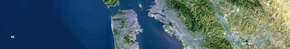
Browse_Graphic:
Browse_Graphic_File_Name: http://walrus.wr.usgs.gov/infobank/l/l876np/html/l-8-76-np.nav.gif
Browse_Graphic_File_Description: Trackline map of L-8-76-NP
Browse_Graphic_File_Type: GIF
Browse_Graphic:
Browse_Graphic_File_Name: http://walrus.wr.usgs.gov/infobank/l/l876np/html/l-8-76-np.grav.gif
Browse_Graphic_File_Description: Gravity data trackline map of L-8-76-NP
Browse_Graphic_File_Type: GIF
Browse_Graphic:
Browse_Graphic_File_Name: http://walrus.wr.usgs.gov/infobank/l/l876np/html/l-8-76-np.mag.gif
Browse_Graphic_File_Description: Magnetics data trackline map of L-8-76-NP
Browse_Graphic_File_Type: GIF
Browse_Graphic:
Browse_Graphic_File_Name: http://walrus.wr.usgs.gov/infobank/l/l876np/html/l-8-76-np.bath.gif
Browse_Graphic_File_Description: Bathymetry data trackline map of L-8-76-NP
Browse_Graphic_File_Type: GIF
Browse_Graphic:
Browse_Graphic_File_Name: http://walrus.wr.usgs.gov/infobank/l/l876np/html/l-8-76-np.samp.gif
Browse_Graphic_File_Description: Sampling locations map of L-8-76-NP
Browse_Graphic_File_Type: GIF
Data_Set_Credit:
Bob Duncan (Watchstander);
Brent Dalrymple (Chief Scientist);
Byron Ruppel (Geophysicist);
Carrie Carpenter (Dafe Curator);
Cece Roots (Watchstander);
Curtis Thompson (Chief Mate);
Dave Clague (Geologist);
Dick Doell (Navigator);
Elliot Sims (Watchstander);
Gary Greene (Geologist);
Harry Hill (Electronics Technician);
Jim Magill (Watchstander, MDB);
Karen Bachmann (Navigator);
Keith Bargar (Geologist);
Mark Brandon (Watchstander);
Pat McCrory (Watchstander);
Ralph Curtiss (Chief Engineer);
Ron Kistler (Geologist);
Steve Bright (Watchstander, MDB);
Sven Keinanen (Ship Captain)
Native_Data_Set_Environment: Digital, ASCII
Cross_Reference:
Citation_Information:
Originator: U.S. Geological Survey (USGS), Coastal and Marine Geology (CMG)
Publication_Date: Unknown
Title: USGS/CMG Information Bank
Publication_Information:
Publisher: U.S. Geological Survey (USGS), Coastal and Marine Geology (CMG)
Other_Citation_Details: Updated daily
Online_Linkage: http://walrus.wr.usgs.gov/infobank/
Data_Quality_Information:
Attribute_Accuracy:
Attribute_Accuracy_Report: Identified as best available version.
Logical_Consistency_Report: Unspecified
Completeness_Report:
Start and end date/times of data
>Navigation Data (l-8-76-np.011 [DRS])
>YYYYMMDDHHMMSST YYYYMMDDHHMMSST
>197609290140000 197610070702000
>197610070804000 197610070804000
>197610070900000 197610072030000
>197610072316000 197610080056000
>197610080142000 197610080400000
>197610080446000 197610080630000
>197610080712000 197610090456000
>197610090642000 197610100922000
>197610101016000 197610111206000
>197610111254000 197610121942000
>197610160230000 197610160230000
>197610160356000 197610160502000
>197610160606000 197610170940000
>197610171022000 197610200114000
>197610200206000 197610200240000
>197610200322000 197610200448000
>197610200530000 197610201820000
>197610201904000 197610201944000
>197610202046000 197610210432000
>197610210526000 197610210526000
>YYYYMMDDHHMMSST YYYYMMDDHHMMSST
>Gravity Data (l-8-76-np.160_011)
>YYYYMMDDHHMMSST YYYYMMDDHHMMSST
>197610040543300 197610040928300
>197610041028300 197610052023300
>197610060928300 197610061138300
>197610061328300 197610061428300
>197610061503300 197610070133300
>197610070148300 197610070228300
>197610070238300 197610070953300
>197610071018300 197610071028300
>197610072058300 197610080103300
>197610080113300 197610081438300
>197610081448300 197610082238300
>197610090028300 197610090443300
>197610090458300 197610090653300
>197610090713300 197610120133300
>197610120903300 197610121433300
>197610121443300 197610121828300
>197610160258300 197610171713300
>197610172158300 197610200123300
>197610200143300 197610201938300
>YYYYMMDDHHMMSST YYYYMMDDHHMMSST
>Magnetics Data (l-8-76-np.240_011)
>YYYYMMDDHHMMSST YYYYMMDDHHMMSST
>197609290140000 197609290527100
>197609290548200 197609300959300
>197609301045100 197609301200500
>197610010041000 197610011435400
>197610011525300 197610011934000
>197610040500000 197610051725000
>197610082345000 197610121440000
>197610160255000 197610171430000
>197610172200000 197610181750000
>197610182115000 197610191810000
>197610191825000 197610191830000
>197610191845000 197610192300000
>197610200035000 197610201130000
>197610201140000 197610201530000
>197610201630000 197610210430000
>YYYYMMDDHHMMSST YYYYMMDDHHMMSST
>Bathymetry Data (l-8-76-np.335_011)
>YYYYMMDDHHMMSST YYYYMMDDHHMMSST
>197609292205000 197609300045000
>197609300130000 197609300145000
>197609300151000 197609300550000
>197609300655000 197609300955000
>197610040535000 197610050904000
>197610050910000 197610051805000
>197610051815000 197610060135000
>197610060143000 197610060434000
>197610060440000 197610061144000
>197610061150000 197610061603000
>197610061610000 197610070950000
>197610071800000 197610072319000
>197610072325000 197610091425000
>197610091440000 197610110414000
>197610110420000 197610111125000
>197610111131000 197610120649000
>197610120655000 197610121428000
>197610121435000 197610121644000
>197610121650000 197610121720000
>197610121735000 197610121830000
>197610160630000 197610161435000
>197610161455000 197610161529010
>197610161535000 197610161620000
>197610161655000 197610162238000
>197610162255000 197610171708000
>197610171715000 197610171754000
>197610171800000 197610201640000
>197610201647000 197610210525000
>YYYYMMDDHHMMSST YYYYMMDDHHMMSST
Positional_Accuracy:
Horizontal_Positional_Accuracy:
Horizontal_Positional_Accuracy_Report: Unspecified
Vertical_Positional_Accuracy:
Vertical_Positional_Accuracy_Report: Unspecified
Lineage:
Process_Step:
Process_Description:
Navigation Data
>Converted to time format with year at start.
>
>01/31/86 KAYE DUA0:[DATA.L876NP.N]L876NP.011;
>DRB0:[DRS.REFMT]REFORMAT.EXE;5
>
Process_Date: 20001030
Process_Contact:
Contact_Information:
Contact_Organization_Primary:
Contact_Organization: U.S. Geological Survey (USGS), Coastal and Marine Geology (CMG)
Contact_Person: Clint Steele
Contact_Position: Data Acquisition, Processing, and Storage (DAPS) Group Leader
Contact_Address:
Address_Type: mailing and physical address
Address: USGS, MailStop 999, 345 Middlefield Road
City: Menlo Park
State_or_Province: CA
Postal_Code: 94025-3561
Country: USA
Contact_Voice_Telephone: (650) 329-5055
Contact_Facsimile_Telephone: (650) 329-5190
Contact_Electronic_Mail_Address: csteele@usgs.gov
Process_Step:
Process_Description:
Gravity Data
>10/31/1998 /tiger/l/l876np/grav/l-8-76-np.160_011
>/bear/programs/edit/automerge/automerge
>
>Input was...
>Converted to time format with year at start.
>
>02/04/86 BARB DUA0:[DATA.L876NP.G]L876NP.160;
>DRB0:[DRS.REFMT]REFORMAT.EXE;5
>
>Input was...
>Converted to time format with year at start.
>
>01/31/86 KAYE DUA0:[DATA.L876NP.N]L876NP.011;
>DRB0:[DRS.REFMT]REFORMAT.EXE;5
>
>time, lat, long, time(sec) to nearest nav fix, data values
Process_Date: 19981031
Process_Contact:
Contact_Information:
Contact_Organization_Primary:
Contact_Organization: U.S. Geological Survey (USGS), Coastal and Marine Geology (CMG)
Contact_Person: Clint Steele
Contact_Position: Data Acquisition, Processing, and Storage (DAPS) Group Leader
Contact_Address:
Address_Type: mailing and physical address
Address: USGS, MailStop 999, 345 Middlefield Road
City: Menlo Park
State_or_Province: CA
Postal_Code: 94025-3561
Country: USA
Contact_Voice_Telephone: (650) 329-5055
Contact_Facsimile_Telephone: (650) 329-5190
Contact_Electronic_Mail_Address: csteele@usgs.gov
Process_Step:
Process_Description:
Magnetics Data
>10/31/1998 /tiger/l/l876np/mag/l-8-76-np.240_011
>/bear/programs/edit/automerge/automerge
>
>Input was...
>Converted to time format with year at start.
>
>01/03/86 CAROLYN DRS$DATA:[L876NP.M]L876NP.240;
>DRB0:[DRS.REFMT]REFORMAT.EXE;5
>272/0500 to 275/1900 (20 sec data) from
> L876NP.200 from Barb
>278/0500 to 295/0400 ( 5 min data) from
> L876NP._.MAGSX1 on TAM139
> L876NP200.DAT on VAM139
>
>Input was...
>Converted to time format with year at start.
>
>01/31/86 KAYE DUA0:[DATA.L876NP.N]L876NP.011;
>DRB0:[DRS.REFMT]REFORMAT.EXE;5
>
>time, lat, long, time(sec) to nearest nav fix, data values
Process_Date: 20001102
Process_Contact:
Contact_Information:
Contact_Organization_Primary:
Contact_Organization: U.S. Geological Survey (USGS), Coastal and Marine Geology (CMG)
Contact_Person: Clint Steele
Contact_Position: Data Acquisition, Processing, and Storage (DAPS) Group Leader
Contact_Address:
Address_Type: mailing and physical address
Address: USGS, MailStop 999, 345 Middlefield Road
City: Menlo Park
State_or_Province: CA
Postal_Code: 94025-3561
Country: USA
Contact_Voice_Telephone: (650) 329-5055
Contact_Facsimile_Telephone: (650) 329-5190
Contact_Electronic_Mail_Address: csteele@usgs.gov
Process_Step:
Process_Description:
Bathymetry Data
>10/31/1998 /tiger/l/l876np/bath/l-8-76-np.335_011
>/bear/programs/edit/automerge/automerge
>
>Input was...
>Converted to time format with year at start.
>
>05/20/86 BECKIE DUA0:[DATA.LEE76]TEST.335;
>DUA0:[DATA.LEE76]TEMP.EXE;
>
>02/11/86 BECKIE DISK$USERDISK:[BECKIE.TEMP]L876NP.335;
>DRB0:[DRS.BAT]BATRED.EXE;1
>This file was hand-digetized in 2-way traveltime(secs).
>It was reduced using no Matthews correction and velocity
>of sound assumed was 1500m/sec.
>
>Input was...
>Converted to time format with year at start.
>
>01/31/86 KAYE DUA0:[DATA.L876NP.N]L876NP.011;
>DRB0:[DRS.REFMT]REFORMAT.EXE;5
>
>time, lat, long, time(sec) to nearest nav fix, data values
Process_Date: 20001120
Process_Contact:
Contact_Information:
Contact_Organization_Primary:
Contact_Organization: U.S. Geological Survey (USGS), Coastal and Marine Geology (CMG)
Contact_Person: Clint Steele
Contact_Position: Data Acquisition, Processing, and Storage (DAPS) Group Leader
Contact_Address:
Address_Type: mailing and physical address
Address: USGS, MailStop 999, 345 Middlefield Road
City: Menlo Park
State_or_Province: CA
Postal_Code: 94025-3561
Country: USA
Contact_Voice_Telephone: (650) 329-5055
Contact_Facsimile_Telephone: (650) 329-5190
Contact_Electronic_Mail_Address: csteele@usgs.gov
Spatial_Data_Organization_Information:
Indirect_Spatial_Reference: Northern Pacific
Direct_Spatial_Reference_Method: Point
Point_and_Vector_Object_Information:
SDTS_Terms_Description:
SDTS_Point_and_Vector_Object_Type: Point
Spatial_Reference_Information:
Horizontal_Coordinate_System_Definition:
Geographic:
Latitude_Resolution: 0.00001
Longitude_Resolution: 0.00001
Geographic_Coordinate_Units: Decimal degrees
Geodetic_Model:
Horizontal_Datum_Name: North American Datum of 1927
Ellipsoid_Name: Clarke 1866
Semi-major_Axis: 6378206.4
Denominator_of_Flattening_Ratio: 294.98
Vertical_Coordinate_System_Definition:
Depth_System_Definition:
Depth_Datum_Name: Local surface
Depth_Resolution: 0.1
Depth_Distance_Units: meters
Depth_Encoding_Method: Attribute values
Entity_and_Attribute_Information:
Overview_Description:
Entity_and_Attribute_Overview: Bathymetry with Time Stamp
Entity_and_Attribute_Detail_Citation:
Edited bathymetry data
>Mnemonic: (Year, Day, Hour, Min, Sec, Tenths, 2WayTravelTime, UncorrDepth)
>FORTRAN format: (i4.4, i3.3, 3i2.2, i1.1, t16, f7.4, t23, f7.1)
>C format: (%4.4i%3.3i3%2.2i%1.1i %7.4f %7.1f\\n)
>Naming: .330
Overview_Description:
Entity_and_Attribute_Overview: Gravity with Time Stamp
Entity_and_Attribute_Detail_Citation:
Free Air Anomaly data
>Mnemonic: (Year, Day, Hour, Min, Sec, Tenths, Eotvos, ObsGrv, TheoGrv, FAA)
>FORTRAN format: (i4.4, i3.3, 3i2.2, i1.1, t16, f6.1, t23, f9.1, t33, f9.1, t43, f8.1)
>C format: (%4.4i%3.3i3%2.2i%1.1i %6.1f %9.1f %9.1f %8.1f\\n)
>Naming: .160
Overview_Description:
Entity_and_Attribute_Overview: Magnetics with Time Stamp
Entity_and_Attribute_Detail_Citation:
Raw gradiometer data
>Mnemonic: (Year, Day, Hour, Min, Sec, Tenths, MstObs, SlvObs)
>FORTRAN format: (i4.4, i3.3, 3i2.2, i1.1, t16, f7.1, t24, f7.1)
>C format: (%4.4i%3.3i3%2.2i%1.1i %7.1f %7.1f\\n)
>Naming: .240
Overview_Description:
Entity_and_Attribute_Overview: Navigation with Time Stamp
Entity_and_Attribute_Detail_Citation:
Dead reckoning data
>Mnemonic: (Year, Day, Hour, Min, Sec, Tenths, Latitude, Longitude)
>FORTRAN format: (i4.4, i3.3, 3i2.2, i1.1, t16, f9.5, t26, f10.5)
>C format: (%4.4i%3.3i3%2.2i%1.1i %9.5f %10.5f\\n)
>Naming: .010
Distribution_Information:
Distributor:
Contact_Information:
Contact_Organization_Primary:
Contact_Organization: U.S. Geological Survey (USGS), Coastal and Marine Geology (CMG)
Contact_Person: Clint Steele
Contact_Position: Data Acquisition, Processing, and Storage (DAPS) Group Leader
Contact_Address:
Address_Type: mailing and physical address
Address: USGS, MailStop 999, 345 Middlefield Road
City: Menlo Park
State_or_Province: CA
Postal_Code: 94025-3561
Country: USA
Contact_Voice_Telephone: (650) 329-5055
Contact_Facsimile_Telephone: (650) 329-5190
Contact_Electronic_Mail_Address: csteele@usgs.gov
Resource_Description: Downloadable Data L-8-76-NP data set
Distribution_Liability:
Please recognize the U.S. Geological Survey (USGS) as
the source of this information.
Physical materials are under controlled on-site access.
Some USGS information accessed through this means
may be preliminary in nature and presented without
the approval of the Director of the USGS. This
information is provided with the understanding
that it is not guaranteed to be correct or complete
and conclusions drawn from such information are
the responsibility of the user.
This information is not intended for navigational
purposes.
Any use of trade, firm, or product names is for
descriptive purposes only and does not imply
endorsement by the U.S. Government.
Standard_Order_Process:
Digital_Form:
Digital_Transfer_Information:
Format_Name: ASCII
File_Decompression_Technique: No compression applied
Transfer_Size: 0.2
Digital_Transfer_Option:
Online_Option:
Computer_Contact_Information:
Network_Address:
Network_Resource_Name: http://walrus.wr.usgs.gov/infobank/l/l876np/html/l-8-76-np.nav.html
Digital_Form:
Digital_Transfer_Information:
Format_Name: ASCII
File_Decompression_Technique: No compression applied
Transfer_Size: 0.3
Digital_Transfer_Option:
Online_Option:
Computer_Contact_Information:
Network_Address:
Network_Resource_Name: http://walrus.wr.usgs.gov/infobank/l/l876np/html/l-8-76-np.grav.html
Digital_Form:
Digital_Transfer_Information:
Format_Name: ASCII
File_Decompression_Technique: No compression applied
Transfer_Size: 1.0
Digital_Transfer_Option:
Online_Option:
Computer_Contact_Information:
Network_Address:
Network_Resource_Name: http://walrus.wr.usgs.gov/infobank/l/l876np/html/l-8-76-np.mag.html
Digital_Form:
Digital_Transfer_Information:
Format_Name: ASCII
File_Decompression_Technique: No compression applied
Transfer_Size: 0.2
Digital_Transfer_Option:
Online_Option:
Computer_Contact_Information:
Network_Address:
Network_Resource_Name: http://walrus.wr.usgs.gov/infobank/l/l876np/html/l-8-76-np.bath.html
Fees: None
Metadata_Reference_Information:
Metadata_Date: 20081216
Metadata_Contact:
Contact_Information:
Contact_Organization_Primary:
Contact_Organization: U.S. Geological Survey (USGS), Coastal and Marine Geology (CMG)
Contact_Person: Clint Steele
Contact_Position: Data Acquisition, Processing, and Storage (DAPS) Group Leader
Contact_Address:
Address_Type: mailing and physical address
Address: USGS, MailStop 999, 345 Middlefield Road
City: Menlo Park
State_or_Province: CA
Postal_Code: 94025-3561
Country: USA
Contact_Voice_Telephone: (650) 329-5055
Contact_Facsimile_Telephone: (650) 329-5190
Contact_Electronic_Mail_Address: csteele@usgs.gov
Metadata_Standard_Name: FGDC Content Standards for Digital Geospatial Metadata
Metadata_Standard_Version: FGDC-STD-001-1998
Metadata_Time_Convention: universal time
Metadata_Access_Constraints: none
Metadata_Use_Constraints: none
|