|
|
|
Metadata
|
|
ID
|
77035
|
|
Also Known As
|
77035
ANNA2-77
A-2-77-MA
|
|
Abstract
|
United States Geological Survey, Woods Hole, Massachusetts.
Chief Scientist: Chuck O'Hara. Data (navigation) of field
activity 77035 (A-2-77-MA) in Massachusetts Nantucket Sound
from 09/27/1977 to 10/02/1977
|
|
Organization
|
United States Geological Survey, Woods Hole, Massachusetts
|
|
Project/Theme
|
Massachusetts Coastal Mineral Resources
|
|
Chief Scientist
|
Chuck O'Hara
|
|
Platform
|
Annandale
|
|
Area of Operation
|
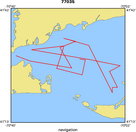
Massachusetts Nantucket Sound
|
|
Location map
|

|
|
Bounding Coordinates
|
41.70000
-70.70000 -70.00000
41.30000
|
|
Dates
|
09/27/1977 (JD 270) to 10/02/1977 (JD 275)
|
|
Analog Materials
|
No analog holdings.
|
|
Index map
|
|
|
Crew
|
|
Chuck O'Hara
|
Chief Scientist, USGS Woods Hole
|
|
John Aaron
|
Geologist, USGS
|
|
Diane Eskenasy
|
GFA, USGS
|
|
Wayne Ferrebee
|
Geologist, USGS
|
|
Jack McLane
|
Geologist, USGS
|
|
Gary Clayton
|
Biologist, Mass CZM
|
|
Kim Katsolis
|
Field Supervisor, Eastern Instrument Corp., Norwood, NJ
|
|
|
Equipment Used
|
|
|
Purpose
|
|
|
Got Help?
|
For 77035, we would appreciate any information on -- activity type, analog materials, contract, days at sea, dive count, funding, information specialist, information to be derived, kms of navigation, national plan, NGDC Info, notes, owner, ports, project number, publications, scanned materials, seismic description, station count, station description, submersible, summary, tabulated info.
|
|


