Flowage Easement Land
The lakes at the Elm Fork- Ray Roberts, Lewisville, and Grapevine- all have guidelines for landowners who have property adjacent to Government property and/or who own property which contains a flowage easement. A flowage easement occurs on property that is privately owned, but on which the Government owns the right to flood in perpetuity. There are restrictions as to what landowners can do on flowage easement property. A flowage easement description should be found in the deed to your property, or cited for reference in the appropriate county deeds. In some instances the reference to flowage easement restrictions is omitted during the preparation of new deeds with changes in ownership. The omission does not diminish the legality or validity of flowage easement restrictions over the property involved.
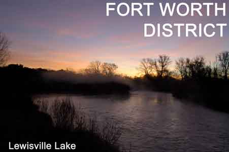
Flowage easement lands around Grapevine Lake are defined as those lands below the elevation contour of 572.0 feet above mean sea level (may vary on some properties). Flowage easement lands around Lewisville Lake are defined as those lands below the elevation contour of 537.0 feet above mean sea level. There are areas that may vary, be sure to check your deed.
The Owner of Flowage Easement Land, at his discretion, may:
- Construct a fence to, or along, the Government boundary line which does not impede the flow of water.
- Mow, clear, or plant vegetation so long as the original land contours are not changed and fill is neither brought in or removed.
- Sell or lease the land to others, subject to all restrictions contained in the flowage easement instrument.
Activities which are prohibited on Flowage Easement lands:
- Construct or maintain any structure for human habitation, including mobile homes, travel trailers, recreational camping vehicles, tents, or other shelters which are normally used for overnight occupancy.
- Place or construct any other structure or facility in, under, on, or over the land without prior approval by the District Engineer. This includes, but is not limited to, buildings, ramps, roads, channels, ditches, dams, dikes, wells, earthen tanks, roads, utility lines, and tramways.
- Add fill material to raise flowage easement lands above the specific lake's flowage easement elevation contour.
Activities on Flowage Easement lands which may be permitted:
- The owner of flowage easement must make written application for a permit to place or construct any type of structure or facility on flowage easement property. With written approval of the District Engineer, the landowner then may:
- Construct almost any type building, other than one designed or intended for human habitation.
- Build streets or roads.
- Construct utility lines.
- Drill or dig wells.
- Construct water, sewer, or septic tanks and systems.
- Use the land for recreational purposes.
- The construction of wells, water, sewer or septic systems will be examined on a case by case basis to ensure that no pollution of the lake or water wells, nor interference of the operation of the reservoir, will occur. Construction must be in accordance with all applicable laws, rules, and regulations. Specifically in the case of requests for sewage and septic systems, written approval from both the state health department and the County Environmental Health Department, (if the site is located in an unincorporated area), or the City within whose jurisdiction the site is located and/or the Texas Commission on Environmental Quality (TCEQ), Region 4 Office located in Arlington, Texas must accompany the request to the District Engineer. State Health Department regulations require, that all septic systems should not be located within a minimum of 75 feet from the lake water surface at the uncontrolled spillway elevation. Please contact the Elm Fork Project Office for specific details concerning flowage easement requirements, controlling elevations and requirements for submitting an application.
Permit Applications
All requests for construction or placement of any structure or facility on flowage easement land must include:
- A letter of application
- Detailed design plans of construction (4 copies)
- A plat map showing the location of proposed action, and the relationship with the Government boundary and lake shore (4 copies).
- Written approval from any other agencies as noted previously.
Please address all permit applications or other correspondence to : Lake Manager, Elm Fork Project office, 1801 N. Mill St. Lewisville, TX 75067.
Applications cannot be processed until all this information is complete.
back to top |