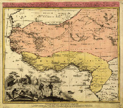
1743 French Map of Northwest Africa, depicting the areas covered in this curriculum unit.
Courtesy of American Memory at the Library of Congress.
Subject Areas
Art and Culture
Anthropology
Architecture
History and Social Studies
World History - Africa
World History - Ancient World
World History - Asia/Far East
Time Required
Activity 1: 2 class periods (1 for lesson; 1 for assessment)
Activity 2: 2 class periods
Activity 3: 2 class periods
Activity 4: 2 class periods
Activity 5: 2 class periods
Activity 6: 2 class periods
Activity 7: 2 class periods
Activity 8: indeterminate
Skills
Map skills
Observation and description
Historical interpretation and analysis
Critical Thinking
Information gathering
Visual analysis
Communication
The ancient city of Timbuktu lies in West Africa in the present-day nation of Mali. This is a region of varied landscapes, ranging from sizzling desert sands to tropical jungle. The Niger River that flows through Mali has been an important trading highway as well as a source of subsistence for the local people since very early times.
The first thing people back home will ask you is “Where in the
world is Timbuktu?” Before you set out, better open up those maps and take a
look.
You already know Timbuktu's in Mali, but where's Mali? And what's
the landscape like there? How do you get around in Mali? And what's the weather
like?
After you've completed your geographical investigations, you should be
able to do the following:
Locate Mali on a world map
Describe the landscape and climate of Mali
Locate the city of Timbuktu and describe the local weather
Indicate the route of the Niger River and discuss the river's economic significance
Compare life along the Niger in ancient times to that of today
You've got a bunch of maps in front of you. Where to start? Why not begin
with the one taken from outer space?
Access Map
of Africa: This is a satellite map. Notice how the Sahara Desert (the
tan area) covers the entire northern part of Africa, with the exception of
a few coastal areas. Look at the western bulge of the continent. The parts
of this bulge that lie along the edge of the desert and south of it make up
a region known as West Africa.
Now go to the Africa
Map. Wait a minute! Why is Timbuktu spelled another way?
(The city's name is often spelled in the French manner—Tombouktou.
This is because Mali was once a part of French West Africa.)
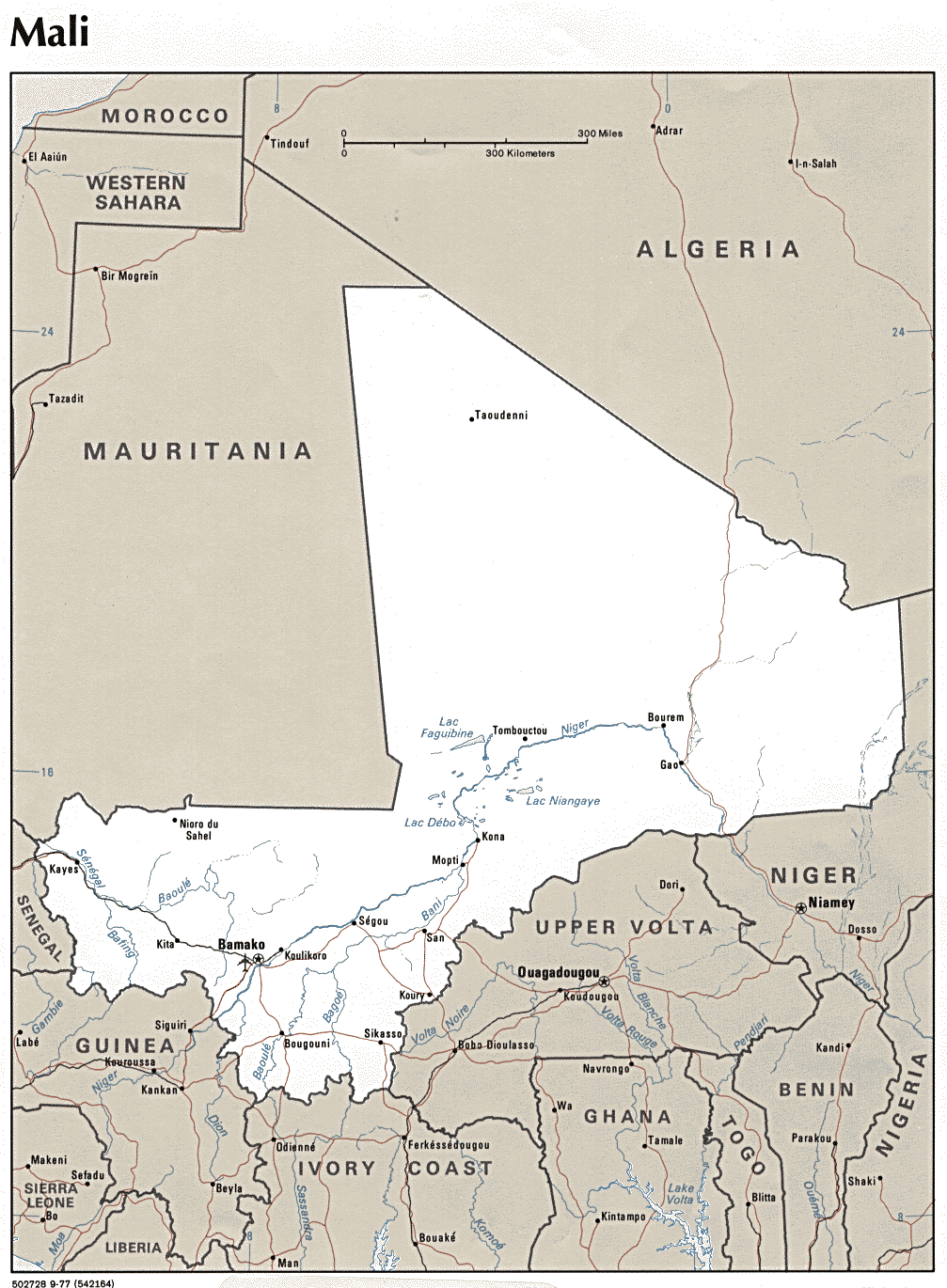
Go to Map of
Africa: This is a political map. Put your finger on Mali. Now find each
of the other modern countries of West Africa: Mauritania, Niger, Nigeria,
Senegal, The Gambia, Guinea-Bissau, Guinea, Sierra Leone, Liberia, Cote D'Ivoire,
Burkina Faso, Ghana, Togo, Benin.
Go to Map
of Africa. Find Mali and Timbuktu. What is the capital of modern Mali?
2. Mali's Landscape and Climate
Now that you know where Mali is, you'll need to get a sense of the “lay
of the land.”
Go to Mali: Geography
and History: Read the first paragraph and then find Timbuktu (Tombouktou)
on the map. How wide is the sahel? What are the three distinct geographical
regions of Mali? Better write these down in your notepad!
Now go to the Clickable
Map of Africa. Click on the section containing Mali and Niger. What is
the difference between the sahel and the savanna
Return to Map
of Africa. Find the equator.Now find the lines of latitude known
as the Tropic of Cancer and the Tropic of Capricorn. Which is closest to Mali?
The area lying between these lines is known as the tropics.
What kind of weather do you associate with the tropics? Hot? Only if you're
in a flat place. It's cool and pleasant on the top of Mt. Kenya! Steamy? Only
if you're near the ocean! So what do you suppose the weather's like in Timbuktu?
Access Temperature
in Timbuktu: What is the average daytime temperature in Timbuktu at this
time of year? Would the temperature vary very much from month to month?
3. The Niger River
Did you notice how the Niger River curls its way through Mali?This
river forms a highway from the mountainous jungles of Guinea to Timbuktu—and
beyond.
Access the Niger
River Basin Map. Follow the river from its source in Guinea to where it
loops southeastward (just beyond Timbuktu), then on to its mouth in Nigeria.
What countries does it flow through?
Go to the map of Mali.
Locate Timbuktu. Do you see the lakes? (Lac is the French word for
"lake.") How can there be lakes in such an arid land?
Now find Bamako. See the airport? Get your ticket and fly to Bamako!
When you get there, find your way to the Niger and catch a ride downstream on
one of the boats. Destination: Timbuktu.
Return to Mali:
Geography and History. Read paragraphs 3 and 4. In what three ways has
the Niger River been the source of subsistence for local inhabitants? How
often does the river flood? In earlier times, what major products were transported
along the river?
What do you see as your boats proceeds along the river? Got your
camera ready?
Here's a photo op!
View the fishermen
on the river. Piroques like these have been used for fishing
and transportation along the Niger since ancient times.
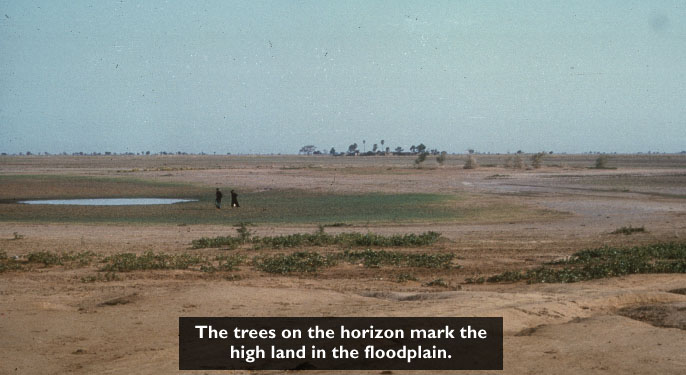
The prime farming area of the Niger is the inland delta in Mali.Like
the Nile River of ancient Egypt, the Niger floods its banks once a year, depositing
a rich new layer of silt on the floodplain in this wide, flat stretch of land.
Access Landscapes.
Read the first paragraph. During what time of year is the annual flooding?
About how much land is covered?
Now you know why there are lakes in the desert and the sahel!
Another photo op!
Inland
Niger Delta Landscape. View the close-up map of the delta and floodplain
at Inland
Niger Delta. Notice that Timbuktu lies in the Sahara Desert, a few miles
inland from the river.
Getting hungry? Go to Wonders:
Niger River. Read the second paragraph. What four food economies thrive
in the region of the inland delta?
What should you order for lunch? Fish fritters? Boiled rice? How
about a hamburger?
You can learn a lot about life along the river by talking to some
of the local inhabitants. Go to:
Write a letter to the producers of Globe Trekker. Describe the
parts of Mali you have visited so far. Remember—you're trying to convince them
that this is a great place for an upcoming TV episode.
Map of Africa
[http://plasma.nationalgeographic.com/mapmachine/index.html?id=362&size=medium&left
=-39&bottom=-34.6&right=72.8&top=38.2&point=x16.9,x1.8&text=Africa]
Map of Africa
[http://www.library.northwestern.edu/africana/map/]
EDSITEment
contains a variety of links to other websites and references to resources available
through government, nonprofit, and commercial entities. These links and references
are provided solely for informational purposes and the convenience of the user.
Their inclusion does not constitute an endorsement. For more information, please
click the Disclaimer icon.

