[USGS Logo]
Eastern Equine Encephalitis
Human
2008
Picture of Human
USGS Logo Banner
Eastern Equine Encephalitis:  Maryland - Human
[Clickable Map of USA]
Washington County Allegany County Garrett County Cecil County Harford County Baltimore County Carroll County Frederick County Harford County Kent County Baltimore City Howard County Montgomery County Harford County Queen Anne's County Baltimore County Anne Arundel County Baltimore City Caroline County Prince George's County Queen Anne's County Talbot County Queen Anne's County Queen Anne's County Talbot County Calvert County Talbot County Dorchester County Charles County Wicomico County Dorchester County Dorchester County Saint Marys County Worcester County Worcester County Dorchester County Dorchester County Dorchester County Dorchester County Worcester County Somerset County Dorchester County Charles County Dorchester County Dorchester County Somerset County Dorchester County Somerset County Somerset County Saint Marys County Somerset County Worcester County Worcester County Worcester County Somerset County Somerset County Somerset County Somerset County Somerset County Somerset County Somerset County Navigate to Delaware page Navigate to District of Columbia page Navigate to New Jersey page Navigate to New Jersey page Navigate to New Jersey page Navigate to Pennsylvania page Navigate to Virginia page Navigate to Virginia page Navigate to Virginia page Navigate to Virginia page Navigate to Virginia page Navigate to Virginia page Navigate to Virginia page Navigate to Virginia page Navigate to Virginia page Navigate to Virginia page Navigate to Virginia page Navigate to Virginia page Navigate to Virginia page Navigate to Virginia page Navigate to Virginia page Navigate to Virginia page Navigate to Virginia page Navigate to Virginia page Navigate to Virginia page Navigate to Virginia page Navigate to Virginia page Navigate to Virginia page Navigate to Virginia page Navigate to Virginia page Navigate to Virginia page Navigate to Virginia page Navigate to Virginia page Navigate to Virginia page Navigate to Virginia page Navigate to Virginia page Navigate to West Virginia page
Map Scalebar 100 km
Cumulative 2008 Data as of 3 am, Nov 04, 2008*
These data are provisional and may be revised or adjusted in the future.
[Epi curve - Vertical bar graph showing number of incidents for each of 52 weeks]
Did You Know?
You can also navigate to Adjacent States by clicking on them.
Map Legend
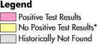
* States and counties in yellow are those in which virus activity has been reported historically, but no positive test results have been reported or no surveillance has occurred this year.