
About the USGS Idaho Water Science Center
Science Center News
 USGS Poster Selected as Idaho’s "Map of the Month"
October 30, 2008
The State of Idaho selected Ken Skinner’s poster, "Trends and Comparisons Between Partial-Development and October 2006 Hydrologic Conditions, Wood River Valley, Idaho" as its Map of the Month for November. Derived from information published in USGS Scientific Investigations Report 2007-5258., the map will be displayed throughout November in the Len B. Jordan state office building adjacent to the Idaho State Capitol. The Map of the Month series is designed to raise awareness of the profound role geospatial data play in government and other sectors.
Coeur d’Alene River Flooding Worst Since 1996
May 19, 2008
Northern Idaho’s Coeur d’Alene River has risen to its highest flood stage since 1996, according to information collected by the U.S. Geological Survey (USGS). As of 11:00 am, Mountain Daylight Time, today, the USGS streamflow gage on the Coeur d’Alene River near Cataldo, Idaho measured the height of the river at 45.87 feet. This is the highest stage measurement recorded at that gage since February 9, 1996, when the river stood at 51.62 feet. Flood stage for the Coeur d’Alene River at Cataldo is 43 feet. Read more
USGS and the Idaho Department of Water Resources to Measure Water Levels in 1,300 Southern Idaho Wells
March 27, 2008
Between March 31 and April 11, employees of the U.S. Geological Survey (USGS), working in cooperation with the Idaho Department of Water Resources (IDWR), will measure ground water levels in more than 1,300 wells throughout southern Idaho’s eastern Snake River Plain. The eastern Snake River Plain aquifer, with an estimated volume of 200 billion cubic feet, is the area’s chief source of drinking water, provides irrigation for one million acres of farmland, and is the water source for the state’s aquaculture industry. Read more
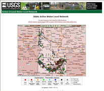 USGS Web Site Provides Idaho Ground Water Information
January 18, 2008
The U.S. Geological Survey (USGS) has developed a Web site that provides a wealth of data about ground water levels in Idaho and across the Nation. The USGS Ground Water Network includes water-level measurements from 871 wells throughout Idaho. Read more
USGS Study Shows Declining Water Levels in Idaho’s Wood River Valley
December 18, 2007
As south-central Idaho’s Wood River Valley continues to grow in population, residents and authorities are concerned about the long-term sustainability of the area’s water resources. A study released by the U.S. Geological Survey (USGS) shows that ground water levels and streamflows in some parts of the valley are indeed declining beyond what might be expected from typical, short-term fluctuations. Read more
Elevated Levels of Mercury Found in Fish Collected from Four Idaho and Nevada Reservoirs
December 10, 2007
Fish tissue samples taken from rainbow trout collected from four Idaho and Nevada reservoirs revealed elevated concentrations of methylmercury, according to data released by the U.S. Geological Survey (USGS) and the Shoshone-Paiute Tribes of the Duck Valley Indian Reservation. Read more
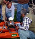 From Iraq to Idaho: Scientists Share Knowledge to Manage Water Resources
December 7, 2007
Scientists and engineers from throughout Iraq recently gathered in Boise, Idaho to learn about the latest technology and methods for managing their nation’s water resources. Read more
See the related news story Iraq Water Resources Benefit From U.S. Expertise, Funding
Read more USGS news releases at the USGS Newsroom.
