|
|
|
Metadata
|
|
ID
|
M-2-98-NC
|
|
Abstract
|
Chief Scientists: Herman Karl, Dave Jones. Sampling data
(VanVeengrab) of field activity M-2-98-NC in Northern
California from 04/23/1998 to 05/04/1998
|
|
National Plan
|
Environment
|
|
Chief Scientist
|
Herman Karl
Dave Jones
|
|
Activity Type
|
Sampling
|
|
Platform
|
McArthur
|
|
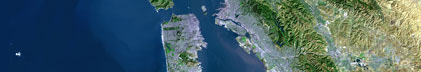
Area of Operation
|
Northern California
|
|
Location map
|
|
|
Bounding Coordinates
|
37.85379
-123.33207 -122.19276
37.45587
|
|
Ports
|
leave Redwood City, CA
arrive San Francisco, CA
|
|
Dates
|
04/23/1998 (JD 113) to 05/04/1998 (JD 124)
|
|
Analog Materials
|
list
|
|
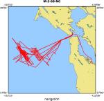
Index map

|
|
|
Crew
|
|
Herman Karl
|
Chief Scientist, USGS Western Region
|
|
Dave Jones
|
Chief Scientist, British Geological Survey
|
|
Dan Howard
|
Biologist, Gulf Of The Farallon National Marine Sanctary
|
|
Fred Payne
|
Electronics Technician, USGS Western Region
|
|
Mike Hamer
|
Facs Curator and Navigator, USGS Western Region
|
|
Phil Roberts
|
Geochemist, British Geological Survey
|
|
Pat Shanks
|
Geochemist, USGS Western Region
|
|
John Chin
|
Geologist, USGS Western Region
|
|
Gita Dunhill
|
Navigator, USGS Western Region
|
|
Lynn Karr
|
Unspecified Investigator, EPA
|
|
Scott Faller
|
Unspecified Investigator, EPA (Radiological Saftey)
|
|
Robert Hall
|
Unspecified Investigator, EPA
|
|
Bill Sites
|
Commanding Officer, McArthur
|
|
Duane Timmons
|
Executive Officer, McArthur
|
|
Dana Wilkes
|
Field Operations Officer, McArthur
|
|
Greg Jubner
|
3rd Mate, McArthur
|
|
Dave Minshall
|
Chief Bosun, McArthur
|
|
Steve Pierce
|
Bosun Group Leader, McArthur
|
|
Dave Hermanson
|
Seaman Surveyor, McArthur
|
|
Leroy Jordan
|
Seaman Surveyor, McArthur
|
|
Cheryl Ells
|
Able-bodied Seaman, McArthur
|
|
Terence Singerline
|
Able-bodied Seaman, McArthur
|
|
Lillian Stuart
|
Ordinary Seaman, McArthur
|
|
Hilary Swartz
|
Ordinary Seaman, McArthur
|
|
Dave Waller
|
Chief Marine Engineer, McArthur
|
|
Dave Bennett
|
1st Engineer, McArthur
|
|
Sam Hardy
|
Junior Engineer, McArthur
|
|
Brett Puckett
|
Engineer Utility Man, McArthur
|
|
Chris Dvorak
|
Wiper, McArthur
|
|
John Knox
|
Lead Electronics Technician, McArthur
|
|
Kaye Kinoshita
|
Senior Survey Technician, McArthur
|
|
Art Mercardo
|
Chief Stweard, McArthur
|
|
Dave Boden
|
Chief Cook, McArthur
|
|
Raul Monillas
|
2nd Cook, McArthur
|
|
|
Equipment Used
|
|
|
Notes
|
|
May 15, 1998
|
|
|
|
FARALLONS CRUISE
|
|
A survey of the Farallon Islands Radioactive Waste Dump site was
|
|
recently completed using the NOAA ship McArthur. The survey
|
|
was a collaboration among the U.S .Environmental Protection Agency,
|
|
the U.S. Geological Survey, the British Geological Survey, and the
|
|
Gulf of the Farallones National Marine Sanctuary. Approximately
|
|
47,800 barrels of low-level radioactive waste were dumped at 3 sites
|
|
between 1946 and 1970. The barrels litter a 1400-square-km area,
|
|
most of which is now within the boundary of the Gulf of the
|
|
Farallones National Marine Sanctuary. Previous studies in 1990,
|
|
using SeaMARC 1A, identified objects on the seafloor at the site
|
|
which were interpreted as barrels. This interpretation was confirmed
|
|
by video footage during the sidescan cruise, and subsequently in 1994
|
|
using the U.S. Navy submersible 'Sea Cliff' and the unmanned
|
|
Advanced Tethered Vehicle. Systematic regional data on seafloor
|
|
radioactivity were obtained on the McArthur using the BGS-towed
|
|
sea-bed gamma-ray spectrometer (EEL) system. More localized data
|
|
were also collected with the system at known sites of barrel clusters.
|
|
Sediment samples were collected, both regionally and around the
|
|
known barrel clusters, for subsequent laboratory analysis. Studies
|
|
were focused on the shallower parts of the dump site where commercial
|
|
fishing is carried out. About 90 line-km of EEL trackline were
|
|
obtained in the shallowest part of the dump site (the '90 m site'),
|
|
and 9 sediment samples were collected at locations determined
|
|
by the variation in the EEL "signature". Approximately 80 line-km
|
|
of EEL data were gathered in the intermediate-depth section of the
|
|
site (the '900 m site') and extending towards the deepest part
|
|
(the '1800m site'). Six sediment samples were collected on the
|
|
tracklines at the 900-m site. In addition, 10 samples were collected
|
|
clustered around known barrel clusters. The deepest EEL survey line
|
|
was towed in 1500 m of water, extending the previous record for the
|
|
system (600m) by a considerable margin. Preliminary interpretation
|
|
of the data suggests that the observed variations in seafloor
|
|
radioactivity can be attributed to geological features. There were no
|
|
indications of man-made radioactivity, suggesting that, if present on
|
|
a regional scale, it is only at very low levels. Further information
|
|
will become available when data and sample analyses are completed.
|
|
Participants on the cruise were Dave Jones and Phil Roberts (BGS),
|
|
Dan Howard (GFNMS), and Bob Hall and Lynn Karr (USEPA) (who due to
|
|
circumstances beyond our control, were replaced by Scott Faller (USEPA)),
|
|
Pat Shanks (USGS-Denver), John Chin, Michael Hamer, Gita Dunhill,
|
|
Fred Payne, and Herman Karl. MarFac, coordinated by Steve Wallace
|
|
and Dave Hogg, as usual, provided excellent support in getting
|
|
this cruise out to sea, and shipping equipment back to England.
|
|
Owing to the efforts of all above, this cruise was highly successful,
|
|
despite extremely adverse conditions. It is one cruise that Herman
|
|
Karl is glad to have behind him, however! Of note, and of unknown
|
|
significance, is that a rainbow appeared both at the start and end
|
|
of the cruise, just as the McArthur sailed under the Golden Gate.
|
|
For a snapshot of the cruise go to:
|
|
http://www.pmc.noaa.gov/mcarthur/ar9803.htm to view the website
|
|
prepared by Kaye Kinoshita.
|
|
|
Publications
|
|
|
Got Help?
|
For M-2-98-NC, we would appreciate any information on -- contract, days at sea, dive count, funding, information specialist, information to be derived, kms of navigation, NGDC Info, organization, owner, project, project number, purpose, scanned materials, seismic description, station count, station description, submersible, summary, tabulated info.
|
|