- Title:
-
Sampling data of field activity M-2-98-NC in Northern
California from 04/23/1998 to 05/04/1998
- Abstract:
-
Chief Scientists: Herman Karl, Dave Jones. Sampling data
(VanVeengrab) of field activity M-2-98-NC in Northern
California from 04/23/1998 to 05/04/1998,
<http://walrus.wr.usgs.gov/infobank/m/m298nc/html/m-2-98-nc.meta.html>.
- Supplemental_Information:
-
Equipment Used -
VanVeengrab
Notes -
May 15, 1998
FARALLONS CRUISE
A survey of the Farallon Islands Radioactive Waste Dump site was
recently completed using the NOAA ship McArthur. The survey
was a collaboration among the U.S .Environmental Protection Agency,
the U.S. Geological Survey, the British Geological Survey, and the
Gulf of the Farallones National Marine Sanctuary. Approximately
47,800 barrels of low-level radioactive waste were dumped at 3 sites
between 1946 and 1970. The barrels litter a 1400-square-km area,
most of which is now within the boundary of the Gulf of the
Farallones National Marine Sanctuary. Previous studies in 1990,
using SeaMARC 1A, identified objects on the seafloor at the site
which were interpreted as barrels. This interpretation was confirmed
by video footage during the sidescan cruise, and subsequently in 1994
using the U.S. Navy submersible 'Sea Cliff' and the unmanned
Advanced Tethered Vehicle. Systematic regional data on seafloor
radioactivity were obtained on the McArthur using the BGS-towed
sea-bed gamma-ray spectrometer (EEL) system. More localized data
were also collected with the system at known sites of barrel clusters.
Sediment samples were collected, both regionally and around the
known barrel clusters, for subsequent laboratory analysis. Studies
were focused on the shallower parts of the dump site where commercial
fishing is carried out. About 90 line-km of EEL trackline were
obtained in the shallowest part of the dump site (the '90 m site'),
and 9 sediment samples were collected at locations determined
by the variation in the EEL "signature". Approximately 80 line-km
of EEL data were gathered in the intermediate-depth section of the
site (the '900 m site') and extending towards the deepest part
(the '1800m site'). Six sediment samples were collected on the
tracklines at the 900-m site. In addition, 10 samples were collected
clustered around known barrel clusters. The deepest EEL survey line
was towed in 1500 m of water, extending the previous record for the
system (600m) by a considerable margin. Preliminary interpretation
of the data suggests that the observed variations in seafloor
radioactivity can be attributed to geological features. There were no
indications of man-made radioactivity, suggesting that, if present on
a regional scale, it is only at very low levels. Further information
will become available when data and sample analyses are completed.
Participants on the cruise were Dave Jones and Phil Roberts (BGS),
Dan Howard (GFNMS), and Bob Hall and Lynn Karr (USEPA) (who due to
circumstances beyond our control, were replaced by Scott Faller (USEPA)),
Pat Shanks (USGS-Denver), John Chin, Michael Hamer, Gita Dunhill,
Fred Payne, and Herman Karl. MarFac, coordinated by Steve Wallace
and Dave Hogg, as usual, provided excellent support in getting
this cruise out to sea, and shipping equipment back to England.
Owing to the efforts of all above, this cruise was highly successful,
despite extremely adverse conditions. It is one cruise that Herman
Karl is glad to have behind him, however! Of note, and of unknown
significance, is that a rainbow appeared both at the start and end
of the cruise, just as the McArthur sailed under the Golden Gate.
For a snapshot of the cruise go to:
<http://www.pmc.noaa.gov/mcarthur/ar9803.htm> to view the website
prepared by Kaye Kinoshita.
Publications -
<a href="<http://geopubs.wr.usgs.gov/circular/c1198/c1198_short.pdf>"><http://geopubs.wr.usgs.gov/circular/c1198/c1198_short.pdf>, p. 68-71</a><BR>
<HR>
<a href="<http://geopubs.wr.usgs.gov/circular/c1198/chapters/218-237_MeasuringRad.pdf>"><http://geopubs.wr.usgs.gov/circular/c1198/chapters/218-237_MeasuringRad.pdf>
Similar information is available for thousands
of other USGS/CMG-related Activities.
If known, available are Activity-specific
navigation, gravity, magnetics, bathymetry,
seismic, and sampling data; track maps; and
equipment information; as well as summary
overviews, crew lists, and information
about analog materials.
If available, access to physical samples is
described in the "WR CMG Sample Distribution
Policy" at:
<http://walrus.wr.usgs.gov/infobank/programs/html/main/sample-dist-policy.html>
Primary access to the USGS/CMG Information
Bank's digital data, analog data, and
metadata is provided through...
<http://walrus.wr.usgs.gov/infobank/>
This page accomodates a variety of search
approaches (e.g., by platform, by region,
by scientist, by equipment type, etc.).
- How should this data set be cited?
U.S. Geological Survey (USGS), Coastal and Marine Geology (CMG), 20081216, Sampling data of field activity M-2-98-NC in Northern California from 04/23/1998 to 05/04/1998: U.S. Geological Survey (USGS), Coastal and Marine Geology (CMG).
Online Links:
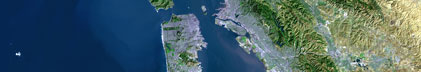
- What geographic area does the data set cover?
- West_Bounding_Coordinate: -123.33207
- East_Bounding_Coordinate: -122.19276
- North_Bounding_Coordinate: 37.85379
- South_Bounding_Coordinate: 37.45587
- What does it look like?
- <http://walrus.wr.usgs.gov/infobank/m/m298nc/html/m-2-98-nc.nav.gif> (GIF)
-
Trackline map of M-2-98-NC
- <http://walrus.wr.usgs.gov/infobank/m/m298nc/html/m-2-98-nc.samp.gif> (GIF)
-
Sampling locations map of M-2-98-NC
- Does the data set describe conditions during a particular time period?
- Beginning_Date: 23-Apr-1998
- Ending_Date: 04-May-1998
- Currentness_Reference: ground condition
- What is the general form of this data set?
- How does the data set represent geographic features?
- How are geographic features stored in the data set?
- Indirect_Spatial_Reference: Northern California
This is a Point data set.
It contains the following vector data types (SDTS terminology):
- What coordinate system is used to represent geographic features?
Horizontal positions are specified in geographic coordinates, that is, latitude and longitude.
Latitudes are given to the nearest 0.00001.
Longitudes are given to the nearest 0.00001.
Latitude and longitude values are specified in Decimal degrees.
The horizontal datum used is North American Datum of 1983.
The ellipsoid used is Geodetic Reference System 80.
The semi-major axis of the ellipsoid used is 6378137.
The flattening of the ellipsoid used is 1/298.257.
- Vertical_Coordinate_System_Definition:
-
- Depth_System_Definition:
-
- Depth_Datum_Name: Local surface
- Depth_Resolution: 0.1
- Depth_Distance_Units: meters
- Depth_Encoding_Method: Attribute values
- How does the data set describe geographic features?
- Entity_and_Attribute_Overview: Navigation with Time Stamp
- Entity_and_Attribute_Detail_Citation:
-
Integrated navigation (SINS) data
Mnemonic:       (Year, Day, Hour, Min, Sec, Tenths, Latitude, Longitude)
FORTRAN format: (i4.4, i3.3, 3i2.2, i1.1, t16, f9.5, t26, f10.5)
C format:       (%4.4i%3.3i3%2.2i%1.1i %9.5f %10.5f\\n)
Naming:         .050
- Who are the originators of the data set? (may include formal authors, digital compilers, and editors)
- U.S. Geological Survey (USGS), Coastal and Marine Geology (CMG)
- Who also contributed to the data set?
Herman Karl (Chief Scientist, USGS Western Region);
Dave Jones (Chief Scientist, British Geological Survey);
Dan Howard (Biologist, Gulf Of The Farallon National Marine Sanctary);
Fred Payne (Electronics Technician, USGS Western Region);
Mike Hamer (Facs Curator and Navigator, USGS Western Region);
Phil Roberts (Geochemist, British Geological Survey);
Pat Shanks (Geochemist, USGS Western Region);
John Chin (Geologist, USGS Western Region);
Gita Dunhill (Navigator, USGS Western Region);
Lynn Karr (Unspecified Investigator, EPA);
Scott Faller (Unspecified Investigator, EPA (Radiological Saftey));
Robert Hall (Unspecified Investigator, EPA);
Bill Sites (Commanding Officer, McArthur);
Duane Timmons (Executive Officer, McArthur);
Dana Wilkes (Field Operations Officer, McArthur);
Greg Jubner (3rd Mate, McArthur);
Dave Minshall (Chief Bosun, McArthur);
Steve Pierce (Bosun Group Leader, McArthur);
Dave Hermanson (Seaman Surveyor, McArthur);
Leroy Jordan (Seaman Surveyor, McArthur);
Cheryl Ells (Able-bodied Seaman, McArthur);
Terence Singerline (Able-bodied Seaman, McArthur);
Lillian Stuart (Ordinary Seaman, McArthur);
Hilary Swartz (Ordinary Seaman, McArthur);
Dave Waller (Chief Marine Engineer, McArthur);
Dave Bennett (1st Engineer, McArthur);
Sam Hardy (Junior Engineer, McArthur);
Brett Puckett (Engineer Utility Man, McArthur);
Chris Dvorak (Wiper, McArthur);
John Knox (Lead Electronics Technician, McArthur);
Kaye Kinoshita (Senior Survey Technician, McArthur);
Art Mercardo (Chief Stweard, McArthur);
Dave Boden (Chief Cook, McArthur);
Raul Monillas (2nd Cook, McArthur)
- To whom should users address questions about the data?
U.S. Geological Survey (USGS), Coastal and Marine Geology (CMG)
c/o Clint Steele
Data Acquisition, Processing, and Storage (DAPS) Group Leader
USGS, MailStop 999, 345 Middlefield Road
Menlo Park, CA 94025-3561
USA
(650) 329-5055 (voice)
(650) 329-5190 (FAX)
csteele@usgs.gov
These data and information are intended for science
researchers, students from elementary through
college, policy makers, and general public.
- From what previous works were the data drawn?
- How were the data generated, processed, and modified?
- Date: 11-Jul-2000 (process 1 of 1)
-
Navigation Data
time/lat/long style, multi-record, in caps
temporal-spatial data
data acquisition systems

       1         2         3
3456789012345678901234567890123456
Person who carried out this activity:
U.S. Geological Survey (USGS), Coastal and Marine Geology (CMG)
c/o Clint Steele
Data Acquisition, Processing, and Storage (DAPS) Group Leader
USGS, MailStop 999, 345 Middlefield Road
Menlo Park, CA 94025-3561
USA
(650) 329-5055 (voice)
(650) 329-5190 (FAX)
csteele@usgs.gov
- What similar or related data should the user be aware of?
U.S. Geological Survey (USGS), Coastal and Marine Geology (CMG), Unknown, USGS/CMG Information Bank: U.S. Geological Survey (USGS), Coastal and Marine Geology (CMG).
Online Links:
- Other_Citation_Details: Updated daily
- How well have the observations been checked?
Identified as best available version.
- How accurate are the geographic locations?
Unspecified
- How accurate are the heights or depths?
Unspecified
- Where are the gaps in the data? What is missing?
Start and end date/times of data
Navigation Data (m-2-98-nc.050 [SINS])
YYYYMMDDHHMMSST    YYYYMMDDHHMMSST
199804231208202    199804231604508
199804231620504    199804261832009
199804261837500    199804281640506
199804281651200    199804291949004
199804291957203    199805040411301
YYYYMMDDHHMMSST    YYYYMMDDHHMMSST
- How consistent are the relationships among the observations, including topology?
Unspecified
Are there legal restrictions on access or use of the data?
- Access_Constraints:
-
Physical materials are under controlled on-site access.
If available, access to physical samples is described
in the "WR CMG Sample Distribution Policy" at:
<http://walrus.wr.usgs.gov/infobank/programs/html/main/sample-dist-policy.html>
- Use_Constraints:
-
Please recognize the U.S. Geological Survey (USGS) as
the source of this information.
Physical materials are under controlled on-site access.
Some USGS information accessed through this means
may be preliminary in nature and presented without
the approval of the Director of the USGS. This
information is provided with the understanding
that it is not guaranteed to be correct or complete
and conclusions drawn from such information are
the responsibility of the user.
This information is not intended for navigational
purposes.
Any use of trade, firm, or product names is for
descriptive purposes only and does not imply
endorsement by the U.S. Government.
- Who distributes the data set? (Distributor 1 of 1)
U.S. Geological Survey (USGS), Coastal and Marine Geology (CMG)
c/o Clint Steele
Data Acquisition, Processing, and Storage (DAPS) Group Leader
USGS, MailStop 999, 345 Middlefield Road
Menlo Park, CA 94025-3561
USA
(650) 329-5055 (voice)
(650) 329-5190 (FAX)
csteele@usgs.gov
- What's the catalog number I need to order this data set?
Downloadable Data M-2-98-NC data set
- What legal disclaimers am I supposed to read?
Please recognize the U.S. Geological Survey (USGS) as
the source of this information.
Physical materials are under controlled on-site access.
Some USGS information accessed through this means
may be preliminary in nature and presented without
the approval of the Director of the USGS. This
information is provided with the understanding
that it is not guaranteed to be correct or complete
and conclusions drawn from such information are
the responsibility of the user.
This information is not intended for navigational
purposes.
Any use of trade, firm, or product names is for
descriptive purposes only and does not imply
endorsement by the U.S. Government.
- How can I download or order the data?
- Availability in digital form:
- Cost to order the data: None
- Dates:
- Last modified: 16-Dec-2008
- Metadata author:
-
U.S. Geological Survey (USGS), Coastal and Marine Geology (CMG)
c/o Clint Steele
Data Acquisition, Processing, and Storage (DAPS) Group Leader
USGS, MailStop 999, 345 Middlefield Road
Menlo Park, CA 94025-3561
USA
(650) 329-5055 (voice)
(650) 329-5190 (FAX)
csteele@usgs.gov
- Metadata standard:
- FGDC Content Standards for Digital Geospatial Metadata (FGDC-STD-001-1998)
Generated by mp version 2.9.2 on Tue Dec 16 03:34:09 2008
|


