USGS - science for a changing world

Oregon Water Science Center

Home Data Studies Publications Information

U.S Geological Survey
Oregon Water Science Center
2130 SW 5th Ave
Portland, OR 97201
Phone: (503) 251-3200
Fax: (503) 251-3470
E-mail: info-or@usgs.gov

ONLINE DATA

INFORMATION CENTER

ABOUT THE OREGON WSC

ABOUT THE USGS

USGS IN YOUR STATE


USGS Water Science Centers are located in each state and territory.
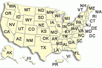
There is a USGS Water Science Center office in each State. Washington Oregon California Idaho Nevada Montana Wyoming Utah Colorado Arizona New Mexico North Dakota South Dakota Nebraska Kansas Oklahoma Texas Minnesota Iowa Missouri Arkansas Louisiana Wisconsin Illinois Mississippi Michigan Indiana Ohio Kentucky Tennessee Alabama Pennsylvania West Virginia Georgia Florida Caribbean Alaska Hawaii New York Vermont New Hampshire Maine Massachusettes South Carolina North Carolina Rhode Island Virginia Connecticut New Jersey Maryland-Delaware-D.C.

Climate and Hazards


Floods | Climate | Earthquakes | Volcanoes | Fire

Floods

Hydrologic forecasts Recent flood warnings, watches, forecasts, and related information for regions of the Pacific Northwest from NOAA's Northwest River Forecast Center (NWRFC)

Current streamflow conditions at USGS gaging stations (with links to real-time data):

FEMA Flood Risk and Insurance Information


Climate

Portland Metropolitan Area Weather and Precipitation Rainfall data and forecasts

Snow data from the NWRFC

Snow-water-equivalent map for western river basins from the WRCC

National Weather Service, Portland

Western Regional Climate Center Snotel, satellite, radar, forecasts, etc.

NOAA Drought Information Center Comprehensive drought information

National Drought Mitigation Center Another good drought site

Drought severity index Maintained by NOAA's Climate Prediction Center

Crop moisture index map Maintained by NOAA's Climate Prediction Center


Earthquakes

USGS National Earthquake Information Center Near real-time earthquake data and extensive general earthquake information.

Pacific Northwest Earthquake information Location and magnitude of recent Pacific Northwest earthquakes. Data from University of Washington Geophysics Program.


Volcanoes

USGS Cascades Volcano Observatory Extensive information on Cascades volcanoes.

USGS Volcano Hazards Program


Fire

National Interagency Fire Center Current wildland fire information, wildland fire potential, fire links, fire education, more.

National Weather Service Boise District fire weather Web site Fire weather forecasts and fire situation reports.

USGS Home Water Resources Biology Geography Geology Geospatial

Accessibility FOIA Privacy Policies and Notices

Take Pride in America logo USA.gov logo U.S. Department of the Interior | U.S. Geological Survey
URL: http://or.water.usgs.gov/climate_hazards.html
Page Contact Information: Oregon Webteam
Page Last Modified: Thursday, 20-Mar-2008 20:12:27 EDT

14319500: Flow=5070cfs,Stage=4.84ft,Floodstage=26.0ft,2008-11-06 18:30,>90,NORTH UMPQUA RIVER AT WINCHESTER, OR 14316700: Flow=1120cfs,Stage=2.93ft,2008-11-06 18:45,>90,STEAMBOAT CREEK NEAR GLIDE, OR 14305500: Flow=4710cfs,Stage=7.88ft,Floodstage=16.0ft,2008-11-06 18:30,>90,SILETZ RIVER AT SILETZ, OR 14211500: Flow=94cfs,Stage=3.14ft,Floodstage=11.0ft,2008-11-06 13:30,>90,JOHNSON CREEK AT SYCAMORE, OR 14183000: Flow=7340cfs,Stage=6.11ft,Floodstage=11.0ft,2008-11-06 18:00,>90,NORTH SANTIAM RIVER AT MEHAMA, OR 14162500: Flow=5730cfs,Stage=3.00ft,Floodstage=11.0ft,2008-11-06 18:00,>90,MCKENZIE RIVER NEAR VIDA, OR 14152000: Flow=7750cfs,2008-11-06 18:00,>90,MIDDLE FORK WILLAMETTE RIVER AT JASPER, OR 14141500: Flow=474cfs,Stage=3.50ft,2008-11-06 14:15,>90,LITTLE SANDY RIVER NEAR BULL RUN, OR 14139800: Flow=372cfs,Stage=5.07ft,2008-11-06 18:30,>90,SOUTH FORK BULL RUN RIVER NEAR BULL RUN, OR 14138900: Flow=437cfs,Stage=2.57ft,2008-11-06 18:30,>90,NORTH FORK BULL RUN RIVER NEAR MULTNOMAH FALLS, OR 14138870: Flow=129cfs,Stage=2.81ft,2008-11-06 18:30,>90,FIR CREEK NEAR BRIGHTWOOD, OR 14138850: Flow=1680cfs,Stage=6.91ft,2008-11-06 18:30,>90,BULL RUN RIVER NEAR MULTNOMAH FALLS, OR 14138800: Flow=305cfs,Stage=2.82ft,2008-11-06 18:30,>90,BLAZED ALDER CREEK NEAR RHODODENDRON, OR 14120000: Flow=1670cfs,Stage=5.14ft,Floodstage=13.0ft,2008-11-06 18:30,>90,HOOD RIVER AT TUCKER BRIDGE, NEAR HOOD RIVER, OR 14033500: Flow=302cfs,Stage=3.01ft,2008-11-06 18:15,>90,UMATILLA RIVER NEAR UMATILLA, OR 13183000: Flow=34cfs,Stage=1.16ft,2008-11-06 19:30,>90,OWYHEE RIVER BELOW OWYHEE DAM, OR 13269000: Flow=10400cfs,Stage=3.57ft,2008-11-06 19:00,<10,SNAKE RIVER AT WEISER ID 14400000: Flow=5840cfs,Stage=6.55ft,2008-11-06 18:30,76-90,CHETCO RIVER NEAR BROOKINGS, OR 14377100: Flow=2050cfs,Stage=7.12ft,Floodstage=35.0ft,2008-11-06 18:45,76-90,ILLINOIS RIVER NEAR KERBY, OR 14372300: Flow=3730cfs,Stage=3.92ft,Floodstage=17.0ft,2008-11-06 15:00,76-90,ROGUE RIVER NEAR AGNESS, OR 14369500: Flow=382cfs,Stage=2.51ft,Floodstage=13.0ft,2008-11-06 18:15,76-90,APPLEGATE RIVER NEAR WILDERVILLE, OR 14362000: Flow=256cfs,Stage=1.89ft,2008-11-06 15:30,76-90,APPLEGATE RIVER NEAR COPPER, OR 14359000: Flow=1920cfs,Stage=1.70ft,Floodstage=12.0ft,2008-11-06 18:45,76-90,ROGUE RIVER AT RAYGOLD NEAR CENTRAL POINT, OR 14357500: Flow=45cfs,Stage=2.72ft,Floodstage=10.0ft,2008-11-06 18:15,76-90,BEAR CREEK AT MEDFORD, OR 14338000: Flow=125cfs,Stage=2.54ft,2008-11-06 18:30,76-90,ELK CREEK NEAR TRAIL, OR 14330000: Flow=1270cfs,Stage=2.45ft,2008-11-06 14:30,76-90,ROGUE RIVER BELOW PROSPECT, OR 14325000: Flow=975cfs,Stage=3.03ft,2008-11-06 18:00,76-90,SOUTH FORK COQUILLE RIVER AT POWERS, OR 14318000: Flow=513cfs,Stage=4.09ft,2008-11-06 18:45,76-90,LITTLE RIVER AT PEEL, OR 14316500: Flow=1300cfs,Stage=5.71ft,2008-11-06 14:30,76-90,N UMPQUA RIVER ABV COPELAND CK NR TOKETEE FALLS,OR 14312500: Flow=98cfs,Stage=2.04ft,2008-11-06 18:30,76-90,LAKE CREEK NEAR DIAMOND LAKE, OR 14312000: Flow=1830cfs,Stage=6.08ft,Floodstage=26.0ft,2008-11-06 18:00,76-90,SOUTH UMPQUA RIVER NEAR BROCKWAY, OR 14309500: Flow=207cfs,Stage=3.83ft,2008-11-06 17:30,76-90,WEST FORK COW CREEK NEAR GLENDALE, OR 14308000: Flow=1170cfs,Stage=3.47ft,Floodstage=18.0ft,2008-11-06 18:30,76-90,SOUTH UMPQUA RIVER AT TILLER, OR 14306500: Flow=984cfs,Stage=3.62ft,Floodstage=18.0ft,2008-11-06 14:00,76-90,ALSEA RIVER NEAR TIDEWATER, OR 14301500: Flow=2420cfs,Stage=5.58ft,Floodstage=12.0ft,2008-11-06 18:30,76-90,WILSON RIVER NEAR TILLAMOOK, OR 14301000: Flow=2500cfs,Stage=5.39ft,Floodstage=14.0ft,2008-11-06 18:00,76-90,NEHALEM RIVER NEAR FOSS, OR 14211720: Flow=36500cfs,Stage=3.35ft,2008-11-06 13:30,76-90,WILLAMETTE RIVER AT PORTLAND, OR 14207500: Flow=718cfs,Stage=4.01ft,Floodstage=13.5ft,2008-11-06 18:00,76-90,TUALATIN RIVER AT WEST LINN, OR 14203500: Flow=209cfs,Stage=11.19ft,Floodstage=17.5ft,2008-11-06 18:00,76-90,TUALATIN RIVER NEAR DILLEY, OR 14189000: Flow=11100cfs,Stage=6.08ft,2008-11-06 18:00,76-90,SANTIAM RIVER AT JEFFERSON, OR 14178000: Flow=776cfs,Stage=3.46ft,2008-11-06 13:30,76-90,NO SANTIAM R BLW BOULDER CRK, NR DETROIT, OR 14174000: Flow=13900cfs,Stage=7.01ft,Floodstage=25.0ft,2008-11-06 18:00,76-90,WILLAMETTE RIVER AT ALBANY, OR 14170000: Flow=1140cfs,Stage=5.74ft,Floodstage=9.0ft,2008-11-06 18:00,76-90,LONG TOM RIVER AT MONROE, OR 14166000: Flow=14500cfs,Stage=5.89ft,Floodstage=14.0ft,2008-11-06 14:00,76-90,WILLAMETTE RIVER AT HARRISBURG, OR 14165000: Flow=366cfs,Stage=2.52ft,Floodstage=15.0ft,2008-11-06 19:00,76-90,MOHAWK RIVER NEAR SPRINGFIELD, OR 14159200: Flow=623cfs,Stage=4.70ft,2008-11-06 18:00,76-90,SO FK MCKENZIE RIVER ABV COUGAR LAKE NR RAINBOW OR 14158850: Flow=898cfs,Stage=6.67ft,2008-11-06 18:30,76-90,MCKENZIE R BLW TRAIL BR DAM NR BELKNAP SPRINGS, OR 14157500: Flow=1480cfs,Stage=3.59ft,2008-11-06 18:00,76-90,COAST FORK WILLAMETTE RIVER NEAR GOSHEN, OR 14154500: Flow=815cfs,Stage=4.39ft,2008-11-06 18:15,76-90,ROW RIVER ABOVE PITCHER CREEK, NEAR DORENA, OR 14142500: Flow=3470cfs,Stage=10.58ft,Floodstage=19.3ft,2008-11-06 18:45,76-90,SANDY RIVER BLW BULL RUN RIVER, NR BULL RUN, OR 14091500: Flow=1520cfs,Stage=1.33ft,2008-11-06 19:00,76-90,METOLIUS RIVER NEAR GRANDVIEW, OR 14015000: Flow=20cfs,Stage=1.93ft,2008-11-06 16:00,76-90,MILL CREEK AT WALLA WALLA, WA 10352500: Flow=7.2cfs,Stage=2.52ft,2008-11-06 16:45,76-90,MCDERMITT C NR MCDERMITT NV 14020300: Flow=15cfs,Stage=1.46ft,2008-11-06 18:15,10-24,MEACHAM CREEK AT GIBBON, OR 13290450: Flow=8960cfs,Stage=64.79ft,2008-11-06 19:30,10-24,SNAKE RIVER AT HELLS CANYON DAM ID-OR STATE LINE 11501000: Flow=250cfs,Stage=1.68ft,2008-11-06 18:30,10-24,SPRAGUE RIVER NEAR CHILOQUIN, OR 14361500: Flow=2070cfs,Stage=1.94ft,Floodstage=20.0ft,2008-11-06 18:15,25-75,ROGUE RIVER AT GRANTS PASS, OR 14339000: Flow=1600cfs,Stage=2.79ft,Floodstage=10.0ft,2008-11-06 18:00,25-75,ROGUE RIVER AT DODGE BRIDGE, NEAR EAGLE POINT, OR 14337600: Flow=1370cfs,Stage=2.04ft,2008-11-06 14:30,25-75,ROGUE RIVER NEAR MCLEOD, OR 14337500: Flow=123cfs,Stage=3.31ft,2008-11-06 14:45,25-75,BIG BUTTE CREEK NEAR MCLEOD, OR 14314500: Flow=46cfs,Stage=3.24ft,2008-11-06 18:45,25-75,CLEARWATER RIVER ABV TRAP CK NR TOKETEE FALLS, OR 14313500: Flow=59cfs,Stage=4.36ft,2008-11-06 18:45,25-75,N UMPQUA RIVER BLW LEMOLO LK, NR TOKETEE FALLS, OR 14302900: Flow=33cfs,Stage=2.76ft,2008-11-06 18:15,25-75,NESTUCCA RIVER NEAR FAIRDALE, OR 14209000: Flow=416cfs,Stage=5.30ft,2008-11-06 18:15,25-75,OAK GROVE FORK ABOVE POWERPLANT INTAKE, OR. 14208700: Flow=130cfs,Stage=1.89ft,2008-11-06 19:00,25-75,OAK GROVE FORK NEAR GOVERNMENT CAMP, OR 14202000: Flow=631cfs,Stage=8.94ft,Floodstage=22.0ft,2008-11-06 19:00,25-75,PUDDING RIVER AT AURORA, OR 14200000: Flow=1150cfs,Stage=11.69ft,Floodstage=23.0ft,2008-11-06 18:00,25-75,MOLALLA RIVER NEAR CANBY, OR 14191000: Flow=21600cfs,Stage=9.40ft,Floodstage=28.0ft,2008-11-06 18:00,25-75,WILLAMETTE RIVER AT SALEM, OR 14187500: Flow=3290cfs,Stage=4.62ft,Floodstage=12.0ft,2008-11-06 18:00,25-75,SOUTH SANTIAM RIVER AT WATERLOO, OR 14171000: Flow=144cfs,Stage=3.82ft,Floodstage=20.0ft,2008-11-06 14:00,25-75,MARYS RIVER NEAR PHILOMATH, OR 14158500: Flow=276cfs,Stage=1.76ft,2008-11-06 18:30,25-75,MCKENZIE RIVER AT OUTLET OF CLEAR LAKE, OR 14140000: Flow=254cfs,Stage=4.05ft,2008-11-06 18:45,25-75,BULL RUN RIVER NEAR BULL RUN (RIVER ONLY), OR 14123500: Flow=688cfs,Stage=4.10ft,2008-11-06 18:00,25-75,WHITE SALMON RIVER NEAR UNDERWOOD, WA 14113000: Flow=811cfs,Stage=4.08ft,Floodstage=9.0ft,2008-11-06 19:00,25-75,KLICKITAT RIVER NEAR PITT, WA 14105700: Flow=115000cfs,Stage=76.92ft,2008-11-06 14:00,25-75,COLUMBIA RIVER AT THE DALLES, OR 14103000: Flow=5330cfs,Stage=3.11ft,Floodstage=8.0ft,2008-11-06 18:30,25-75,DESCHUTES RIVER AT MOODY, NEAR BIGGS, OR 14097100: Flow=289cfs,Stage=1.26ft,2008-11-06 14:00,25-75,WARM SPRINGS RIVER NEAR KAHNEETA HOT SPRINGS, OR 14092500: Flow=4480cfs,Stage=3.08ft,2008-11-06 14:15,25-75,DESCHUTES RIVER NEAR MADRAS, OR 14087400: Flow=1390cfs,Stage=2.14ft,2008-11-06 18:00,25-75,CROOKED RIVER BELOW OPAL SPRINGS, NEAR CULVER, OR 14076500: Flow=1030cfs,Stage=3.38ft,2008-11-06 18:00,25-75,DESCHUTES RIVER NEAR CULVER, OR 14048000: Flow=362cfs,Stage=2.28ft,2008-11-06 18:45,25-75,JOHN DAY RIVER AT MCDONALD FERRY, OR 14046500: Flow=440cfs,Stage=2.60ft,Floodstage=11.5ft,2008-11-06 18:30,25-75,JOHN DAY RIVER AT SERVICE CREEK, OR 14046000: Flow=200cfs,Stage=3.01ft,Floodstage=14.0ft,2008-11-06 18:30,25-75,NORTH FORK JOHN DAY RIVER AT MONUMENT, OR 14044000: Flow=45cfs,Stage=2.18ft,2008-11-06 19:00,25-75,MIDDLE FORK JOHN DAY RIVER AT RITTER, OR 14038530: Flow=110cfs,Stage=3.83ft,Floodstage=8.0ft,2008-11-06 16:00,25-75,JOHN DAY RIVER NEAR JOHN DAY, OR 14018500: Flow=147cfs,Stage=3.27ft,Floodstage=13.0ft,2008-11-06 18:30,25-75,WALLA WALLA RIVER NEAR TOUCHET, WA 14013000: Flow=46cfs,Stage=14.69ft,2008-11-06 16:15,25-75,MILL CREEK NEAR WALLA WALLA, WA 13333000: Flow=836cfs,Stage=3.47ft,Floodstage=10.0ft,2008-11-06 19:00,25-75,GRANDE RONDE RIVER AT TROY, OR 13331500: Flow=118cfs,Stage=0.52ft,2008-11-06 18:00,25-75,MINAM RIVER NEAR MINAM, OR 13330000: Flow=56cfs,Stage=1.86ft,2008-11-06 18:30,25-75,LOSTINE RIVER NEAR LOSTINE, OR 13292000: Flow=183cfs,Stage=1.61ft,Floodstage=5.5ft,2008-11-06 18:15,25-75,IMNAHA RIVER AT IMNAHA, OR 13251000: Flow=1680cfs,Stage=5.60ft,2008-11-06 19:30,25-75,PAYETTE RIVER NR PAYETTE ID 13217500: Flow=0.65cfs,Stage=1.41ft,2008-11-06 19:15,25-75,NORTH FORK MALHEUR RIVER AT BEULAH OR 13215000: Flow=0.07cfs,Stage=3.30ft,2008-11-06 19:15,25-75,MALHEUR RIVER BEL WARMSPRINGS RES NR RIVERSIDE OR 13213000: Flow=926cfs,Stage=8.76ft,2008-11-06 19:30,25-75,BOISE RIVER NR PARMA ID 13181000: Flow=138cfs,Stage=1.61ft,2008-11-06 19:30,25-75,OWYHEE RIVER NR ROME OR 11516530: Flow=1340cfs,Stage=2.78ft,2008-11-06 18:15,25-75,KLAMATH R BL IRON GATE DAM CA 11510700: Flow=1920cfs,Stage=5.01ft,2008-11-06 18:45,25-75,KLAMATH RIVER BLW JOHN C.BOYLE PWRPLNT, NR KENO,OR 11509500: Flow=996cfs,2008-11-06 18:45,Stage=3.87ft,2008-10-23 02:45:00,25-75,KLAMATH RIVER AT KENO, OR 11502500: Flow=599cfs,Stage=3.65ft,Floodstage=9.0ft,2008-11-06 19:00,25-75,WILLIAMSON RIVER BLW SPRAGUE RIVER NR CHILOQUIN,OR 14366000: Flow=288cfs,Stage=1.71ft,Floodstage=13.0ft,2008-10-31 23:30,Not ranked,APPLEGATE RIVER NEAR APPLEGATE, OR 14362250: Flow=2.3cfs,Stage=1.21ft,2008-11-06 18:15,Not ranked,STAR GULCH NEAR RUCH, OR 14361900: Stage=1900.17ft,2008-11-06 15:30:00,Not ranked,APPLEGATE LAKE NEAR COPPER, OR. 14354200: Flow=20cfs,Stage=0.30ft,2008-11-06 14:15,Not ranked,BEAR CREEK BLW ASHLAND CREEK AT ASHLAND, OR 14353500: Flow=8.9cfs,Stage=1.91ft,2008-11-06 17:15,Not ranked,EAST FORK ASHLAND CREEK NEAR ASHLAND, OR 14353000: Flow=7.4cfs,Stage=1.14ft,2008-11-06 18:15,Not ranked,WEST FORK ASHLAND CREEK NEAR ASHLAND, OR 14335040: Stage=1812.87ft,2008-11-06 11:54:00,Not ranked,LOST CREEK LAKE NEAR MCLEOD, OR 14332000: Flow=17cfs,Stage=1.61ft,2008-11-06 18:30,Not ranked,SOUTH FORK ROGUE RIVER NEAR PROSPECT, OR 14321000: 2008-11-06 18:15,Not ranked,Equipment malfunction,UMPQUA RIVER NEAR ELKTON, OR 14320934: Flow=14cfs,Stage=1.98ft,2008-11-06 18:30,Not ranked,LITTLE WOLF CREEK NEAR TYEE, OR 14319835: Flow=6.2cfs,Stage=1.59ft,2008-11-06 18:00,Not ranked,NORTH FORK HINKLE CREEK NEAR NONPAREIL, OR 14319830: Flow=18cfs,Stage=1.41ft,2008-11-06 18:00,Not ranked,SOUTH FORK HINKLE CREEK NEAR NONPAREIL, OR 14316495: Flow=226cfs,Stage=3.69ft,2008-11-06 18:00,Not ranked,BOULDER CREEK NEAR TOKETEE FALLS, OR 14316455: Flow=291cfs,Stage=2.78ft,2008-11-06 18:45,Not ranked,N.UMPQUA R BLW SODA SPGS RESV, NR TOKETEE FALLS,OR 14315950: Flow=96cfs,Stage=4.93ft,2008-11-06 18:15,Not ranked,FISH CREEK ABV SLIPPER CREEK NR TOKETEE FALLS, OR 14315700: Flow=59cfs,Stage=7.17ft,2008-11-06 18:15,Not ranked,N.UMPQUA R BLW SLIDE CK DAM NR TOKETEE FALLS, OR 14315500: Flow=72cfs,Stage=3.04ft,2008-11-06 18:15,Not ranked,NORTH UMPQUA RIVER AT TOKETEE FALLS, OR 14314700: Flow=50cfs,Stage=4.70ft,2008-11-06 18:30,Not ranked,CLEARWATER R BLW MOWICH CREEK, NR TOKETEE FALLS,OR 14313700: Flow=62cfs,Stage=5.02ft,2008-11-06 18:30,Not ranked,N.UMPQUA R BLW WARM SPRINGS CK NR TOKETEE FALLS,OR 14313200: Flow=56cfs,Stage=1.32ft,2008-11-06 18:30,Not ranked,N.UMPQUA R ABV WHITE MULE CK, NR TOKETEE FALLS, OR 14313000: Stage=4124.84ft,2008-11-06 18:15:00,Not ranked,LEMOLO LAKE NEAR TOKETEE FALLS, OR 14312450: Stage=5183.75ft,2008-11-06 18:30:00,Not ranked,DIAMOND LAKE NEAR DIAMOND LAKE, OR 14310000: Flow=714cfs,Stage=2.70ft,Floodstage=22.0ft,2008-11-06 09:30,Not ranked,COW CREEK NEAR RIDDLE, OR 14309000: Flow=69cfs,Stage=1.48ft,2008-11-06 09:30,Not ranked,COW CREEK NEAR AZALEA, OR 14308990: Flow=51cfs,2008-11-06 09:30,Not ranked,COW CREEK ABV GALESVILLE RES, NR AZALEA, OR. 14307620: Flow=1800cfs,Stage=5.85ft,2008-11-06 12:00,Not ranked,SIUSLAW RIVER NEAR MAPLETON, OR 14306340: Flow=20cfs,Stage=2.65ft,Floodstage=18.0ft,2008-11-06 18:45,Not ranked,EAST FORK LOBSTER CREEK NEAR ALSEA, OR. 14303600: Flow=1680cfs,Stage=6.16ft,2008-11-06 18:45,Not ranked,NESTUCCA RIVER NEAR BEAVER, OR 14303200: Stage=11.44ft,2008-11-06 18:45,Not ranked,Rating being developed or revised,TUCCA CREEK NEAR BLAINE, OR. 14302480: Flow=1470cfs,Stage=8.50ft,Floodstage=16.5ft,2008-11-06 18:00,Not ranked,TRASK RIVER ABOVE CEDAR CREEK, NEAR TILLAMOOK, OR 14302020: Stage=12.84ft,2008-11-06 19:00:00,Not ranked,WILSON RIVER AT SOLLIE SMITH BR AT TILLAMOOK, OR 14299800: Flow=128cfs,Stage=4.70ft,Floodstage=12.0ft,2008-11-06 18:00,Not ranked,NEHALEM RIVER NEAR VERNONIA, OR 14246900: 0000-00-00 00:00,Stage=3.04ft,2008-11-06 14:45:00,Not ranked,Equipment malfunction,COLUMBIA RIVER @ BEAVER ARMY TERMINAL NR QUINCY,OR 14211820: Flow=-581cfs,2008-10-28 04:00,Stage=3.42ft,2008-11-06 14:30:00,Not ranked,COLUMBIA SLOUGH AT PORTLAND, OR 14211814: Flow=20cfs,Stage=4.76ft,2008-11-06 14:00,Not ranked,FAIRVIEW CREEK AT GLISAN ST NEAR GRESHAM, OR 14211550: Flow=162cfs,Stage=25.32ft,2008-11-06 09:30,Not ranked,JOHNSON CREEK AT MILWAUKIE, OR 14211499: Flow=7.4cfs,Stage=2.90ft,2008-11-06 11:15,Not ranked,KELLEY CREEK AT SE 159TH DRIVE AT PORTLAND, OR 14211400: Flow=56cfs,Stage=5.30ft,2008-11-06 14:00,Not ranked,JOHNSON CREEK AT REGNER ROAD, AT GRESHAM, OR 14211315: Flow=6.6cfs,Stage=3.38ft,2008-11-06 19:00,Not ranked,TRYON CREEK BLW NETTLE CREEK, NEAR LAKE OSWEGO, OR 14211010: Flow=2280cfs,Stage=24.75ft,Floodstage=39.0ft,2008-11-06 12:30,Not ranked,CLACKAMAS RIVER NEAR OREGON CITY, OR 14210000: Flow=2510cfs,Stage=12.41ft,2008-11-06 11:30,Not ranked,CLACKAMAS RIVER AT ESTACADA, OR 14209500: Flow=1600cfs,Stage=2.12ft,2008-11-06 12:00,Not ranked,CLACKAMAS RIVER ABOVE THREE LYNX CREEK, OR 14207770: Stage=6.81ft,2008-11-06 14:00:00,Floodstage=27.0ft,Not ranked,WILLAMETTE RIVER BELOW FALLS, AT OREGON CITY, OR 14207740: Stage=56.63ft,2008-11-06 11:30:00,Not ranked,WILLAMETTE RIVER ABOVE FALLS, AT OREGON CITY, OR 14206950: Flow=28cfs,Stage=2.42ft,2008-11-03 17:45,Not ranked,FANNO CREEK AT DURHAM, OR 14206900: Flow=2.2cfs,Stage=8.91ft,2008-11-06 14:00,Not ranked,FANNO CREEK AT 56TH AVE, AT PORTLAND, OR 14205400: Flow=38cfs,Stage=4.36ft,2008-11-06 08:30,Not ranked,EAST FORK DAIRY CREEK NEAR MEACHAM CORNER, OR 14201340: Flow=428cfs,Stage=8.31ft,2008-11-06 14:00,Not ranked,PUDDING RIVER NEAR WOODBURN, OR 14201300: Flow=4.9cfs,Stage=4.26ft,2008-11-06 13:30,Not ranked,ZOLLNER CREEK NEAR MT ANGEL, OR 14199704: Flow=0.99cfs,Stage=1.66ft,2008-11-06 13:30,Not ranked,NATE CREEK TRIBUTARY NEAR COLTON, OR 14198400: Flow=0.17cfs,Stage=3.91ft,2008-11-06 18:15,Not ranked,BULL CREEK NEAR WILHOIT, OR 14197900: Flow=21700cfs,Stage=58.55ft,2008-11-06 09:30,Not ranked,WILLAMETTE RIVER AT NEWBERG, OR 14194150: Flow=850cfs,Stage=14.64ft,Floodstage=50.0ft,2008-11-06 18:00,Not ranked,SOUTH YAMHILL RIVER AT MCMINNVILLE, OR 14190500: Flow=414cfs,Stage=5.93ft,Floodstage=27.0ft,2008-11-06 11:30,Not ranked,LUCKIAMUTE RIVER NEAR SUVER, OR 14188800: Flow=737cfs,Stage=6.85ft,Floodstage=18.0ft,2008-11-06 18:45,Not ranked,THOMAS CREEK NEAR SCIO, OR 14188610: Flow=39cfs,Stage=5.03ft,2008-11-06 18:45,Not ranked,SCHAFER CREEK NEAR LACOMB, OR 14187600: Flow=164cfs,Stage=3.16ft,2008-11-06 13:30,Not ranked,LEBANON SANTIAM CANAL NEAR LEBANON, OR 14187200: Flow=3340cfs,Stage=12.01ft,2008-11-06 12:03,Not ranked,SOUTH SANTIAM RIVER NEAR FOSTER, OR 14187000: Flow=197cfs,Stage=2.65ft,2008-11-06 11:51,Not ranked,WILEY CREEK NEAR FOSTER, OR 14185900: Flow=1990cfs,Stage=7.43ft,2008-11-06 11:51,Not ranked,QUARTZVILLE CREEK NEAR CASCADIA, OR 14185000: Flow=1320cfs,Stage=4.57ft,2008-11-06 11:51,Not ranked,SOUTH SANTIAM RIVER BELOW CASCADIA, OR 14184100: Flow=7010cfs,Stage=17.95ft,2008-11-06 19:00,Not ranked,NORTH SANTIAM R AT GREENS BRIDGE, NR JEFFERSON, OR 14182500: Flow=232cfs,Stage=3.54ft,2008-11-03 09:30,Not ranked,LITTLE NORTH SANTIAM RIVER NEAR MEHAMA, OR 14182400: Flow=2270cfs,Stage=8.80ft,2008-11-06 18:30,Not ranked,LITTLE N SANTIAM R ABV BEAR CREEK, NR MEHAMA, OR 14181750: Flow=108cfs,Stage=7.48ft,2008-11-06 19:00,Not ranked,ROCK CREEK NEAR MILL CITY, OR 14181500: Flow=4270cfs,Stage=5.21ft,2008-11-06 12:00,Not ranked,NORTH SANTIAM RIVER AT NIAGARA, OR 14180300: Flow=97cfs,Stage=3.86ft,2008-11-06 18:00,Not ranked,BLOWOUT CREEK NEAR DETROIT, OR 14179000: Flow=721cfs,Stage=4.00ft,Floodstage=10.0ft,2008-11-06 13:00,Not ranked,BREITENBUSH R ABV FRENCH CR NR DETROIT, OR. 14169000: Flow=1070cfs,Stage=4.29ft,2008-11-06 11:00,Not ranked,LONG TOM RIVER NEAR ALVADORE, OR 14166500: Flow=119cfs,Stage=1.82ft,2008-11-06 11:00,Not ranked,LONG TOM RIVER NEAR NOTI, OR 14164900: Flow=6120cfs,Stage=54.50ft,2008-11-06 18:00,Not ranked,McKENZIE RIVER ABV HAYDEN BR, AT SPRINGFIELD,OR 14164700: Flow=27cfs,Stage=2.06ft,2008-11-06 14:30,Not ranked,CEDAR CREEK AT SPRINGFIELD, OR 14163900: Flow=4800cfs,Stage=4.14ft,2008-11-06 10:45,Not ranked,MCKENZIE RIVER NEAR WALTERVILLE, OR 14163150: Flow=4040cfs,Stage=5.82ft,2008-11-06 12:00,Not ranked,MCKENZIE RIVER BLW LEABURG DAM, NR LEABURG, OR 14162200: Flow=854cfs,Stage=5.04ft,2008-11-06 11:00,Not ranked,BLUE RIVER AT BLUE RIVER, OR 14161500: Flow=146cfs,Stage=3.09ft,2008-11-06 11:00,Not ranked,LOOKOUT CREEK NEAR BLUE RIVER, OR 14159500: Flow=2050cfs,Stage=3.18ft,2008-11-06 12:00,Not ranked,SOUTH FORK MCKENZIE RIVER NEAR RAINBOW, OR 14155500: Flow=980cfs,Stage=3.73ft,2008-11-06 12:00,Not ranked,ROW RIVER NEAR COTTAGE GROVE, OR 14153500: Flow=206cfs,Stage=3.65ft,2008-11-06 09:45,Not ranked,COAST FORK WILLAMETTE R BLW COTTAGE GROVE DAM, OR 14151000: Flow=1130cfs,Stage=4.14ft,2008-11-06 09:30,Not ranked,FALL CREEK BLW WINBERRY CREEK, NEAR FALL CREEK, OR 14150800: Flow=125cfs,Stage=1.96ft,2008-11-06 18:00,Not ranked,WINBERRY CREEK NEAR LOWELL,OR 14150000: Flow=5750cfs,Stage=6.00ft,2008-11-06 12:00,Not ranked,MIDDLE FORK WILLAMETTE RIVER NEAR DEXTER, OR 14148000: Flow=4240cfs,Stage=3.69ft,2008-11-06 11:00,Not ranked,MF WILLAMETTE RIVER BLW N FORK, NR OAKRIDGE, OR. 14145500: Flow=2490cfs,Stage=5.05ft,2008-11-06 12:00,Not ranked,MF WILLAMETTE RIVER ABV SALT CRK, NEAR OAKRIDGE,OR 14144700: Stage=2.14ft,2008-11-06 03:15:00,Not ranked,COLUMBIA RIVER AT VANCOUVER, WA 14142800: Flow=63cfs,Stage=6.77ft,2008-11-06 10:00,Not ranked,BEAVER CREEK AT TROUTDALE, OR 14139900: Stage=859.97ft,2008-11-06 19:00:00,Not ranked,BULL RUN RESERVOIR NO 2, NEAR BULL RUN, OR 14139000: Stage=1014.75ft,2008-11-06 19:00:00,Not ranked,BULL RUN RESERVOIR NO 1 NEAR BULL RUN, OR 14138720: Flow=25cfs,Stage=1.30ft,2008-11-06 19:00,Not ranked,BULL RUN RIVER AT LOWER FLUME NR BRIGHTWOOD, OR 14138560: Stage=3170.77ft,2008-11-06 19:00:00,Not ranked,BULL RUN LAKE NEAR BRIGHTWOOD, OR 14137002: Stage=693.90ft,2008-11-06 14:15,Not ranked,Rating being developed or revised,SANDY RIVER BELOW MARMOT DAM, NEAR MARMOT, OR 14136500: Flow=2390cfs,Stage=8.07ft,2008-11-06 18:30,Not ranked,SANDY RIVER BELOW SALMON RIVER NEAR BRIGHTWOOD, OR 14128870: Stage=11.65ft,2008-11-06 14:15:00,Not ranked,COLUMBIA RIVER BELOW BONNEVILLE DAM, OR. 14113200: Flow=7.9cfs,Stage=2.62ft,2008-11-06 18:45,Not ranked,MOSIER CREEK NEAR MOSIER, OR 14096850: Flow=46cfs,Stage=2.23ft,2008-11-06 19:00,Not ranked,BEAVER CREEK BELOW QUARTZ CREEK, NR SIMNASHO, OR 14096300: Flow=62cfs,Stage=5.83ft,2008-11-06 18:15,Not ranked,MILL CREEK, NR BADGER BUTTE, NR WARM SPRINGS, OR 14095500: Flow=129cfs,Stage=4.90ft,2008-11-06 14:30,Not ranked,WARM SPRINGS RIVER NEAR SIMNASHO, OR 14093000: Stage=4.04ft,2008-11-06 18:00,Not ranked,Temporarily unavailable,SHITIKE CREEK NEAR WARM SPRINGS, OR 14092750: Flow=79cfs,Stage=1.33ft,2008-11-06 18:00,Not ranked,SHITIKE CRK AT PETERS PASTURE, NR WARM SPRINGS, OR 14092050: Stage=1943.71ft,2008-11-06 18:25:00,Not ranked,LAKE BILLY CHINOOK NEAR GRANDVIEW, OR 14090400: Flow=89cfs,Stage=5.00ft,2008-11-06 18:30,Not ranked,WHITEWATER RIVER NEAR CAMP SHERMAN, OR. 14090350: Flow=128cfs,Stage=1.98ft,2008-11-06 18:15,Not ranked,JEFFERSON CREEK NEAR CAMP SHERMAN, OR 14087520: Stage=1943.71ft,2008-11-06 18:22:00,Not ranked,LAKE BILLY CHINOOK, NEAR CULVER, OR 14087380: Flow=228cfs,Stage=2.47ft,2008-11-06 18:00,Not ranked,CROOKED RIVER BLW OSBORNE CANYON, NR OPAL CITY, OR 14046890: Flow=0.69cfs,Stage=4.67ft,2008-11-06 14:30,Not ranked,PINE CREEK NEAR CLARNO, OR 14046778: Flow=9.2cfs,Stage=1.84ft,2008-11-06 18:30,Not ranked,BRIDGE CR ABV COYOTE CANYON NR MITCHELL, OR 14034500: Flow=8.9cfs,Stage=3.02ft,2008-11-06 10:30,Not ranked,WILLOW CREEK AT HEPPNER, OR 14034490: Stage=2066.03ft,2008-11-06 15:15:00,Not ranked,WILLOW CREEK LAKE AT HEPPNER, OR 14034470: 2008-11-06 10:30,Not ranked,Equipment malfunction,WILLOW CREEK ABV WILLOW CR LAKE, NR HEPPNER, OR 14020850: Flow=70cfs,Stage=3.44ft,2008-11-06 18:00,Not ranked,UMATILLA R AT W RESERVATION BNDY NR PENDLETON, OR 14020000: Flow=49cfs,Stage=2.74ft,Floodstage=7.0ft,2008-11-06 18:15,Not ranked,UMATILLA RIVER ABOVE MEACHAM CREEK, NR GIBBON, OR 14013800: Stage=1192.75ft,2008-11-06 18:00:00,Not ranked,MILL CREEK LAKE NEAR WALLA WALLA, WA 14013700: Flow=40cfs,Stage=5.93ft,2008-11-06 18:30,Not ranked,MILL CREEK AT FIVE MILE RD BR NR WALLA WALLA, WA 13330500: Flow=16cfs,Stage=1.33ft,2008-11-06 18:15,Not ranked,BEAR CREEK NEAR WALLOWA, OR 13330300: Flow=66cfs,Stage=2.96ft,2008-11-06 15:00,Not ranked,LOSTINE RIVER AT BAKER ROAD, NEAR LOSTINE, OR 13329770: Flow=188cfs,Stage=2.00ft,2008-11-06 18:15,Not ranked,WALLOWA R ABV CROSS CNTRY CANAL, NR ENTERPRISE, OR 13324300: Flow=62cfs,Stage=4.21ft,2008-11-06 18:30,Not ranked,LOOKINGGLASS CREEK NEAR LOOKING GLASS, OR. 13317660: Flow=14600cfs,Stage=5.69ft,2008-11-06 18:45,Not ranked,SNAKE RIVER BL MCDUFF RAPIDS AT CHINA GARDENS, ID 13233300: Flow=121cfs,Stage=1.37ft,2008-11-06 19:30,Not ranked,MALHEUR RIVER BELOW NEVADA DAM NEAR VALE OR 13213100: Stage=5.91ft,2008-10-30 06:30,Not ranked,Temporarily unavailable,SNAKE RIVER AT NYSSA OR 11507500: Flow=1060cfs,Stage=1.84ft,2008-11-06 18:15,Not ranked,LINK RIVER AT KLAMATH FALLS, OR 11507001: Stage=4138.93ft,2008-11-06 14:30:00,Not ranked,UPPER KLAMATH LAKE NR K.FALLS(WEIGHT/MEAN ELEV) OR 11507000: Stage=4138.95ft,2008-11-06 14:30:00,Not ranked,UPPER KLAMATH LAKE NEAR KLAMATH FALLS, OR 11505900: Stage=4138.98ft,2008-11-06 18:30:00,Not ranked,UPPER KLAMATH LAKE AT RATTLESNAKE POINT, OR 11505800: Stage=4138.89ft,2008-11-06 14:30:00,Not ranked,UPPER KLAMATH LAKE AT ROCKY POINT, OR 11495800: Flow=31cfs,Stage=4.09ft,2008-11-06 14:30,Not ranked,N FORK SPRAGUE RIVER AT POWER PLANT, NEAR BLY, OR 11493500: Flow=0.00cfs,Stage=1.00ft,2008-11-06 18:30,Not ranked,WILLIAMSON RIVER NEAR KLAMATH AGENCY, OR 11492200: Stage=6170.50ft,2008-11-06 18:30:00,Not ranked,CRATER LAKE NEAR CRATER LAKE, OR 10396000: 2008-11-06 18:00,Not ranked,Temporarily unavailable,DONNER UND BLITZEN RIVER NR FRENCHGLEN OR Go to WaterWatch (offsite) for a larger map with additional options 14319500: Flow=5070cfs,Stage=4.84ft,Floodstage=26.0ft,2008-11-06 18:30,>90,NORTH UMPQUA RIVER AT WINCHESTER, OR 14316700: Flow=1120cfs,Stage=2.93ft,2008-11-06 18:45,>90,STEAMBOAT CREEK NEAR GLIDE, OR 14305500: Flow=4710cfs,Stage=7.88ft,Floodstage=16.0ft,2008-11-06 18:30,>90,SILETZ RIVER AT SILETZ, OR 14211500: Flow=94cfs,Stage=3.14ft,Floodstage=11.0ft,2008-11-06 13:30,>90,JOHNSON CREEK AT SYCAMORE, OR 14183000: Flow=7340cfs,Stage=6.11ft,Floodstage=11.0ft,2008-11-06 18:00,>90,NORTH SANTIAM RIVER AT MEHAMA, OR 14162500: Flow=5730cfs,Stage=3.00ft,Floodstage=11.0ft,2008-11-06 18:00,>90,MCKENZIE RIVER NEAR VIDA, OR 14152000: Flow=7750cfs,2008-11-06 18:00,>90,MIDDLE FORK WILLAMETTE RIVER AT JASPER, OR 14141500: Flow=474cfs,Stage=3.50ft,2008-11-06 14:15,>90,LITTLE SANDY RIVER NEAR BULL RUN, OR 14139800: Flow=372cfs,Stage=5.07ft,2008-11-06 18:30,>90,SOUTH FORK BULL RUN RIVER NEAR BULL RUN, OR 14138900: Flow=437cfs,Stage=2.57ft,2008-11-06 18:30,>90,NORTH FORK BULL RUN RIVER NEAR MULTNOMAH FALLS, OR 14138870: Flow=129cfs,Stage=2.81ft,2008-11-06 18:30,>90,FIR CREEK NEAR BRIGHTWOOD, OR 14138850: Flow=1680cfs,Stage=6.91ft,2008-11-06 18:30,>90,BULL RUN RIVER NEAR MULTNOMAH FALLS, OR 14138800: Flow=305cfs,Stage=2.82ft,2008-11-06 18:30,>90,BLAZED ALDER CREEK NEAR RHODODENDRON, OR 14120000: Flow=1670cfs,Stage=5.14ft,Floodstage=13.0ft,2008-11-06 18:30,>90,HOOD RIVER AT TUCKER BRIDGE, NEAR HOOD RIVER, OR 14033500: Flow=302cfs,Stage=3.01ft,2008-11-06 18:15,>90,UMATILLA RIVER NEAR UMATILLA, OR 13183000: Flow=34cfs,Stage=1.16ft,2008-11-06 19:30,>90,OWYHEE RIVER BELOW OWYHEE DAM, OR 13269000: Flow=10400cfs,Stage=3.57ft,2008-11-06 19:00,<10,SNAKE RIVER AT WEISER ID 14400000: Flow=5840cfs,Stage=6.55ft,2008-11-06 18:30,76-90,CHETCO RIVER NEAR BROOKINGS, OR 14377100: Flow=2050cfs,Stage=7.12ft,Floodstage=35.0ft,2008-11-06 18:45,76-90,ILLINOIS RIVER NEAR KERBY, OR 14372300: Flow=3730cfs,Stage=3.92ft,Floodstage=17.0ft,2008-11-06 15:00,76-90,ROGUE RIVER NEAR AGNESS, OR 14369500: Flow=382cfs,Stage=2.51ft,Floodstage=13.0ft,2008-11-06 18:15,76-90,APPLEGATE RIVER NEAR WILDERVILLE, OR 14362000: Flow=256cfs,Stage=1.89ft,2008-11-06 15:30,76-90,APPLEGATE RIVER NEAR COPPER, OR 14359000: Flow=1920cfs,Stage=1.70ft,Floodstage=12.0ft,2008-11-06 18:45,76-90,ROGUE RIVER AT RAYGOLD NEAR CENTRAL POINT, OR 14357500: Flow=45cfs,Stage=2.72ft,Floodstage=10.0ft,2008-11-06 18:15,76-90,BEAR CREEK AT MEDFORD, OR 14338000: Flow=125cfs,Stage=2.54ft,2008-11-06 18:30,76-90,ELK CREEK NEAR TRAIL, OR 14330000: Flow=1270cfs,Stage=2.45ft,2008-11-06 14:30,76-90,ROGUE RIVER BELOW PROSPECT, OR 14325000: Flow=975cfs,Stage=3.03ft,2008-11-06 18:00,76-90,SOUTH FORK COQUILLE RIVER AT POWERS, OR 14318000: Flow=513cfs,Stage=4.09ft,2008-11-06 18:45,76-90,LITTLE RIVER AT PEEL, OR 14316500: Flow=1300cfs,Stage=5.71ft,2008-11-06 14:30,76-90,N UMPQUA RIVER ABV COPELAND CK NR TOKETEE FALLS,OR 14312500: Flow=98cfs,Stage=2.04ft,2008-11-06 18:30,76-90,LAKE CREEK NEAR DIAMOND LAKE, OR 14312000: Flow=1830cfs,Stage=6.08ft,Floodstage=26.0ft,2008-11-06 18:00,76-90,SOUTH UMPQUA RIVER NEAR BROCKWAY, OR 14309500: Flow=207cfs,Stage=3.83ft,2008-11-06 17:30,76-90,WEST FORK COW CREEK NEAR GLENDALE, OR 14308000: Flow=1170cfs,Stage=3.47ft,Floodstage=18.0ft,2008-11-06 18:30,76-90,SOUTH UMPQUA RIVER AT TILLER, OR 14306500: Flow=984cfs,Stage=3.62ft,Floodstage=18.0ft,2008-11-06 14:00,76-90,ALSEA RIVER NEAR TIDEWATER, OR 14301500: Flow=2420cfs,Stage=5.58ft,Floodstage=12.0ft,2008-11-06 18:30,76-90,WILSON RIVER NEAR TILLAMOOK, OR 14301000: Flow=2500cfs,Stage=5.39ft,Floodstage=14.0ft,2008-11-06 18:00,76-90,NEHALEM RIVER NEAR FOSS, OR 14211720: Flow=36500cfs,Stage=3.35ft,2008-11-06 13:30,76-90,WILLAMETTE RIVER AT PORTLAND, OR 14207500: Flow=718cfs,Stage=4.01ft,Floodstage=13.5ft,2008-11-06 18:00,76-90,TUALATIN RIVER AT WEST LINN, OR 14203500: Flow=209cfs,Stage=11.19ft,Floodstage=17.5ft,2008-11-06 18:00,76-90,TUALATIN RIVER NEAR DILLEY, OR 14189000: Flow=11100cfs,Stage=6.08ft,2008-11-06 18:00,76-90,SANTIAM RIVER AT JEFFERSON, OR 14178000: Flow=776cfs,Stage=3.46ft,2008-11-06 13:30,76-90,NO SANTIAM R BLW BOULDER CRK, NR DETROIT, OR 14174000: Flow=13900cfs,Stage=7.01ft,Floodstage=25.0ft,2008-11-06 18:00,76-90,WILLAMETTE RIVER AT ALBANY, OR 14170000: Flow=1140cfs,Stage=5.74ft,Floodstage=9.0ft,2008-11-06 18:00,76-90,LONG TOM RIVER AT MONROE, OR 14166000: Flow=14500cfs,Stage=5.89ft,Floodstage=14.0ft,2008-11-06 14:00,76-90,WILLAMETTE RIVER AT HARRISBURG, OR 14165000: Flow=366cfs,Stage=2.52ft,Floodstage=15.0ft,2008-11-06 19:00,76-90,MOHAWK RIVER NEAR SPRINGFIELD, OR 14159200: Flow=623cfs,Stage=4.70ft,2008-11-06 18:00,76-90,SO FK MCKENZIE RIVER ABV COUGAR LAKE NR RAINBOW OR 14158850: Flow=898cfs,Stage=6.67ft,2008-11-06 18:30,76-90,MCKENZIE R BLW TRAIL BR DAM NR BELKNAP SPRINGS, OR 14157500: Flow=1480cfs,Stage=3.59ft,2008-11-06 18:00,76-90,COAST FORK WILLAMETTE RIVER NEAR GOSHEN, OR 14154500: Flow=815cfs,Stage=4.39ft,2008-11-06 18:15,76-90,ROW RIVER ABOVE PITCHER CREEK, NEAR DORENA, OR 14142500: Flow=3470cfs,Stage=10.58ft,Floodstage=19.3ft,2008-11-06 18:45,76-90,SANDY RIVER BLW BULL RUN RIVER, NR BULL RUN, OR 14091500: Flow=1520cfs,Stage=1.33ft,2008-11-06 19:00,76-90,METOLIUS RIVER NEAR GRANDVIEW, OR 14015000: Flow=20cfs,Stage=1.93ft,2008-11-06 16:00,76-90,MILL CREEK AT WALLA WALLA, WA 10352500: Flow=7.2cfs,Stage=2.52ft,2008-11-06 16:45,76-90,MCDERMITT C NR MCDERMITT NV 14020300: Flow=15cfs,Stage=1.46ft,2008-11-06 18:15,10-24,MEACHAM CREEK AT GIBBON, OR 13290450: Flow=8960cfs,Stage=64.79ft,2008-11-06 19:30,10-24,SNAKE RIVER AT HELLS CANYON DAM ID-OR STATE LINE 11501000: Flow=250cfs,Stage=1.68ft,2008-11-06 18:30,10-24,SPRAGUE RIVER NEAR CHILOQUIN, OR 14361500: Flow=2070cfs,Stage=1.94ft,Floodstage=20.0ft,2008-11-06 18:15,25-75,ROGUE RIVER AT GRANTS PASS, OR 14339000: Flow=1600cfs,Stage=2.79ft,Floodstage=10.0ft,2008-11-06 18:00,25-75,ROGUE RIVER AT DODGE BRIDGE, NEAR EAGLE POINT, OR 14337600: Flow=1370cfs,Stage=2.04ft,2008-11-06 14:30,25-75,ROGUE RIVER NEAR MCLEOD, OR 14337500: Flow=123cfs,Stage=3.31ft,2008-11-06 14:45,25-75,BIG BUTTE CREEK NEAR MCLEOD, OR 14314500: Flow=46cfs,Stage=3.24ft,2008-11-06 18:45,25-75,CLEARWATER RIVER ABV TRAP CK NR TOKETEE FALLS, OR 14313500: Flow=59cfs,Stage=4.36ft,2008-11-06 18:45,25-75,N UMPQUA RIVER BLW LEMOLO LK, NR TOKETEE FALLS, OR 14302900: Flow=33cfs,Stage=2.76ft,2008-11-06 18:15,25-75,NESTUCCA RIVER NEAR FAIRDALE, OR 14209000: Flow=416cfs,Stage=5.30ft,2008-11-06 18:15,25-75,OAK GROVE FORK ABOVE POWERPLANT INTAKE, OR. 14208700: Flow=130cfs,Stage=1.89ft,2008-11-06 19:00,25-75,OAK GROVE FORK NEAR GOVERNMENT CAMP, OR 14202000: Flow=631cfs,Stage=8.94ft,Floodstage=22.0ft,2008-11-06 19:00,25-75,PUDDING RIVER AT AURORA, OR 14200000: Flow=1150cfs,Stage=11.69ft,Floodstage=23.0ft,2008-11-06 18:00,25-75,MOLALLA RIVER NEAR CANBY, OR 14191000: Flow=21600cfs,Stage=9.40ft,Floodstage=28.0ft,2008-11-06 18:00,25-75,WILLAMETTE RIVER AT SALEM, OR 14187500: Flow=3290cfs,Stage=4.62ft,Floodstage=12.0ft,2008-11-06 18:00,25-75,SOUTH SANTIAM RIVER AT WATERLOO, OR 14171000: Flow=144cfs,Stage=3.82ft,Floodstage=20.0ft,2008-11-06 14:00,25-75,MARYS RIVER NEAR PHILOMATH, OR 14158500: Flow=276cfs,Stage=1.76ft,2008-11-06 18:30,25-75,MCKENZIE RIVER AT OUTLET OF CLEAR LAKE, OR 14140000: Flow=254cfs,Stage=4.05ft,2008-11-06 18:45,25-75,BULL RUN RIVER NEAR BULL RUN (RIVER ONLY), OR 14123500: Flow=688cfs,Stage=4.10ft,2008-11-06 18:00,25-75,WHITE SALMON RIVER NEAR UNDERWOOD, WA 14113000: Flow=811cfs,Stage=4.08ft,Floodstage=9.0ft,2008-11-06 19:00,25-75,KLICKITAT RIVER NEAR PITT, WA 14105700: Flow=115000cfs,Stage=76.92ft,2008-11-06 14:00,25-75,COLUMBIA RIVER AT THE DALLES, OR 14103000: Flow=5330cfs,Stage=3.11ft,Floodstage=8.0ft,2008-11-06 18:30,25-75,DESCHUTES RIVER AT MOODY, NEAR BIGGS, OR 14097100: Flow=289cfs,Stage=1.26ft,2008-11-06 14:00,25-75,WARM SPRINGS RIVER NEAR KAHNEETA HOT SPRINGS, OR 14092500: Flow=4480cfs,Stage=3.08ft,2008-11-06 14:15,25-75,DESCHUTES RIVER NEAR MADRAS, OR 14087400: Flow=1390cfs,Stage=2.14ft,2008-11-06 18:00,25-75,CROOKED RIVER BELOW OPAL SPRINGS, NEAR CULVER, OR 14076500: Flow=1030cfs,Stage=3.38ft,2008-11-06 18:00,25-75,DESCHUTES RIVER NEAR CULVER, OR 14048000: Flow=362cfs,Stage=2.28ft,2008-11-06 18:45,25-75,JOHN DAY RIVER AT MCDONALD FERRY, OR 14046500: Flow=440cfs,Stage=2.60ft,Floodstage=11.5ft,2008-11-06 18:30,25-75,JOHN DAY RIVER AT SERVICE CREEK, OR 14046000: Flow=200cfs,Stage=3.01ft,Floodstage=14.0ft,2008-11-06 18:30,25-75,NORTH FORK JOHN DAY RIVER AT MONUMENT, OR 14044000: Flow=45cfs,Stage=2.18ft,2008-11-06 19:00,25-75,MIDDLE FORK JOHN DAY RIVER AT RITTER, OR 14038530: Flow=110cfs,Stage=3.83ft,Floodstage=8.0ft,2008-11-06 16:00,25-75,JOHN DAY RIVER NEAR JOHN DAY, OR 14018500: Flow=147cfs,Stage=3.27ft,Floodstage=13.0ft,2008-11-06 18:30,25-75,WALLA WALLA RIVER NEAR TOUCHET, WA 14013000: Flow=46cfs,Stage=14.69ft,2008-11-06 16:15,25-75,MILL CREEK NEAR WALLA WALLA, WA 13333000: Flow=836cfs,Stage=3.47ft,Floodstage=10.0ft,2008-11-06 19:00,25-75,GRANDE RONDE RIVER AT TROY, OR 13331500: Flow=118cfs,Stage=0.52ft,2008-11-06 18:00,25-75,MINAM RIVER NEAR MINAM, OR 13330000: Flow=56cfs,Stage=1.86ft,2008-11-06 18:30,25-75,LOSTINE RIVER NEAR LOSTINE, OR 13292000: Flow=183cfs,Stage=1.61ft,Floodstage=5.5ft,2008-11-06 18:15,25-75,IMNAHA RIVER AT IMNAHA, OR 13251000: Flow=1680cfs,Stage=5.60ft,2008-11-06 19:30,25-75,PAYETTE RIVER NR PAYETTE ID 13217500: Flow=0.65cfs,Stage=1.41ft,2008-11-06 19:15,25-75,NORTH FORK MALHEUR RIVER AT BEULAH OR 13215000: Flow=0.07cfs,Stage=3.30ft,2008-11-06 19:15,25-75,MALHEUR RIVER BEL WARMSPRINGS RES NR RIVERSIDE OR 13213000: Flow=926cfs,Stage=8.76ft,2008-11-06 19:30,25-75,BOISE RIVER NR PARMA ID 13181000: Flow=138cfs,Stage=1.61ft,2008-11-06 19:30,25-75,OWYHEE RIVER NR ROME OR 11516530: Flow=1340cfs,Stage=2.78ft,2008-11-06 18:15,25-75,KLAMATH R BL IRON GATE DAM CA 11510700: Flow=1920cfs,Stage=5.01ft,2008-11-06 18:45,25-75,KLAMATH RIVER BLW JOHN C.BOYLE PWRPLNT, NR KENO,OR 11509500: Flow=996cfs,2008-11-06 18:45,Stage=3.87ft,2008-10-23 02:45:00,25-75,KLAMATH RIVER AT KENO, OR 11502500: Flow=599cfs,Stage=3.65ft,Floodstage=9.0ft,2008-11-06 19:00,25-75,WILLIAMSON RIVER BLW SPRAGUE RIVER NR CHILOQUIN,OR 14366000: Flow=288cfs,Stage=1.71ft,Floodstage=13.0ft,2008-10-31 23:30,Not ranked,APPLEGATE RIVER NEAR APPLEGATE, OR 14362250: Flow=2.3cfs,Stage=1.21ft,2008-11-06 18:15,Not ranked,STAR GULCH NEAR RUCH, OR 14361900: Stage=1900.17ft,2008-11-06 15:30:00,Not ranked,APPLEGATE LAKE NEAR COPPER, OR. 14354200: Flow=20cfs,Stage=0.30ft,2008-11-06 14:15,Not ranked,BEAR CREEK BLW ASHLAND CREEK AT ASHLAND, OR 14353500: Flow=8.9cfs,Stage=1.91ft,2008-11-06 17:15,Not ranked,EAST FORK ASHLAND CREEK NEAR ASHLAND, OR 14353000: Flow=7.4cfs,Stage=1.14ft,2008-11-06 18:15,Not ranked,WEST FORK ASHLAND CREEK NEAR ASHLAND, OR 14335040: Stage=1812.87ft,2008-11-06 11:54:00,Not ranked,LOST CREEK LAKE NEAR MCLEOD, OR 14332000: Flow=17cfs,Stage=1.61ft,2008-11-06 18:30,Not ranked,SOUTH FORK ROGUE RIVER NEAR PROSPECT, OR 14321000: 2008-11-06 18:15,Not ranked,Equipment malfunction,UMPQUA RIVER NEAR ELKTON, OR 14320934: Flow=14cfs,Stage=1.98ft,2008-11-06 18:30,Not ranked,LITTLE WOLF CREEK NEAR TYEE, OR 14319835: Flow=6.2cfs,Stage=1.59ft,2008-11-06 18:00,Not ranked,NORTH FORK HINKLE CREEK NEAR NONPAREIL, OR 14319830: Flow=18cfs,Stage=1.41ft,2008-11-06 18:00,Not ranked,SOUTH FORK HINKLE CREEK NEAR NONPAREIL, OR 14316495: Flow=226cfs,Stage=3.69ft,2008-11-06 18:00,Not ranked,BOULDER CREEK NEAR TOKETEE FALLS, OR 14316455: Flow=291cfs,Stage=2.78ft,2008-11-06 18:45,Not ranked,N.UMPQUA R BLW SODA SPGS RESV, NR TOKETEE FALLS,OR 14315950: Flow=96cfs,Stage=4.93ft,2008-11-06 18:15,Not ranked,FISH CREEK ABV SLIPPER CREEK NR TOKETEE FALLS, OR 14315700: Flow=59cfs,Stage=7.17ft,2008-11-06 18:15,Not ranked,N.UMPQUA R BLW SLIDE CK DAM NR TOKETEE FALLS, OR 14315500: Flow=72cfs,Stage=3.04ft,2008-11-06 18:15,Not ranked,NORTH UMPQUA RIVER AT TOKETEE FALLS, OR 14314700: Flow=50cfs,Stage=4.70ft,2008-11-06 18:30,Not ranked,CLEARWATER R BLW MOWICH CREEK, NR TOKETEE FALLS,OR 14313700: Flow=62cfs,Stage=5.02ft,2008-11-06 18:30,Not ranked,N.UMPQUA R BLW WARM SPRINGS CK NR TOKETEE FALLS,OR 14313200: Flow=56cfs,Stage=1.32ft,2008-11-06 18:30,Not ranked,N.UMPQUA R ABV WHITE MULE CK, NR TOKETEE FALLS, OR 14313000: Stage=4124.84ft,2008-11-06 18:15:00,Not ranked,LEMOLO LAKE NEAR TOKETEE FALLS, OR 14312450: Stage=5183.75ft,2008-11-06 18:30:00,Not ranked,DIAMOND LAKE NEAR DIAMOND LAKE, OR 14310000: Flow=714cfs,Stage=2.70ft,Floodstage=22.0ft,2008-11-06 09:30,Not ranked,COW CREEK NEAR RIDDLE, OR 14309000: Flow=69cfs,Stage=1.48ft,2008-11-06 09:30,Not ranked,COW CREEK NEAR AZALEA, OR 14308990: Flow=51cfs,2008-11-06 09:30,Not ranked,COW CREEK ABV GALESVILLE RES, NR AZALEA, OR. 14307620: Flow=1800cfs,Stage=5.85ft,2008-11-06 12:00,Not ranked,SIUSLAW RIVER NEAR MAPLETON, OR 14306340: Flow=20cfs,Stage=2.65ft,Floodstage=18.0ft,2008-11-06 18:45,Not ranked,EAST FORK LOBSTER CREEK NEAR ALSEA, OR. 14303600: Flow=1680cfs,Stage=6.16ft,2008-11-06 18:45,Not ranked,NESTUCCA RIVER NEAR BEAVER, OR 14303200: Stage=11.44ft,2008-11-06 18:45,Not ranked,Rating being developed or revised,TUCCA CREEK NEAR BLAINE, OR. 14302480: Flow=1470cfs,Stage=8.50ft,Floodstage=16.5ft,2008-11-06 18:00,Not ranked,TRASK RIVER ABOVE CEDAR CREEK, NEAR TILLAMOOK, OR 14302020: Stage=12.84ft,2008-11-06 19:00:00,Not ranked,WILSON RIVER AT SOLLIE SMITH BR AT TILLAMOOK, OR 14299800: Flow=128cfs,Stage=4.70ft,Floodstage=12.0ft,2008-11-06 18:00,Not ranked,NEHALEM RIVER NEAR VERNONIA, OR 14246900: 0000-00-00 00:00,Stage=3.04ft,2008-11-06 14:45:00,Not ranked,Equipment malfunction,COLUMBIA RIVER @ BEAVER ARMY TERMINAL NR QUINCY,OR 14211820: Flow=-581cfs,2008-10-28 04:00,Stage=3.42ft,2008-11-06 14:30:00,Not ranked,COLUMBIA SLOUGH AT PORTLAND, OR 14211814: Flow=20cfs,Stage=4.76ft,2008-11-06 14:00,Not ranked,FAIRVIEW CREEK AT GLISAN ST NEAR GRESHAM, OR 14211550: Flow=162cfs,Stage=25.32ft,2008-11-06 09:30,Not ranked,JOHNSON CREEK AT MILWAUKIE, OR 14211499: Flow=7.4cfs,Stage=2.90ft,2008-11-06 11:15,Not ranked,KELLEY CREEK AT SE 159TH DRIVE AT PORTLAND, OR 14211400: Flow=56cfs,Stage=5.30ft,2008-11-06 14:00,Not ranked,JOHNSON CREEK AT REGNER ROAD, AT GRESHAM, OR 14211315: Flow=6.6cfs,Stage=3.38ft,2008-11-06 19:00,Not ranked,TRYON CREEK BLW NETTLE CREEK, NEAR LAKE OSWEGO, OR 14211010: Flow=2280cfs,Stage=24.75ft,Floodstage=39.0ft,2008-11-06 12:30,Not ranked,CLACKAMAS RIVER NEAR OREGON CITY, OR 14210000: Flow=2510cfs,Stage=12.41ft,2008-11-06 11:30,Not ranked,CLACKAMAS RIVER AT ESTACADA, OR 14209500: Flow=1600cfs,Stage=2.12ft,2008-11-06 12:00,Not ranked,CLACKAMAS RIVER ABOVE THREE LYNX CREEK, OR 14207770: Stage=6.81ft,2008-11-06 14:00:00,Floodstage=27.0ft,Not ranked,WILLAMETTE RIVER BELOW FALLS, AT OREGON CITY, OR 14207740: Stage=56.63ft,2008-11-06 11:30:00,Not ranked,WILLAMETTE RIVER ABOVE FALLS, AT OREGON CITY, OR 14206950: Flow=28cfs,Stage=2.42ft,2008-11-03 17:45,Not ranked,FANNO CREEK AT DURHAM, OR 14206900: Flow=2.2cfs,Stage=8.91ft,2008-11-06 14:00,Not ranked,FANNO CREEK AT 56TH AVE, AT PORTLAND, OR 14205400: Flow=38cfs,Stage=4.36ft,2008-11-06 08:30,Not ranked,EAST FORK DAIRY CREEK NEAR MEACHAM CORNER, OR 14201340: Flow=428cfs,Stage=8.31ft,2008-11-06 14:00,Not ranked,PUDDING RIVER NEAR WOODBURN, OR 14201300: Flow=4.9cfs,Stage=4.26ft,2008-11-06 13:30,Not ranked,ZOLLNER CREEK NEAR MT ANGEL, OR 14199704: Flow=0.99cfs,Stage=1.66ft,2008-11-06 13:30,Not ranked,NATE CREEK TRIBUTARY NEAR COLTON, OR 14198400: Flow=0.17cfs,Stage=3.91ft,2008-11-06 18:15,Not ranked,BULL CREEK NEAR WILHOIT, OR 14197900: Flow=21700cfs,Stage=58.55ft,2008-11-06 09:30,Not ranked,WILLAMETTE RIVER AT NEWBERG, OR 14194150: Flow=850cfs,Stage=14.64ft,Floodstage=50.0ft,2008-11-06 18:00,Not ranked,SOUTH YAMHILL RIVER AT MCMINNVILLE, OR 14190500: Flow=414cfs,Stage=5.93ft,Floodstage=27.0ft,2008-11-06 11:30,Not ranked,LUCKIAMUTE RIVER NEAR SUVER, OR 14188800: Flow=737cfs,Stage=6.85ft,Floodstage=18.0ft,2008-11-06 18:45,Not ranked,THOMAS CREEK NEAR SCIO, OR 14188610: Flow=39cfs,Stage=5.03ft,2008-11-06 18:45,Not ranked,SCHAFER CREEK NEAR LACOMB, OR 14187600: Flow=164cfs,Stage=3.16ft,2008-11-06 13:30,Not ranked,LEBANON SANTIAM CANAL NEAR LEBANON, OR 14187200: Flow=3340cfs,Stage=12.01ft,2008-11-06 12:03,Not ranked,SOUTH SANTIAM RIVER NEAR FOSTER, OR 14187000: Flow=197cfs,Stage=2.65ft,2008-11-06 11:51,Not ranked,WILEY CREEK NEAR FOSTER, OR 14185900: Flow=1990cfs,Stage=7.43ft,2008-11-06 11:51,Not ranked,QUARTZVILLE CREEK NEAR CASCADIA, OR 14185000: Flow=1320cfs,Stage=4.57ft,2008-11-06 11:51,Not ranked,SOUTH SANTIAM RIVER BELOW CASCADIA, OR 14184100: Flow=7010cfs,Stage=17.95ft,2008-11-06 19:00,Not ranked,NORTH SANTIAM R AT GREENS BRIDGE, NR JEFFERSON, OR 14182500: Flow=232cfs,Stage=3.54ft,2008-11-03 09:30,Not ranked,LITTLE NORTH SANTIAM RIVER NEAR MEHAMA, OR 14182400: Flow=2270cfs,Stage=8.80ft,2008-11-06 18:30,Not ranked,LITTLE N SANTIAM R ABV BEAR CREEK, NR MEHAMA, OR 14181750: Flow=108cfs,Stage=7.48ft,2008-11-06 19:00,Not ranked,ROCK CREEK NEAR MILL CITY, OR 14181500: Flow=4270cfs,Stage=5.21ft,2008-11-06 12:00,Not ranked,NORTH SANTIAM RIVER AT NIAGARA, OR 14180300: Flow=97cfs,Stage=3.86ft,2008-11-06 18:00,Not ranked,BLOWOUT CREEK NEAR DETROIT, OR 14179000: Flow=721cfs,Stage=4.00ft,Floodstage=10.0ft,2008-11-06 13:00,Not ranked,BREITENBUSH R ABV FRENCH CR NR DETROIT, OR. 14169000: Flow=1070cfs,Stage=4.29ft,2008-11-06 11:00,Not ranked,LONG TOM RIVER NEAR ALVADORE, OR 14166500: Flow=119cfs,Stage=1.82ft,2008-11-06 11:00,Not ranked,LONG TOM RIVER NEAR NOTI, OR 14164900: Flow=6120cfs,Stage=54.50ft,2008-11-06 18:00,Not ranked,McKENZIE RIVER ABV HAYDEN BR, AT SPRINGFIELD,OR 14164700: Flow=27cfs,Stage=2.06ft,2008-11-06 14:30,Not ranked,CEDAR CREEK AT SPRINGFIELD, OR 14163900: Flow=4800cfs,Stage=4.14ft,2008-11-06 10:45,Not ranked,MCKENZIE RIVER NEAR WALTERVILLE, OR 14163150: Flow=4040cfs,Stage=5.82ft,2008-11-06 12:00,Not ranked,MCKENZIE RIVER BLW LEABURG DAM, NR LEABURG, OR 14162200: Flow=854cfs,Stage=5.04ft,2008-11-06 11:00,Not ranked,BLUE RIVER AT BLUE RIVER, OR 14161500: Flow=146cfs,Stage=3.09ft,2008-11-06 11:00,Not ranked,LOOKOUT CREEK NEAR BLUE RIVER, OR 14159500: Flow=2050cfs,Stage=3.18ft,2008-11-06 12:00,Not ranked,SOUTH FORK MCKENZIE RIVER NEAR RAINBOW, OR 14155500: Flow=980cfs,Stage=3.73ft,2008-11-06 12:00,Not ranked,ROW RIVER NEAR COTTAGE GROVE, OR 14153500: Flow=206cfs,Stage=3.65ft,2008-11-06 09:45,Not ranked,COAST FORK WILLAMETTE R BLW COTTAGE GROVE DAM, OR 14151000: Flow=1130cfs,Stage=4.14ft,2008-11-06 09:30,Not ranked,FALL CREEK BLW WINBERRY CREEK, NEAR FALL CREEK, OR 14150800: Flow=125cfs,Stage=1.96ft,2008-11-06 18:00,Not ranked,WINBERRY CREEK NEAR LOWELL,OR 14150000: Flow=5750cfs,Stage=6.00ft,2008-11-06 12:00,Not ranked,MIDDLE FORK WILLAMETTE RIVER NEAR DEXTER, OR 14148000: Flow=4240cfs,Stage=3.69ft,2008-11-06 11:00,Not ranked,MF WILLAMETTE RIVER BLW N FORK, NR OAKRIDGE, OR. 14145500: Flow=2490cfs,Stage=5.05ft,2008-11-06 12:00,Not ranked,MF WILLAMETTE RIVER ABV SALT CRK, NEAR OAKRIDGE,OR 14144700: Stage=2.14ft,2008-11-06 03:15:00,Not ranked,COLUMBIA RIVER AT VANCOUVER, WA 14142800: Flow=63cfs,Stage=6.77ft,2008-11-06 10:00,Not ranked,BEAVER CREEK AT TROUTDALE, OR 14139900: Stage=859.97ft,2008-11-06 19:00:00,Not ranked,BULL RUN RESERVOIR NO 2, NEAR BULL RUN, OR 14139000: Stage=1014.75ft,2008-11-06 19:00:00,Not ranked,BULL RUN RESERVOIR NO 1 NEAR BULL RUN, OR 14138720: Flow=25cfs,Stage=1.30ft,2008-11-06 19:00,Not ranked,BULL RUN RIVER AT LOWER FLUME NR BRIGHTWOOD, OR 14138560: Stage=3170.77ft,2008-11-06 19:00:00,Not ranked,BULL RUN LAKE NEAR BRIGHTWOOD, OR 14137002: Stage=693.90ft,2008-11-06 14:15,Not ranked,Rating being developed or revised,SANDY RIVER BELOW MARMOT DAM, NEAR MARMOT, OR 14136500: Flow=2390cfs,Stage=8.07ft,2008-11-06 18:30,Not ranked,SANDY RIVER BELOW SALMON RIVER NEAR BRIGHTWOOD, OR 14128870: Stage=11.65ft,2008-11-06 14:15:00,Not ranked,COLUMBIA RIVER BELOW BONNEVILLE DAM, OR. 14113200: Flow=7.9cfs,Stage=2.62ft,2008-11-06 18:45,Not ranked,MOSIER CREEK NEAR MOSIER, OR 14096850: Flow=46cfs,Stage=2.23ft,2008-11-06 19:00,Not ranked,BEAVER CREEK BELOW QUARTZ CREEK, NR SIMNASHO, OR 14096300: Flow=62cfs,Stage=5.83ft,2008-11-06 18:15,Not ranked,MILL CREEK, NR BADGER BUTTE, NR WARM SPRINGS, OR 14095500: Flow=129cfs,Stage=4.90ft,2008-11-06 14:30,Not ranked,WARM SPRINGS RIVER NEAR SIMNASHO, OR 14093000: Stage=4.04ft,2008-11-06 18:00,Not ranked,Temporarily unavailable,SHITIKE CREEK NEAR WARM SPRINGS, OR 14092750: Flow=79cfs,Stage=1.33ft,2008-11-06 18:00,Not ranked,SHITIKE CRK AT PETERS PASTURE, NR WARM SPRINGS, OR 14092050: Stage=1943.71ft,2008-11-06 18:25:00,Not ranked,LAKE BILLY CHINOOK NEAR GRANDVIEW, OR 14090400: Flow=89cfs,Stage=5.00ft,2008-11-06 18:30,Not ranked,WHITEWATER RIVER NEAR CAMP SHERMAN, OR. 14090350: Flow=128cfs,Stage=1.98ft,2008-11-06 18:15,Not ranked,JEFFERSON CREEK NEAR CAMP SHERMAN, OR 14087520: Stage=1943.71ft,2008-11-06 18:22:00,Not ranked,LAKE BILLY CHINOOK, NEAR CULVER, OR 14087380: Flow=228cfs,Stage=2.47ft,2008-11-06 18:00,Not ranked,CROOKED RIVER BLW OSBORNE CANYON, NR OPAL CITY, OR 14046890: Flow=0.69cfs,Stage=4.67ft,2008-11-06 14:30,Not ranked,PINE CREEK NEAR CLARNO, OR 14046778: Flow=9.2cfs,Stage=1.84ft,2008-11-06 18:30,Not ranked,BRIDGE CR ABV COYOTE CANYON NR MITCHELL, OR 14034500: Flow=8.9cfs,Stage=3.02ft,2008-11-06 10:30,Not ranked,WILLOW CREEK AT HEPPNER, OR 14034490: Stage=2066.03ft,2008-11-06 15:15:00,Not ranked,WILLOW CREEK LAKE AT HEPPNER, OR 14034470: 2008-11-06 10:30,Not ranked,Equipment malfunction,WILLOW CREEK ABV WILLOW CR LAKE, NR HEPPNER, OR 14020850: Flow=70cfs,Stage=3.44ft,2008-11-06 18:00,Not ranked,UMATILLA R AT W RESERVATION BNDY NR PENDLETON, OR 14020000: Flow=49cfs,Stage=2.74ft,Floodstage=7.0ft,2008-11-06 18:15,Not ranked,UMATILLA RIVER ABOVE MEACHAM CREEK, NR GIBBON, OR 14013800: Stage=1192.75ft,2008-11-06 18:00:00,Not ranked,MILL CREEK LAKE NEAR WALLA WALLA, WA 14013700: Flow=40cfs,Stage=5.93ft,2008-11-06 18:30,Not ranked,MILL CREEK AT FIVE MILE RD BR NR WALLA WALLA, WA 13330500: Flow=16cfs,Stage=1.33ft,2008-11-06 18:15,Not ranked,BEAR CREEK NEAR WALLOWA, OR 13330300: Flow=66cfs,Stage=2.96ft,2008-11-06 15:00,Not ranked,LOSTINE RIVER AT BAKER ROAD, NEAR LOSTINE, OR 13329770: Flow=188cfs,Stage=2.00ft,2008-11-06 18:15,Not ranked,WALLOWA R ABV CROSS CNTRY CANAL, NR ENTERPRISE, OR 13324300: Flow=62cfs,Stage=4.21ft,2008-11-06 18:30,Not ranked,LOOKINGGLASS CREEK NEAR LOOKING GLASS, OR. 13317660: Flow=14600cfs,Stage=5.69ft,2008-11-06 18:45,Not ranked,SNAKE RIVER BL MCDUFF RAPIDS AT CHINA GARDENS, ID 13233300: Flow=121cfs,Stage=1.37ft,2008-11-06 19:30,Not ranked,MALHEUR RIVER BELOW NEVADA DAM NEAR VALE OR 13213100: Stage=5.91ft,2008-10-30 06:30,Not ranked,Temporarily unavailable,SNAKE RIVER AT NYSSA OR 11507500: Flow=1060cfs,Stage=1.84ft,2008-11-06 18:15,Not ranked,LINK RIVER AT KLAMATH FALLS, OR 11507001: Stage=4138.93ft,2008-11-06 14:30:00,Not ranked,UPPER KLAMATH LAKE NR K.FALLS(WEIGHT/MEAN ELEV) OR 11507000: Stage=4138.95ft,2008-11-06 14:30:00,Not ranked,UPPER KLAMATH LAKE NEAR KLAMATH FALLS, OR 11505900: Stage=4138.98ft,2008-11-06 18:30:00,Not ranked,UPPER KLAMATH LAKE AT RATTLESNAKE POINT, OR 11505800: Stage=4138.89ft,2008-11-06 14:30:00,Not ranked,UPPER KLAMATH LAKE AT ROCKY POINT, OR 11495800: Flow=31cfs,Stage=4.09ft,2008-11-06 14:30,Not ranked,N FORK SPRAGUE RIVER AT POWER PLANT, NEAR BLY, OR 11493500: Flow=0.00cfs,Stage=1.00ft,2008-11-06 18:30,Not ranked,WILLIAMSON RIVER NEAR KLAMATH AGENCY, OR 11492200: Stage=6170.50ft,2008-11-06 18:30:00,Not ranked,CRATER LAKE NEAR CRATER LAKE, OR 10396000: 2008-11-06 18:00,Not ranked,Temporarily unavailable,DONNER UND BLITZEN RIVER NR FRENCHGLEN OR Go to WaterWatch (offsite) for a larger map with additional options