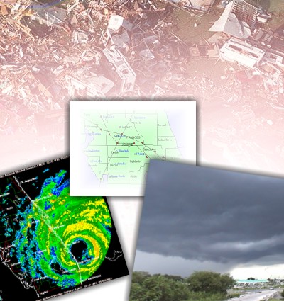
POST STORM DAMAGE SURVEYS & SUMMARIES
Local NWS offices have the responsibility of surveying sites which experience significant weather related damage. The survey team is usually lead by the Warning Coordination Meteorologist (WCM) and often includes one or more staff meteorologists. The team determines the type of damage (i.e. straight-line wind, microburst, tornado) based on the pattern of debris, and the most likely peak wind speed associated with the storm. In the case of a tornado, the touchdown location is identified, as well as the length and width of track, and the strength based on the Fujita scale (F0 -weakest to F5 - strongest). Beginning in February of 2007, a new "Enhanced Fujita Scale" came into usage. Below are some pictures from recent surveys. If you witness storm damage, either as it is occurring or afterwards, we are interested in your report. Please contact us via telephone (321-255-0212), US Mail (421 Croton Road Melbourne, FL 32935), or by email .
If you are looking for specific spotter reports of storms or storm damage, visit the Local Storm Report Archive at the Southeast Regional Climate Center.
|
| August 18-22, 2008 |
Tropical Storm Fay causes tornadoes, dumps record amounts of rainfall on east-central Florida... |
| March 6, 2008 |
By 3:34 PM the storm was moving across Stuart, producing small hail. The air traffic control tower at Martin County Airport / Witham Field reported a wind gust to 97 mph at 3:55 PM. |
| February 12, 2008 |
The parent storm which produced the EF0 tornado developed along the coast between Melbourne/Palm Bay and Satellite Beach around 2:00 PM... |
| September 20, 2007 |
A stacked mid to upper level low across the Eastern Gulf of Mexico induced an area of surface low pressure to develop on Thursday, September 20th. (Eustis Tornado) |
| June 1-2, 2007 |
Tropical Storm Barry area summary. |
| February 2, 2007 |
The Groundhog Day Tornadoes of 2007. (Preliminary Survey) |
| December 25, 2006 |
The Christmas Day tornado outbreak. (Preliminary Survey) |
| November 7, 2006 |
On Tuesday afternoon, a small-scale area of low pressure, referred to as a "mesolow", formed over the Gulf of Mexico... |
| August 28-31, 2006 |
Tropical Storm Ernesto passes through the area. |
| April 27, 2006 |
Weather-related issues in Brevard County wildfires. |
| October 23-24, 2005 |
Hurricane Wilma
slashes through Martin County and affects much of east-central Florida with tornadoes, wind, and flooding. |
| September 8-9, 2005 |
Hurricane Ophelia
lingers offshore the Space Coast. |
| August 24, 2005 |
Hurricane Katrina
brushes the area. |
| August 4, 2005 |
Winter Garden storm.
Around 7 o'clock on August 4th, a severe thunderstorm developed over Lake Apopka... |
| February 27, 2005 |
F-1 Tornado in Palm Bay
Several long track supercell thunderstorms moved eastward across central Florida during the afternoon of February 27, 2005. At least one storm produced a damaging (F1) tornado... |
| September 26, 2004 |
Hurricane Jeanne in east-central Florida.
Preliminary Summary Report for Hurricane Jeanne
Selected Radar Images of Jeanne's Passage through central Florida, and much more... |
| September 4-5, 2004 |
Hurricane Frances in east-central Florida.
Preliminary Summary Report for Hurricane Frances
Selected Radar Images of Frances' Passage through central Florida, and much more... |
| August 13, 2004 |
Hurricane Charlie in east-central Florida.
Preliminary Summary Report for Hurricane Charley
Selected Radar Images of Charley's Passage through central Florida, and much more... |
| August 4, 2004 |
F0 Tornado in Canova Beach
Under westerly steering flow, a band of showers and thunderstorms moved from central Florida and rapidly intensified... |
| June 4, 2004 |
Wind Damage in LaGrange
Strong to severe thunderstorms occurred over east central Florida during the afternoon as a large boundary moved south into the area and teamed with the sea breeze. |
| April 27, 2004 |
Microburst in Melbourne
A strong storm developed along a cold front as it moved through Brevard County around 2 pm on April 27, 2004. A microburst within the storm produced a narrow swath of wind damage... |
| April 8, 2004 |
Hail & Wind Storms hit Central Florida
In the early afternoon of April 8th, severe storms rolled through the central Florida area, causing scattered areas of damage... |
| September 20, 2003 |
Deadly Lightning Storm
On September 20th 2003, a 46 year old female physical education teacher was killed by a bolt of lightning while on a soccer complex... |
| August 6, 2003 |
Rockledge Storm
The east coast sea breeze pushed just inland during the early afternoon of 8/6/2003. Meanwhile... |
| August 1, 2003 |
Okeechobee Storm
ON FRIDAY EVENING...A NATIONAL WEATHER SERVICE DAMAGE SURVEY TEAM INVESTIGATED WIND DAMAGE WHICH OCCURRED... |
| March 19, 2003 |
Deltona Storm
At 6:25 PM a severe thunderstorm warning was issued for the Deltona area of central Volusia County. |
| January 24, 2003 |
Cold & Flurries
An arctic air mass roared into central Florida early Friday morning... |
| December 13, 2002 |
Wabasso Tornado
At 11:55 AM, a tornado formed in Wabasso, Florida, traveling approximately 1.5 miles, roughly following highway 510. |
| November 16, 2002 |
West Melbourne Microburst
Severe thunderstorms moved up from southwest Brevard county, producing a damaging microburst in the area of Sam's Club in west Melbourne at about 4:15 pm on November 16, 2002. |
| September 4, 2002 |
Tropical Storm Edouard Summary
POST TROPICAL CYCLONE REPORT...TROPICAL STORM EDOUARD
NATIONAL WEATHER SERVICE MELBOURNE FL
235 PM EDT THU SEP 5 2002 |
| August 27, 2002 |
Port St. Lucie Microburst
Early morning storms along the west central Florida coast produced an outflow boundary which moved east across the peninsula, reaching the east coast by mid afternoon. This boundary interacted with the east coast sea breeze, which resulted in the development of storms, which rapidly intensified. |
July 27, 2002
|
Ft. Pierce F0 Tornado/Landspout
The damage survey revealed that an F-0 tornado developed and then quickly dissipated in the area of Fort Pierce at US 1 and El Rancho Drive to Maple Avenue. Eyewitnesses described the formation of the funnel and it's dissipation between 11:00 am and 11:05 am EDT. |
September 14, 2001
|
Tropical Storm Gabrielle/Brevard County Tornado
As Tropical Storm Gabrielle was moving onshore southwest Florida, an outer rainband produced a persistent tornado-producing cell which brushed the Sebastian Inlet area (about 7:25 AM) , causing minor damage, then produced F-0 damage in the Melbourne area on the east end of the Melbourne causeway (about 7:55 AM), at the Anchorage Yacht Basin (photo above). |
June 24, 2001
|
Indian River County/Sebastian Tornado
Severe thunderstorms spawned a weak (F0-F1) tornado which was responsible for property damage in Indian River County. The event occurred during the afternoon on Sunday (06/24/01) between 240 pm and 300 pm. |
May 22, 2001 |
Osceola County F0 Tornado
Strong thunderstorm winds accompanied by an embedded weak tornado (F0) were responsible for some property damage in parts of north Osceola County. The event occurred during the early evening on Tuesday (05/22/01) around 6:30 PM. |
March 13, 2001 |
Volusia County Macroburst/Tornado Survey
Damaging winds occurred in Volusia County during the late morning hours as severe thunderstorms moved east through the county. The severe storms were part of a line of storms associated with an advancing cold front which moved into the area. Several thunderstorms became severe over Volusia County, impacting areas from Pierson to Ormond Beach and Daytona Beach. |
July 20, 2000 |
Leesburg Convective Wind Storm
On the evening of July 20th, 2000, severe thunderstorms moved across Lake County three times. The first storms moved out of Sumter County across the Mascotte area to near Mount Dora producing minor wind damage. |
October 16, 1999 |
Hurricane Irene Summary
HIGHEST WIND, in Knots. Speed is expressed as DDFF, where first two digits represent speed direction and last two is speed. For example, 3520 means wind was from north (350 degrees) at 20 knots. |
Sept. 14-15, 1999 |
Hurricane Floyd Summary
HIGHEST WIND, in Knots. Speed is expressed as DDFF, where first two digits represent speed direction and last two is speed. For example, 3520 means wind was from north (350 degrees) at 20 knots. |
February 22-23, 1998 |
Central Florida Tornado Outbreak
On February 22, 1998, a massive and powerful weather system approached central Florida from the northwest and Gulf of Mexico. Later that night, thunderstorms associated with this storm system spawned three tornado-producing supercells, and we've all seen the tragic results. |
February 17, 1998 |
Indialantic Tornado
The tornado first touched down around 707 AM on February 17th, 1998 in the 500 block of South River Oaks Drive on the barrier island near Indialantic. The tornado knocked down some fencing in the backyard and tore the porch roof off of one house and damaged portions of the main roof. |
December 27, 1997 |
St. Cloud (Lake Toho) Tornado
A long track supercell developed over west central Florida during the early morning hours of 27 December. Radar signatures indicated the storm was becoming tornadic over Polk County (just west of the NWSO Melbourne County Warning Area [CWA]) prior to 4 AM (0900 UTC). |
November 13, 1997 |
Lake Washington (Melbourne) Tornado
THE F0 TORNADO FIRST TOUCHED DOWN NEAR INTERSTATE 95 JUST NORTH OF EAU GALLIE BLVD IN MELBOURNE AROUND 350 PM WHERE HIGHWAY SIGNS WERE KNOCKED DOWN AND DEBRIS WAS THROWN ONTO THE ROAD. |
November 2, 1997
|
New Smyrna Beach Tornado
AN F0-F1 TORNADO TOUCHED DOWN ABOUT 4000 FEET WEST OF HIGHWAY 1 BETWEEN ENTERPRISE AND WAYNE AVENUES... |
March 29, 1997 |
KSC Microburst Survey
Wind Damage Survey - Kennedy Space Center 04/02/97 Storm of 03/29/97 |
| October 7, 1996 |
Edgewater Tornado Survey
Edgewater Tornado Survey 10/8/96 - Storm of 10/7/96. Damage Photos... |
| May 12, 1996 |
Okeechobee Tornado
WSR-88D Imagery from Okeechobee Tornado - May 12, 1996 . Showers developing on boundary over Lake Okeechobee. (b-ref/.5deg/130158z) |
| March 31, 1996 |
Indian River County Hailstorm
WSR-88D Imagery from March 31, 1996 . Mesocyclone associated with large hail producing supercell over east Indian River County. (srm/.5 deg/010109z) |
| March 30, 1996 |
Severe Weather Outbreak & Cape Canaveral Tornado
WSR-88D Imagery from March 30, 1996. Supercell with associated hook echo passing by Kenansville. (b-ref/.5 deg/302211z) |
March 28, 1996 |
Possible Volusia County Tornado
WSR-88D Imagery from March 28, 1996. Storm relative velocity display of mesocyclone over southern Volusia County. Arrow points to area of potential tornado.(srm/.5 deg/2132z) |

 National Weather Service Forecast Office