|
Cedar
RAWS -
near Lake Meredith
Bootleg
RAWS -
near Hereford
Caprock
Canyons State Park RAWS
Matador
RAWS -
near Paducah
Pinion
Canyon RAWS -
near Trinidad CO
Cimarron
RAWS -
near Elkhart KS
Mills
Canyon RAWS -
near Roy NM
Ute
Canyon RAWS -
near Campo CO
Southwest
Region RAWS Current Weather
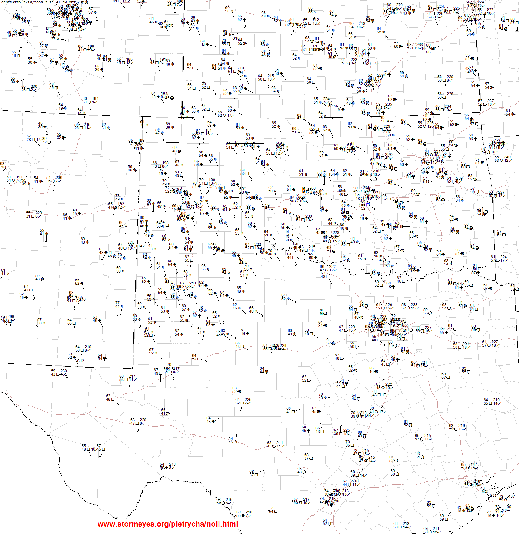
Current
Weather Summary for Amarillo CWA
Oklahoma Mesonet
Oklahoma
Fire Danger Model and Maps - select
"Fire Danger Model" from menu
Texas Weather Connection
Current Conditions TX,OK
Southern
Plains Current Map
Current Map - click and drag mouse over
map
MesoWest
- AMA WFO Amarillo, Texas
West
Texas MesoNet Current Obs
Current
Texas Keetch-Byram Drought Index
U.S.
Drought Monitor
Palmer
Drought Severity Index
Drought
Monitoring
|
Lightning
Data - courtesy of Ken Schneider
Recent
Image,Loop
SPC
Fire Weather Analysis Page
MODIS
Active Fires Map
MODIS
Fire Detection Map
Keetch-Byram
Drought Index
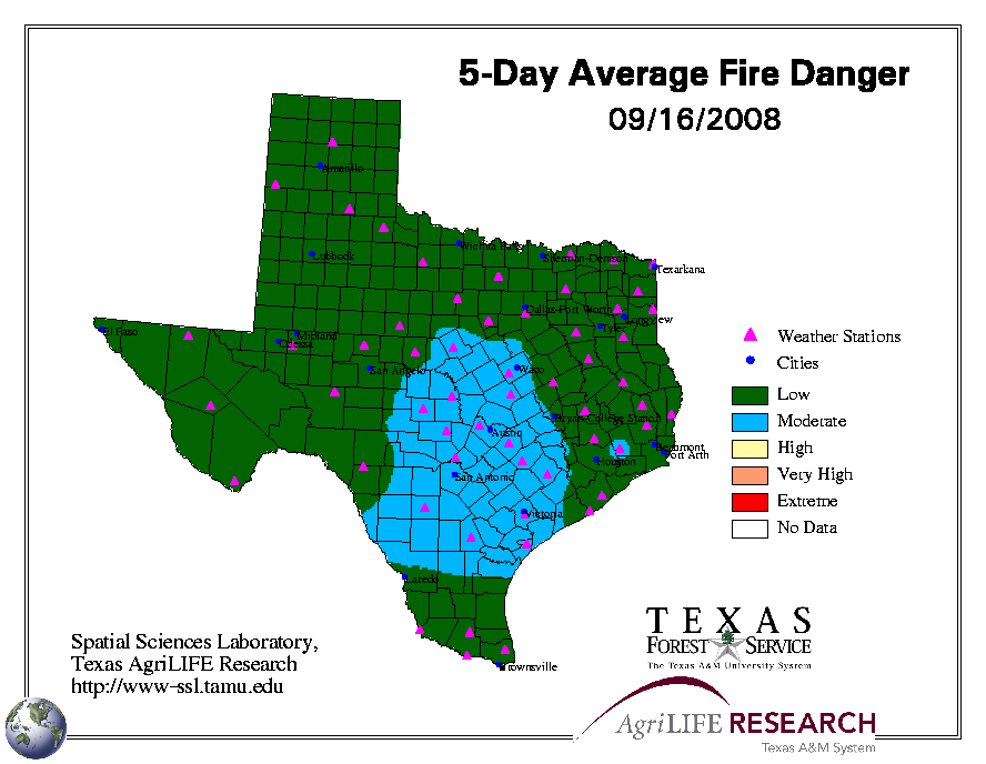
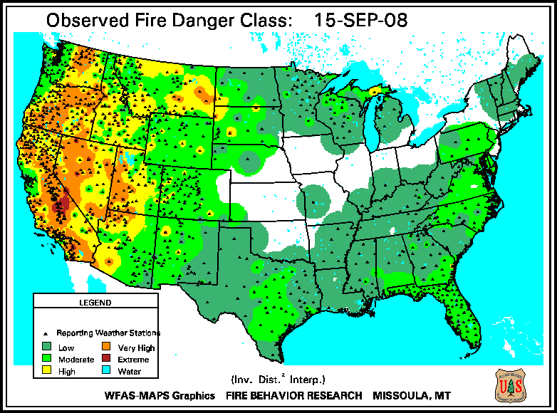
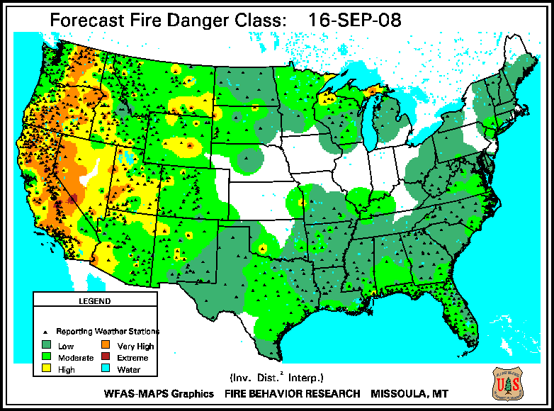
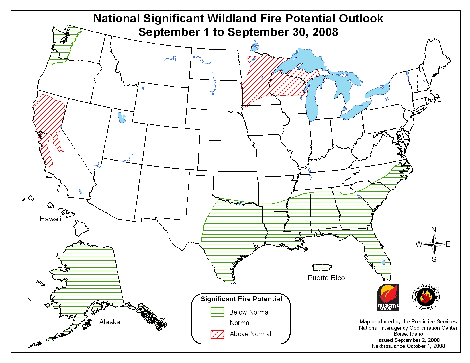
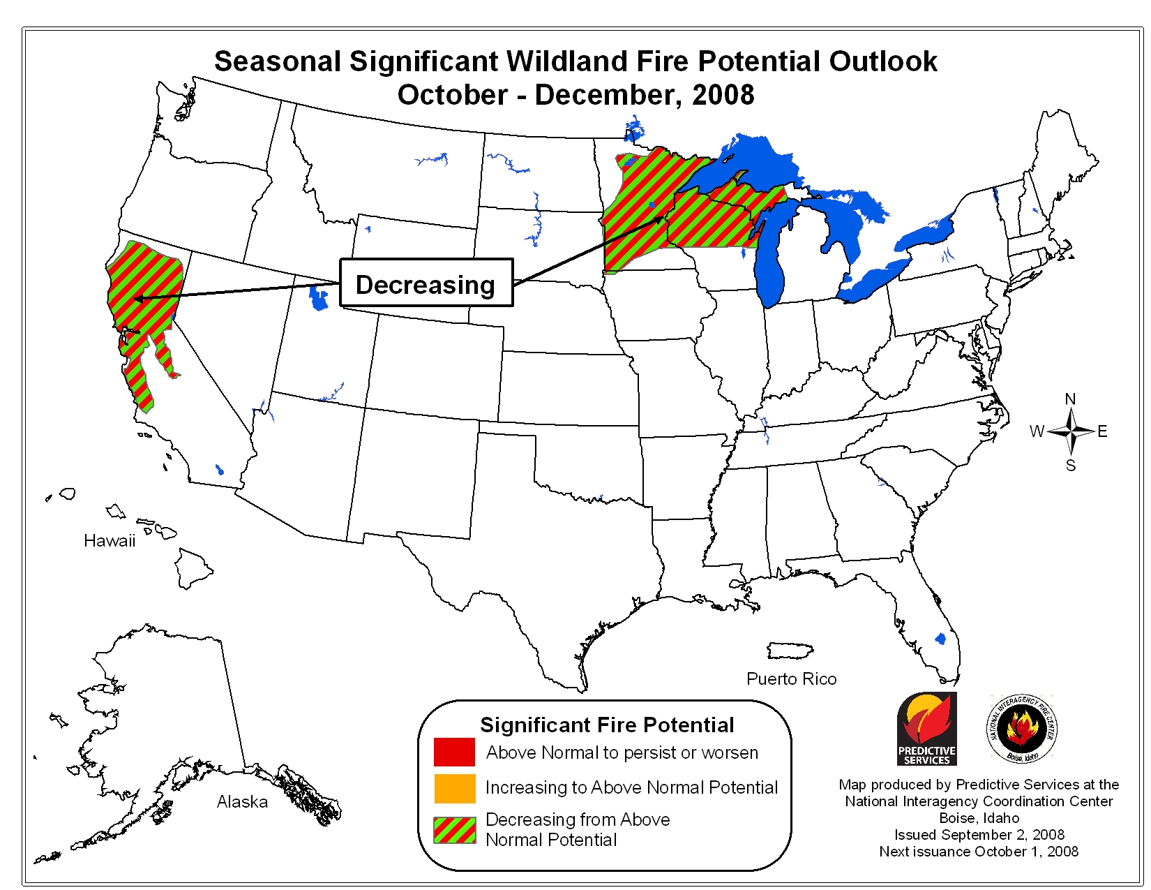
Fire
Danger Rating
Lower
Atmosphere Stability (Haines) Index
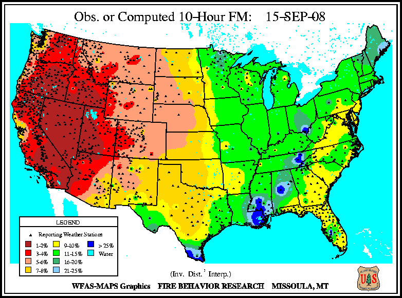
Dead Fuel Moisture Contents
10-hour,
1/4-1" diameter fuels
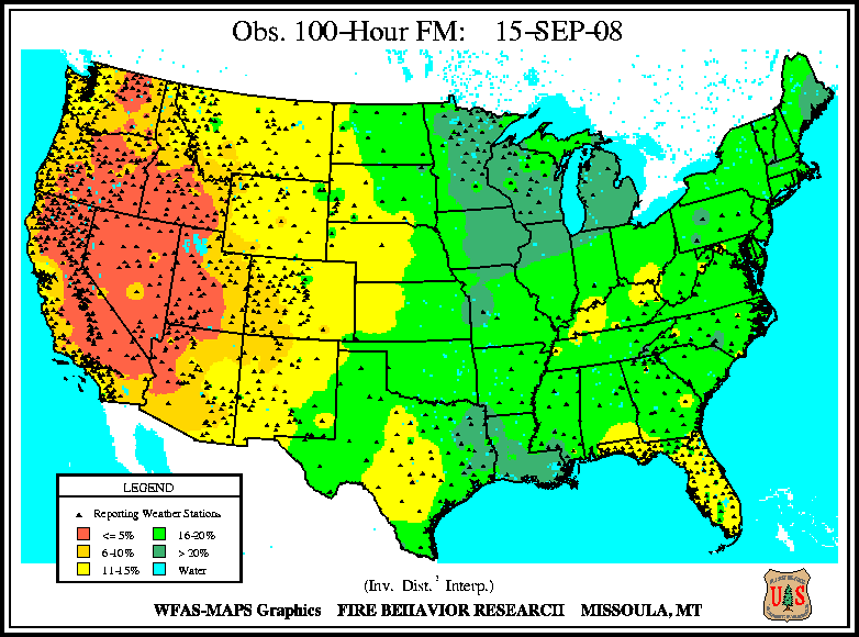
100-hour,
1-3" diameter fuels
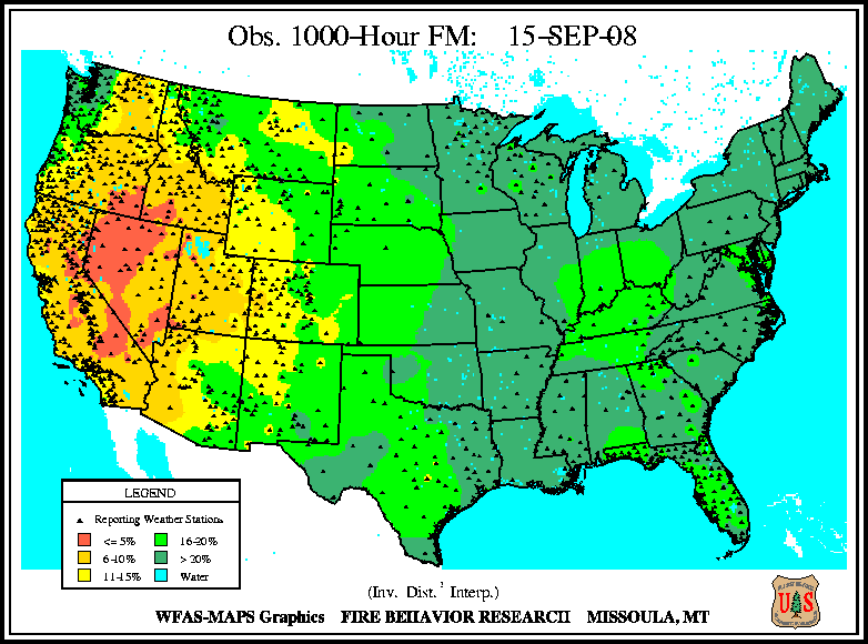
1000-hour,
3-8" diameter fuels
Visual Satellite Images
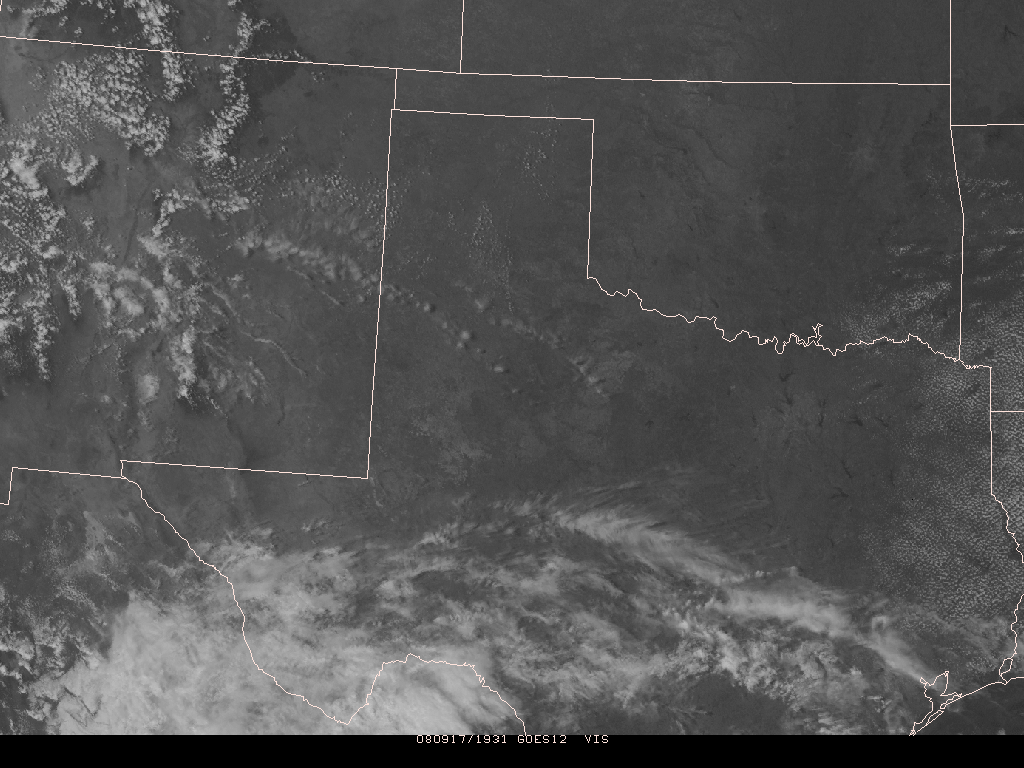
1,
2,
3,
4,
5
(loop), 6
(loop)
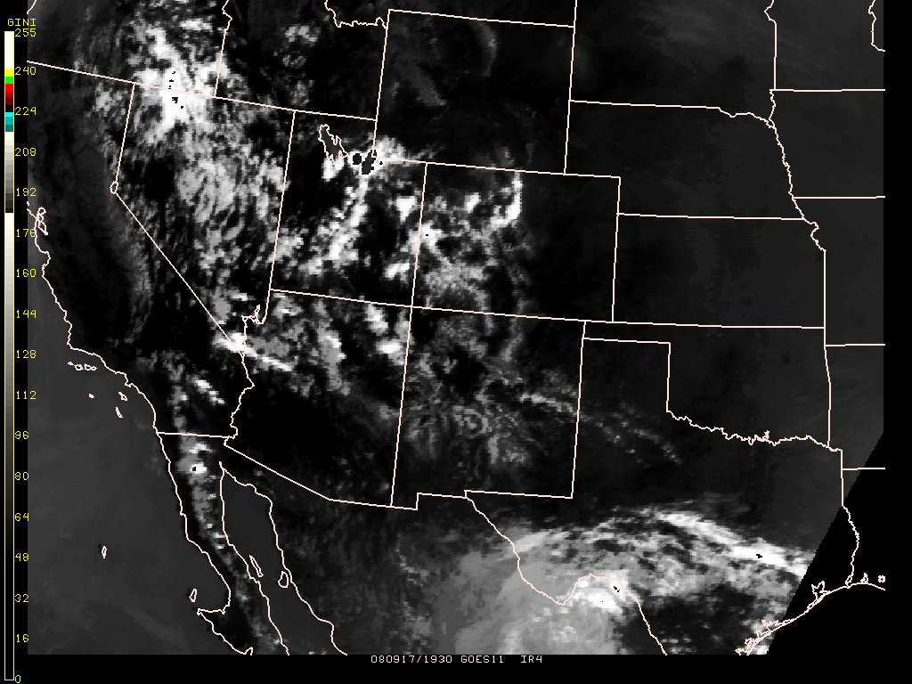
Infrared Satellite Images
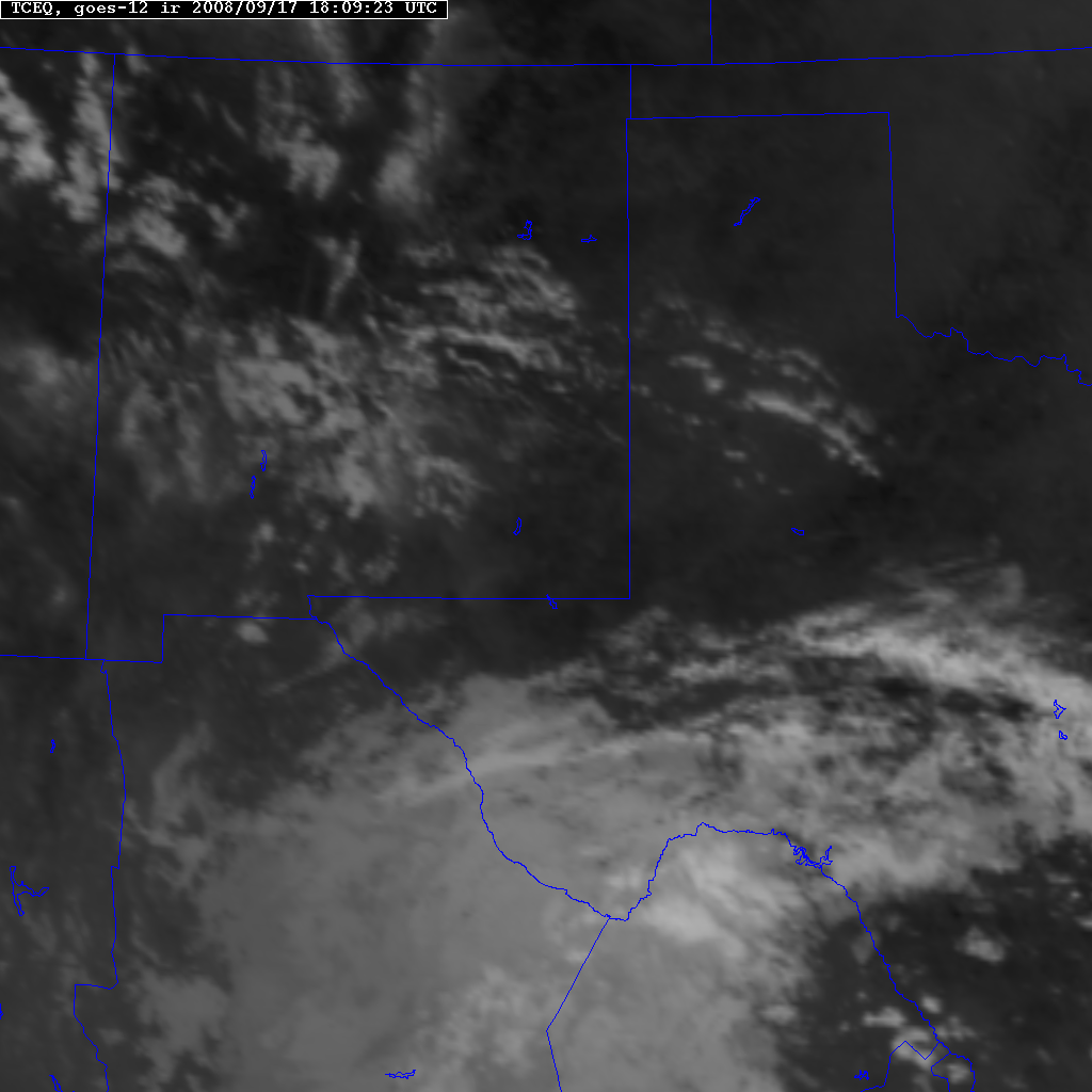
1,
2,
3,
4,
5
(loop), 6
(loop)
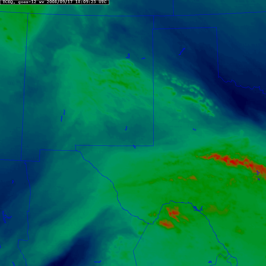
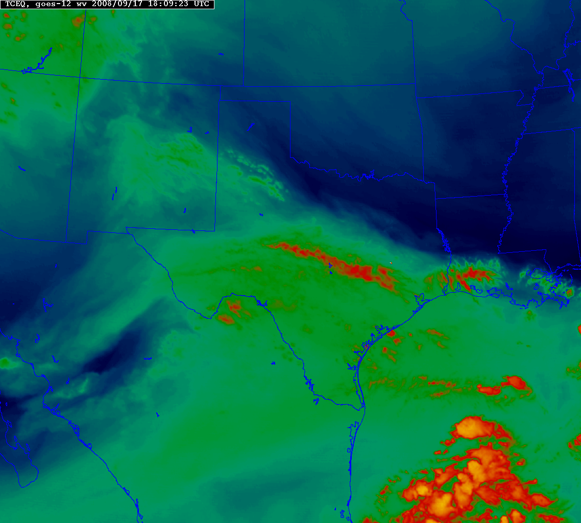
Water Vapor Satellite Images
1,
2,
3,
4
(loop)
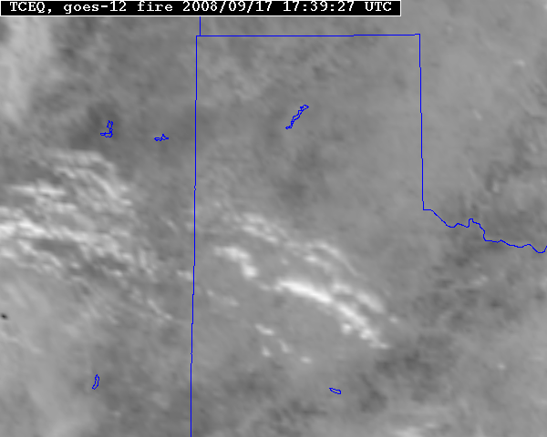
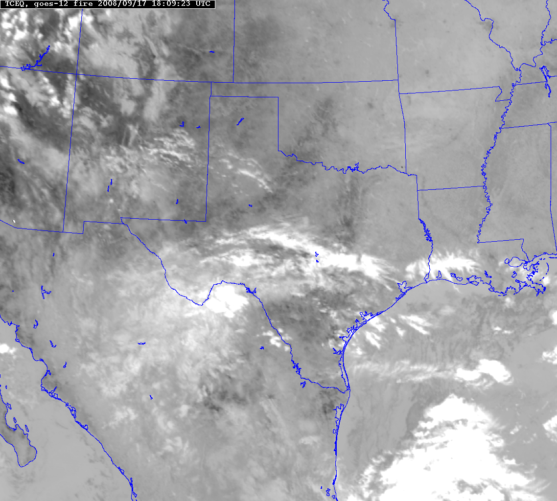
Fire Channel Satellite Image
1,
2,
3
OSEI Fire Events
Satellite
Fire Detection Program |

 National Weather Service Forecast Office
