Tsunami Generation from the 2004 M=9.2 Sumatra-Andaman Earthquake
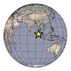
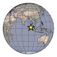
The December 26, 2004 magnitude (M) 9.2 Sumatra-Andaman earthquake occurred along a tectonic subduction zone in which the India Plate, an oceanic plate, is being subducted beneath the Burma micro-plate, part of the larger Sunda plate. The boundary between the downgoing and overriding plates of the subduction zone is marked by the Sunda Trench above. The pages on this web site listed in the Table of Contents above provide a brief overview of the tectonic setting and seismological chacteristics of the earthquake, as well as a summary of tsunami generation modeling for this event and the March 28, 2005 M=8.6 northern Sumatra earthquake. For additional information, the Disaster Prevention Research Institute at Kyoto University provides a comprehensive web site of data collected in the aftermath of this event.
|
Tsunami Generation from the 2004 M=9.2 Sumatra-Andaman Earthquake
Tsunamis & Earthquakes Site |
|||||||||
|
||||||||||

![]() U.S. Department of the Interior | U.S. Geological Survey
U.S. Department of the Interior | U.S. Geological Survey
URL: http://walrus.wr.usgs.gov/tsunami/sumatraEQ/
Science questions to: Eric L. Geist
Site maintained by: Laura Zink Torresan
Page Last Modified: 28 July 2008 (lzt)

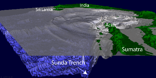
 Tectonics of Sumatra-Andaman Islands