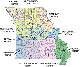
Click map for your area of interest or Text Version of Map Links
FEATURES:
Water Resources Data Missouri Water Year—2007 —USGS, in cooperation with the State of Missouri and with other agencies.
Water Resources Data Missouri Water Year—2006 —USGS, in cooperation with the State of Missouri and with other agencies.
Water Resources Data Missouri Water Year 2005 Water Data Report MO-05-1—Prepared by H.S. Hauck and T.H. Harris, USGS, in cooperation with the State of Missouri and with other agencies.
Estimated Flood-Inundation Mapping for the Upper Blue River, Indian Creek, and Dyke Branch in Kansas City, Missouri, 2006–08 SIR 2008-5068 —prepared by B.P. Kelly, R.H. Huizinga, U.S. Geological Survey, in cooperation with the City of Kansas City, Missouri.
Estimated Flood Inundation Maps for the Lower Blue River in Kansas City, Missouri
Hydraulic Analyses of Sni-A-Bar Creek and Selected Tributaries at Grain Valley, Jackson County, Missouri SIR 2008-5051 —prepared by P.H. Rydlund, Jr., W. Otero-Benítez, and D.C. Heimann, U.S. Geological Survey, in cooperation with the City of Grain Valley, Jackson County, Missouri.
Potentiometric Surface of the Ozark Aquifer near Springfield, Missouri, 2006–07 SIM 3003—prepared by J.M. Richards, and D.N. Mugel, U.S. Geological Survey, in cooperation with Greene County, Missouri, the U.S. Army Corps of Engineers, and the Missouri Department of Natural Resources.
Two-Dimensional Simulation of Flow and Evaluation of Bridge Scour at Structure A-1700 on Interstate 155 over the Mississippi River near Caruthersville, Missouri SIR 2007–5230—prepared by R.J. Huizinga, U.S. Geological Survey, in cooperation with the Missouri Department of Transportation.
Water and Streambed-Sediment Quality in the Upper Elk River Basin, Missouri and Arkansas, 2004–06 SIR 2007–5181—prepared by B.J. Smith, J.M. Richards, and J.G. Schumacher, U.S. Geological Survey, in cooperation with the Missouri Department of Natural Resources.
Effects of Impoundments and Land-Cover Changes on Streamflows and Selected Fish Habitat in the Upper Osage River Basin, Missouri and Kansas SIR 2007–5175—prepared by D.C. Heimann, S.S. Licher, and G.K.Schalk, U.S. Geological Survey, in cooperation with the Missouri Department of Conservation.
Two-Dimensional Hydrodynamic Modeling and Analysis of the Proposed Channel Modifications and Grade Control Structure on the Blue River near Byram's Ford Industrial Park, Kansas City, Missouri SIR 2007–5098—prepared by R.J. Huizinga, U.S. Geological Survey, in cooperation with the U.S. Army Corps of Engineers.
For more information contact:
U.S. Geological Survey
Missouri Water Science Center
1400 Independence Road, MS-100
Rolla, MO 65401
Telephone: (573) 308-3667
Fax: (573) 308-3645
![]() Get Acrobat Reader
Get Acrobat Reader
Missouri Water Science Center Cooperating Agencies
Missouri Water Science Center Employees Directory
Missouri Water Science Center Organization Chart (PDF File)
Directions to the Missouri Offices
Streamgages at Risk of Discontinuation
Daily Streamflow Conditions Map
Missouri Current Water Resources Conditions
National Streamflow Conditions Map
Kansas City, || St. Louis, || Springfield
Hydrologic Studies and Research
Missouri Water Science Center Reports
USGS Missouri Water Resources Research Institute Program
U.S. Department of the Interior, U.S. Geological Survey
Maintainer: Rita Choate, Webmaster
Updated: December 8, 2005
Privacy Statement || Disclaimer || FOIA || Accessibility
URL:http://mo.water.usgs.gov/index.htm