|
There are always at least two forecasters on duty in the operations area 24 hours a day. One forecaster, referred to as the public forecaster (pictured below), writes forecasts intended for the general public, such as the Zone Forecast. This is the forecast of sky condition, temperature, wind, and rain chance that most folks are familiar with. This same forecaster will also compose the Coastal Waters Forecast of winds, waves and weather on the Gulf of Mexico, a technical Area Forecast Discussion, the Hazardous Weather Outlook, and any non-routine products that are necessary to alert the public to hazardous weather. Some of the most common products of this type include freeze warnings, dense fog advisories, heat advisories, and flood watches and warnings.


A second forecaster (pictured below) will write forecasts tailored to specific user groups. For example, he/she will write a set of coded products intended for use by airports, pilots and others associated with the aviation industry. These include TAFs and TWEBs. This forecaster also prepares a routine Fire Weather Forecast. The fire weather forecaster also prepares any Red Flag Warnings or Fire Weather Watches that may be necessary, and issues spot forecasts on demand to help foresters with prescribed burns or wild fires. This forecaster is also responsible for writing the event-driven Short Term Forecast. During severe weather, this forecaster would man the radar and put out any warnings necessary for tornadoes, severe thunderstorms, or flooding. As staffing allows, we try to schedule additional forecasters to monitor the radar at times when the other forecasters are at their busiest preparing our routine products.
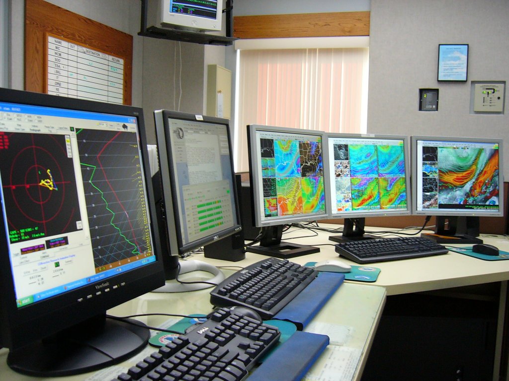
Both forecasters prepare their various forecasts at workstations like the one pictured above. In the foreground is a PC that foreasters use to access the internet and e-mail, as well as to interrogate weather analysis software, such as the BUFKIT software pictured in the image that is used to anlyze model sounding data. Adjacent to the PC is the main system we use to prepare our forecasts, called the Advanced Weather Interactive Processing System, or AWIPS. This state-of-the-art computer hardware and software allow forecasters to view many different types of meteorological data on one system. Each AWIPS workstation consists of three graphics monitors and one text workstation. There are six AWIPS workstations in our office. The "brains" of the entire system is pictured below.

The graphics monitors are capable of displaying up to 20 different windows, each containing its own display of weather information. Forecasters interrogate radar and satellite imagery, lightning data, upper air data generated by weather balloons, observed surface weather, and a plethora of numerical model data. These fields can be looped, zoomed, and even overlaid on one another. Prior to AWIPS, forecasters had to use several different machines to view all of these different types of data. The text workstation is used to prepare and disseminate forecast and warning products as well as to look at various text products such as weather discussions.

In late 2002, NWS Tallahassee began using on a new system that changed the way we prepare forecasts, the Interactive Forecast Preparation System (IFPS) and the Graphical Forecast Editor (GFE). For decades, forecasters have spent time analyzing observations and model data and then typing their forecasts. With IFPS/GFE (pictured below), forecasters manipulate the actual model guidance in digital format and the computer then automatically generates all of the various text products from this digital database. In addition to the traditional text products, an entire suite of forecast graphics are produced and posted to our web page. The latest graphics are available here.

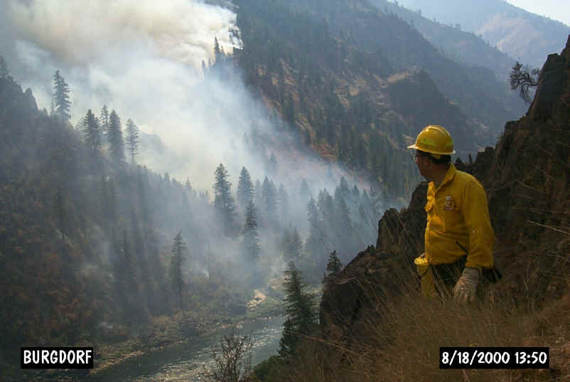
While most of our forecasting takes place here in the forecast office, specially trained forecasters are occasionally detailed from some offices to work on location at the site of wildfires, oil spills and other HAZMAT incidents. The forecaster, known as an Incident Meteorologist or IMET, is responsible for providing microscale meteorological support to the incident management teams. One IMET that formerly worked in our office, Mike Edmonston, is pictured below at the site of the Burgdorf Junction wildfire that occurred in Idaho in August 2000. To see additional photos, visit our Fire Weather Photo Gallery.

 
|