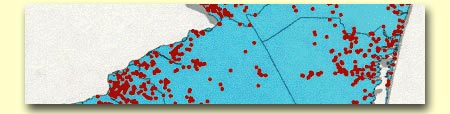
About
the maps used as illustrations
on this web site

Health
Risk Analysis of the Rio De Janeiro Water Supply Using Geographical
Information Systems

Population-Based
Prevalence of Cocaine in Newborn Infants—Georgia, 1994

Geographic
Analysis of Childhood Lead Exposure in New York State
GIS
Analysis of Brain Cancer Incidence near National Priorities List
Sites in New Jersey (this map was not used in the paper)

Drinking
Water Source Protection and GIS in Reno County, Kansas

A
New GIS-Based Tool for the Assessment of Environmental Equity and
Death Rates Near Superfund Sites in the Urban Counties of Washington
State

Prenatal
Health Behaviors and Birth Outcomes


Exploring
the Demographic and Socioeconomic Determinants of Health along the
US-Mexico Border: An Online Interactive Application
|


