NWS Gaylord Spotter Page
Your source for preparedness and spotter information in Northern Michigan
![]() eSpotter
eSpotter
![]() Weather Event Feedback form
Weather Event Feedback form
Spotter Briefing Information:
![]() Hazardous Weather Outlook
Hazardous Weather Outlook
![]() Storm Prediction Center
Storm Prediction Center
![]() Recent severe weather reports from around the country
Recent severe weather reports from around the country
|


Weather Event Archive
 Severe Weather Event Archive and damage surveys
Local Spotter Information
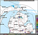
![]() Local Storm Reports
Local Storm Reports
![]() Scheduled Spotter Training Classes
Scheduled Spotter Training Classes
![]() Storm Spotter and Safety Training (Large File for highspeed connections)
Storm Spotter and Safety Training (Large File for highspeed connections)
![]() Spotter Training Quiz Answers
Spotter Training Quiz Answers
![]() Spring 2008 Newsletter (large PDF file with pictures)
Spring 2008 Newsletter (large PDF file with pictures)
Spotter References
![]() Microburst (Straight Line Winds) handbook
Microburst (Straight Line Winds) handbook
![]() Severe Weather guide produced by NWS Norman, OK
Severe Weather guide produced by NWS Norman, OK
![]() Severe Weather Glossary produced by NWS Norman, OK
Severe Weather Glossary produced by NWS Norman, OK
![]() Enhanced Fujita Scale
Enhanced Fujita Scale
![]() Beaufort Scale
Beaufort Scale
Tornado Safety Plans
![]() Developing a Tornado Safety Plan
Developing a Tornado Safety Plan
![]() Tornado preparedness in schools (Storm Prediction Center)
Tornado preparedness in schools (Storm Prediction Center)
![]() Tornado safety planning (American Red Cross)
Tornado safety planning (American Red Cross)