|
|
 |
|
SVS Projects
At any particular time, the Scientific Visualization Studio (SVS)
is involved in providing visualization products, systems, and expertise
to various NASA projects and missions. This page briefly describes our
current activities, with links to more information.
|
|
Science Informal Education
|
Through this project, the members of the SVS create animations
and imagery explaining current NASA missions and scientific results. For
each visualization product, a team of scientists, writers, and animators
work together to create products that can be used by the TV and print
media, educators, museums, the public, and anyone else who might need
to explain some NASA result. Most of the actual visualizations found on
this web site are products of this project.
|

|
|
HPC Visualization Support
The High Performance Computing Visualization Support team explores the use of visualization for research and exploration of large-scale data sets processed on NASA's supercomputers. At times, this means creating movies and images for scientists. Other times, this means building specialized hardware systems and creating software products to view multiple data sets simultaneously.
|
|
One example of this project's work is the Modeling, Analysis, and Prediction Program (MAP). You can view information about the MAP project at http://map.nasa.gov.
|
|
Digital Earth
The Digital Earth Initiative seeks to enable the creation
of a global environment for the interchange and dissemination of geo-referenced
information about the Earth. In the first generation of this project, members of the SVS created the
Digital Earth Workbench, which was one of the early technologies that
fostered the Digital Earth concept. The second generation of this project resulted in a software product
that brought the functionality of the Digital Earth Workbench onto the personal computer of the teacher,
the scientist, the student. This software product, Digital Earth PC, or DEPC for short, runs on
regular personal computers, supporting multiple operating systems. It allows the viewing of Cartesian-projected
images on a 3-D globe. This project led to the creation of many visualization products in this format.
Those products are available through the SVS Image Server.
Find out more about the SVS Image Server
|
|
|
Missions
|
The SVS directly supports individual NASA missions by creating
specific visualization products and systems. At this time, the SVS is
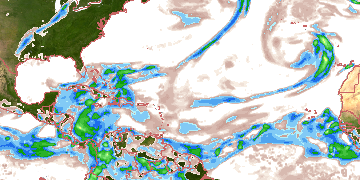
working with TRMM, the Tropical
Rainfall Measuring Mission, to produces precipitation maps and three-dimensional storm flybys from TRMM data.
|

|
|
This page was last updated on July 13, 2007.
|
|
|